Three Wheelchair-Accessible Pend Oreille River Views
Sometimes wheelchairs and Mother Nature just don’t mix. Although access to natural areas has greatly improved over the years, some panoramic views are still out of reach to wheelchair-users and slow walkers. Fortunately that’s not the case on the Pend Oreille River in Northeastern Washington. In fact, thanks to the efforts of Seattle City Light and the US Forest Service, there are three well developed wheelchair-accessible Pend Oreille River viewpoints near Metaline Falls. Add in a few short trails, some interpretive exhibits and a nice mix of wildlife, and it’s a great place to slip away and enjoy mother nature for a few hours.
Vista House
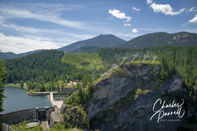
Vista House, which is the first wheelchair-accessible Pend Oreille River view, is located just south of the Nelson-Metaline border crossing along the International Selkirk Loop (emerginghorizons.com/the-international-selkirk-loop-for-wheelchair-users-and-slow-walkers/). From Highway 31, (the International Selkirk Look) turn west on East Side Road near Crescent Lake. As soon as you turn on to East Side Road you’ll be captivated by the view of Crescent Lake on the left, and as you drive through the forest, you’ll see bits and pieces of it along the way. Continue along the road for about two miles, until you reach Vista House at the end of the line.
There’s plenty of accessible parking in the lot, with barrier-free access to Vista House and the nearby accessible restrooms. Vista House is a small interpretive center that overlooks Boundary Dam. There’s level access to the building, which houses a few exhibits; but to be honest the best views can be had from the outside.
There’s a standard picnic table on the left side of the building, with room at the end for a wheelchair. There are also built-in benches that line the deck area which can be used for a picnic. From the left side of Vista House you’ll get a view of the dam, and if you roll around to the right side of the building you’ll get a nice view of the Pend Oreille River.
There’s also a quarter-mile trail that leads down to a lower viewpoint, but because of the elevation change it’s really not doable for wheelchair-users. Some slow walkers may be able to do it, but take some time to evaluate the slope before you give it a try. Still, the view from top is reason enough to put this stop on your list. Even better — it’s not crowded.
Peewee Falls Overlook
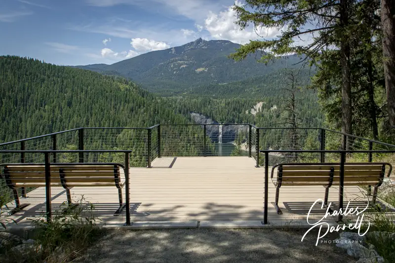
As you head back to Highway 31, be sure and stop at the Peewee Falls Overlook, which is about a mile from Vista House. The turn is well marked, and the dirt road is maintained and doable in a standard vehicle. It may be a bit dusty, but that’s just part of the rustic ambiance.
There’s plenty of accessible parking at the Peewee Falls Overlook in the large paved lot, with barrier-free access to the nearby accessible vault toilets and accessible picnic tables. From the picnic area, a hard-packed dirt trail covered in crushed gravel leads down to the viewpoint.
Peewee Falls cascades down into Boundary Lake, which was formed by the creation of the Boundary Dam on the Pend Oreille River. It’s not a massive waterfall — hence the name — but the lake isn’t very crowed and the whole view is rather calming. It’s a pleasant quarter-mile round trip stroll to the viewpoint; and again, this stop is minus the crowds.
Riverside Canyon Overlook
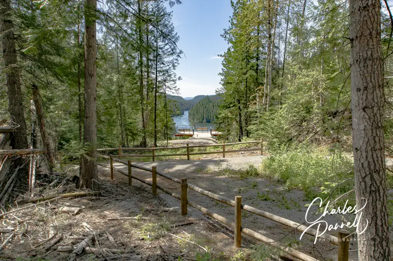
Last but not least, save time for a stop at Riverside Canyon Overlook on your Pend Oreille River drive. From Peewee Falls, continue back to Highway 31 and head south. Make a right on Forest Road 172, about five miles down the road. Although it’s hard to spot the street sign, the turn is well marked by a brown “Riverside Canyon Overlook” sign. Continue down the dirt road for another mile and follow the signs to the overlook parking lot.
There’s accessible parking near the accessible vault toilets, and a level path over to the accessible picnic tables. From the picnic area a hard-packed dirt trail covered in crushed gravel leads down to the viewpoint. It’s a .4-mile one-way hike, although you can get a slight glimpse of the view from the half-way point. That said, the best view of the river is from the accessible viewing platform at the end of the trail. Although the trail is accessible it’s not level, and there are several uphill and downhill sections along the way. Still it’s within code, with spaces to rest in between the uphill sections. Additionally, you can get a good view of Hooknose Mountain from the parking lot.
After you’ve had a good dose of Mother Nature along the Pend Oreille River, you can continue on along the International Selkirk Loop, take a hike at the Mill Pond Site, and maybe even stop for a bite to eat in Metaline Falls. There’s really no shortage of accessible choices in this scenic neck of the woods.

Barrier-Free Travel
Washington National Parks
for Wheelers and Slow Walkers