Visit the Grand Canyon Skywalk
Arizona, Canyon, desert, Eagle Point, glass floor, Grand Canyon, Guano Point, Hualapai, Las Vegas, reservation, skywalk
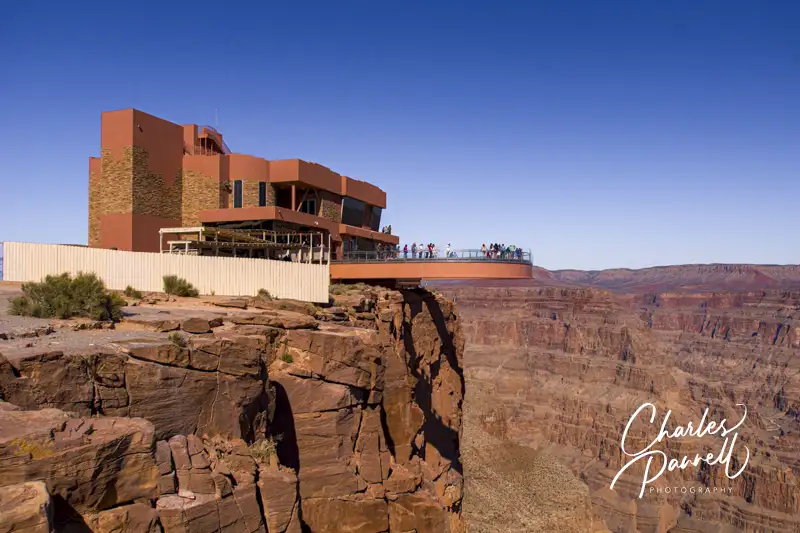
Located 130 miles southeast of Las Vegas, Grand Canyon West (grandcanyonwest.com) is not part of the US National Park System. It’s located on the Hualapai Reservation, and it’s home to the Grand Canyon Skywalk. This massive cantilever glass bridge extends out over the canyon rim and gives visitors a panoramic view of the canyon below. And although it’s outside the jurisdiction of the US government, this popular attraction offers good access for wheelchair-users and slow walkers. You can roll right out on the skywalk, and enjoy the beautiful canyon.
The Basics
Grand Canyon West is not located anywhere near the popular South Rim or the more remote North Rim of Grand Canyon National Park. It’s about a four-hour drive from the South Rim, and over six-hours from the North Rim. It’s definitely not a doable day trip from either of those sites. On the other hand, it’s just a two-hour drive from Las Vegas, so if you get an early start it makes a good day excursion from there.
It should be noted that because Grand Canyon West is not part of the US National Park system, national park passes are not valid for admission. Unfortunately the entrance price tag isn’t cheap either, but many consider it a treat and a once-in-a-lifetime experience. Still, leave room in your budget for the hefty entrance fee — usually about $100 per person.
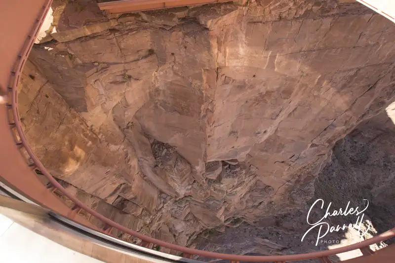
The Skywalk itself is considered an engineering marvel, as it extends out over the canyon and provides unobstructed views below. If you’re a little hesitant, don’t worry, as it’s incredibly sturdy. It’s built to withstand an 8.0 earthquake and winds up to 100 miles-per-hour. Still, looking straight down through the glass at the canyon floor may cause temporary vertigo in some people. If that happens, there’s one simple cure — just close your eyes.
The Grand Canyon Skywalk Experience
There are three main sections to Grand Canyon West, and a wheelchair-accessible shuttle connects these areas with the entrance plaza. Eagle Point is where the Skywalk is located, Guano Point is an abandoned mining site with some great canyon views, and Hualapai Point is home to the lodge, ranch and western village.
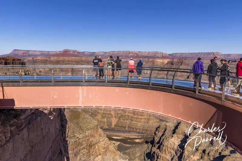
The Skywalk itself offers great wheelchair access. There’s ramp access up to the entrance and level access to the adjacent locker area. Nothing is permitted out on the skywalk, so all purses, cameras, backpacks and bags must be left in the lockers. Ambulatory visitors are asked to wear disposable booties on the skywalk, but there are no restrictions for wheelchair-users.
From the locker area, you can just roll right out to the skywalk, to get a bird’s eye view of the canyon below. It’s truly a breathtaking experience, and you can spend as much time on the skywalk as you want. And since cameras are prohibited on the skywalk, staff photographers are on hand to photograph visitors. Granted there’s an extra charge for this, but it’s a highly recommended souvenir.
It’s important to note that Grand Canyon West gets extremely busy with bus tours after 11 AM. Best bet for a more memorable experience is to get an alpine start and hit the Skywalk when it opens at 8 AM. Spend some time at Guano Point and Hualapai Point afterwards, enjoy the native dancers, browse through the crafts market and then have a bite to eat. And as you head out, the bulk of the crowds will be entering the site. Truly, it’s the most relaxing way to enjoy the Grand Canyon Skywalk.
Barrier-Free Travel
the Grand Canyon
for Wheelers and Slow Walkers