Enjoy These Wheelchair-Accessible National Park Railroads
Amtrak, Cuyahoga, Denali, excursion, Glacier, Grand Canyon, Mount Rainier, national park, railroad, railway, Yosemite
Although most folks associate national parks with hiking, camping and outdoor activities, a few of our nation’s natural showplaces also have active railroads running through or near them. Be it a short train excursion in a national park or a longer rail journey to get there, riding the rails is a fun and accessible option for all visitors. So check out these wheelchair-accessible national park railroads on your next visit to these popular sites.
Grand Canyon National Park
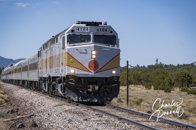
emerginghorizons.com/grand-canyon-without-a-car
The Grand Canyon Railway departs from Williams and travels north to the Grand Canyon’s South Rim. Along the way this historic train passes through a Ponderosa Pine forest before it drops down to an open prairie, and then climbs back up to the Pinyon Pine forest near the South Rim. There are six classes of service, with Pullman, Coach and First Class being the most accessible, All of the cars can be accessed by a portable lift, and they are outfitted with wheelchair-tie downs and nearby companion seats. Passengers can do this excursion as a day trip, or opt to spend a night or two on the South Rim before returning to Williams. And if you’d like a longer rail journey, Amtrak’s Southwest Chief offers service to Flagstaff, with transfers available to Williams.
Yosemite National Park

emerginghorizons.com/a-wheelchair-accessible-yosemite-rail-excursion/
If you’d like to ride the rails to Yosemite National Park, then hop aboard Amtrak’s Gold Runner. This route travels from Northern California and Southern California to the Merced Amtrak Station. From there passengers are transferred to an Amtrak Connection bus (operated by YARTS) for the rest of the journey to Yosemite National Park. All Amtrak trains feature lift boarding and have wheelchair tie-downs abord; and although all YARTS busses are accessible, it’s important to note your access needs on your Amtrak reservation. And once you get to Yosemite National Park it’s easy to get around, as the free shuttle stops at all of the popular attractions in Yosemite Valley. And all the park shuttles are wheelchair-accessible.
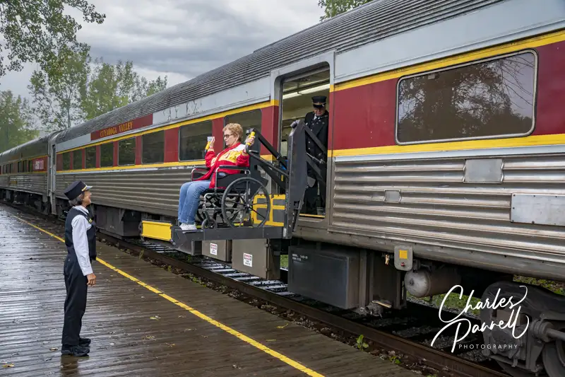
Cuyahoga National Park
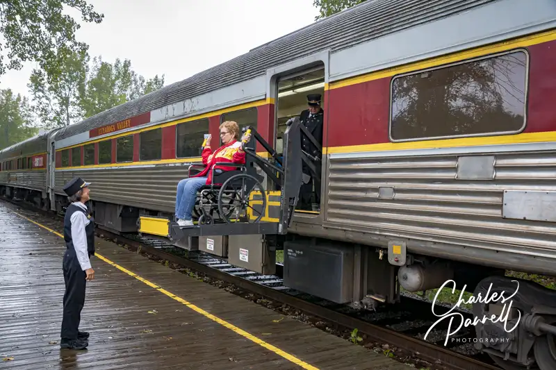
emerginghorizons.com/plan-a-wheelchair-accessible-reunion-at-cuyahoga-valley-national-park/
Next up on our list of wheelchair-accessible national park railroads is the Cuyahoga Valley Scenic Railway. This Northeastern Ohio scenic railway dates back to the 1800s, and today it operates excursions through Cuyahoga National Park. The 3.5-hour excursion begins in the Rockside Station and passes south along the Cuyahoga River through Brecksville, the Boston Store Visitor Center and Peninsula Depot, before it winds its way down to the Akron Northside Station. After a short stop, it then returns north to the Rockside Station. Access on board is great, with lift access to the accessible car which has 60 seats, all of which can be flipped up to accommodate wheelchair-users. It’s a scenic excursion through the national park, with plenty of opportunity for wildlife viewing, including catching a glance or two at the resident bald eagles.
Glacier National Park
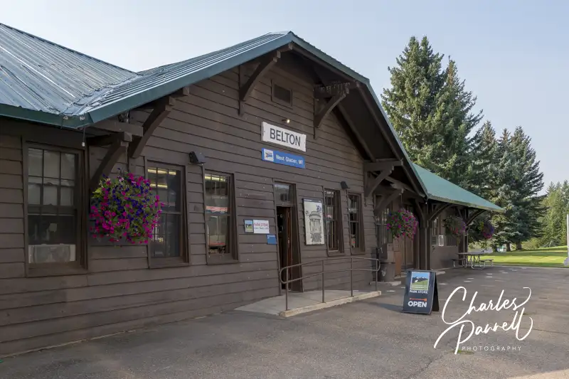 Belton Depot in West Glacier
Glacier National Park is another national park that you can get to without a car. Amtrak’s Empire Builder runs from Chicago to Spokane, with connections to Portland and Seattle. There is lift access to the train, with wheelchair-seating on board. The train stops at both West Glacier and East Glacier; and wheelchair-accessible shuttle transportation is available at both stops to connect to select lodges. And after you are settled in, you can use the Going-to-the-Sun Road shuttle or sign up for Red Bus tour to explore the park.
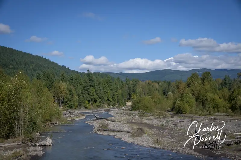
Mount Rainier National Park
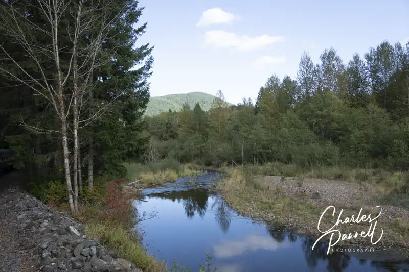 View from the Mount Rainier Scenic Railroad
emerginghorizons.com/all-aboard-the-mt-rainier-scenic-railroad/
Although the namesake Mount Rainier Scenic Railroad does not go into the national park, it’s still worthy of a mention here because of the scenery and iconic Mount Rainier views. The train departs from Elbe, which is about 15 minutes from the Nisqually Entrance of the national park. This daily excursion train features historic cars which are pulled by a Polson Logging No. 70 steam locomotive. That said, historic does not mean inaccessible, as a manual wheelchair lift is available at the station. Two excursions are available on the railway, both of which travel through the countryside, as attendants share the history of the area and points of interest along the way. And if the weather cooperates and the clouds clear, you’ll also be treated to an impressive Mount Rainier view.
Denali National Park
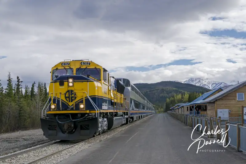 Alaska Railroad’s Denali Star
emerginghorizons.com/wheelchair-accessible-denali-national-park/
Last but certainly not least on our list of wheelchair-accessible national park railroads is the Denali Star up in Alaska. Operated by Alaska Railroad during the summer months, this line runs from Anchorage and Fairbanks to Denali National Park. All stations as well as the GoldStar dome cars are wheelchair-accessible. It’s a great way to get to this remote park, and most cruise lines also offer it as a post-cruise excursion. And you just can’t beat the scenery along the way. It’s a great prelude to a Denali National Park visit.

Barrier-Free Travel
Glacier, Yellowstone and Grand Teton National Parks
for Wheelers and Slow Walkers