Although it only takes a day to complete, the Golden Circle drive is the highlight of any Iceland visit. This popular route loops past waterfalls, geysers and all the spectacular scenery that makes the country a photographer’s dream. Not only are there some fantastic windshield views on the drive, but three of Iceland’s top natural attractions are also located along the route. So pack a picnic lunch and get ready to enjoy the scenic south on this fun Reykjavik side trip.
The Basics
The good news is, the Golden Circle route is an easy drive from Reykjavik. The roads are good, and there are plenty of signs along the way. The 190-mile route includes stops at Thingvellir, Geysir and Gullfoss, and features a beautiful country drive back to the city.
The bad news is that accessible rental vans are nearly non-existent in Iceland. That said, station wagons are widely available; so if you can transfer, fold up your wheelchair and stow it in back, that might be an option.
If not, there are several tour companies that can provide accessible Golden Circle tours. Prime Tours (primetours.is/) can customize a tour to meet your specific needs and interests. Their accessible van can carry one wheelchair-user and four other people, and their guides are well versed about access needs.
Where it All Began
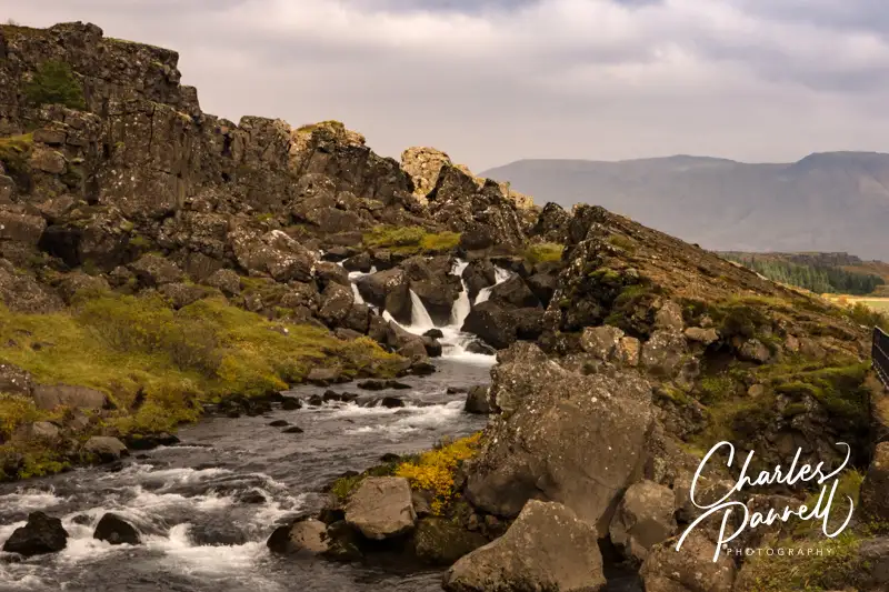
Waterfall in Allmanagjá Canyon, Thingvellir National Park
Located just 31 miles east of Reykjavik, Thingvellir National Park (www.thingvellir.is/en) is the first stop on most Golden Circle tours. Noted for both its beauty and geological value, this UNESCO World Heritage site is where the oldest existing Parliament first met.
People traveled to the Parliament sessions from all over the country and erected stone and turf shelters to protect them from the elements. Today, ruins of those structures can be seen in the surrounding fields. The assembly, which was held outside, took place at the Logberg (Law Rock) and the Logretta (Law Council). Unfortunately their precise locations are unknown, however interpretive panels that outline the history of the site are located throughout this national shrine.
The site was also designated as a national park in 1928 because of its tectonic and volcanic features. The continental drift on the North American and Eurasian tectonic plates can clearly be seen in the cracks and faults that are found in the area.
Access is variable throughout the site. Although paved pathways lead past the interpretive panels, there are a lot of rocks on the paths. Still, it depends on the time of year, and how recently the paths have been cleared. Some of the walkways may be a little steep, but there’s no harm in just doing as much as you can. It’s still a great stop as the drive around Lake Thingvallavatn is absolutely beautiful.
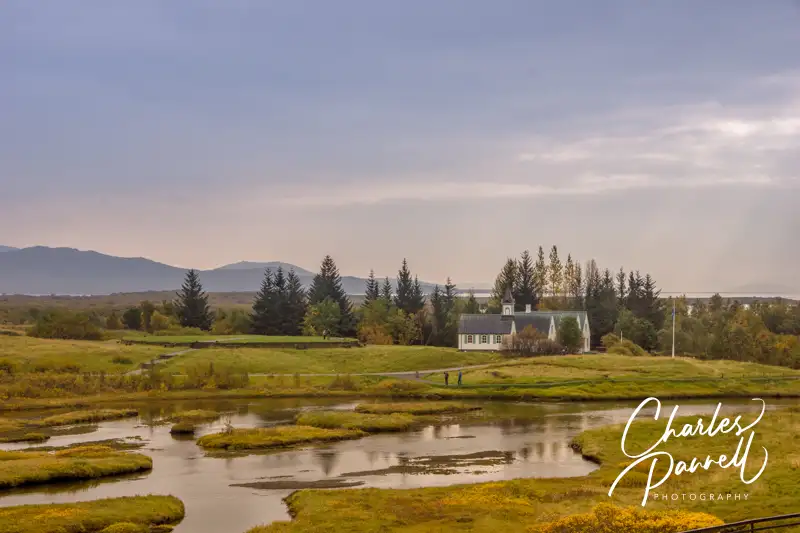
Thingvallakirkja Church in Thingvellir National Park
Geothermal Activity
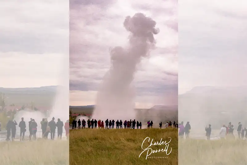
Strokkur Geyser
From Thingvellir, the route continues east to Highway 35, where you’ll find Geysir, a site of high geothermal activity. There’s level access to the Visitor Center, which has automatic doors and barrier-free access throughout the building. Inside there’s a restaurant, a cafeteria, a gift shop and a small collection of interpretive exhibits about the geothermal area. An accessible family restroom is also located in the building.
The geothermal area is located across the street, where a paved brick pathway leads around the Haukadalur geothermal area, which contains mud pools, fumaroles, algal deposits and geysers. The highlight of the geothermal area is the Strokkur geyser, which erupts every four-to-eight minutes. And although this Old Faithful of Iceland erupts regularly, some eruptions are more spectacular than others, so stick around until you catch one of the 30-foot high displays.
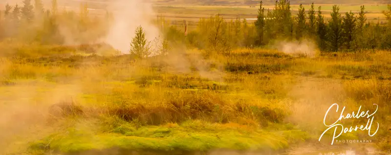
Steaming Grounds in Geysir
Cascading Waters
Gullfoss Waterfall
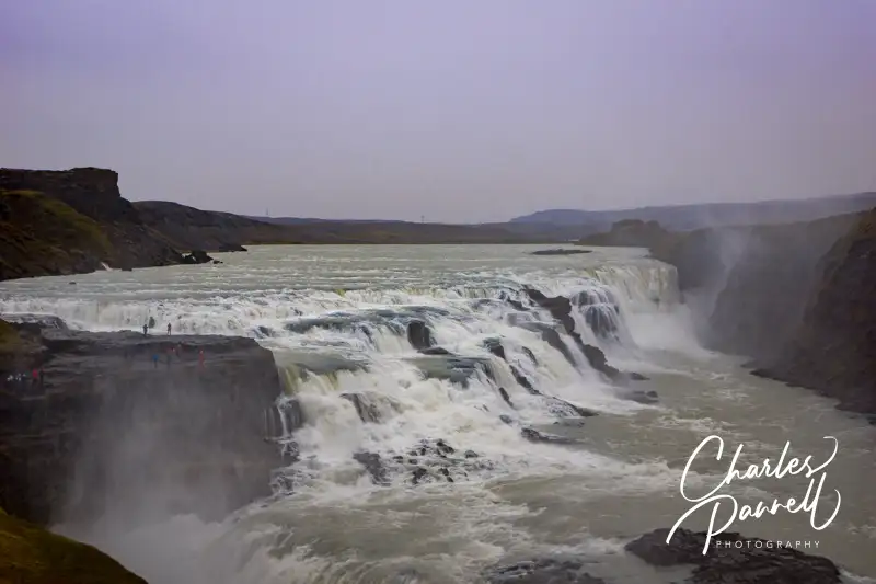
Just down the road from Geysir, you’ll find the crown jewel of the Golden Circle route, Gullfoss. Literally translated Gullfoss means “golden falls”, and on sunny days there’s usually a shimmering rainbow over the falls.
Accessible parking is located near a level boardwalk that leads out to an overlook. Even if you can’t manage the walk to the overlook, you’ll still get an excellent view of the double cascade falls tumbling down the rugged canyon, from just about anywhere along the boardwalk.
There is also stair access to an upper overlook, but the view is actually better from the lower overlook. Either way, the second largest waterfall in Iceland is definitely worth a stop, and it’s the perfect way to top off any Golden Circle drive.
Barrier-Free Travel 101 Accessible Vacations: Travel Ideas for Wheelchair-users and Slow Walkers
Located in Northwestern Washington, the Chinook Scenic Byway runs from the mountain community of Enumclaw to the fertile Naches Valley. This picturesque slice of Highway 410 winds through the Mt. Baker-Snoqualmie National Forest, snags the northeast corner of Mount Rainier National Park, and crosses over Chinook Pass, before it winds down to Naches. Dense forests line this mountain route; and if the cloud cover lifts, you’ll also get a magnificent Mount Rainier view. You can drive the route straight through in just two hours, but it’s best to budget a whole day, so you can fully enjoy the scenic wheelchair-accessible stops along the way. The Chinook Scenic Byway is much more than just a mountain highway — it’s a destination by itself.
Mount Rainier Gateway
Located about an hour southeast of Seattle, the mountain community of Enumclaw marks the beginning of the Chinook Scenic Byway. Known as the gateway to Mount Rainier National Park, Enumclaw is a good place to base yourself to explore the Sunrise section of the park, or to overnight before a Chinook Scenic Byway jaunt.
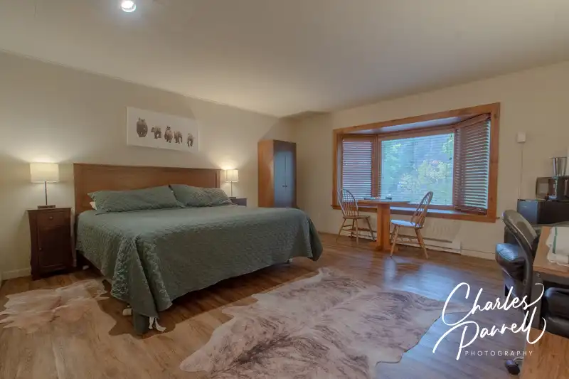
The GuestHouse Enumclaw (www.stayinns.com), which is located in the Enumclaw historic district, is a good choice for wheelchair-users and slow walkers. There’s an accessible drop-off area in front, with barrier-free access over to the front desk. Accessible room 1001 is located on the ground floor, just a short roll from the lobby.
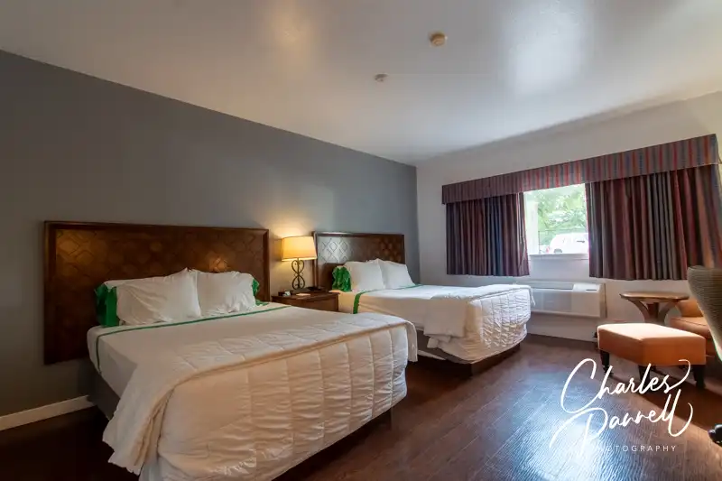
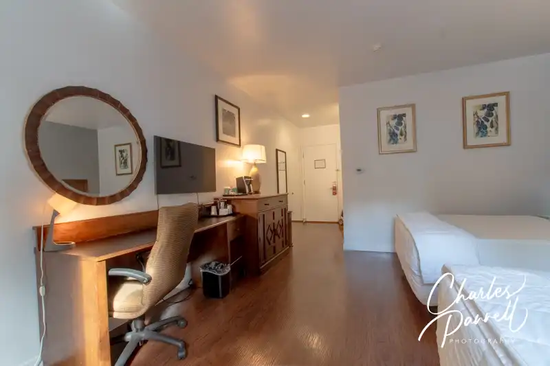
Access features include, wide doorways, lever handles, laminate flooring for easy rolling and good pathway access. It’s furnished with two 27-inch high open-frame queen-sized beds with an access aisle in the middle. Other furnishings include a nightstand, an easy chair, a desk with a chair and a chest of drawers. The room also has a refrigerator and a microwave.
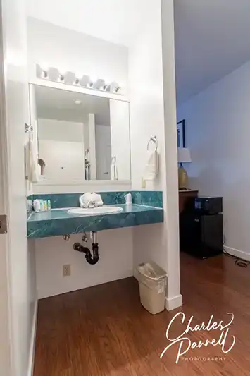
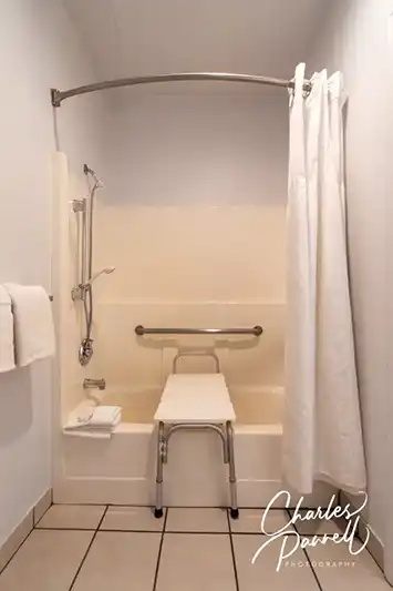
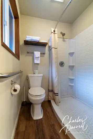
The bathroom has a tub/shower combination with grab bars and a hand-held showerhead. There’s also a portable shower bench in the bathroom. The toilet grab bars are located on the back and right walls (as seated), and there’s a roll-under sink just outside the bathroom.
A Continental breakfast is included with each stay, and it includes waffles, bread, cereal, fruit and beverages. Additionally, guests receive a 10% discount at Ranchitos Mexican Restaurant, which is located near the lobby. It’s a comfortable road trip property.
Room 1001 at the GuestHouse Enumclaw
Room 1001 at the GuestHouse Enumclaw (view 2)
Vanity in Room 1001 at the GuestHouse Enumclaw
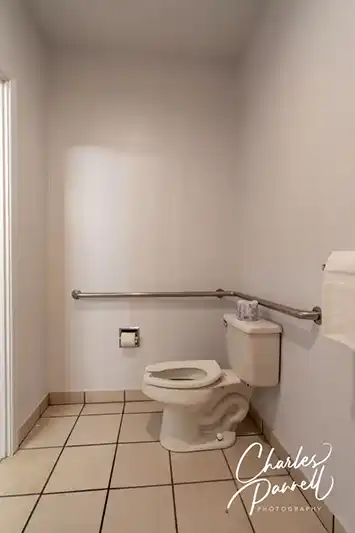
Toilet in Room 1001 at the GuestHouse Enumclaw
Shower in Room 1001 at the GuestHouse Enumclaw
Hit the Road
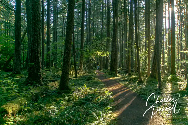
Whispering Hemlocks Loop Trail in Federation Forest State Park
From Enumclaw, head east on the Chinook Scenic Byway (Highway 410). Although it’s a beautiful route, with more than a fair share of windshield views, there are a few places worth a stop along this first stretch of the road. At the top of that list is Federation Forest State Park (parks.wa.gov/find-parks/state-parks/federation-forest-state-park), which is located about 15 miles east of downtown Enumclaw.
There’s accessible parking in the large lot, with level access over to the visitor center and the trailhead. The Whispering Hemlocks Loop Trail, which is the most accessible trail in the park, begins just to the left of the visitor center. This wide level hard-packed dirt trail is covered in crushed gravel, and winds through a shady slice of the forest. There are interpretive plaques along the way and a few benches tucked in secluded nooks here and there. This .3-mile loop trail offers a pleasant stroll through the forest, and it’s an excellent choice for wheelchair-users and slow walkers.
And if you’d like to stop for lunch, there’s also a nice picnic area in the park. The main park road loops through the picnic area, and about midway along there’s an accessible family restroom with accessible parking nearby. From there it’s just a short level walk to a shaded accessible picnic table.
As you continue east on the byway, be on the lookout for Skookum Falls Viewpoint on the right. It’s easy to miss as the signs aren’t always visible from the road, but it’s located about eight miles east of Greenwater. There’s a small paved parking lot at the viewpoint, with room for an adapted van to parallel park. To be honest, this is more of a river view; however you can usually spot the falls in the distance. Take your binoculars!
Mount Rainier Visit
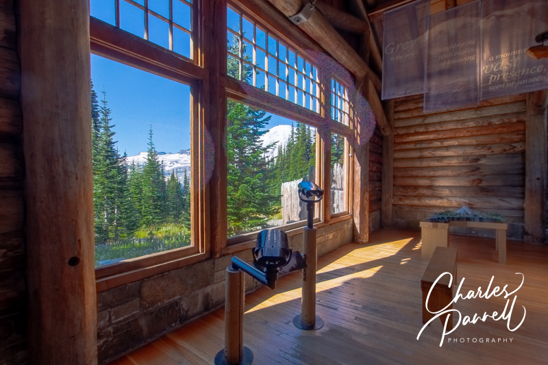
View from the Visitor Center at Paradise
The byway continues south through the forest; and just after it passes the turnoff to Crystal Mountain Resort, it enters Mount Rainier National Park. At this point, keep your eyes peeled to the west for some impressive views of Mount Rainier. There’s a small turnout between mileage markers 63 and 64 that’s worth a stop. There’s no paved parking, but it’s easy to parallel park and get a great view of the mountain from your vehicle. But to be honest, you’ll catch some great views all along this leg of the trip.
Although it’s a slight detour off the byway, a stop at Mount Rainier National Park is highly recommend. Just take the The White River Entrance south of Crystal Creek, and follow the 11.5-mile road to Sunrise — the highest point in the park navigable by vehicle.
At the top of the road, you’ll find the visitor center on the far side of the parking lot. The accessible entrance is on the side, and there’s barrier-free access throughout the building which is filled with exhibits on the surrounding area. The highlight of the visitor center is the Mount Rainier view, which can be had from the far window. And if you’d like a closer look, there’s an accessible scope set up near the window. There’s an equally good view outside, near the picnic tables to the left of the building.
On the way back down the hill be sure and stop at Sunrise Point, which is located on the last switchback before the top. There’s a paved lot in the middle of the switchback, or you can pull over on the side of the road. Either way, you’ll get a beautiful view.
More Mount Rainier Views
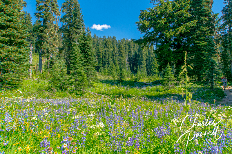
Wildflowers at Tipsoo Lake
After you’ve explored the Sunrise area, head back down the mountain and rejoin Highway 410. Continue south through the park and be on the lookout for more gorgeous Mount Rainier views on the west side of the road. When you come to the junction oh Highway 410 and Highway 123, continue east on Highway 410 towards Chinook Pass. There’s no shortage of windshield views along this stretch of the byway, but make sure and stop at Tipsoo Lake for a closer look at the landscape.
Located near the summit, this stop boasts a large picnic area and trailhead. There’s accessible parking near the accessible vault toilet, and near a few usable tables in the picnic area. There’s no view of the namesake lake from the parking area; however there are some great mountain views. Even if you don’t park the car, it’s worth a quick drive-through.
As you approach Chinook Pass (5,432 feet), you’ll pass under a pedestrian bridge that crosses the byway; and just up ahead there’ a pullout on the right. There are spots to parallel park in the lot, and there’s a lowered wall nearby to afford wheelchair-users a better view. And if you need to use the facilities, there’s an accessible vault toilet in the parking lot across the street.
A Scenic Drive
Mather Memorial Parkway
After Chinook Pass, the byway winds down the mountain, past the turnoff to Bumping Lake and through the evergreen forest. As it descends to a lower altitude, you’ll spot deciduous trees and the Naches River flowing alongside the road. It’s an especially scenic drive in the fall, with the changing colors.
There’s no shortage of pullouts along the route, so feel free to pull over and take in the scenery. It’s also a great route for photographers. Additionally, there’s a nice rest stop about 24 miles from Chinook Pass on the east side of the road. Technically it’s the trailhead for the Mather Memorial Parkway Nature Trail; however there are also accessible vault toilets near the accessible parking area at this site. It’s a nice spot to take a break, but keep in mind that it may be closed near the end of the season.
A Historic Lodge
Just down the road in Cliffdell, Whistlin’ Jack’s Outpost and Lodge (www.whistlinjacks.com), is also worth a stop. A Washington state icon since 1957, the lodge was named for the the whistling warning sounds made by marmots, which later became associated with the local lumberjacks. There’s accessible parking in front of the office with level access over to the gift shop and restaurant. It makes a nice lunch stop, or even a spot for a short break. There’s a pleasant river view from the restaurant, and a few picnic tables outside on a level grassy area.
And although the lodge doesn’t have any wheelchair-accessible rooms, Room 1 may work for some slow walkers. There’s standard parking in front of the room; however there’s some additional space on one side. The room has a one-inch lip at the threshold but it has a wide door, lever handles and laminate flooring. It’s furnished with a 26-inch high open-frame king-sized bed with plenty of room on both sides, two night stands, a wardrobe, an easy chair and a desk with a chair. There’s also a microwave, a refrigerator, a coffee maker and a table with two chairs.
The bathroom has a sliding pocket door with a 29-inch clearance, but there’s not enough room for a wheelchair inside the bathroom. It includes a large low-step shower (three inch lip) that measures 58 inches by 28 inches. There are no grab bars in the shower, but the toilet has a grab bar on the right side (as seated). And there’s a standard sink and mirror just outside of the bathroom. Again, the room is not wheelchair-accessible, but it may work for some slow walkers.
Room 1 at Whistlin’ Jack’s
Toilet and Shower in Room 1 at Whistlin’ Jack’s
Vanity in Room 1 at Whistlin’ Jack’s
Naches and Beyond
Autumn View at the Oak Creek Big Horn Sheep Feeding Station
Although the Chinook Scenic Byway technically ends when Highway 410 transitions into Highway 12, there are still a few worthwhile stops past the official end point. The Oak Creek Big Horn Feeding Station is located on Old Naches Road, about a half-mile from the intersection of Highway 410 and Highway 12. Although they only put food out for the bighorn sheep in the winter months, you can sometimes catch a gander of them in the nearby hills. Plus the scenery is beautiful, so it’s worth the short detour even if you don’t spot any wildlife.
Natches Trading Post
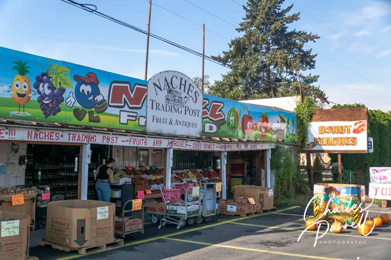
Just down the Road in Naches, the Naches Trading Post (www.facebook.com/nachestradingpost/) makes a good stop for some fresh produce, a collection of antiques and some yummy huckleberry fudge. There’s accessible parking in front, and level access to this huge fruit stand. Even if you don’t buy anything, it’s a fun place to stop and look at the antiques and collectables.
Be sure to take some time to enjoy the scenery on this stretch of the road, as orchards line both sides of the highway on this final part of the drive. And after you complete the route, you can continue on to the end of Highway 12 in Yakima, linger on and enjoy Washington wine country or continue along your way. Either way, the Chinook Scenic Byway is a must-drive route on any Northwestern Washington road trip.
Barrier-Free Travel Washington National Parks for Wheelers and Slow Walkers
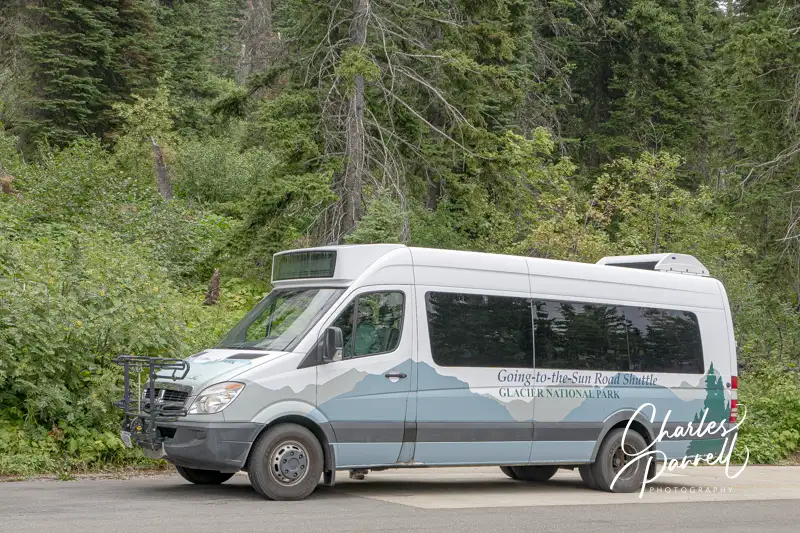
All shuttles are wheelchair-accessible, and the ticket price is a very reasonable $1 for passengers over 2 years old (there’s no charge for lap children). Shuttles depart from Apgar Visitor Center and Lake McDonald Lodge on the west side, and St. Mary Visitor Center and the Rising Sun Picnic Area on the east side. Advance tickets are required, and they are only available at www.recreation.gov. A portion of the tickets are released 60 days in advance, while the remainder are available 7 PM MDT for next day entry. Plan ahead, as walk-up tickets are not available at the park.
Why Take the Shuttle?
And in case you are on the fence about riding the shuttle, here are six reasons that make it a worthwhile choice.
The drive on the winding road up to Logan Pass can be daunting if you’re not used to driving in the mountains. Taking the shuttle allows you to relax and leave the driving to someone else.
You’ll definitely save on gas if you take the shuttle. And you won’t have to worry about filling up your tank to make it to your next destination.
You can really enjoy the view along the way, and even take some breathtaking photos if you’re not driving.
You don’t have to worry about finding a parking place at Logan Pass. The shuttle drops you off right in front of the Visitor Center. And there’s a nice accessible trail near the Visitor Center.
If you’re worried about time management, taking the shuttle can help you keep to a schedule. It’s easy for time to slip away while stopping at every pullout along the way to Logan Pass.
Last but not least, you don’t have to worry about driving in inclement weather if you take the shuttle. Rain storms and even a summer snowfall can make the winding mountain road to the top of Logan Pass slick, and even dangerous, in some places. Play it safe and take the shuttle.
So get your Glacier National Park tickets today at www.recreation.gov and have a safe and relaxing visit to Glacier National Park.
Barrier-Free Travel Glacier, Yellowstone and Grand Teton National Parks for Wheelchair-Users and Slow Walkers
There’s a certain seductive allure to Sedona. Some folks come for the mystical experience, while others enjoy gallery hopping. And then there’s the scenery. You just can’t beat the red rock formations that literally surround this Northern Arizona enclave. And the good news is, a good chunk Sedona’s red rock beauty is accessible to wheelchair-users and slow walkers.
Red Rock Scenic Byway
Red Rock Scenic Byway
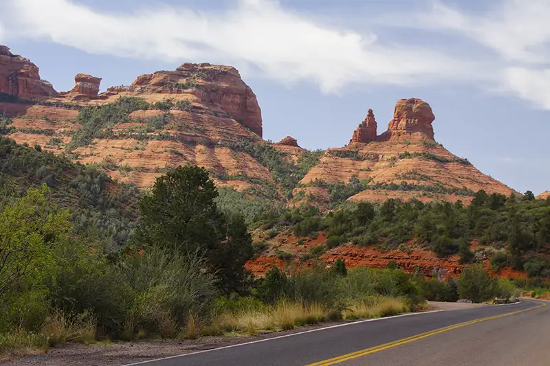
One of the best ways to enjoy Sedona’s red rock beauty is to take a drive on the Red Rock Scenic Byway. This popular route is located off of Interstate 17. Just take exit 298, and once you cross the Dry Beaver Creek bridge, the show begins.
The 7.5 mile scenic drive, which winds through the majestic landscape, is often referred to as a “museum without walls”. As you pass Oak Creek Village, the scenery becomes more dramatic. Bell Rock, one of Sedona’s four vortices, is located just past Oak Creek Village on the right. You can’t miss it. Bell Rock is one of the more accessible red rock formations, as the upper part of Bell Rock Trail is wide, level and made of hard-packed dirt. It’s doable for most wheelchair-users, however you can also get a great view of the iconic formation from the parking lot overlook.
Be sure to stop at nearby Courthouse Butte to admire the expansive scenery. And don’t miss the Chapel of the Holy Cross (chapeloftheholycross.com), which is built into the red rock buttes. There are a few accessible parking spots near the sanctuary, and golf cart transportation is available from the remote parking area. The chapel features ramp access, but some manual wheelchair-users may require assistance because of the pitch. Still it’s worth a stop even if it closed, just for a view of the impressive front facade.
Just up the road, the Red Rock Scenic Byway ends at Highway 89A. All in all it only takes 20 minutes to drive the route, but allow for extra time for lots of photo stops. And even though a Red Rock Pass is required for hikers, it’s not required for quick photo stops of 15 minutes or less.
Red Rock State Park
Mesquite Interpretive Loop
Red Rock State Park (www.azstateparks.com/red-rock), which is located on Highway 89A South is also worth a visit. There are a two accessible trails in the park, but they don’t offer much shade, so it’s best to go early in the day.
Accessible parking is located near the visitor center, with ramp access down to the building. Inside there’s plenty of room to maneuver a wheelchair around the gift shop, ranger information desk and interpretive exhibits. Accessible restrooms are located near the front door, and there’s also level access to the theater and classroom next door. And don’t miss the hummingbird garden on the back patio.
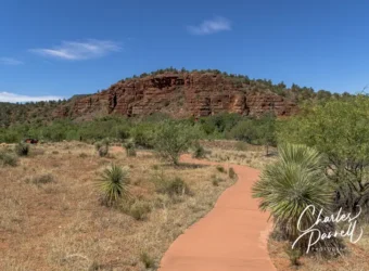
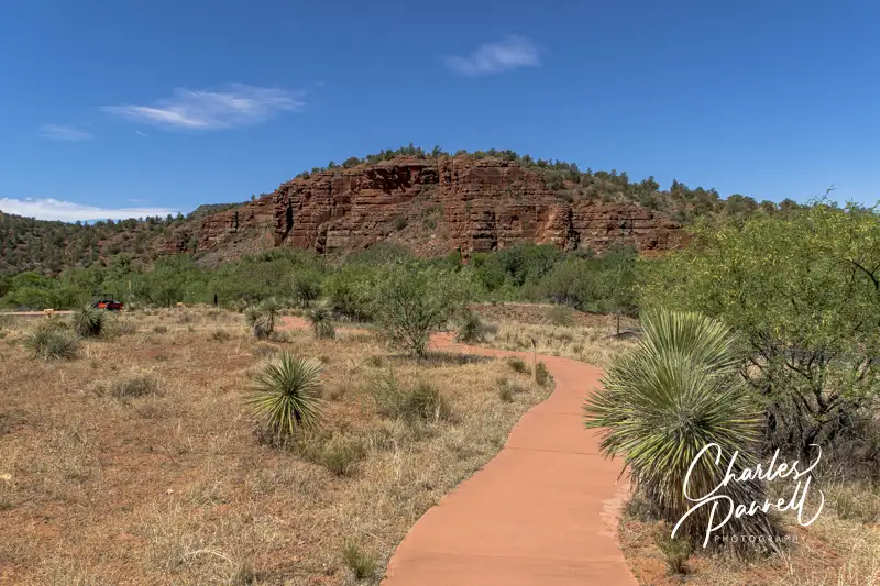
The accessible Mesquite Interpretive Loop begins near the parking lot. This short trail features a paved level pathway around garden filled with native plants. There’s a shaded picnic area with accessible tables near the trail; and there’s also a shade structure located in the middle of this quarter-mile trail.
The longer Bunkhouse Trail begins behind the visitor center. Although you can access it from the parking lot, that pathway has a steep grade. Alternatively, there’s level access to the trail from the hummingbird garden. The paved trail is fairly level, although there’s a bit of a grade in the beginning. Power wheelchair-users won’t have a problem, but some manual wheelchair-users may require assistance. There are also some cracks along the paved trail, but other than that it’s fairly smooth rolling.
At about the .2-mile mark there’s an accessible hard-packed dirt trail down to the Kingfisher Bridge, which provides a pleasant — and shaded — view of Oak Creek. From there a hard-packed dirt path follows the creek for another .2 mile before the trail loses its access. All in all it’s a pleasant mile-long out-and-back hike.
Slide Rock State Park
Pendley Homestead House on the Pendley Homestead Trail
Finally, if you’d like to hit a local favorite, head on over to Slide Rock State Park (azstateparks.com/slide-rock). It’s located 20 minutes north of Red Rock State Park on Highway 89A. This park provides access to Oak Creek, and it takes its name from the rocks that many folks use as slides to get into the water.
Unfortunately the path down to the creek is not accessible, but there is a short trail that offers a scenic overlook of the canyon. That said, the admission is pretty steep ($20 to $30 per car, depending on the season) for just that trail; however if you have an Arizona State Park Pass, this park makes a nice lunch stop.
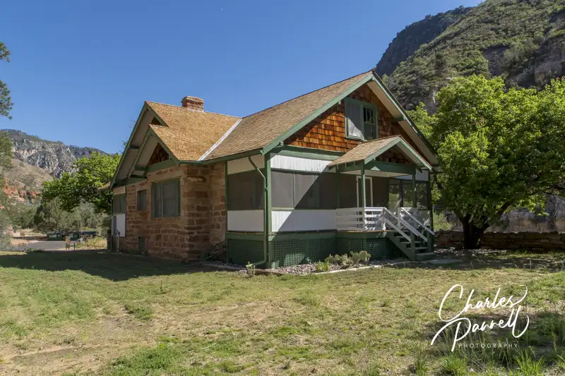
There’s accessible parking near the shaded picnic area — which has several accessible tables — and barrier-free access over to the Pendley Homestead Trail. This paved level trail leads past a small store, and by a display of vintage farming equipment, over to the old homestead which features a tractor display in the adjacent barn.
The trail then connects with the Cliff Top Trail which has a 75-foot paved path out to an accessible overlook that offers an expansive view of Oak Creek Canyon. All in all it’s about a quarter-mile round trip, and it makes for a nice stroll before of after lunch. And if you’d prefer to skip the hike, this piece of Sedona’s red rock beauty is easily visible from the the picnic area.
Barrier-Free Travel the Grand Canyon for Wheelchair-users and Slow Walkers
The good news is, Daytona Beach is very accessible; in fact it’s known for it’s hard-packed sand beaches. You can drive on the beach, and wheelchair-users have no problems rolling over the almost cement-like sand surface. That said, if you’d like information on loaner beach wheelchairs, visit volusia.org/services/public-protection/beach-safety/beach-information-for-the-disabled.stml. There’s also information about accessible beach parking there.
And for a detailed information on Daytona Beach wheelchair accessible activities, including, accessible trails, dining, transportation and itinerary suggestions, visit daytonabeach.com/accessibility/. Compiled by local accessibility expert Steve Deal, this helpful resource includes copious information about each listing, so visitors will have no problems determining what will and what won’t work for them,
Check out these two great resources before your next Daytona Beach visit.
Barrier-Free Travel Favorite Florida State Parks for Wheelers and Slow Walkers
Sometimes wheelchairs and Mother Nature just don’t mix. Although access to natural areas has greatly improved over the years, some panoramic views are still out of reach to wheelchair-users and slow walkers. Fortunately that’s not the case on the Pend Oreille River in Northeastern Washington. In fact, thanks to the efforts of Seattle City Light and the US Forest Service, there are three well developed wheelchair-accessible Pend Oreille River viewpoints near Metaline Falls. Add in a few short trails, some interpretive exhibits and a nice mix of wildlife, and it’s a great place to slip away and enjoy mother nature for a few hours.
Vista House
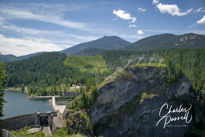
Boundary Dam on the Pend Oreille River Viewed From Vista House
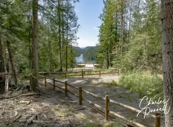
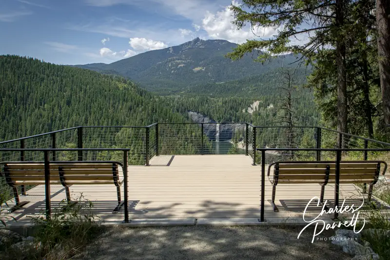
Vista House, which is the first wheelchair-accessible Pend Oreille River view, is located just south of the Nelson-Metaline border crossing along the International Selkirk Loop (emerginghorizons.com/the-international-selkirk-loop-for-wheelchair-users-and-slow-walkers/). From Highway 31, (the International Selkirk Look) turn west on East Side Road near Crescent Lake. As soon as you turn on to East Side Road you’ll be captivated by the view of Crescent Lake on the left, and as you drive through the forest, you’ll see bits and pieces of it along the way. Continue along the road for about two miles, until you reach Vista House at the end of the line.
There’s plenty of accessible parking in the lot, with barrier-free access to Vista House and the nearby accessible restrooms. Vista House is a small interpretive center that overlooks Boundary Dam. There’s level access to the building, which houses a few exhibits; but to be honest the best views can be had from the outside.
There’s a standard picnic table on the left side of the building, with room at the end for a wheelchair. There are also built-in benches that line the deck area which can be used for a picnic. From the left side of Vista House you’ll get a view of the dam, and if you roll around to the right side of the building you’ll get a nice view of the Pend Oreille River.
There’s also a quarter-mile trail that leads down to a lower viewpoint, but because of the elevation change it’s really not doable for wheelchair-users. Some slow walkers may be able to do it, but take some time to evaluate the slope before you give it a try. Still, the view from top is reason enough to put this stop on your list. Even better — it’s not crowded.
Peewee Falls Overlook
Viewpoint at Peewee Falls
As you head back to Highway 31, be sure and stop at the Peewee Falls Overlook, which is about a mile from Vista House. The turn is well marked, and the dirt road is maintained and doable in a standard vehicle. It may be a bit dusty, but that’s just part of the rustic ambiance.
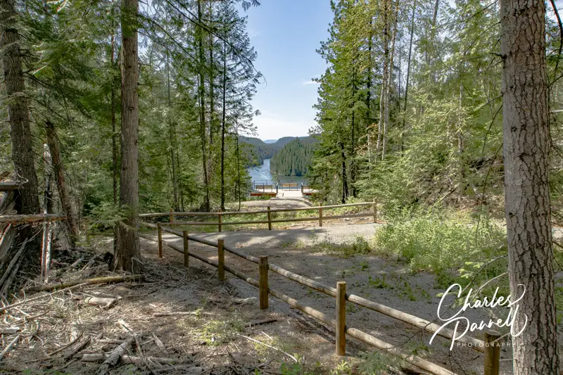
There’s plenty of accessible parking at the Peewee Falls Overlook in the large paved lot, with barrier-free access to the nearby accessible vault toilets and accessible picnic tables. From the picnic area, a hard-packed dirt trail covered in crushed gravel leads down to the viewpoint.
Peewee Falls cascades down into Boundary Lake, which was formed by the creation of the Boundary Dam on the Pend Oreille River. It’s not a massive waterfall — hence the name — but the lake isn’t very crowed and the whole view is rather calming. It’s a pleasant quarter-mile round trip stroll to the viewpoint; and again, this stop is minus the crowds.
Riverside Canyon Overlook
Trail to Riverside Canyon Overlook
Last but not least, save time for a stop at Riverside Canyon Overlook on your Pend Oreille River drive. From Peewee Falls, continue back to Highway 31 and head south. Make a right on Forest Road 172, about five miles down the road. Although it’s hard to spot the street sign, the turn is well marked by a brown “Riverside Canyon Overlook” sign. Continue down the dirt road for another mile and follow the signs to the overlook parking lot.
There’s accessible parking near the accessible vault toilets, and a level path over to the accessible picnic tables. From the picnic area a hard-packed dirt trail covered in crushed gravel leads down to the viewpoint. It’s a .4-mile one-way hike, although you can get a slight glimpse of the view from the half-way point. That said, the best view of the river is from the accessible viewing platform at the end of the trail. Although the trail is accessible it’s not level, and there are several uphill and downhill sections along the way. Still it’s within code, with spaces to rest in between the uphill sections. Additionally, you can get a good view of Hooknose Mountain from the parking lot.
After you’ve had a good dose of Mother Nature along the Pend Oreille River, you can continue on along the International Selkirk Loop, take a hike at the Mill Pond Site, and maybe even stop for a bite to eat in Metaline Falls. There’s really no shortage of accessible choices in this scenic neck of the woods.
Barrier-Free Travel Washington National Parks for Wheelers and Slow Walkers
There’s no shortage of scenic beauty in the Pacific Northwest, but the Mount Hood Infinity Loop in Northwestern Oregon offers more that its fair share of eye candy. The route begins about 20 miles east of Portland as it follows Highway 84 alongside the Columbia River, then heads south through vineyards and farmland to majestic Mount Hood. Finally it circles back north through conifer forests, and offers a picturesque side trip through a waterfall corridor.
The 135-mile loop takes about three hours to drive straight through; however it’s best to spend a few nights in the area, take your time and enjoy the stops along the way. And although the route travels through the mountains and other harsh terrain, there are plenty of wheelchair-accessible stops along the way. So get ready to hit the road and enjoy a wheelchair-accessible slice of the scenic Mount Hood Infinity Loop.
Well Dam!
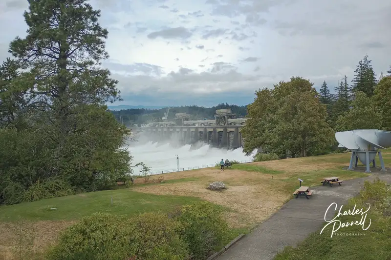
Bonneville Dam on the Mount Hood Infinity Loop
The first stop stop on this accessible Mount Hood Infinity Loop is Bonneville Dam (www.nwp.usace.army.mil/bonneville/). Built in 1938 by the Army Corps of Engineers, the site features the dam, two powerhouses, a spillway, a navigation lock, fish ladders and a fish hatchery. Just take exit 40 from Highway 84 and follow the signs. Bear right at the security gate and head over to the Bradford Island Visitor Center.
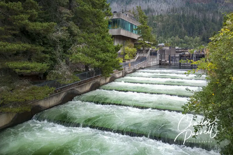
There’s accessible parking in the visitor center lot, with level access to the building. Inside, there’s plenty of room to navigate a wheelchair and there are accessible restrooms around the corner. This fourth-floor lobby serves as an information and welcome center. Start your visit with an elevator ride down to the third floor to watch a movie about the dam; then continue on down to the first floor to see some interpretive exhibits and viewing windows on the fish ladders. Complete your visit with a trip to the roof for a birds-eye view of the dam.
The navigation locks are located a short drive away, with accessible parking in front. There’s ramp access up to the viewing platform and lock visitor center. The visitor center has a collection of exhibits that explain the operation of the locks. And if you’re lucky, a ship will pass through and you’ll see them in operation.
Save some time for a stop at the fish hatchery, which includes accessible parking and paved access around the outside display ponds. There’s barrier-free access to the visitor center, which details the operations of the hatchery. There’s also level access to the nearby gift shop. It’s a pleasant and accessible walk through the shaded grounds around the ponds — and don’t forget to feed the trout.
Fish ladder at the Bonneville Dam on the Mount Hood Infinity Loop
The View From Washington
Bridge of the Gods
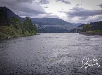
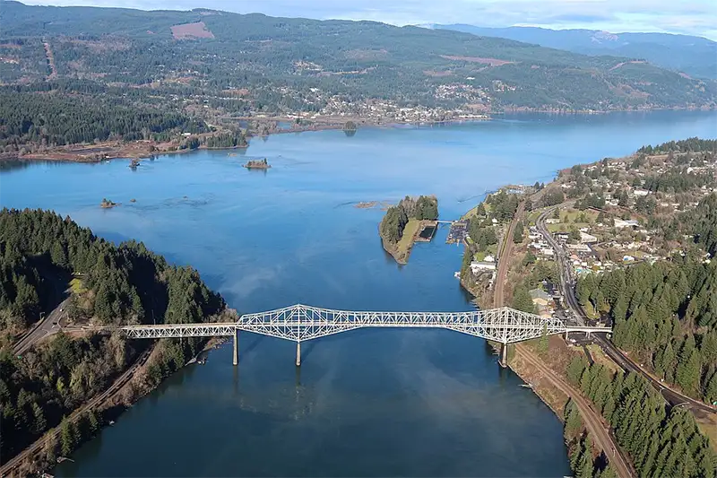
As you continue east on Highway 84, you can’t miss the Bridge of the Gods (www.portofcascadelocks.gov/bridge-of-the-gods). Originally constructed in 1926, this cantilever bridge had to be raised 44 feet after Bonneville Dam was completed. Subsequently, Charles Lindbergh flew under it in true daredevil fashion in 1927.
Although you’ll get a better view of it from afar, it’s also worth a short detour to cross this historic structure. From Highway 84, take exit 44 and follow the signs. This two-lane toll bridge, which is just 22 feet wide, spans the Columbia River and connects Oregon with Washington.
Of course once you cross over to the Washington side, you’ll have good view of the bridge, the Columbia River, and the Oregon side of things. A pleasant place to enjoy that view is Skamania Lodge (www.skamania.com), more specifically the Cascade Dining Room at Skamania Lodge. It’s a nice spot for a leisurely brunch, as it overlooks the Columbia River with views of the lush pine forests on the Oregon side. Menu offerings range from brioche bread French toast and a crab eggs Benedict to steelhead tacos, a pacific crab roll and a delicious seafood salad. The choices are tasty and the view is exceptional.
Stay a Spell
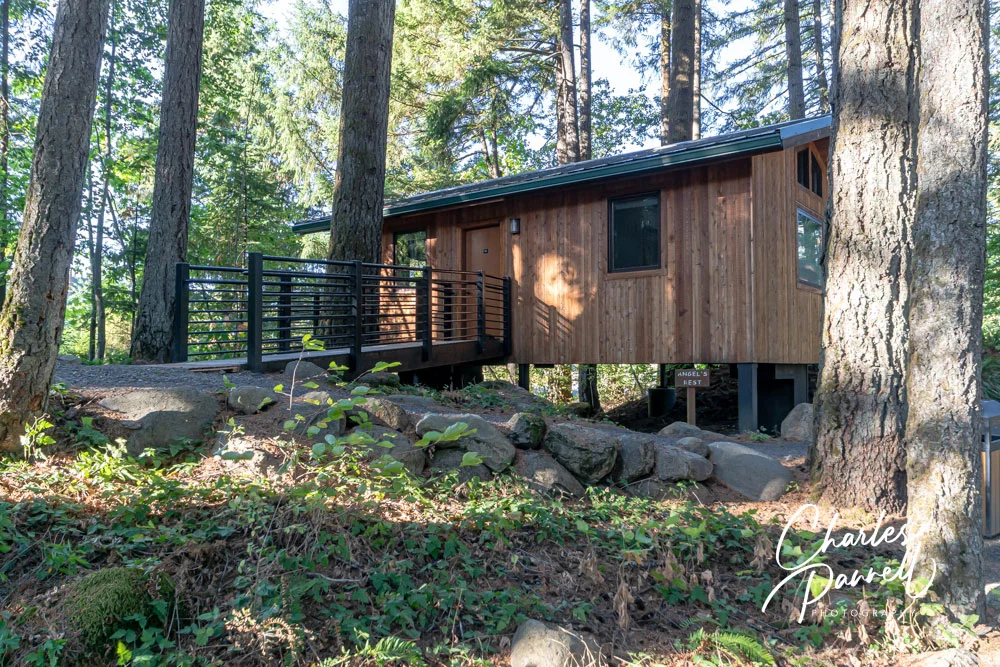
Angels Rest Accessible Treehouse Suite at Skamania Lodge, Oregon
Skamania Lodge also makes an ideal home base for a multi-day Mount Hood Infinity Loop excursion. Access is excellent throughout the property, which offers accessible lodge rooms with either a roll-in shower or a tub/shower combination. And if you’d like something a little different, spend the night in the treetops in a wheelchair-accessible treehouse (emerginghorizons.com/sleep-in-a-wheelchair-accessible-treehouse-at-skamania-lodge/).
The newest addition to the accessible lodging inventory at Skamania Lodge is a luxurious wheelchair-accessible cabin. https://emerginghorizons.com/relax-in-a-skamania-lodge-wheelchair-accessible-cabin/. Nestled away in the treehouse section of the property, this spacious cabin includes a large bathroom with a roll-in shower, a compact kitchen, a separate bedroom, a cozy fireplace and a spacious deck with a firepit — and it’s all wheelchair-accessible.
Vintage Autos & Aircraft Galore
Planes at The Western Antique Aeroplane and Automobile Museum
After a Skamania Lodge visit — or overnight stay — cross back over the Bridge of the Gods and continue east on Highway 84. Take exit 62 about 20 miles down the road, then follow Country Club Drive and Barrett Road to the Western Antique Aeroplane and Automobile Museum www.waaamuseum.org. It’s a pleasant 25 mile drive, as the scenery transitions from the Columbia River landscape to the farming and agricultural region around Mount Hood.
There’s accessible parking near the museum entrance, with level access over to the building. The large collection is housed in three adjacent hangers, which have cement floors and plenty of room to maneuver a wheelchair. There’s also an accessible restroom on site, barrier-free access to the gift shop, and a power wheelchair available to rent.
The thing that makes this massive auto, aircraft and motorcycle museum unique, is that most of the collection is flyable or drivable. And besides the aircraft and autos, you’ll find vintage furniture, appliances, toys and decorations woven between them. This museum houses much more than airplanes — it includes everything that flies, from balloons to gliders — and it also features a substantial Wright Brothers exhibit. And don’t miss the oldest Boeing aircraft, a 1928 40C mail plane — and yes it still flies.
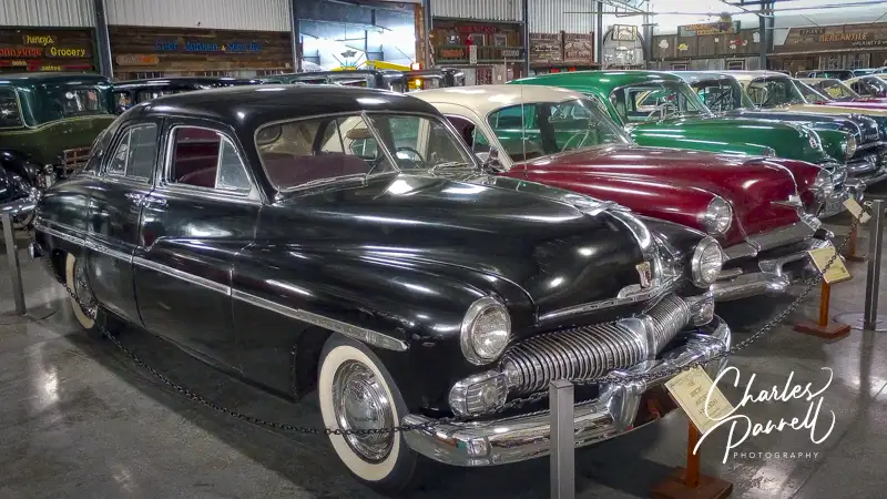
A second hangar is devoted to military planes and includes a large collection of military equipment, from radios and MREs to bicycles, scooters and even a jeep. The final hangar is filled with over 130 cars, including a 1914 electric car, a Studebaker and a Locomobile. And if you get tired, there are plenty of spots to sit and take a break along the way. It’s an excellent and often overlooked museum.
Autos at the Western Antique Aeroplane and Automobile Museum
At the Summit
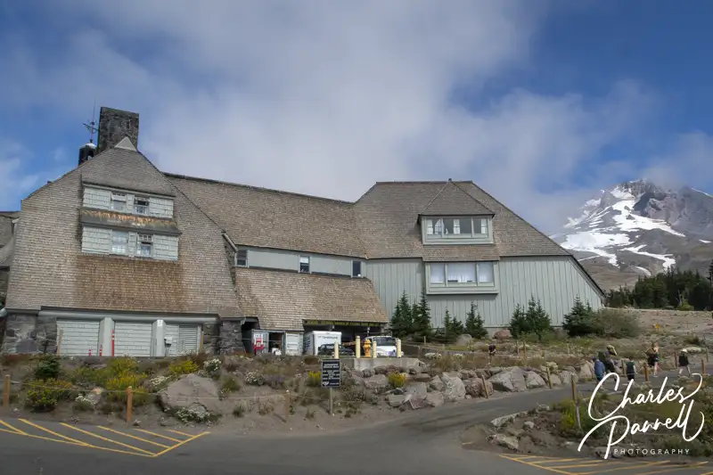
Timberline Lodge at Mount Hood, Oregon
One of the highlights of the Mount Hood Infinity Loop, is a visit to Timberline Lodge (www.timberlinelodge.com) at the summit. From the Western Antique Aeroplane and Automobile Museum follow Odelle and Davis Drive to Highway 35 south, then take Highway 26 east to the Timberline Highway. From there it’s just a six mile drive; however the road has up to a 10% grade with numerous switchbacks along the way. Timberline Lodge is located at 6,000 feet, and it’s not unusual to see snow there, even in the summer.
Known as the showplace of Works Projects Administration projects, Timberline Lodge was dedicated in 1935 by President Roosevelt. The consulting architect, Gilbert Stanley Underwood, who designed national park lodges in Yosemite and Bryce Canyon, was known for using natural materials to help his buildings blend in with their surroundings. The Underwood style caught director Stanley Kubrick’s eye, and he ultimately used aerial shots of the property in the opening scenes of The Shining.
And although the drive is certainly scenic, the best plan of action is to enjoy a little time on top, look around the lodge and have lunch. There are two different parking areas on top. The lot close to the lodge is reserved for overnight guests, while the one further away is for day visitors. And the walk to the lodge is uphill from the day-use parking. Still if you stop at the guard shack and tell them you have a disabled passenger they will let you drive in and drop them off. Although there are steps up to the front entrance, there’s plenty of accessible parking near an elevator that takes you up to the lobby level. It’s a pleasant place for a midday break.
Mount Hood History
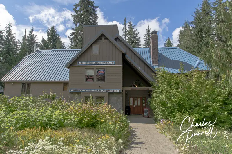
Mount Hood Cultural Center & Museum
After you get descend from the mountaintop, take a little time to learn about some local history at the Mt. Hood Cultural Center & Museum mthoodmuseum.org. To get there, continue east on Highway 26, then make a right on Government Camp Loop, about a quarter-mile down the road. The Mt. Hood Cultural Center & Museum is on the left, with street parking in front.
Accessible parking is located near the museum, with level access over to the building. And although the museum occupies several floors, there’s elevator access between them.
Downstairs, there’s an information center and a gallery that focuses on the history of the ski area and the local ski and recreation clubs. Upstairs there’s a gallery that showcases the works of Mount Hood area artists, and another one that boasts a large collection of skis and details the history of skiing. There’s also a gallery that focuses on the early exploration of the area and one that includes exhibits about the natural history and the regional flora and fauna. All in all this small museum offers a good primer of the area, with volunteers on hand to help you plan your visit, and loads of free brochures available to map out your travels.
Take a Hike
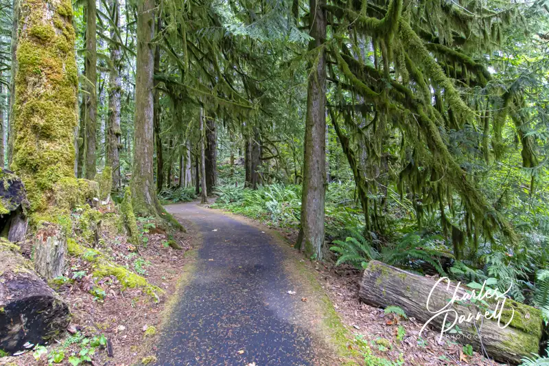
Cascade Streamwatch Trail in the Recreation Area
If you’d like to get out and enjoy a hike or two, head on over to the Wildwood Recreation Site www.blm.gov/visit/wildwood-recreation-site, which is on Highway 26 about 13 miles east of the Mt. Hood Cultural Center & Museum. This site has two accessible trails and a nice picnic area. And although there is a day-use fee at this area, the America the Beautiful Access Pass (emerginghorizons.com/how-to-get-a-lifetime-national-park-pass/) is also good there.
The Cascade Streamwatch Loop is located all the way at the end of the the main park road. There’s accessible parking near the accessible restrooms, and level access over to the trail. Make a right just past the amphitheater and follow this .75-mile paved loop through the alder and conifer forest. Be sure and take a slight detour near the beginning of the trail to the underwater viewing window, where you can see the hidden side of the river ecosystem. After you rejoin the main trail, continue alongside the Salmon River and loop back to the beginning. There are benches to rest along the way, and the picnic area near the pavilion includes an accessible table on level ground. It’s shaded by the trees, and a very pleasant place to take a break.
The equally accessible Wetlands Loop can be accessed from the next parking lot. Although there is a connector trail from the Cascade Streamwatch Loop, it’s steep and not accessible. Accessible parking and restrooms are located near the trailhead, with level access over the .75-mile trail. It begins as a paved trail, crosses the river and continues as a boardwalk through the cattail marsh, before it reconnects to the paved trail and loops back to the parking area.
Million Dollar View
Jonsrud Viewpoint on Highway 36
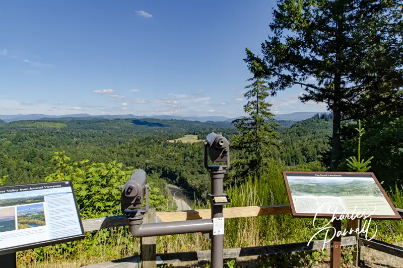
You’ll catch fleeting glimpses of Mount Hood from Highway 26, but for a great photo op continue east along the thoroughfare to an often overlooked viewpoint. It’s located about four miles down the road in Sandy. Turn north at the Walgreens on Bluff Road, then continue on for about a mile to the Jonsrud Viewpoint, on the right.
There’s accessible parking near the viewpoint, with curb-cut access to a brick path to the overlook. From there you’ll get what’s billed as “one of the best views of Mount Hood in Oregon.” There’s also a wheelchair-height viewing scope, which allows folks who are color blind to view the vivid scenery of the Sandy River Valley. This neighborhood overlook is also the perfect spot to wait out the clouds and for an unobstructed view of Mount Hood. It’s a great little detour.
Tracking Sasquatch
North American Bigfoot Center
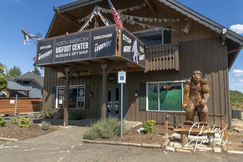
Once you’re back on Highway 26, continue east for five miles to Boring, and make a stop at the North American Bigfoot Center northamericanbigfootcenter.com. Located just off the highway it’s easy to find — turn in at the Chevron, then wind past Chester’s Pub to the back of the parking lot. You can’t miss this eclectic attraction, as the entrance is marked with a giant Bigfoot statue.
There’s accessible parking and a level entrance to the museum, which houses Bigfoot evidence and artifacts from around the world. There’s plenty of room to navigate a wheelchair throughout the galleries, and to roll up to a life-sized Sasquatch (named Murphy) for a photo.
The galleries are filled with photos, films and descriptions of first-person sightings of Bigfoot from around the world. From Vietnam and Australia, to Western Sumatra, California and of course the Pacific Northwest, there are Bigfoot stories from nearly every corner of the world. There’s also a robust collection of Bigfoot artifacts, including, footprints, handprints, fingerprints and even hair (in a Nutella jar). And if you’d like some first-hand information on Bigfoot, the museum is staffed with experienced field researchers who are happy to share their stories. Don’t miss the gift shop, which has a solid collection of Bigfoot books, clothing and assorted trinkets. Even if you don’t buy anything, it’s quite entertaining to browse through the assorted offerings.
A Waterfall Detour & More
Bridal Veil Falls
After you’ve had your Sasquatch fix, continue east on Highway 26 to Troutdale and make a quick stop at Barn Hall (www.facebook.com/THSkingofroads/). Although this small museum has limited hours (check the website), it includes some interesting exhibits about the history of the area. The barn itself was constructed in 1988 by the Troutdale Historical Society, and 10 years later they opened their doors. The exhibits change up a bit every few years, but they always focus on the history of the Columbia River Gorge.
There’s no striped parking in the gravel lot, but depending on the crowds, it’s usually possible to parallel park an adapted van, with room to deploy the ramp. There’s barrier-free access to the museum, and plenty of room to maneuver a wheelchair inside. Although it’s a small museum, it’s definitely worth a stop if you can catch it open when you’re in the area.
To complete the Mount Hood Infinity Loop, hop on Highway 84 and continue east. There is, however, a highly recommended short scenic waterfall detour along the way (emerginghorizons.com/explore-the-historic-columbia-river-highway-waterfall-corridor/). From Highway 84 take exit 22 at Corbet, then follow Corbet Hill Road south on this short section of the Columbia River Highway. The two-lane road meanders past five waterfalls, and it’s especially scenic during the spring runoff. You can drive straight through or stop and linger along the way. Either way, it’s a worthy side trip. And when you’re through, hop back on Highway 84 and continue on your way. It’s the perfect ending to any Mount Hood Infinity Loop scenic drive.
Barrier-Free Travel Washington National Parks for Wheelers and Slow Walkers
Population 243
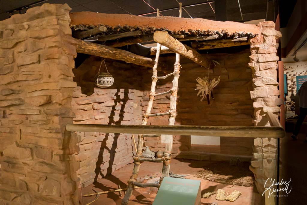
This Southern Utah town, which is located along Scenic Byway 12, connects Capitol Reef National Park and Bryce Canyon National Park. It’s home to the Anasazi State Park Museum (www.stateparks.utah/parks/anasazi) , which offers an intimate look at the Anasazi people who once inhabited the area. The highlight of the museum is the Coombs excavation site out back — where 97 rooms, 10 pit structures and hundreds of thousands of artifacts were unearthed. There’s a level walkway through the excavation site, with interpretive panels about the former residents along the way. While you’re in town, stop in and have a bite at the Burr Trail Grill — which features level access — and don’t forget to save room for a piece of their mouth-watering home made pie. Last but not least, save some time for a scenic drive on the Burr Trail, which begins next to the Burr Trail Grill and winds through Grand Staircase-Escalante National Monument.
Located in Eastern Utah just five miles north of Moab, Arches National Park is known for its more than 2,000 natural stone arches. The main park road runs from the visitor center to the Devils Garden Trailhead, and connects with side roads to the Windows Section and Wolfe Ranch. And although the major sites are marked on the park map, there are also a number of unmarked pullouts along the way that offer spectacular windshield views of the beautiful red rock landscape.
Insider Tips
Don’t miss Balanced Rock – one of the most accessible sites in the park. It offers a nice .2-mile out-and-back accessible stroll around the seemingly precariously perched namesake rock, with a killer view from an overlook located midway along the route.
Although the main trail to Skyline Arch is not accessible, due to steps and rocks. wheelchair-users and slow walkers can easily access the other side of the arch from the Needles Campground. Just drive to the amphitheater, park in the accessible parking area, and take the level sidewalk over to the amphitheater. There’s an absolutely beautiful close-up view of Skyline Arch from just about anywhere in the amphitheater.
In addition to an entrance fee or a park pass, a day use vehicle entrance reservation is also required for Arches National Park, for visits from April through October between 7 AM and 4PM. Reservations are released in monthly blocks on recreation.gov beginning in January. Print out the reservation or do a screen capture, as cell phone service is spotty in the park. Entry reservation are not available at the park, and visitors who don’t have one will not be admitted.
If you don’t have an entrance reservation, consider entering the park before 7 AM. You’ll dodge the crowds and the park is absolutely beautiful as things begin to come to life for the day.
Located 2.5 hours northeast of Bryce Canyon National Park, Capitol Reef National Park is named for two of its prominent geological features. Take the name of a dome-like formation that resembles the US Capitol, and combine it with a massive rock wall that was likened to a barrier reef by early explorers, and voila, you have Capitol Reef. Today the 100-mile long Waterpocket Fold still presents a formidable reef-like obstacle, while Capitol Dome is one of the most recognizable park landmarks. Highway 24 bisects the park, which has a west entrance near Torrey and an east entrance 10 miles west of Caineville.
Insider Tips
If you have little ones in tow, be sure and stop in at the Ripple Rock Nature Center, which offers interpretive programs for children from Memorial Day to Labor Day. Activities include wool spinning, fossil identification and cornmeal grinding. Junior Ranger booklets and Family Fun Packs are also available there. Best of all, the nature center is wheelchair-accessible.
Most visitors completely miss Panorama Point, which offers one of the best views in the park. The turnout to the viewpoint is located west of the visitor center, at milepost 77 on Highway 24; and the overlook features a comprehensive and very scenic overview of the park. And although the trail to the upper viewpoint is steep and not wheelchair-accessible, there’s level access out to the lower viewpoint, and even a great windshield view from the parking lot.
Don’t miss the Petroglyph Boardwalk, which offers good views of the petroglyphs carved into the canyon walls along Highway 24. There’s level access to the viewing platform, which has an accessible scope trained on the canyon wall. The adjacent boardwalk also features level access, as it passes by another collection of petroglyphs believed to have been made by the Hopi and Paiute people.


 Although it only takes a day to complete, the Golden Circle drive is the highlight of any Iceland visit. This popular route loops past waterfalls, geysers and all the spectacular scenery that makes the country a photographer’s dream. Not only are there some fantastic windshield views on the drive, but three of Iceland’s top natural attractions are also located along the route. So pack a picnic lunch and get ready to enjoy the scenic south on this fun Reykjavik side trip.