Population 4,070
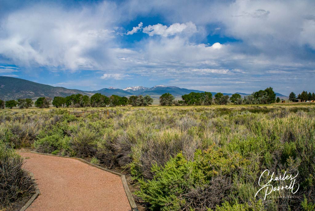
Located in Southern Colorado, about 50 miles north of the New Mexico border, Monte Vista is named for its spectacular mountain view. And although it’s a popular road trip stopover town, the big draw is is actually located on Highway 15 just south of town — the Monte Vista National Wildlife Refuge (www.fws.gov/refuge/monte_vista/). During the spring and fall thousands of Sandhill Cranes and migrating waterfowl descend on the surrounding wetlands, while song birds, shore birds and water birds nest there in the summer. Although most of the refuge can be seen in a car on the 2.5-mile auto loop, there’s also a short accessible trail near the entrance. This wide level pathway winds alongside the marsh and continues for 100 yards, and ends at an accessible overlook. It’s a nice spot to get some fresh air, and if you’d like to dine al fresco, there’s also a picnic table located near the trailhead.
Although California’s Central Valley can be dreary during winter, the migrant Sandhill Cranes have an entirely different view of it. To them it’s paradise; as it boasts abundant food, a temperate climate and a suitable habitat. It has everything a Sandhill Crane could want. That’s why every September they hit the Pacific Flyway in droves, and head south to their winter nirvana – the marshes and wetlands near Lodi, California. And although they have specific habitat requirements, they’re easy to find if you know where to look.
Consumnes River Preserve
Sandhill Cranes at the Consumnes River Preserve
Located between San Francisco and Stockton, just off Interstate 5, the Consumnes River Preserve (www.cosumnes.org) is an excellent place to spot the wintering cranes. It makes a great day trip from San Francisco or even a nice diversion on a longer road trip.
If you’re traveling south on Interstate 5, take the Twin Cities exit, turn east and drive for a mile until you reach Franklin Boulevard. Turn south on Franklin Boulevard, drive 1.7 miles and look for the visitor center on your left. Northbound traffic should take the Walnut Grove -Thornton Road exit, turn east on Thornton Road and drive for about 2 miles. You’ll spot the visitor center on your right, just after you cross the Thornton-Franklin Bridge.
There’s plenty of accessible parking in the upper lot next to the visitor center, and ramped access to the front entrance. Inside you’ll find a number of interpretive exhibits, along with an information desk. The building itself overlooks a wetlands area, and there are also several accessible picnic tables on the deck.
Wetlands Walk
Wetlands Walk at the Consumnes River Preserve
Directly behind the visitor center, you’ll find the trailhead for the Wetlands Walk. This one-mile loop begins with a boardwalk though the wetlands, then continues on a paved level trail. There are several viewing areas along the way, and also a secluded accessible picnic table after the first boardwalk. Near the end of the loop, a half-mile boardwalk branches off to the right. It’s wide, level and nicely accessible, with a large viewing platform that overlooks the marsh. It’s an excellent place to spot Great Egrets, Northern Pintails, Red Winged Blackbirds, Turkey Vultures and — in season — Sandhill Cranes.
And if you just want to enjoy the boardwalk, but can’t manage the Wetlands Walk, there’s also accessible parking by the boardwalk next to an accessible pit toilet. This parking area is located north of the Visitor Center on the opposite side of Franklin Boulevard.
It should be noted that the rangers close the boardwalk at dusk, as it’s a favorite night roosting spot for the Sandhill Cranes. That said, the best time to visit this area is early evening, just before dusk, as it’s a beehive of activity then. Visitors are welcome to bring lawn chairs and just sit back and enjoy the show.
After the boardwalk, the Wetlands Walk winds past one final viewing platform and returns to the visitor center. Alternatively, if you’d just like to check out the last viewing platform, there’s also accessible parking and an accessible vault toilet in the lower parking lot at the visitor center. From there, a level sidewalk leads across Franklin Boulevard to the platform.
Woodbridge Ecological Reserve — The Basics
Another good place to get a look at the Sandhill Cranes is at Woodbridge Ecological Reserve (www.wildlife.ca.gov/Lands/Places-to-Visit/Woodbridge-ER ), which is located just south of the Consumnes River Preserve. To get there, follow Franklin Road south to Woodbridge Road, then turn east. The reserve is divided into two sites, across the street from each other — the North Unit and the South Unit.
The South Unit is open to the public, but the North Unit can only be visited on docent-led tours. A CDFW Lands Pass is required to visit either unit, for all visitors 16 years of age and older. You do not need a pass if you have a valid California hunting or fishing license. You can purchase a CDFW Lands Pass online at ca.wildlifelicense.com/internetsales/, then print it out prior to your visit.
Visit Woodbridge Ecological Reserve
The South Unit of the Woodbridge Ecological Reserve has accessible parking near the entrance gates, and a short cement path out to a viewing area that overlooks a wetlands area. It’s a great vantage point to spot the cranes, and there are also a few benches there; however for the optimal Sandhill Crane viewing experience, try to visit right before dusk. For the best daytime crane viewing, continue along Woodbridge Road, and look for the birds feeding in the surrounding farmland.
The North Unit of the reserve can only be seen on guided tours, which are held during the Sandhill Crane wintering season. Advance reservations are required for these docent-led tours, which begin 90 minutes before sunset. The tours begin at the South Unit, with a brief presentation. Afterwards, participants drive to the North Unit in their own vehicles, to view the birds from an accessible shelter. Since there’s very little walking involved, it’s a great option for wheelchair-users. Slow walkers, or folks who have trouble standing for a few hours may want to bring a camp chair. More information about these tours — when available — can be found on the reserve website.
Finally, if you happen to be in the area in early November, be sure and check out the Lodi Sandhill Crane Festival (emerginghorizons.com/enjoy-the-lodi-sandhill-crane-festival/). It’s a full weekend filled with presentations, art, speakers and tours. Not only will you learn more about the Sandhill Cranes, but you’ll also be able to take special tours to see the cranes descend en masse to their overnight roosts. It’s a great addition to any Central Valley birdwatching visit.
Barrier-Free Travel California National Park Road Trips for Wheelchair-Users and Slow Walkers
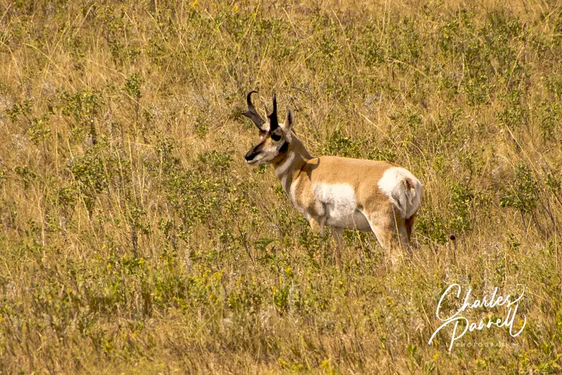
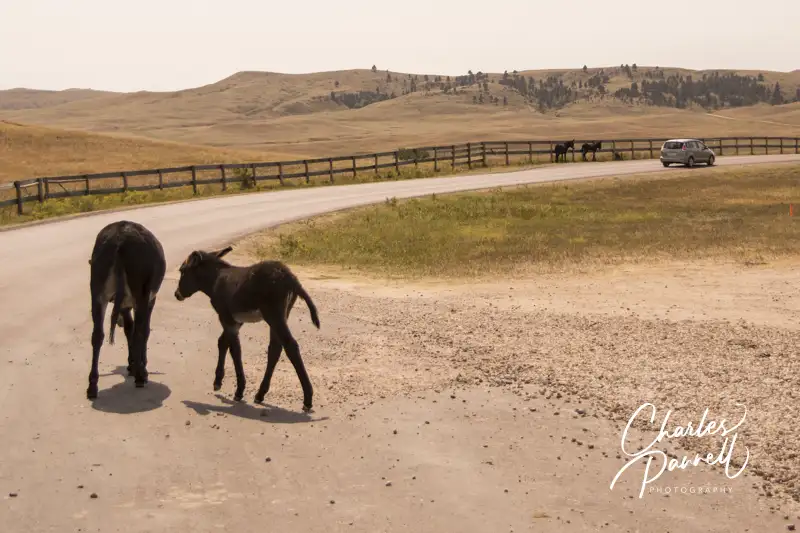
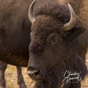
Although Custer State Park (gfp.sd.gov/parks/detail/custer-state-park/) is primarily known for its sizable bison population, this South Dakota favorite also boasts a healthy mixture of other wildlife. From prairie dogs and burros, to elk and even bighorn sheep, there’s no shortage of animal life in the park. And although Custer State Park occupies a whopping 71,000 acres of Black Hills real estate, the southern section of the park is the ground zero for watchable wildlife. Not only is the scenic Wildlife Loop Drive located in this section of the park, but there’s also a visitor center and the Bison Center along the way. And since it’s just a short drive from Badlands National Park, it’s a great addition to any South Dakota road trip.
Drive She Said
Feral burros on the Wildlife Loop Trail in Custer State Park
The best place to start your wildlife adventure is at the Custer State Park Visitor Center, which is located at the intersection of Wildlife Loop Road and Highway 164. There’s accessible parking and level access to the main building, which houses exhibits and a theater. And if you need directions or have a few questions, there are plenty of folks available to help.
After you get your bearings, hop on the 18-mile Wildlife Loop Drive, which runs from the visitor center to the Bell Station Entrance. It takes about 45 minutes to complete the drive as the speed is limited to 25 mph; but that time is variable due to wildlife — especially bison — that sometimes linger on the road. Basically, you’re on their timetable — whenever they decide to move, so can you. But then again, that’s part of the fun.
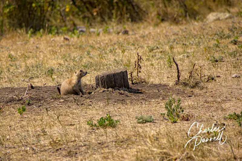
There are lots of pullouts along the drive, and you can get some great windshield views without getting out of your vehicle. The route travels through pastures and forests, with a prairie dog village along the way. And be on the lookout for bighorn sheep which sometimes linger near the road. Then there are the feral burros, which can be overly curious and bold.
Prairie Dog on the Wildlife Loop Road in Custer State Park
The Wildlife Station Visitor Center is located about eight miles from the beginning of the loop. Unfortunately the old CCC building only has steps up to it; however there are accessible vault toilets and an accessible inside picnic area near the parking area. Consider it a shady spot to stop for lunch.
Of course there are no guarantees on how much wildlife you’ll spot along Wildlife Loop Drive, but for optimum game viewing hit the road early in the morning or just before sunset.
Visit the Bison Center
Buffalo in Custer State Park
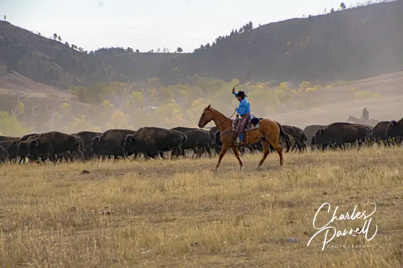
Make sure and stop at the new Bison Center, which is located about two miles from the Wildlife Station Visitor Center. There’s accessible parking near the entrance, with level access to the building. Inside, there are exhibits which trace the history of the 1,500-head buffalo herd, which are descendants of the 36 head that were introduced in 1936. As the herd grew, it outgrew the available forage, so a yearly roundup (emerginghorizons.com/head-over-to-the-custer-buffalo-roundup/) was instituted to keep the population in check. Interactive exhibits at the Bison Center show how the buffalo are inoculated and what animals are sold, and how licensed hunters also help prevent overpopulation.
And if you’ve every wondered what the correct term is — buffalo or bison — there’s an exhibit which answers that question too. In short, both are considered correct. Buffalo is the French word for beef animal, while bison is the scientific name. And for the most part, buffalo is the preferred term in the park.
Cowboy at the Buffalo Roundup in Custer State Park
There’s also level access to the gift shop at the Bison Center, where you’ll find a number of buffalo-themed items. And there’s a level dirt path to the buffalo paddocks which are located on the far side of the parking lot. Take some time to check them out as you may see a few buffalo there; however there are more animals present at Buffalo Roundup time. All in all the Bison Center offers a good overview of one of the world’s largest publicly owned buffalo herds. Plan ahead though, as the Bison Center is only open from Memorial Day to the end of September.
Barrier-Free Travel Glacier, Yellowstone and Grand Teton National Parks for Wheelchair-Users and Slow Walkers
Nicknamed the “American Alps”, North Cascades National Park is one of the most rugged and remote national parks in the US. Filled with black bear, mountain goats and bald eagles, the park is also home to a historic hydroelectric dam. That said you just can’t beat the scenery in this northwestern gem, which ranges from jagged mountain peaks, evergreen forests and alpine meadows, to crystal-clear lakes and a collection of formidable glaciers.
Insider Tips
Don’t miss the Gorge Creek Falls Overlook, located along State Route 20, halfway between Newhalem and the Colonial Creek Campground. This unusual overlook features two grated footbridges that are located on each side of the highway, where visitors can look down and get a bird’s eye view of Gorge Creek Falls. Best of all, they are both wheelchair-accessible.
The Happy Creek Forest Walk is a nice accessible trail, although it’s easy to miss the poorly marked turnoff. Start looking for it on the right as you head east on State Route 20, just past milepost 134; and don’t feel bad if you have to make a U-turn up the road and double back. There’s level access over to the .3-mile hard-packed dirt and boardwalk trail that meanders through the fir, cedar and hemlock forest, before it crosses over the cascading waters and loops back to the trailhead. This old growth forest is also a great place to escape the midday heat when the mercury rises.
Located across from the Skagit Visitor Information Center in Newhalem, the Skagit General Store makes an interesting stop. The building dates back to 1922, when the store was established as an employee commissary for the workers on the Skagit Hydroelectric Project. Today it offers a good variety of general grocery items, snacks, sandwiches and delicious homemade Skagit fudge. It’s also the only place along the State Route 20 section of the park that offers anything to eat.

 Population 4,070