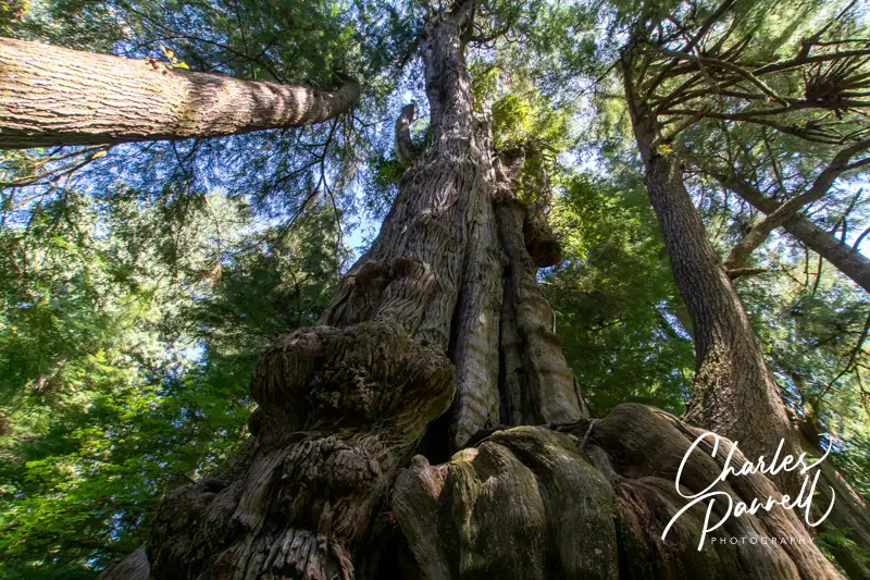
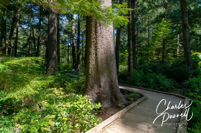
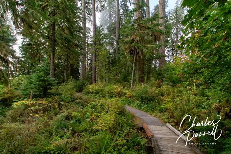
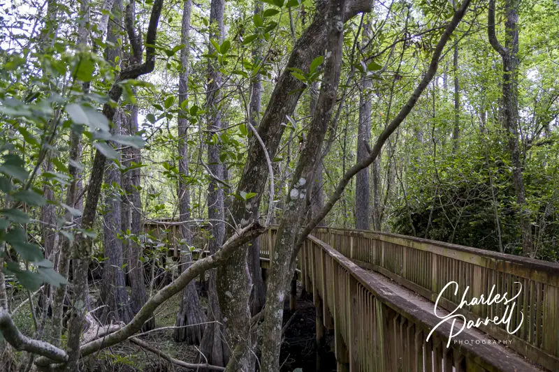
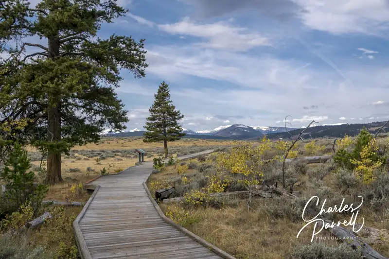
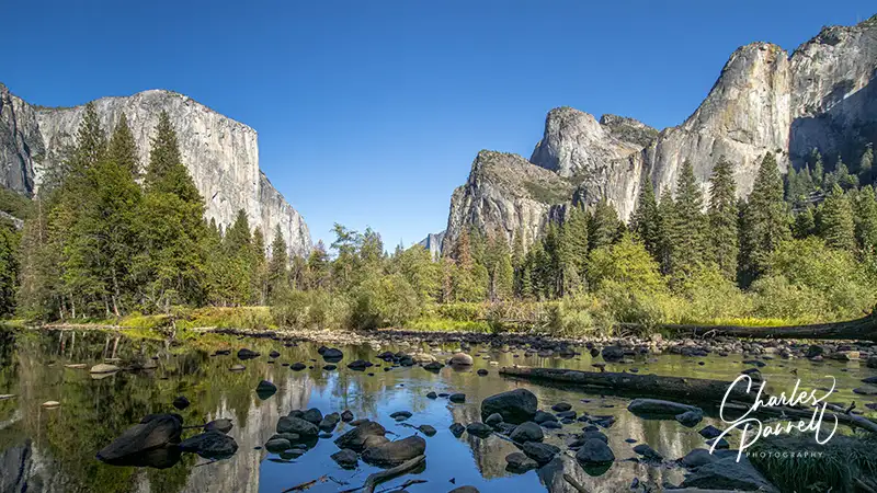
There are lots of self-named “big trees” in the world, but if you happen to be in Northwestern Oregon, be sure and stop in Rockaway Beach, for a gander at Oregon’s largest cedar tree. Lovingly nicknamed the Rockaway Cedar by the locals, this giant stands over 150-feet high, and is surrounded by an equally impressive forest. And believe it or not, it’s in a preserve in the middle of town. The best part is, the half-mile boardwalk that leads out to this local landmark is wheelchair-accessible. So slow down on your next trek down Highway 101, and stop in Rockaway Beach to enjoy a short walk through the forest to admire this stately giant.
A Wheelchair-Accessible Boardwalk
Rockaway Beach Old Growth Cedar Preserve Boardwalk to the Rockaway Cedar
It’s easy to zip by the small parking lot for the Rockaway Beach Old Growth Cedar Preserve. If you’re heading south, slow down when you see the giant hot dog on your left, and look for the parking lot just past Washington Street, on the left. There’s only six standard spaces in the lot, and two accessible slots, but the accessible ones are usually available.
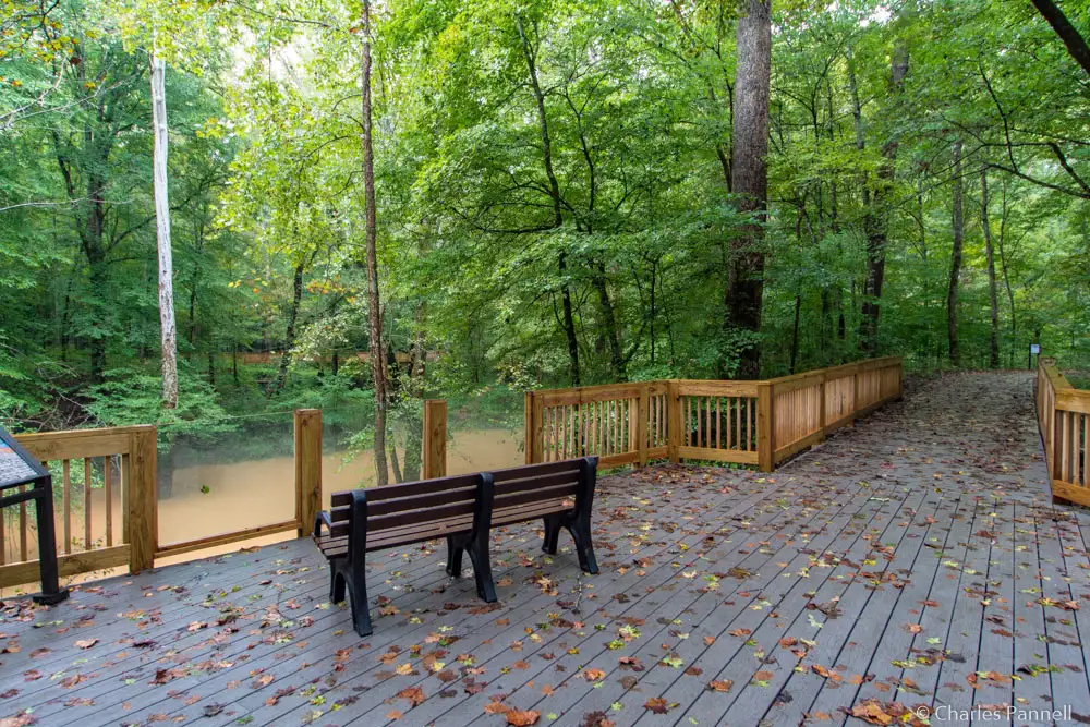
From the parking area, the level boardwalk winds through the 45-acre old growth forest filled with skunk cabbage, salmonberry and coast sedge. About midway along there’s also a level boardwalk over to a viewing platform with a picnic table and benches. It’s a nice secluded spot for a lunch break.
And Oregon’s largest cedar tree – a 154-foot giant — sits at the end of the .6-mile trail. There are a few benches to sit and admire the giant, as well as another picnic table there. There’s also a short stretch of boardwalk that leads over to a more secluded bench if you’d like a little privacy. All in all, it’s a beautiful stroll through the forest, and a must-stop on any Pacific Northwest road trip. And while you’re in the area, be sure to plan a stop at the equally wheelchair-accessible Kilchis Point Reserve, which is just down the road in Bay City emerginghorizons.com/kilchis-point-reserve-a-wheelchair-accessible-tillamook-county-gem/.
Barrier-Free Travel Yosemite, Sequoia and Kings Canyon National Parks for Wheelchair-users and Slow Walkers
Although there’s no shortage of fun diversions in the bustling city of Anchorage, visitors often overlook sights located outside of the city center. Granted, it takes a little planning to take them all in, but it’s well worth the effort. And it’s a great option for a pre- or post-cruise stay. So rent a vehicle, pack your sense of adventure, and get ready to visit these sites on a wheelchair-accessible Anchoarage day trip.
Learn About Indigenous People
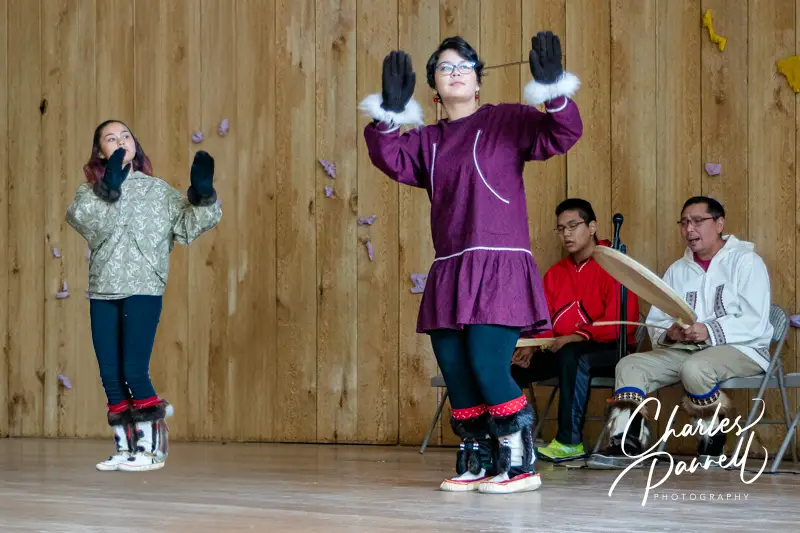
Dancers at theAlaska Heritage Cultural Center
Surrounded by the Chugach Mountains, the Alaska Native Heritage Center (www.alaskanative.net/) tops the must-see list. It’s just a short drive north of downtown Anchorage on the Glenn Highway; however this open-air museum seems a world away from the trappings of city life. Situated on 26 acres of prime forest land, this top-notch cultural attraction offers exhibits and programs about Alaska’s indigenous people.
Access is good at the Alaska Native Heritage Center, with plenty of accessible parking in front, a handy drop-off zone near the door, and level access to the front entrance. There’s a wheelchair available for loan at the front desk, and accessible restrooms near the entrance.
From the information desk a ramp leads down to the Gathering Place, where dances, games and stories are shared throughout the day. There’s also level access over to the Hall of Culture, which offers interactive exhibits about the indigenous cultural groups in Alaska. Films are also screened throughout the day in the adjacent theater, which offers level access with wheelchair and companion seating.
Outside, a level paved pathway circles the lake, where villages representing the indigenous people are located. Each village contains at least one structure, with clothing, weapons, tools and other artifacts of that culture on display. Members of the group — usually youth — are on hand to talk about their culture and to answer questions. And although some buildings have a few steps, it’s still possible to get a feel for each culture from the other interpretive exhibits.
Take a Walk on the Wild Side
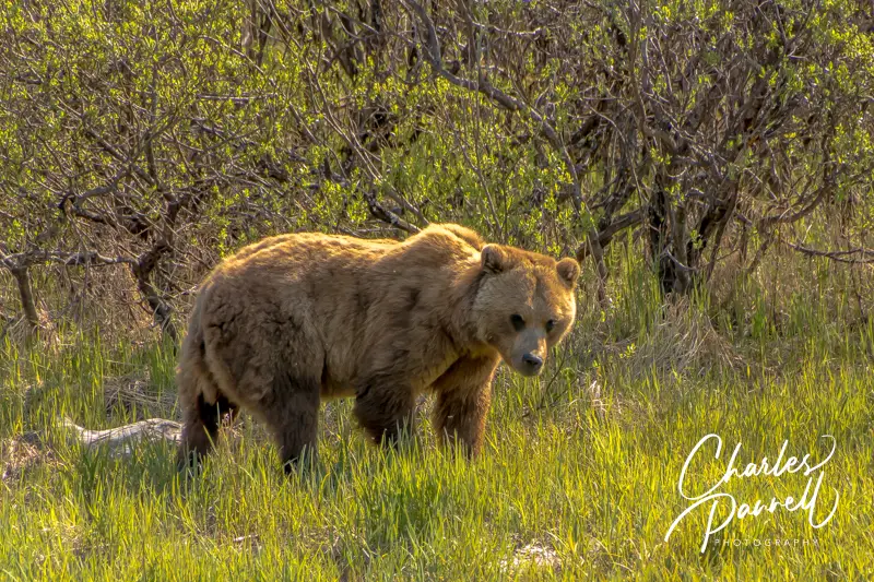
Grizzly Bear at the Alaska Wildlife Conservation Center
If you’d like to get an up-close-and-personal look at some native wildlife, then be sure and stop in at the Alaska Wildlife Conservation Center (alaskawildlife.org/) on your excursion. Technically this attraction is located in Portage, about 48 miles south of Anchorage; however it’s definitely worth the one-hour drive. The compound is easy to find too, as it’s on the Seward Highway, just north of Portage Road.
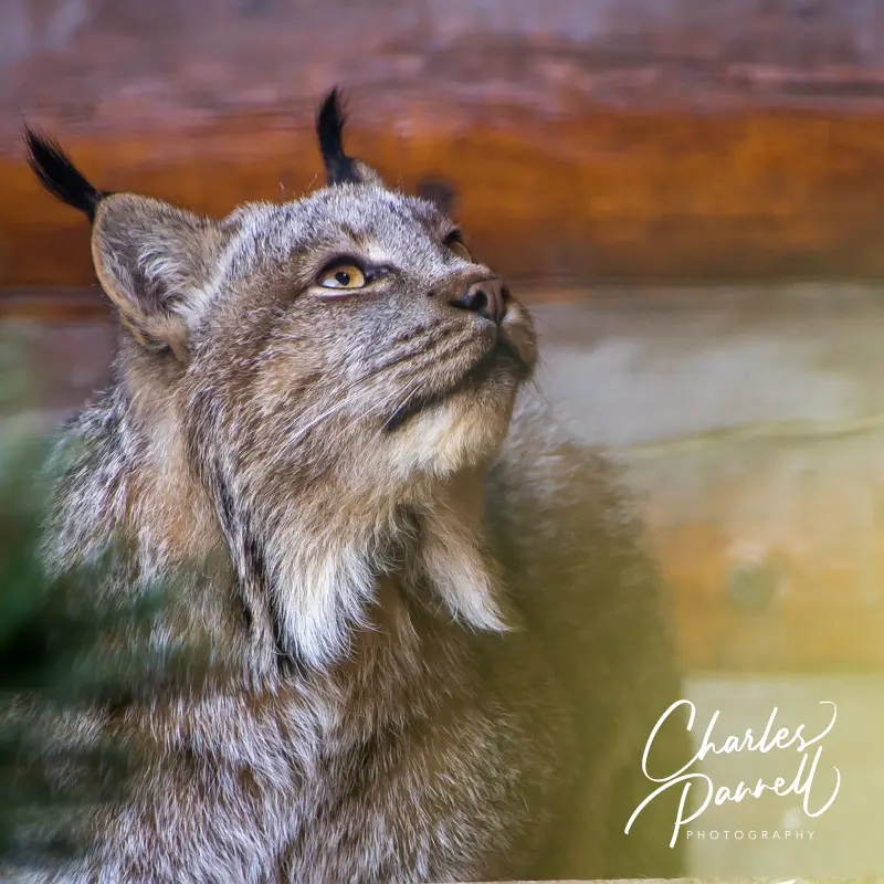
The Alaska Wildlife Conservation Center has a mission of education and conservation. It’s not a zoo, and quite a few of the animals are rescues. There’s ramp access up to the main building, and plenty of room to maneuver a wheelchair inside. Outside, the resident animals are kept in large enclosures surrounded by boardwalks or walkways. Visitors can choose to walk the 1.5-mile level route around the enclosures, or drive their own car and park at the bear boardwalk or the Turnagain Arm boardwalk. Along the way you’ll see moose, reindeer, lynx, elk, caribou and even bison.
The bear enclosure is a must-see, as a boardwalk travels above the exhibit which houses both black bears and grizzlies. And although the Turnagain Arm boardwalk is just outside of the park, it’s definitely worth a stop to see the bald eagles swoop down over the snow-covered mountains, and glide over the mud flats in search of some food. Additionally, there are benches at the end of the boardwalk if you’d like to sit and take a break.
Lynx at the Alaska Wildlife Conservation Center
Bring Your Binoculars
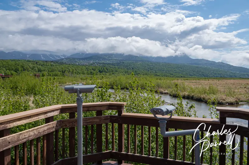
Viewing blind on the Potter Marsh Boardwalk
Last but not least, save some time for a little birdwatching on your Anchorage day trip. And the best place view some avian life is at Potter Marsh (www.adfg.alaska.gov/index.cfm?adfg=viewinglocations.pottermarsh), one of the most accessible bird viewing boardwalks in Alaska. Located about 10 miles south of town on Highway 1 near Milepost 117, this sanctuary is ironically located across the street from the Rabbit Creek Rifle Range.
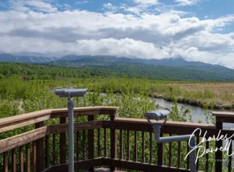
Accessible parking is located near the boardwalk, with accessible vault toilets nearby. The level boardwalk extends a half-mile out over the wetlands and offers several viewing blinds and overlooks along its length. And it’s all very wheelchair-friendly with lowered viewing slots in the blinds, accessible scopes, and lowered railings at overlooks for unobstructed wheelchair viewing. And if you’d just like to sit down and enjoy the view, there’s no shortage of benches along the way.
Potter Marsh is a year-round birdwatching venue, with geese, ducks and grebes in residence from April to September; and gulls, terns and shorebirds the rest of the year. Bald eagles are also frequently spotted in the cottonwoods near the base of the bluff, so bring your binoculars for a look at these magnificent birds.
Rabbit Creek — which is located about halfway along the boardwalk — is a good spot to catch a glimpse at spawning chinook, coho or humpback salmon, from May to August. And although Potter Marsh is ground zero for avian life, you can also spot moose there in the early mornings in late spring and early summer. Additionally, there’s no admission charge, so it’s also very easy on the wallet. Don’t miss this wheelchair-accessible birding hotspot on your next Anchorage adventure.
Barrier-Free Travel the Grand Canyon for Wheelchair-users and Slow Walkers
The North Cascades Scenic Byway is much more than a utilitarian route. Sure it connects North Cascades National Park with points east and west, but it also offers a scenic drive with a few old growth forest wheelchair-accessible hikes along the way. So next time you are tooling along Highway 20 west of North Cascades National Park, be sure and stop for these two wheelchair-accessible big trees trails.
Rockport State Park
Along the West Interpretive Loop in Rockport State Park
First up is the West Interpretive Loop in Rockport State Park (https://parks.wa.gov/find-parks/state-parks/rockport-state-park). It’s located along Highway 20, about 25 miles west of Newhalem. This 1.4-mile round-trip hike offers a beautiful stroll through a wheelchair-accessible slice of an old growth forest.
There’s accessible parking near the picnic area, with level access over to the accessible restroom. From the picnic area, follow the trail west for .2-mile until you get to a junction with a signpost. From there, take a right (away from the Sauk Spring Trail) and continue on the Evergreen Trail for another .2 miles until you get to the West Interpretive Loop.
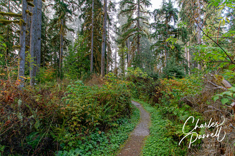
The .6-mile hard-packed dirt trail is covered in crushed rock, and is wide enough to accommodate even large wheelchairs. It’s not a flat trail, but it’s certainly within the ADA trail standards. The undulating trail leads through the lush forest filled with Douglas firs, western red cedars and western hemlocks. There are interpretive plaques along the way, and this shady forest stroll is the perfect place to cool off a hot afternoon. When you complete the loop, head back to the picnic area on the Evergreen Trail. As an added bonus, it’s not a crowded park, so you will probably have the trail to yourself.
Baker Lake
View from Panorama Point at Baker Lake
After you’ve completed the Western Interpretive Loop, continue west on Highway 20 to Concrete, then head north to the Shadow of the Sentinels at Baker Lake (https://www.fs.usda.gov/r06/mbs/recreation/baker-lake). It’s located about 15 miles off Highway 20, but it’s definitely worth the short detour. The trailhead is located in a small pullout, just before the turnoff to Horseshoe Grove Campground. You can’t miss it, as there’s a cross section of a large old growth tree in the parking lot.
Shadow of the Sentinels Trail
There’s accessible parking near the trailhead, and at the other end of the lot near the accessible vault toilet. This .5-mile loop trail begins as a boardwalk through the old growth forest, and transitions back-and-forth between that and an asphalt trail and a hard-packed dirt trail. There’s a slight elevation gain along the way, but it’s well within the standards. The boardwalk is in excellent repair, and although there are a few frost heaves in the asphalt, they are pretty easy to dodge.
The trail is lined with Douglas firs and western hemlocks, with interpretive plaques along the way. There are a number of downed trees and snags in the adjacent forest, and if you’d like to take a break there are a few benches on the trail. There are also a few side trails to viewpoints in the forest, and one to an extra large Douglas fir tree. It’s estimated that some of the trees in this grove are nearly 700 years old.
Shadow of the Sentinels Trail
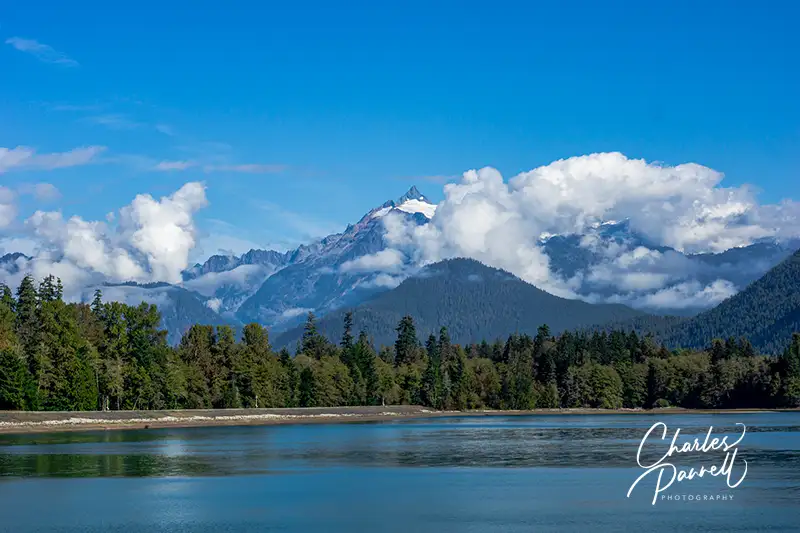
As an added bonus, the drive up to Baker Lake is beautiful. And if you’d like to sneak a peek at at Baker Lake and the Cascades, then head over to the Panorama Point boat launch or drive down to the end of Mount Baker Dam Road. It’s the perfect way to end this North Cascades scenic outing.
Barrier-Free Travel Washington National Parks for Wheelers and Slow Walkers
Although swamps are generally not a top destination choice for wheelchair-users, Everglades National Park (www.nps.gov/ever) may well be the exception. Located in South Florida, this vast track of protected wetlands spans over 1.5 million acres and attracts backcountry enthusiasts from around the world. Granted, the undeveloped areas of the park are not wheelchair-accessible; however there are still plenty of Everglades options for wheelchair-users and slow walkers. In fact, two particular areas of the park – Royal Palm and Shark Valley – boast a bevy of boardwalks and trails for visitors of all abilities.
Royal Palm
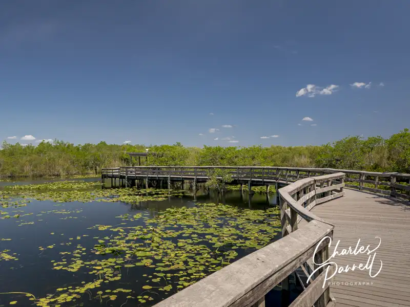
The Anhinga Trail in Everglades National Park
First up on our wheelchair-accessible Everglades visit is Royal Palm, which is located about 20 miles southwest of Florida City. Named for the former state park that grew into the Everglades, this area offers two accessible trails that give visitors a good overview of the native wildlife. There’s plenty of accessible parking in the large lot, with level access to the accessible restrooms, visitor center and gift shop.
The Anhinga Trail – one of the most popular trails in the park — is located behind the visitor center. This .8-mile loop trail begins as a paved path, before it transitions to a wide level boardwalk around the sawgrass marsh. A shaded viewing platform is located midway along the boardwalk, and there’s ample opportunity to catch a glimpse of alligators, turtles and a wide variety of wading birds. And if you get tired, no worries, as there are plenty of benches along the way too. Keep a lookout for the namesake Anhingas, that can be seen in abundance drying their colorful wings in the sun, or perched peacefully in the trees along the trail.
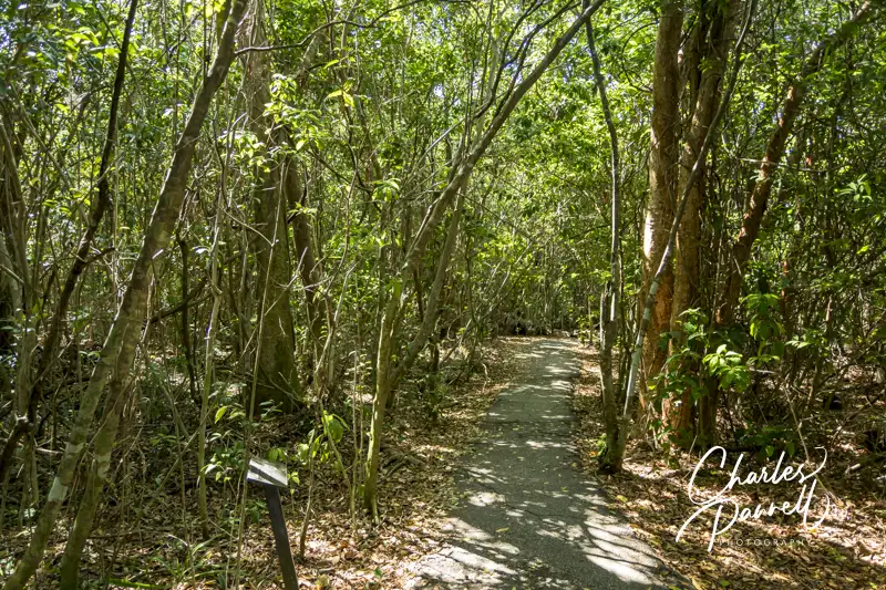
The Gumbo Limbo Trail is also worth a stop while you’re in the area. This .4-mile loop trail begins behind the visitor center, and travels through a tropical hardwood hammock. There are plenty of interpretive plaques along this paved trail; and although the pavement has a few cracks here and there, it’s still quite doable for most folks. The gumbo limbo trees, with their unique peeling red bark, offer shelter to a variety of avian life; and the royal palms, ferns and air plants add a bit of diversity to the forest. It’s a refreshing stroll, especially on a hot day.
The Gumbo Limbo Trail in Everglades National Park
Take a Tram Tour
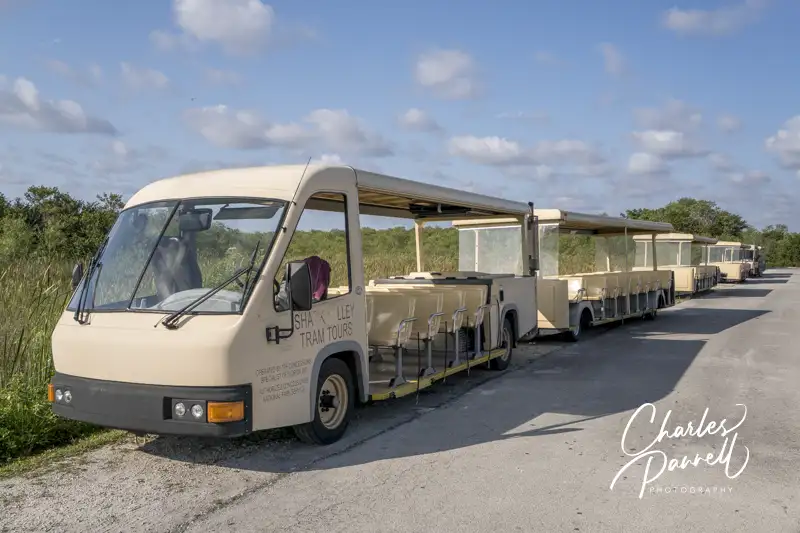
The Shark Valley Tram in Everglades National Park
Shark Valley is another area of the park worth a visit on a wheelchair-accessible Everglades itinerary. It’s located north of Royal Palm, on the Tamiami Trail (Highway 41), about 40 miles west of Miami. And although it doesn’t have any sharks, and it’s really not much of a valley, the sawgrass marsh supports a healthy freshwater ecosystem.
There’s barrier-free access from the accessible parking area to the visitor center, which is the departure point for the popular Shark Valley Tram Tour (www.sharkvalleytramtours.com). This two-hour tour is led by a naturalist who points out some of the hidden treasures in the Everglades. The tour stops at the halfway point at a 45-foot high observation tower, where visitors can get a bird’s eye view of the surrounding swamp. Even better, the tower includes a gently sloping ramp that allows wheelchair access to the top deck.
The tour is conducted in an open-air tram, which can be configured for wheelchair access. There’s ramp access up to the accessible car, which features two wheelchair spaces with tie-downs. Advance notice is required for accessible tours, and reservations can be made by calling (305) 221-8455. And since there are no facilities along the way, it’s a good idea to use the accessible restrooms at the visitor center before the tour. It’s also a good idea to bring along some water and a snack, as there aren’t any concession areas along the tour route either.
Explore Shark Valley
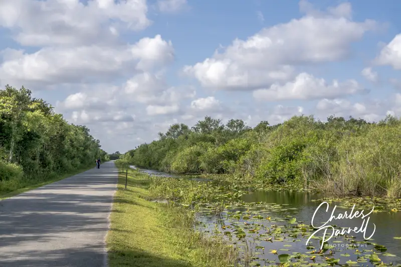
Shark Valley Trail
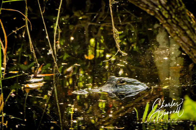
The road that the tram tours runs along — Shark Valley Loop Road — is flat and paved, and it’s also a good choice for wheelchair-users who don’t opt for the tram tour. There’s a fair amount of bicycle traffic along the road, but it’s pretty wide, so there’s plenty of room for everyone. Be sure and stop and look in the grass alongside the road, as it’s not unusual to find alligators there. And if you hear something growling at you from the water, don’t be alarmed, as it’s probably only the mating call of the harmless pig frog.
The Bobcat Boardwalk, which is located behind the visitor center, is also a good place to get a look at – and have a listen to – the swamp inhabitants. This wide level .5-mile boardwalk winds over the marsh and through a mature gumbo limbo forest. There’s a wheelchair accessible overlook along the way, and although you may hear bobcats rustle in the underbrush, they are usually pretty shy. That said, it’s still a good place to spot alligators, and the forest canopy provides a welcome respite on sunny days.
Big Cypress National Preserve
The Kirby Storter Boardwalk in Big Cypress National Preserve
Although it’s not part of the Everglades, save some time to stop at the Kirby Storter Roadside Park on your way to or from Shark Valley. Part of the Big Cypress National Preserve (nps.gov/bicy/), this accessible rest area is located about 30 miles west of Shark Valley. It features accessible parking, with accessible vault toilets nearby, and level access to a shaded picnic area.
After you’ve had a bite to eat, take a stroll along the half-mile accessible Kirby Storter Boardwalk. There’s level access to the boardwalk which travels through a young cypress marsh, before it transitions to a mature pop ash and red maple forest dotted with orchids. The forest canopy shades the trail until it opens up to a full swamp at the end of the boardwalk. There are interpretive signs along the way, and a bench to enjoy the swamp view at the end. It’s a good place to spot alligators, especially during mating season. And since many people pass right on by this scenic stop, you may even have it all to yourself. It’s a great way to top off a wheelchair-accessible Everglades visit.
As one of the most popular national parks, Yellowstone tends to attract the bulk of its visitors during the peak summer season. And although crowds can detract from the pristine natural beauty of Mother Nature, there are a few ways to dodge the crowds in Yellowstone.
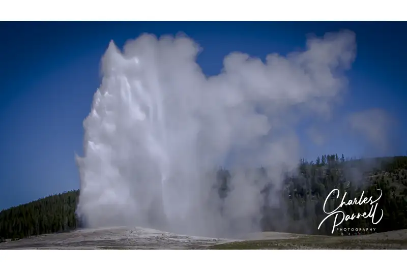
First off, get an alpine start no matter when you visit; and if possible try and plan your trip in the shoulder seasons for a less crowded experience. And although Old Faithful is a must-see, seek out some of these less touristed spots in the park to avoid the masses. And the good news is, all of these sites are good choices for wheelchair-users and slow walkers.
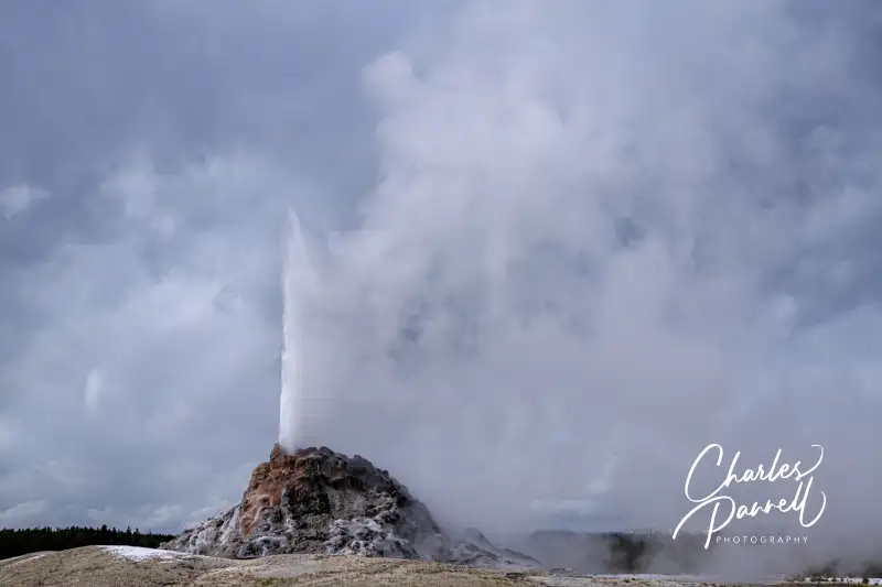
White Dome Geyser on Firehole Lake Drive
White Dome Geyser on Firehole Lake Drive at Yellowstone National Park
A scenic ride along Firehole Lake Drive tops the list of ways to dodge the crowds in Yellowstone. This one-way loop drive begins about a mile south of Fountain Paint Pot, along the road to Old Faithful. You can drive the route straight through, as many of the geysers and hot springs are visible from the road; or opt to stop at the pullouts along the way and get a closer look at the thermal features.
As an added bonus, it’s not unusual to spot bison along the first section of the drive; and there’s nothing quit like hearing their eerie grunts and groans from the boardwalks of the nearby geysers. Even better — the route is pleasantly devoid of the bus loads of tourists that frequent the other area attractions, as larger vehicles are not allowed on this road. And finally, most visitors completely pass it by in their rush to get to Old Faithful.
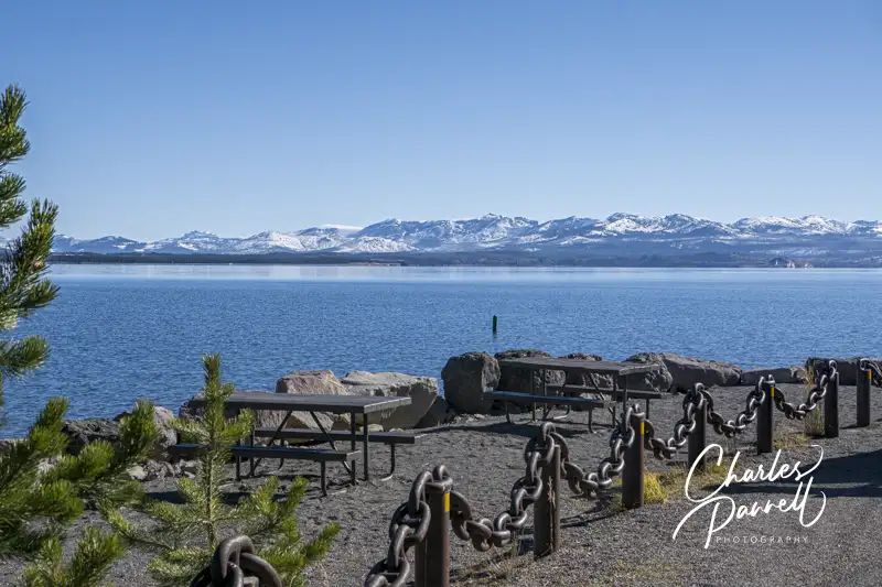
Gull Point Road Unnamed Picnic Area
Gull Point at Yellowstone National Park
Eating alfresco in a national park is a great experience, but unfortunately some of the more popular picnic areas in Yellowstone are packed to the brim. That said, this little gem — that unfortunately lacks a name — usually makes for a pleasant lunch stop. It’s located near the Bridge Bay (north) end of Gull Point Road, about a half-mile north of the turnoff to the Gull Point Picnic Area.
There are just two tables there, but they are located on a level pad and they offer a great view of the lake and the surrounding mountains. Parallel parking is available on a level asphalt area, just steps from the tables, so this spot is especially good for folks who can’t do distances. And even though the tables lack extensions, there’s still room on the end for a wheelchair. There are no restrooms at this picnic area, but don’t let that deter you, as you can always use the accessible ones down the road at the Bridge Bay Marina.
West Thumb Geyser Basin Boardwalk
West Thumb Geyser Basin at Yellowstone National Park
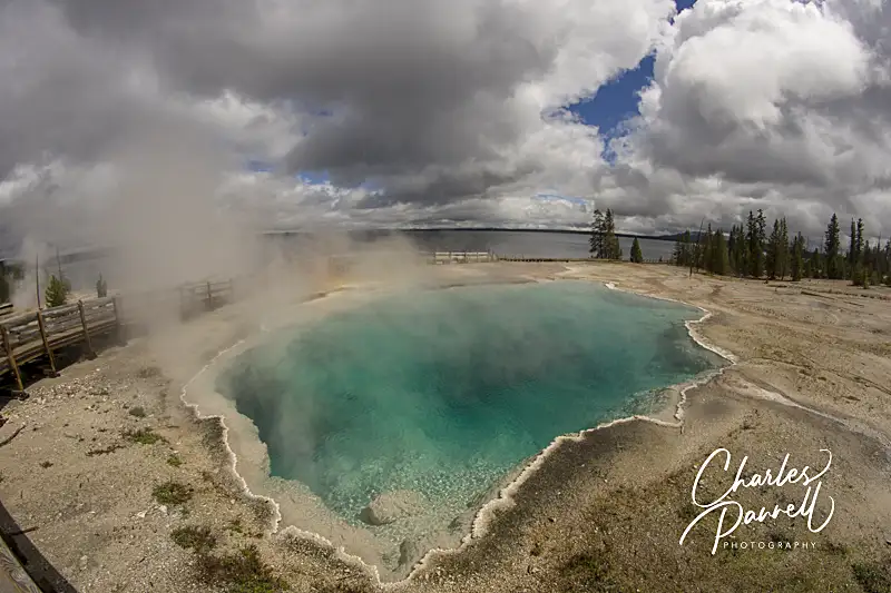
Next up on the list of ways to dodge the crowds in Yellowstone is a visit to West Thumb Geyser Basin. Located just north of Grant Village, this geothermal area offers a short wheelchair-accessible boardwalk. The half-mile trail begins near the accessible parking area, and leads around the inner loop. Along the way it passes by the thumb paint pots and offers a good view of the central basin with the mountains in the background. There are benches to sit and rest along this fairly level boardwalk trail, and accessible vault toilets are located in the parking lot.
The longer outer loop in this geothermal area is not accessible because of a steep grade, and it may be dangerous for wheelchair-users. Still the inner loop offers a good look at the unusual geothermal features. Although West Thumb Geyser Basin isn’t devoid of visitors, it not nearly as crowded as the geothermal areas near Old Faithful.
North Rim Trail
River View on the North Rim Trail at Yellowstone National Park
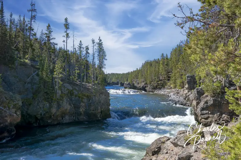
A portion of the North Rim Trail located near the Brink of the Upper Falls is wheelchair-accessible, and most people opt for the brink instead of this trail. To find the trail, take the turnoff to the Brink of the Upper Falls, which is located midway between North Rim Drive and South Rim Drive along the road to Lake Village. From the parking lot follow the sign to the brink, but instead of bearing left and heading downhill, continue straight ahead at the fork.
The path to the right is the North Rim Trail, which offers an equally impressive falls view. The paved trail leads through the woods for a half-mile, before it crosses over the historic Canyon Bridge and offers a great view of Chittenden Bridge in the distance. This trail loses its access because of a steep grade just before Chittenden Bridge, but it still makes for a lovely 1.6-mile out-and-back-hike.
Frying Pan Spring
Frying Pan Spring in Yellowstone National Park
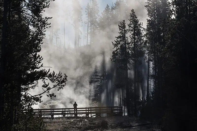
This small hot spring is located north of Norris Campground on the west side of the road to Mammoth. It’s easy to drive right by it, and many folks do exactly that. There’s no striped parking in the pullout, but there’s usually enough room to parallel park an accessible van in the small paved area.
A 400-foot level boardwalk leads from the parking area over to this unusual spring, that’s roughly shaped like a frying pan. There’s also a bench at the end of the boardwalk, if you’d like to sit and admire the view. You’ll most likely have this site to yourself too, as it’s not included on any of the park maps, and it really doesn’t look like much from the road.
Forces of the Northern Range
Forces of the Northern Range Boardwalk in Yellowstone National Park
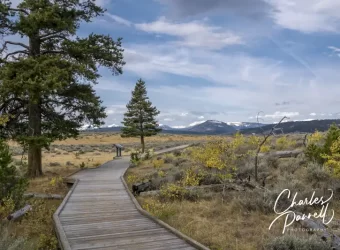
Last but certainly not least on the list of ways to dodge the crowds in Yellowstone, is to check out the Forces of the Northern Range boardwalk. Tucked away along the road between Tower Junction and Mammoth Hot Springs, the trail is only marked by a small brown “self-guided trail” roadside sign. And most folks just zip right on by it.
The half-mile accessible boardwalk winds through the sagebrush and shrub-lined landscape and features scenic views of Yellowstone’s Northern Range in the distance. Interpretive plaques that detail the flora, fauna and geology of the area are dotted along the boardwalk, and several short spurs lead out to secluded areas that are lined with benches, so folks can sit back and admire the scenery. And even though it’s a short trail, because of the spurs and vegetation, it doesn’t feel crowded, even when there are a lot of people out there. It’s a very well designed trail, with magnificent views of the surrounding landscape.
Barrier-Free Travel Glacier, Yellowstone and Grand Teton National Parks for Wheelchair-Users and Slow Walkers
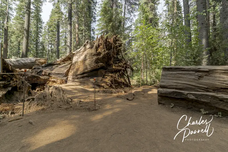
The fallen Pioneer Cabin Tunnel Tree in Calaveras Big Trees State Park
Make no mistake about it, California can have some brutal winters. Take 2017, for example. Between a record rainfall, mudslides and a late season snow it was definitely a challenge for many mountain communities. And unfortunately there were a few causalities, such as the loss of the Pioneer Cabin “tunnel tree” at Calaveras Big Trees State Park (www.parks.ca.gov/?page_id=551).
Sadly this giant sequoia was uprooted during a torrential downpour; however after a massive spring cleanup the grove reopened, with traffic routed around the fallen giant. Today the forest has evolved, however this Northern California state park is still worth a visit for a very accessible and intimate look at the remaining giant sequoias. And for a nice wheelchair-accessible place to spend the night, check out the nearby Black Bear Inn (emerginghorizons.com/sleep-near-the-big-trees-in-calaveras-county/) in Arnold.
The Majestic North Grove
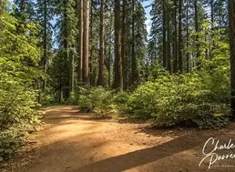
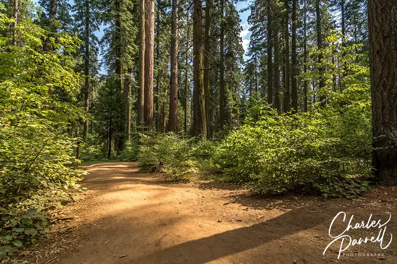
North Grove Trail in Calaveras Big Trees State Park
Although the giant trees are scattered through the park, the North Grove has the most accessible concentration of them. Accessible parking is located near the visitor center, which offers barrier-free access and features a collection of interpretive exhibits. Accessible restrooms with flush toilets are located next to the visitor center.
The trail to the North Grove begins to the left of the visitor center. This hard-packed dirt tail winds around to the right to the Discovery Stump, the official beginning of the grove. This was the site of the first tree that Augustus T. Dowd found in 1852, while he was chasing a wounded grizzly bear. Sadly the tree was felled in 1853, but remnants of it can be found next to the stump.
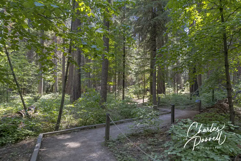
The Three Senses Trail — which is located just past the Discovery Stump on the left — is also worth a stop. This .13-mile hard-packed dirt trail features interpretive plaques about the native vegetation, and includes benches to sit and rest along the way. And although the trail has a few bumps here and there, it’s still a good choice for most wheelchair-users and slow walkers.
Three Senses Trail in Calaveras Big Trees State Park
The hard-packed dirt North Grove Trail, continues past the Three Senses Trail, and winds around the Empire Tree, the Old Bachelor, the Mother-of-the-Forest and the Father-of-the-Forest. At times the dirt transitions to a level boardwalk, as this 1.7-mile trail snakes past the named and unnamed giants.
Just past the Abraham Lincoln Tree, there’s a detour around a fallen giant and through the remains of the Pioneer Cabin Tree. The fallen tree will remain on the ground to provide nourishment to new trees, and continue the forest cycle. And although the North Grove is accessible, it’s best to visit after the winter debris has been cleared in the early summer.
A Meadow Boardwalk
Meadow Boardwalk in Calaveras Big Trees State Park
Although the major focus is on the giant sequoias at Calaveras Big Trees, there’s also a nice accessible boardwalk through a meadow near the North Grove. The meadow itself is surrounded by the North Campground, which is just a short level walk from the visitor center. Follow the park road to the North Grove Campground, and if you hit the dump station, go back as you missed the campground.
Stay on the main campground road, and be on the lookout for accessible campsite 16 on the left. There’s an accessible showerhouse right behind the campsite, and the meadow boardwalk begins on the far side of that building.
There’s level access to this short boardwalk. It’s only .3-mile long, but when the wildflowers are in bloom it’s a sight to see. Lupine and corn lilies fill the meadow in June and July; although peak bloom time is weather dependent. And be on the lookout for Western Tanagers which also frequent the meadow. The boardwalk had low bumpers and no railings so wheelchair-users get an unobstructed view of all of natures beauty. And don’t forget to check at the visitor center to see if there are any wildflower walks scheduled.
The Quieter South Grove
Save some time to explore the South Grove at Calaveras Big Trees. Here you’ll find fewer visitors and the nicely accessible Beaver Creek Trail. It’s easy to find, as it’s near the end of the Walter W. Smith Memorial Parkway, about twenty minutes from the entrance station.
Accessible parking is located near the accessible vault toilet, and there’s level access over to several accessible picnic tables shaded by the surrounding forest. The .7-mile Beaver Creek Trail begins behind the vault toilet. This hard-packed dirt trail follows Beaver Creek, then passes the South Grove parking area, before it loops back to the Beaver Creek picnic area.
Make sure and stop at Beaver Creek along the trail, which is just .1 mile from the Beaver Creek picnic area. Not only are there some more picnic tables near the creek, but beach mats allow for access right up to the water.
Beaver Creek viewed from the Beaver Creek Trail in Calaveras Big Trees State Park
If you want to try a more challenging — yet still accessible — trail, then head on over to the River Picnic Area and try the Stanislaus River Trail. The trailhead for this .35-mile round-trip hike on a hard-packed dirt trail is is next to the parking area. The trail winds downhill to the river, however it still maintains an accessible grade. Make sure and take a good look at the trail in the beginning though, as it’s not flat, and you will have to make your way back up to the parking area.
Stanislaus River Trail in Calaveras Big Trees State Park
You’ll get a nice gander of the river from the end of the trail. It’s also pretty secluded and not frequented by a lot of park visitors. Granted this trail won’t work for everyone, but if you fancy a little workout it’s just what the doctor ordered.
Barrier-Free Travel California National Park Road Trips for Wheelchair-Users and Slow Walkers
The hottest, driest and lowest point in North America, Death Valley is the largest national park in the lower 48 states. And with over three million acres of wilderness area, there’s a huge diversity in the flora and fauna throughout the park. From majestic sand dunes and salt flats, to snow capped peaks, a lush oasis and even a massive crater, there’s something for just about everyone at this remote national treasure.
Insider Tips
A stop at Badwater – the lowest point in the US — is a must do on any Death Valley itinerary. There’s boardwalk access out to the salt flats, and from there you can roll as far as you like. It’s best to hit this area in the morning though, as it can get quite hot later in the day. Additionally, don’t forget the insect repellent, as the biting flies that are common in Death Valley really like this area of the park – especially in the summer.
Many visitors flock to Zabriskie Point and Dantes View, off of Highway 190; while most folks entirely pass up the scenic 20 Mule Team Canyon Drive, which is located between the two. This 2.5-mile scenic drive winds up and down the colorful eroded badlands, and offers an off-the-beaten-track experience without having to trek through the desert for days.
Although there’s no shortage of food offerings at Furnace Creek, head on over to Timbisha Shoshone land and try something different for lunch. Just follow the signs to Timbisha Village Tacos from highway 190, between the Furnace Creek Inn and Furnace Creek Ranch. There aren’t many choices on the menu – Indian tacos, burritos, taco salad and shaved ice – but the food is tasty and the prices are reasonable. And although their hours vary, they are usually open for lunch. To-go food is also available.
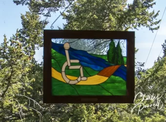
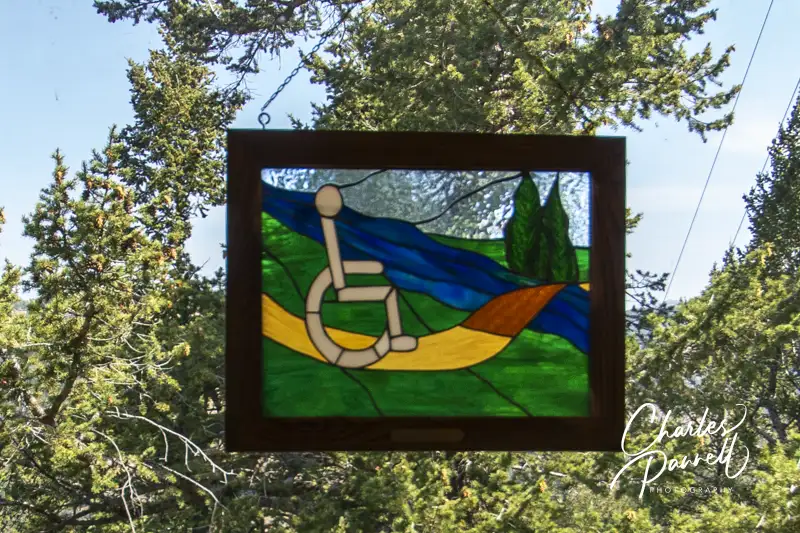
Stained Glass in the Ridge Top Cabin at Wilderness on Wheels, Colorado
Located 60 miles west of Denver near Kenosha Pass, Wilderness on Wheels (WOW) (www.wildernessonwheels.org) offers wheelchair-users and slow walkers the opportunity to hike through a pine forest, fish in a well-stocked pond and spend the night in a tent, hut or in one of two wheelchair-accessible Colorado cabins.
Founded in 1986 by Roger West, WOW is supported through donations, grants and a robust army of dedicated volunteers. There’s no charge to use the boardwalk trails, fishing pond or picnic areas; and the campsites, huts and wheelchair-accessible Colorado cabins are available at very reasonable rates. Not only does WOW make an excellent day trip from Denver, but it can also be worked into a longer Rocky Mountain National Park road trip itinerary (emerginghorizons.com/all-terrain-wheelchair-in-rocky-mountain-national-park/).
Hike, Picnic & Fish
Riverside Boardwalk at Wilderness on Wheels
Accessible parking is available in a large lot at WOW, with barrier-free access over to the ramped office. Inside there’s plenty of room to maneuver a wheelchair or scooter around the office and gift shop.
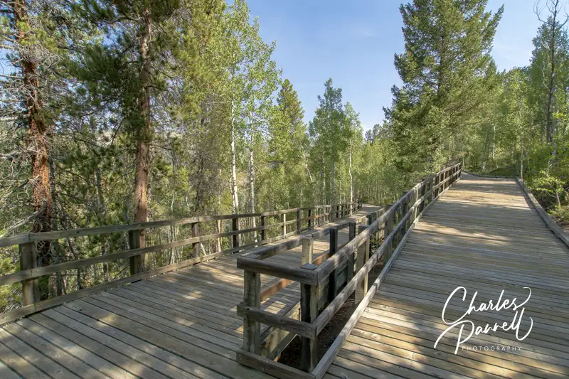
There are two boardwalk trails on the property — the River Boardwalk and the Mountain Boardwalk. The half-mile River Boardwalk follows a mountain stream, winds past the fishing pond, and continues through the forest to the rustic log cabin. And if you’d like to enjoy a picnic lunch there’s an accessible gazebo near the beginning of the boardwalk, and a ramped picnic shelter near the campsites.
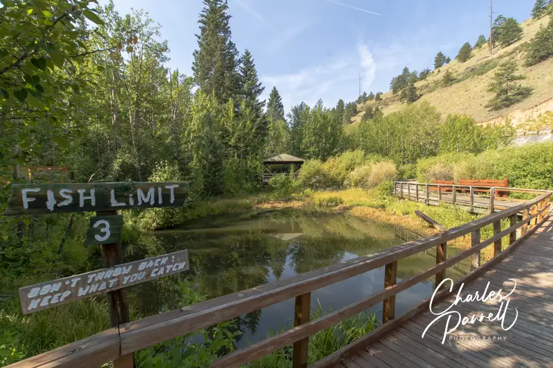
Additionally, there’s level access over to an accessible fishing platform that overlooks the pond. Some accessible fishing gear — including a wheelchair rod holder — is available in the office, but anglers must supply their own fishing rods and bait. The pond is stocked with rainbow trout, and although no fishing license is required for disabled anglers, there is a limit of three fish per person. Able-bodied fisherman with a fishing license are welcome to try their luck over in the stream that runs alongside the boardwalk.
The Mountain Boardwalk at Wilderness on Wheels
The Mountain Boardwalk begins on the other side of the parking lot. This mile-long trail winds gently up to the ridgetop, which has an elevation of just over 9,000 feet. There are several picnic tables along the way, and lots of spots to stop and rest. There’s also barrier-free access to the adjacent property, where the Family Music Festival is held every August. Wheelchair-users can view the festivities and grab a bite to eat on the boardwalk, while the main seating area is located next to the boardwalk. There’s no charge to attend the festival, but it is a fundraiser for WOW, and donations are gladly accepted.
Camp Under the Stars
Tent Platform at Wilderness on Wheels
If you’d like to sleep under the stars, WOW also has a nice selection of accessible campsites and huts along the Riverside Boardwalk. The campsites each include a charcoal grill, a fire ring and an accessible picnic table. Some of the campsites have tent platforms, while the rest have level space to pitch a tent. And some can even accommodate a RV.
Camping Hut at Wilderness on Wheels
The wheelchair-height huts feature a lockable door. Just bring your sleeping bag, roll it out on the platform, then transfer over and tuck yourself in for the night. One hut also includes a cot. The huts all feature a picnic table — some are covered — a charcoal grill and a fire ring. One of the huts also has electricity.
Campers are asked to bring their own charcoal, but plenty of free firewood is available on site. There are no showers in the campground, but accessible restrooms are located near the office. Potable water is also available near the beginning of the River Boardwalk. Plan ahead though, as advance reservations for the campsites and huts are essential.
Wheelchair-Accessible Colorado Cabins
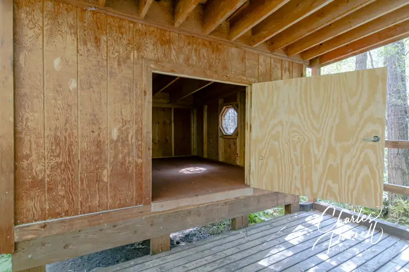
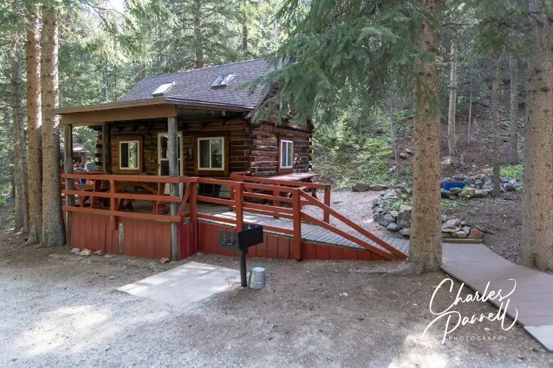
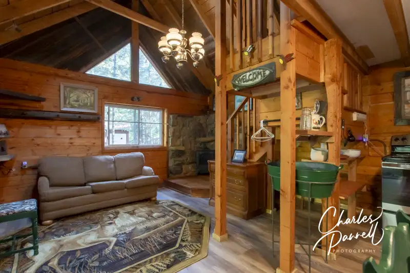
There are also two wheelchair-accessible cabins available at WOW. The Riverside Boardwalk rustic cabin can sleep four and it features ramp access up to the porch and barrier-free access through the wide front door. It includes a full kitchen with a stove, refrigerator, microwave and dishes. There’s a sleeper sofa in the downstairs living area, and a full bed in the upstairs loft. The unit lacks running water, but jugs of water are provided. It’s a comfortable place to sleep in the pines.
(click image to enlarge gallery)
Riverside Cabin at Wilderness on Wheels
Inside the Riverside Cabin
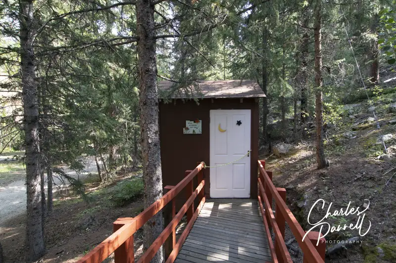
Riverside Cabin Bathroom
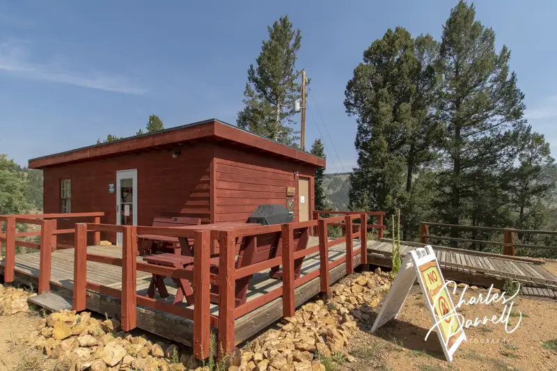
The ridgetop cabin is located near the top of the boardwalk, and you just can’t beat the view. You don’t have to haul your gear up the boardwalk, as you can usually access the cabin from a service road. That said, the road may be impassable for low-clearance vehicles; and if that’s the case the folks at WOW will happily transport you and your gear up to the cabin. Up on top, there’s plenty of room to park an adapted van, and ramp access up to the cabin deck.
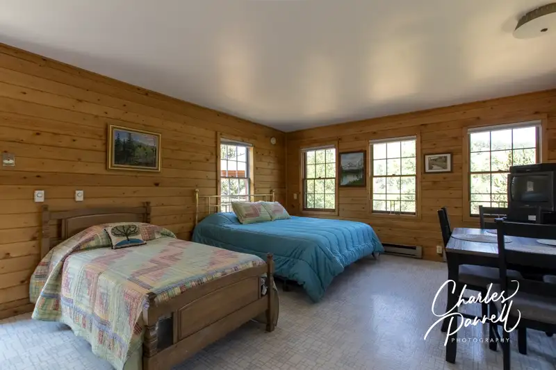
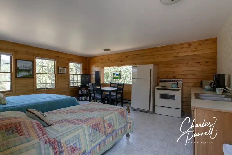
The spacious great room includes a kitchen, dining area, and sleeping space. The kitchen boasts a refrigerator, stove, microwave, and a good selection of dishes, cookware and utensils. There’s also a large dining table near the kitchen, and a 25-inch high king-sized bed, plus a 23-inch high twin bed on the other side of the room.
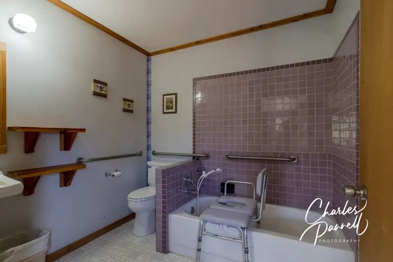
The bathroom is equipped with a tub/shower combination with a hand-held showerhead and grab bars. Other features include a roll-under sink, toilet grab bars on the back and right walls (as seated) and a tub/shower chair.
(click image to enlarge gallery)
Ridgetop Cabin at Wilderness on Wheels
Beds in the Ridgetop Cabin
Kitchen Space in the Ridgetop Cabin
Bathroom in the Ridgetop Cabin
Either one of these wheelchair-accessible Colorado cabins makes an excellent choice for a mountain getaway. Reservations can be made on the WOW website (www.wildernessonwheels.org), but plan ahead as they book up fast.
Barrier-Free Travel Washington National Parks for Wheelers and Slow Walkers
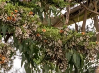
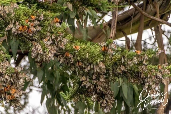
Let’s face it, it’s been a long winter. And there’s no better harbinger of spring than butterflies — more specially Monarch butterflies as they emerge from hibernation along the Northern California coast. After spending several months clumped together in clusters in eucalyptus trees, these migratory Monarchs become more active as they fly around, mate, and prepare for their flights inland to lay their eggs. So check out these three wheelchair-accessible Northern California sites this month, and enjoy a colorful taste of the migratory Monarchs as they emerge from hibernation. But don’t tarry, as these winter visitors will be long gone by the end of March.
Monarch Grove Sanctuary
Monarch Grove Sanctuary in Pacific Grove, California
This popular Monarch stopover is located off of Lighthouse Avenue, just south of the Pacific Grove Municipal Golf Course. Keep an eye out for the Butterfly Grove Inn, then turn south on Ridge Road. A white picket fence marks the path to the grove, but accessible parking is located further down Ridge Road on the left. From there; it’s a level roll up the street to the sanctuary entrance.
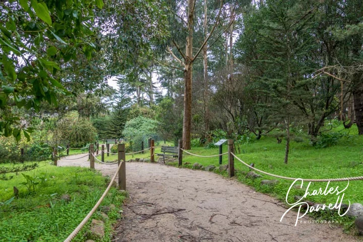
A .15-mile hard-packed dirt path leads through the grove and dead-ends in the adjacent neighborhood. There is an accessible porta-potty near the end of the path; and although the trail has level spots every 20 to 30 feet, some manual wheelchair-users may require assistance up the slight grade on the return trip.
The best time to hit the Monarch Grove Sanctuary is in the afternoon, because as temperatures warm up, the butterflies become more active and start to fly around through the grove. Although they might not be apparent at first, take some time to scan the tips of the pine and cypress trees, as those are their favorite landing places. Also keep an eye out for what looks to be clumps of dead leaves, as these might be clusters of the overwintering Monarchs. Docents are on duty in the season to help point out the butterflies, but for the best experience bring a pair of binoculars to get a closer look at the Monarchs.
Natural Bridges State Beach
Monarch Boardwalk at Natural Bridges State Park
Another favorite spot to view the migratory Monarchs is located up the coast in Santa Cruz, at Natural Bridges State Beach (www.parks.ca.gov/?page_id=541).
It’s pretty easy to find too. From Pacific Grove follow Highway 1 north, until it turns into Mission Street in Santa Cruz. Turn left on Swift Street, which is the first traffic light after the Safeway, then follow the road until it dead ends on West Cliff Drive. From there, turn right and follow the road along the ocean to the park entrance.
The day use area is located a short drive up the park road. There’s accessible parking in the large lot with level access over to the visitor center. Inside, there’s barrier-free access around a number of interpretive exhibits about the butterflies, their habitat, and of course their migration. Accessible family restrooms are located just outside the front door of the visitor center.
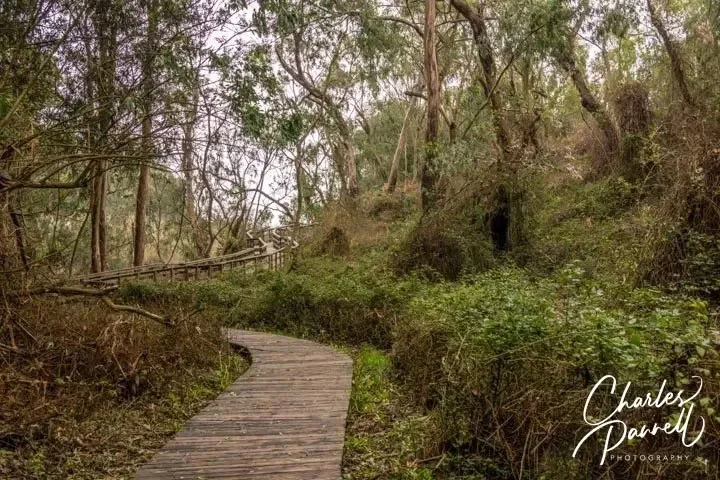
The Monarch Boardwalk is located across the service road from the visitor center. This .15-mile trail winds through a eucalyptus grove, and although it does have a slight downhill grade, there are level spots every 20 to 30 feet. That said, some manual wheelchair-users may need a bit of assistance on the uphill journey.
This is one of the top spots to find the overwintering Monarchs, however it’s usually a hit or miss proposition. Weather plays a big factor in their presence and activity, and you’ll probably strike out after a big storm or on a windy day. That said it is one of their favorite haunts.
Lighthouse Field State Beach
Monarch Butterflies at Lighthouse Field State Beach
Last but not least, don’t forget to stop at Lighthouse Field State Beach, (www.parks.ca.gov/?page_id=550). From Natural Bridges State Beach, back track on West Cliff Drive, pass the lighthouse, and turn into the parking lot for Lighthouse Field on the left. Alternatively, accessible parking is also available across the street in front of the Santa Cruz Surfing Museum.
You’ll find the Monarchs in the Monterey cypress and eucalyptus trees in the grassy field near Pelton Avenue. Although there’s a sizable population during the winter months, getting there can be difficult in rainy years, as the accessible hard-packed dirt paths to the grove flood easily. It’s about a half-mile walk to the grove on the dirt paths.
Bottom line — this is an excellent spot in dry years, as you’ll not only spot the clumps of butterflies, but there are also individual butterflies flying around near the end of the season. Give it a go and see what the dirt paths look like; and if they’re not a mucky mess, then go for it. After all, it’s on the way from Natural Bridges, and it’s definitely worth a quick stop.
Barrier-Free Travel California National Park Road Trips for Wheelchair-Users and Slow Walkers
Known as the “Crown of the Continent” because the Continental Divide bisects the park, Glacier National Park encompasses more than a million acres of coniferous forests, alpine meadows, pristine lakes and glacier-carved peaks. The wildlife in the park is just as diverse at the landscape that supports it, and it includes elk, bighorn sheep, moose, and one of the largest remaining grizzly populations in the lower 48 states.
Insider Tips
A well kept secret along Going-to-the-Sun Road, Red Rock Point offers a beautiful view of McDonald Creek cascading down over the massive red rocks. The turnout is located about a mile north of the Trail of the Cedars on the left side of the road. Keep your eyes peeled when you get close, as there is absolutely no signage to mark the overlook. There’s accessible parking near a hard-packed dirt path that leads .06 miles out to a boardwalk viewing platform.
Although the historic Red Buses of Glacier National Park are not wheelchair-accessible, Xanterra Parks and Resorts has two wheelchair-accessible vehicles in their. The lift-equipped buses have roll-up plastic flaps on the windows, and passengers get a full view of everything around them, thanks to an on-board camera and monitors Even better — the accessible vehicle is booked solely for your party, so you get a private tour at the regular tour price.
In addition to an entrance fee or a park pass, a day use entrance reservation is also required for Glacier National Park visitors during peak visitation periods in the summer. Entrance reservations are currently required for the West Entrance Station, the Camas Entrance Station and Many Glacier Valley. That said the park adjusts the system annually, so check the park website for the most current information. Entrance reservations are not available at the park. They must be purchased at recreation.gov in advance. Visitors without an entrance reservation will not be admitted.