Named for Ebenezer Bryce, a Scottish immigrant who settled in the Paria Valley in 1875, Bryce Canyon National Park is known for the spire-like hoodoos that seem to magically rise from the canyon floor. Created by a combination of freezing, thawing and erosion, these unusual limestone formations were sculpted over millions of years. Today, this Utah national park is often described as a cave without a ceiling; as the hoodoos bear a striking resemblance to stalagmites found on cavern floors.
Insider Tips
Free wheelchair-accessible shuttle bus transportation through the park amphitheater is available from April through the end of September. Although cars are allowed along this route, parking is at a premium during the busy summer season, so taking the shuttle bus is the easiest way to see the park.
Don’t miss the Bryce Canyon Shared Use Path – the longest accessible trail in the park. This paved trail begins outside of the park at the shuttle staging area at Ruby’s in Bryce Canyon City, and travels 2.4 miles to the park entrance, then continues another 2.6 miles to Inspiration Point. It also connects with the shuttle system at the visitor center, general store, lodge, Sunset Point, Sunset Campground and Inspiration Point, so you can do as much of the trail as you like, then hop on the accessible shuttle to return to your car.
The historic Lodge at Bryce Canyon, which dates back to 1925, offers four wheelchair accessible rooms – two with roll-in showers and two with tub/shower combinations. This rustic property was the brainchild of Gilbert Stanley Underwood who also designed Old Faithful Lodge at Yellowstone, the Ahwahnee at Yosemite, and Jackson Lake Lodge at Grand Teton National Park.
There’s a certain seductive allure to Sedona. Some folks come for the mystical experience, while others enjoy gallery hopping. And then there’s the scenery. You just can’t beat the red rock formations that literally surround this Northern Arizona enclave. And the good news is, a good chunk Sedona’s red rock beauty is accessible to wheelchair-users and slow walkers.
Red Rock Scenic Byway
One of the best ways to enjoy Sedona’s red rock beauty is to take a drive on the Red Rock Scenic Byway. This popular drive is located off of Interstate 17. Just take exit 298, and once you cross the Dry Beaver Creek bridge, the show begins.
The 7.5 mile scenic drive, which winds through the majestic landscape, is often referred to as a “museum without walls”. As you pass Oak Creek Village, the scenery becomes more dramatic. Bell Rock, one of Sedona’s four vortices, is located just past Oak Creek Village on the right. You can’t miss it. Bell Rock is one of the more accessible red rock formations, as the upper part of Bell Rock Trail is wide, level and made of hard packed dirt. It’s doable for most wheelchair-users, however you can also get a great view of the iconic formation from the parking lot overlook.
Be sure to stop at nearby Courthouse Butte to admire the expansive scenery. And don’t miss the Chapel of the Holy Cross (chapeloftheholycross.com), which is built into the red rock buttes. There’s a few accessible parking spots near the sanctuary, and golf cart transportation is available from the remote parking area. The chapel features ramp access, but some manual wheelchair-users may require assistance because of the pitch. Still it’s worth a stop even if it closed, just for a view of the impressive front facade.
Just up the road, the Red Rock Scenic Byway ends at Highway 89A. All in all it only takes 20 minutes to drive the route, but allow for extra time for lots of photo stops And even though a Red Rock Pass is required for hikers, it’s not required for quick photo stops of 15 minutes or less.
Red Rock State Park
Red Rock State Park (www.azstateparks.com/red-rock), which is located on Highway 89A South is also worth a visit. There are a two accessible trails in the park, but they don’t offer much shade, so it’s best to go early in the day.
Accessible parking is located near the visitor center, with ramp access down to the building. Inside there’s plenty of room to maneuver a wheelchair around the gift shop, ranger information desk and interpretive exhibits. Accessible restrooms are located near the front door, and there’s also level access to the theater and classroom next door. And don’t miss the hummingbird garden on the back patio.
The accessible Mesquite Interpretive Loop begins near the parking lot. This short trail features a paved level pathway around garden filled with native plants. There’s a shaded picnic area with accessible tables near the trail; and there’s also a shade structure located in the middle of this quarter-mile trail.
The longer Bunkhouse Trail begins behind the visitor center. Although you can access it from the parking lot, that pathway has a steep grade. Alternatively, there’s level access to the trail from the hummingbird garden. The paved trail is fairly level, although there’s a bit of a grade in the beginning. Power wheelchair-users won’t have a problem, but some manual wheelchair-users may require assistance. There are also some cracks along the paved trail, but other than that it’s fairly smooth rolling.
At about the .2-mile mark there’s an accessible hard-packed dirt trail down to the Kingfisher Bridge, which provides a pleasant — and shaded — view of Oak Creek. From there a hard-packed dirt path follows the creek for another .2 mile before the trail loses its access. All in all it’s a pleasant mile-long out-and-back hike.
Slide Rock State Park
Finally, if you’d like to hit a local favorite, head on over to Slide Rock State Park (www.azstateparks.com/slide-rock). It’s located 20 minutes north of Red Rock State Park on Highway 89A. This park provides access to Oak Creek, and it takes its name from the rocks that many folks use as slides to get into the water.
Unfortunately the path down to the creek is not accessible, but there is a short trail that offers a scenic overlook of the canyon. That said, the admission is pretty steep ($20 to $30 per car, depending on the season) for just that trail; however if you have an Arizona State Park Pass, this park makes a nice lunch stop.
There’s accessible parking near the shaded picnic area — which has several accessible tables — and barrier-free access over to the Pendley Homestead Trail. This paved level trail leads past a small store, and by a display of vintage farming equipment, over to the old homestead which features a tractor display in the adjacent barn.
The trail then connects with the Cliff Top Trail which has a 75-foot paved path out to an accessible overlook that offers an expansive view of Oak Creek Canyon. All in all it’s about a quarter-mile round trip, and it makes for a nice stroll before of after lunch. And if you’d prefer to skip the hike, this piece of Sedona’s red rock beauty is easily visible from the the picnic area.
Barrier-Free Travel the Grand Canyon for Wheelchair-users and Slow Walkers
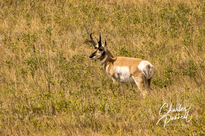
Although Custer State Park (gfp.sd.gov/parks/detail/custer-state-park/) is primarily known for its sizable bison population, this South Dakota favorite also boasts a healthy mixture of other wildlife. From prairie dogs and burros, to elk and even bighorn sheep, there’s no shortage of animal life in the park. And although Custer State Park occupies a whopping 71,000 acres of Black Hills real estate, the southern section of the park is the ground zero for watchable wildlife. Not only is the scenic Wildlife Loop Drive located in this section of the park, but there’s also a visitor center and the Bison Center along the way. And since it’s just a short drive from Badlands National Park, it’s a great addition to any South Dakota road trip.
Drive She Said
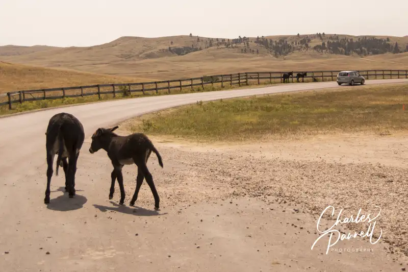
Feral burros on the Wildlife Loop Trail in Custer State Park
The best place to start your wildlife adventure is at the Custer State Park Visitor Center, which is located at the intersection of Wildlife Loop Road and Highway 164. There’s accessible parking and level access to the main building, which houses exhibits and a theater. And if you need directions or have a few questions, there are plenty of folks available to help.
After you get your bearings, hop on the 18-mile Wildlife Loop Drive, which runs from the visitor center to the Bell Station Entrance. It takes about 45 minutes to complete the drive as the speed is limited to 25 mph; but that time is variable due to wildlife — especially bison — that sometimes linger on the road. Basically, you’re on their timetable — whenever they decide to move, so can you. But then again, that’s part of the fun.
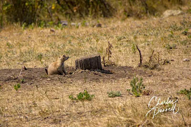
There are lots of pullouts along the drive, and you can get some great windshield views without getting out of your vehicle. The route travels through pastures and forests, with a prairie dog village along the way. And be on the lookout for bighorn sheep which sometimes linger near the road. Then there are the feral burros, which can be overly curious and bold.
Prairie Dog on the Wildlife Loop Road in Custer State Park
The Wildlife Station Visitor Center is located about eight miles from the beginning of the loop. Unfortunately the old CCC building only has steps up to it; however there are accessible vault toilets and an accessible inside picnic area near the parking area. Consider it a shady spot to stop for lunch.
Of course there are no guarantees on how much wildlife you’ll spot along Wildlife Loop Drive, but for optimum game viewing hit the road early in the morning or just before sunset.
Visit the Bison Center
Buffalo in Custer State Park
Make sure and stop at the new Bison Center, which is located about two miles from the Wildlife Station Visitor Center. There’s accessible parking near the entrance, with level access to the building. Inside, there are exhibits which trace the history of the 1,500-head buffalo herd, which are descendants of the 36 head that were introduced in 1936. As the herd grew, it outgrew the available forage, so a yearly roundup (emerginghorizons.com/head-over-to-the-custer-buffalo-roundup/) was instituted to keep the population in check. Interactive exhibits at the Bison Center show how the buffalo are inoculated and what animals are sold, and how licensed hunters also help prevent overpopulation.
And if you’ve every wondered what the correct term is — buffalo or bison — there’s an exhibit which answers that question too. In short, both are considered correct. Buffalo is the French word for beef animal, while bison is the scientific name. And for the most part, buffalo is the preferred term in the park.
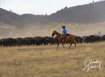
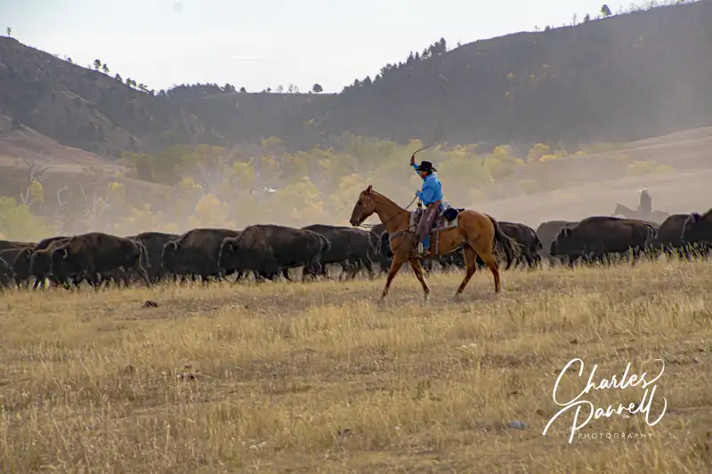
Cowboy at the Buffalo Roundup in Custer State Park
There’s also level access to the gift shop at the Bison Center, where you’ll find a number of buffalo-themed items. And there’s a level dirt path to the buffalo paddocks which are located on the far side of the parking lot. Take some time to check them out as you may see a few buffalo there; however there are more animals present at Buffalo Roundup time. All in all the Bison Center offers a good overview of one of the world’s largest publicly owned buffalo herds. Plan ahead though, as the Bison Center is only open from Memorial Day to the end of September.
Barrier-Free Travel Glacier, Yellowstone and Grand Teton National Parks for Wheelchair-Users and Slow Walkers
Known as America’s Mountain, Pikes Peak is a don’t-miss while you’re in the Colorado Springs area. Of course you can certainly admire the mountain from afar; however there are also two accessible ways to get to the top. One way is take the Pikes Peak Cog Railway and leave the driving to someone else. And although the railway is also a must-do while you’re in the area, save some time to take the other accessible route to the top — drive the Pikes Peak Highway. Not only is it an equally scenic alternative, but you can take things at your own pace and spend as much time on top as you like.
The Basics
The Pikes Peak Highway is located about 15 miles west of Colorado Springs, just off Highway 24 in Cascade. The tollgate is a quarter-mile past the North Pole amusement park. In an effort to make sure there’s ample parking at the summit for all guests, a timed entry permit is required from late May to late September. The permits are good for a two-hour window, and one permit per car is required. In addition to the permit, everyone in the car must also purchase an admission ticket. Timed entry permits and admission tickets are available at https://coloradosprings.gov/pikes-peak-americas-mountain/page/tickets-and-reservations.
The road closes at night, and although it’s technically open year-round, the higher elevations are closed in the winter. Typically the road is only open to the 13-mile mark beginning in mid-October, or after the first snow storm. The round-trip drive itself usually takes two to three hours, but if you plan on stopping at every viewpoint, allow four or five hours. Best bet is to get an early start and have at least a half-tank of gas when you begin. Don’t be in a rush to get to the top, but remember to use the pullouts if you go slower than the traffic flow.
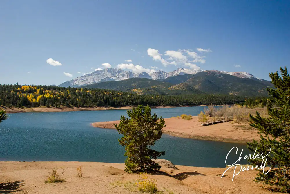
Crystal Reservoir
Crystal Reservoir
The 20-mile route starts at 7,800 feet and climbs to the 14,115-foot summit with lots of scenic overlooks along the way. Pikes Peak is first visible around the three-mile mark as the highway winds through Pike National Forest.
The Crystal Reservoir Visitor Center is located at the six-mile mark. Accessible parking is available on a level asphalt patch and there are accessible vault toilets in the parking lot. There’s level access to the visitor center and gift shop, and some nice accessible picnic tables on a cement slab next to the visitor center. And there’s also a short 200-yard paved pathway down to the boat ramp, which offers a nice view of the reservoir. The path to the right of the visitor center winds past some accessible restrooms and also dead ends in the reservoir. It’s about a .2-mile round trip hike.
The road begins to slowly climb up the hill past the Crystal Reservoir Visitor Center, and the Halfway Picnic Area is about four miles ahead on the right. At first glance this stop appears to be a no-go for wheelchair-users as there are no accessible parking spots or restrooms along the main road. That said, if you turn down the dirt road just before the parking area there’s a nice secluded accessible table next to an accessible vault toilet. And there’s a large level area to park near the facilities.
Glen Cove and Beyond
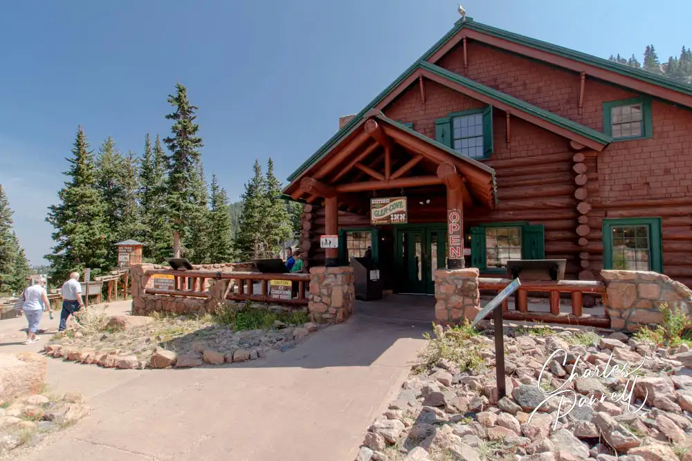
The Glen Cove Lodge
Glen Cove, which is located near mile 13, is also worth a stop. There’s accessible parking in front of the lodge, with ramp access to the front door. Inside there’s plenty or room to maneuver around the gift shop, and over to the small café which offers burgers, hot dogs and snacks. An accessible family restroom is also located inside. A small picnic area with accessible tables on a cement pad is located on the the right side of the building. Glen Cove is also the site of the mandatory brake check on the way back down the mountain.
As you climb up the mountain past Glen Cove you get a real sense of the the elevation gain. After mile 14 there’s a lot of exposure and precious few guardrails, so if you’re skittish about heights it’s best to turn around at Glen Cove. Alternatively you can take the shuttle bus from the mile 7 parking area. Advance tickets are required to take the shuttle, and a lift-equipped bus is available upon request. Shuttle tickets can be purchased at https://coloradosprings.gov/pikes-peak-americas-mountain/page/tickets-and-reservations.
Be sure and stop at the pullout near mile 16 for an impressive view of the switchbacks below, as well as Pikes Peak Reservoir and the Platte River Valley. And as you near the top, be on the lookout for big horn sheep
At the Summit
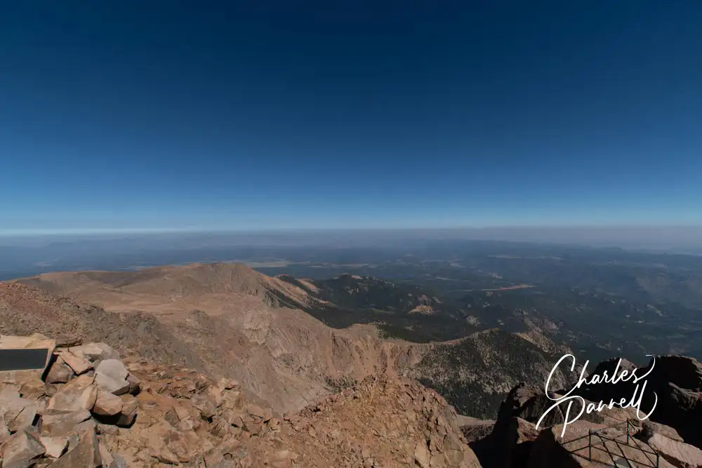
At the top there’s accessible parking and barrier-free access to the Summit House, which was constructed in 2021. Inside there’s level access to the visitor center, a gift shop, a cafeteria and accessible restrooms. The cafeteria serves up sandwiches, burgers and soup, but their homemade doughnuts are a must on any Pikes Peak adventure.
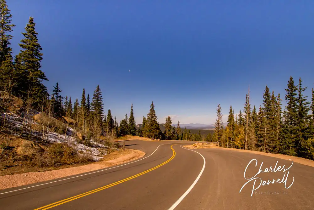
Save some time to browse through the interpretive exhibits which include information on the history, geology and climate of Pikes Peak, as well as an entertaining story about the first woman to summit the mountain — “the bloomer girl”. And don’t forget to take the elevator upstairs for more spectacular mountain views before you head back down the mountain. And when you head downhill, you’ll be treated to an entirely new set of windshield views!
View from the summit of Pikes Peaks Highway
Barrier-Free Travel
Utah National Parks for Wheelchair-users and Slow Walkers
Located in the Southern Sierra Nevada Mountains, Sequoia National Park is home to a large grove of stately giant sequoia trees, including the 275-foot tall General Sherman Tree, the largest tree on Earth. The park is about a four-hour drive from Yosemite Valley, via Highways 41, 99 and 198, through Visalia to the Ash Mountain park entrance. From there the Generals Highway travels through the foothills up to the Giant Forest, and then continues through the Sequoia National Forest and on to Kings Canyon National Park.
Insider Tips
The most accessible way to get to the General Sherman Tree is to park in the lower accessible parking lot on the Generals Highway, and take the quarter-mile paved trail over to the tree. And if you can’t manage the entire length of the trail, you can still get an excellent view of the towering giant about .1-mile up the trail.
You know you’ve found a good picnic spot when you see that the rangers also frequent it – and that’s exactly the case for Pinewood Picnic Area. Located on the Generals Highway just north of the Big Trees Trail, not only is this picnic area very pleasant, but it’s also one of the most accessible ones in the park. The shaded grove features a paved pathway over to the accessible tables and grills, with accessible vault toilets nearby. Additionally, there’s level access to many of the standard tables in the grove.
Wuksachi Lodge, which is located four miles north of the General Sherman Tree, offers a nice selection of accessible rooms. To be more specific, the property boasts eight accessible rooms, all of which have roll-in showers. There’s also good access to the main lodge building which houses the Peaks Restaurant, that offers patrons a panoramic view of the surrounding forest.
Located south of the John D. Rockefeller, Jr. Memorial Parkway and north of Jackson, Wyoming, Grand Teton National Park encompasses over 310,000 acres filled with glacial lakes and bordered by the magnificent Teton Range. There’s no shortage of wildlife in the park either, and visitors commonly encounter elk and bison along the park roads. No mater where you travel in this rugged mountain park, there’s an abundance of scenic windshield views along the way. Grand Teton National Park is truly one of the great – and often overlooked — natural treasures of the American West.
Insider Tips
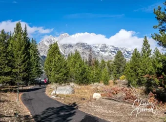
Although the Jenny Lake Scenic Drive is a must-do, most folks entirely miss a beautiful accessible stroll along the way. The access point is near the end of the drive, at a pullout on the right which boasts an accessible parking spot. From there, a paved service road winds a half-mile through the woods to the campground, and then continues along a .16-mile path to the ranger station. From there, you can connect to the accessible portion of the Jenny Lake Trail. As an added bonus, this route isn’t listed on any park maps, so it’s largely devoid of visitors. Plus it’s very accessible.
For a look at the most iconic structure in the park, head over to the Mormon Row Historic District. Located off of Antelope Flats Road, this historic district dates back to the 1890s when Mormon families began to establish homesteads in the area. The historic T. A Moulton Barn, which has adorned many a calendar, is located just across from the parking area. Even if you can’t walk far you, can still enjoy this historic wooden structure framed by the towering Tetons.
Colter Bay Village Cabins offers two accessible cabins, each with a roll-in shower. Cabin 458 is double the size of cabin 456, yet since both these cabins have the same bed configuration and are in the same rate category they rent for the same price. Cabin 458 is definitely a hidden treasure of a deal!
Located near Whitehall, Montana, Lewis & Clark Caverns State Park (fwp.mt.gov/stateparks/lewis-and-clark-caverns/) is named for the famous explorers, even though the closest the duo ever got to their namesake caves was the Jefferson River, some 1,400 feet below. Although the caverns are a definite highlight of the park, visitors can also enjoy the scenic drive up the mountain, and spend the night in a comfortable camping cabin at the park campground. And although caves can be problematic for people with mobility issues, some wheelchair-users and slow walkers may be able to manage a portion of the tour of this 350 million year-old cavern.
Enjoy the Drive
The best place to begin your visit to Lewis & Clark Caverns State Park is at the main visitor center, which is located near the park entrance. There’s accessible parking in the large lot and level access to the building. Inside there’s ample room to maneuver a wheelchair or scooter through the galleries. Pick up a park map and learn a little bit about the geology, flora and fauna in the park.
From the main visitor center it’s about a three-mile drive to the top of the mountain, where the Cave Visitor Center is located. It’s also the starting point for the cavern tours. Take your time to stop along the way to enjoy the view from the numerous pullouts. And even if you don’t have time to stop, there are some great windshield views, going in both directions.
If you’d like to enjoy lunch al fresco, there are also a few options along the drive. The first picnic area is located close to the bottom. It features accessible parking, an accessible vault toilet, and a do-able pathway to some of the closer picnic tables. Up the road, the next picnic area has a level unstriped parking area, and level access over to several picnic tables. The remainder of the tables are located down some steps and over a bridge. And finally, there’s Vista Point. Although there are steps down to the viewing platform, there’s level access over to two shaded tables near the level parking area.
Explore the Caverns
Up at the top of the mountain, there’s accessible parking in front of the visitor center, with ramp access up to it. Built by the Civilian Conservation Corps, the historic stone building is well preserved, and includes the original fireplace. The walls are lined with vintage photos, and there’s also a movie that’s shown throughout the day about the development of the caverns. There’s a cafe and gift shop across the parking lot, with accessible parking nearby.
Cave tour tickets are available at the kiosk next to the visitor center. Tours are only available from May 1 to September 30. Of the tour offerings, the Paradise Tour is the most accessible choice. The 1.5-hour tour requires about a mile of walking or rolling. Unlike the Classic Tour, which includes 600 stairs and a number of tight spaces, this tour is level, with the exception of about 15 steps at the end. The cavern entrance is about a quarter-mile away from the visitor center on a dirt trail covered in crushed granite.
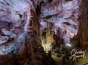
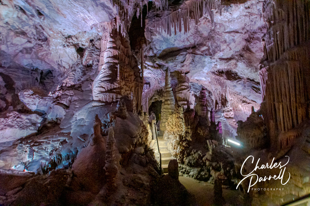
Once inside, a 538-foot tunnel leads over to the Grand Finale Room, which contains an impressive collection of stalactites, stalagmites and columnar formations. Despite the name it’s not the end of the tour, but it’s the farthest that wheelchair-users can go. From there, several staircases with 3-4 steps each lead over to the Paradise Room, which is the official end of the tour. There are railings on the stairs, but the ground is wet. If you can’t do the stairs, you’ll just have to enjoy the Grand Finale Room while the rest of the group visits the Paradise Room. Still the formations are beautiful in the Grand Finale Room, and you can roll around and get a closer look after the crowd moves on.
Spend the Night
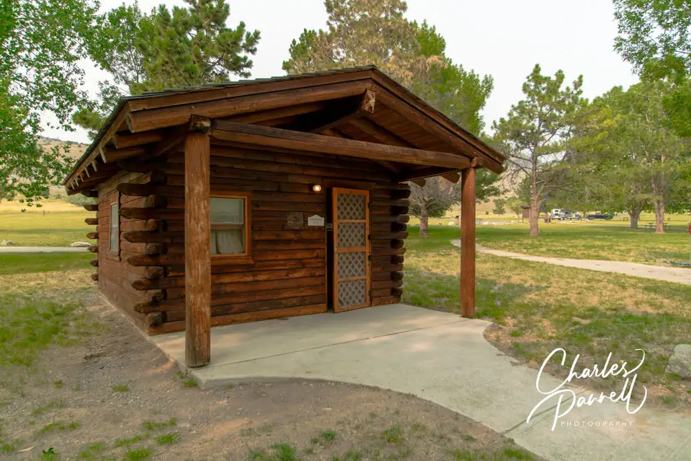
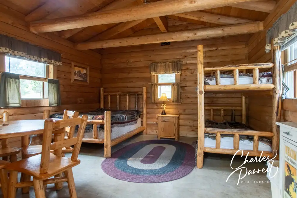
If you’d like to spend the night in Lewis & Clark Caverns State Park, there are several accessible campground options. At the top of the list are the three accessible camping cabins. There’s parking on a level cement pad next to the Morrison Cabin, with an accessible pathway to the front door. It’s furnished with a 27-inch high double bed, and a bunk bed with a 19-inch high lower bunk. There’s also a table and four chairs, some clothing hooks, a mirror and a night stand. Outside there’s an accessible picnic table on a cement pad, a standard grill and a water spigot. This cabin also has electricity.
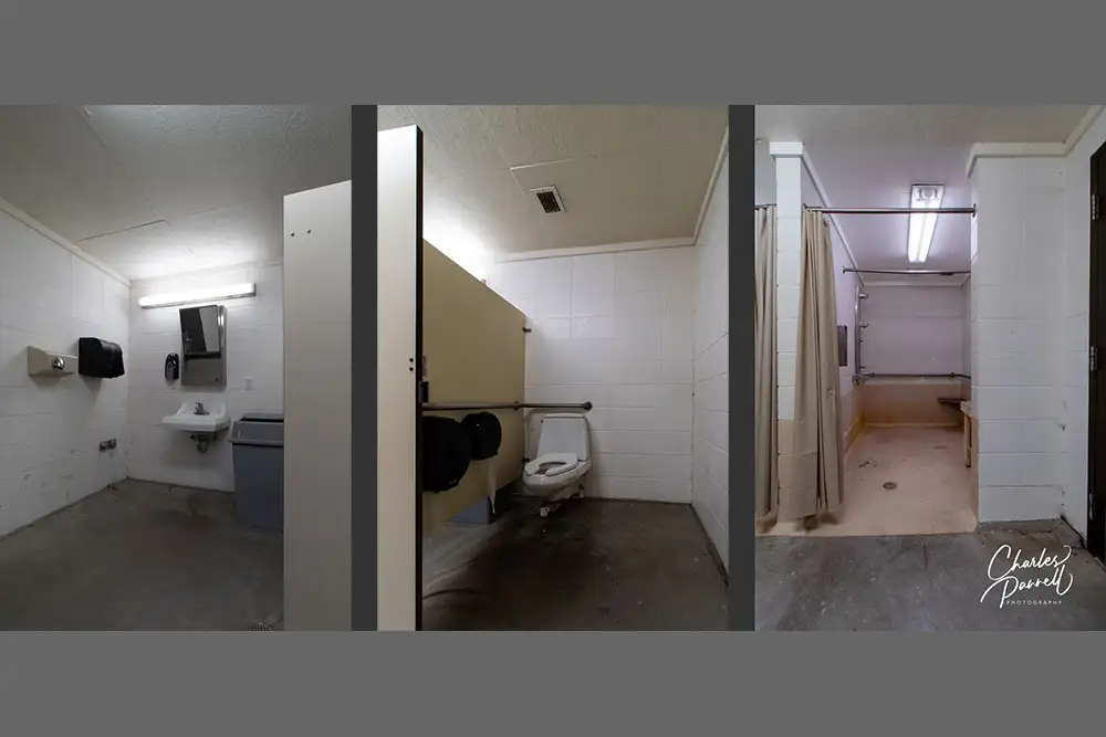
There’s level access to the nearby shower house, which includes an accessible toilet stall with grab bars, and a roll-in shower with grab bars, a lowered control and an accessible pay slot. There’s also a small corner seat in the shower and a slatted bench in the dressing area.
The Smith Cabin and the Woodward Cabin are also accessible, but the Smith Cabin lacks a cement parking space, and both cabins are missing picnic table pads. They are also closer to the other campsites, and lack the privacy of the Morrison Cabin.
Accessible campsite E3 includes a cement parking pad, an accessible table, a raised fire ring and a level tent space. There’s a level sidewalk to the shower house, and it’s the only campsite with electricity. Proof of disability — such as a parking placard — is required to occupy this site.
Finally, the Peregrine Tent is ramped and includes four cots and a small table. There’s also a raised fire ring and a standard table on the grass in front of the unit. It’s not close to the restrooms, and not rated as accessible like the cabins, but it may be doable for some folks.