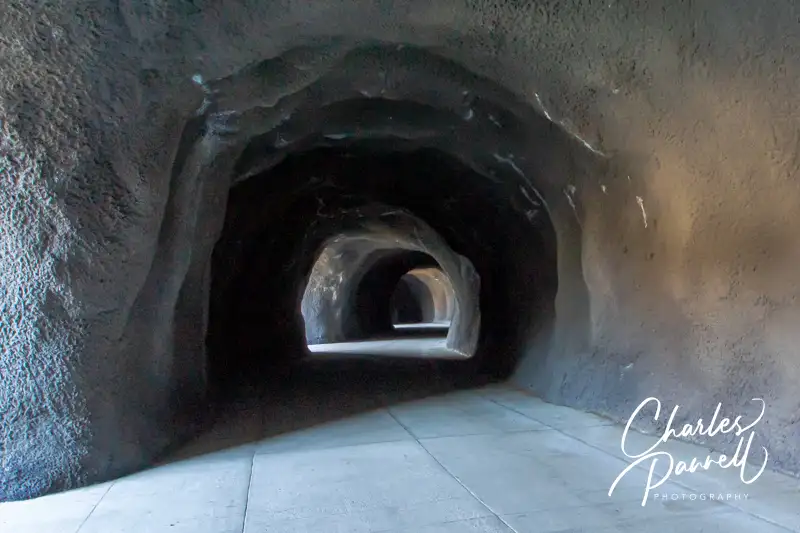
Designed by John Arthur Elliott who took his inspiration from a cliffside tunnel above Lake Lucerne, the original Mitchell Point automotive tunnel was built in 1915. Over the years, traffic along the Historic Columbia River Highway was rerouted to accommodate larger vehicles. In the 1950s the original tunnel was blocked with debris, and it was subsequently destroyed in 1966 during construction of the interstate. After decades of closure, in 2021 the Oregon Department of Transportation launched an ambitious project to build a replica pedestrian tunnel in the same location. The project was completed in 2025, and today the new Mitchell Point Tunnel is a must-stop when you’re heading east on Interstate 84, near Hood River. Just take exit 58 and follow the signs.
There’s accessible parking in the small parking lot, with level access over to the paved trail that leads out to the new Mitchell Point Tunnel. The trail parallels the Columbia River below, and thanks to cutouts in the high rock wall lining the path, everyone can enjoy the expansive view. It’s a pleasant walk, with lots of photo ops. The tunnel itself has five arched openings along its length, to let in light and ease navigation. And when you get to the end there’s an equally impressive Columbia River view. It’s about a half-mile round-trip stroll, and there are also accessible picnic tables and vault toilets near the trailhead. It’s a nice stop for a driving break and a picnic lunch.
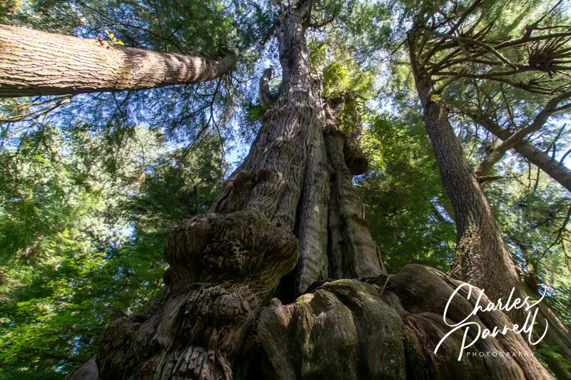
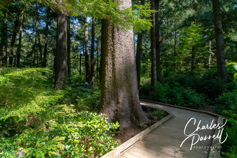
There are lots of self-named “big trees” in the world, but if you happen to be in Northwestern Oregon, be sure and stop in Rockaway Beach, for a gander at Oregon’s largest cedar tree. Lovingly nicknamed the Rockaway Cedar by the locals, this giant stands over 150-feet high, and is surrounded by an equally impressive forest. And believe it or not, it’s in a preserve in the middle of town. The best part is, the half-mile boardwalk that leads out to this local landmark is wheelchair-accessible. So slow down on your next trek down Highway 101, and stop in Rockaway Beach to enjoy a short walk through the forest to admire this stately giant.
A Wheelchair-Accessible Boardwalk
Rockaway Beach Old Growth Cedar Preserve Boardwalk to the Rockaway Cedar
It’s easy to zip by the small parking lot for the Rockaway Beach Old Growth Cedar Preserve. If you’re heading south, slow down when you see the giant hot dog on your left, and look for the parking lot just past Washington Street, on the left. There’s only six standard spaces in the lot, and two accessible slots, but the accessible ones are usually available.
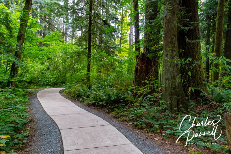
From the parking area, the level boardwalk winds through the 45-acre old growth forest filled with skunk cabbage, salmonberry and coast sedge. About midway along there’s also a level boardwalk over to a viewing platform with a picnic table and benches. It’s a nice secluded spot for a lunch break.
And Oregon’s largest cedar tree – a 154-foot giant — sits at the end of the .6-mile trail. There are a few benches to sit and admire the giant, as well as another picnic table there. There’s also a short stretch of boardwalk that leads over to a more secluded bench if you’d like a little privacy. All in all, it’s a beautiful stroll through the forest, and a must-stop on any Pacific Northwest road trip. And while you’re in the area, be sure to plan a stop at the equally wheelchair-accessible Kilchis Point Reserve, which is just down the road in Bay City emerginghorizons.com/kilchis-point-reserve-a-wheelchair-accessible-tillamook-county-gem/.
Barrier-Free Travel Yosemite, Sequoia and Kings Canyon National Parks for Wheelchair-users and Slow Walkers
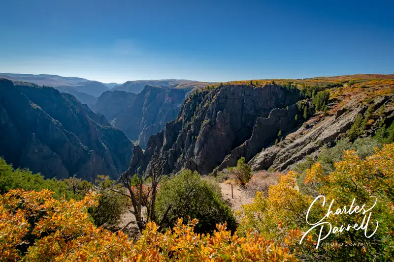
Tomichi Point in Black Canyon of the Gunnison National Park
Although Grand Canyon National Park (emerginghorizons.com/the-grand-canyon-for-wheelers-and-slow-walkers/) is one the country’s most popular national parks, it’s not the only spectacular gorge managed by the National Park Service. Quite the contrary; in fact little known Black Canyon of the Gunnison National Park (www.nps.gov/blca/index.htm) boasts some of the steepest cliffs, oldest rocks and craggiest spires in North America. In contrast to the 21-mile wide Grand Canyon, this Colorado chasm is just nine miles across. Couple that with 2,000-foot canyon walls which drop almost vertically to the Gunnison River, and the result is an eye-popping view. And although the canyon itself isn’t wheelchair-accessible, the best views are had from scenic overlooks along the rim, many of which are doable for wheelchair-users and slow walkers.
A Scenic Drive
The best way to experience the natural beauty of Black Canyon of the Gunnison National Park is to take the seven-mile scenic drive along the south rim. Just follow Highway 50 west from Montrose, then continue along Highway 347 until it dead ends at the park entrance.
You’ll get your first view of the canyon at Tomichi Point, which is near the entrance, just past the campground. There is accessible parking near the rim, with level access out to the overlook. Not only is this a nice canyon view, but if you’re lucky you’ll also get a glimpse of the hikers on the aptly name Rim Rock Trail below.
Be sure and stop in at the Visitor Center, which is just up the road. There’s plenty of accessible parking there, and there’s level access to a very clean accessible restroom. Inside the visitor center, there is barrier-free access to the theater and good pathway access around the interpretive exhibits. There’s also level access to a large deck which offers an impressive canyon view.
The next accessible stop at Black Canyon of the Gunnison is at Pulpit Rock Overlook. Accessible parking is available on the road, near a hard-packed dirt trail that leads out to the lower overlook and offers a sweeping view of the Gunnison River. There are a few bumps at the beginning of the trail, but it’s doable for most folks. To get to the upper overlook you have to go down some steps and then up a very steep ramp, but the river view is much better from the lower vantage point. There is also an accessible restroom at this stop.
Enjoy the Views
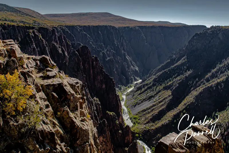
Chasm View in Black Canyon of the Gunnison National Park
Chasm View, which is the next stop on the route, offers the most impressive canyon view. Accessible parking is available near the main trail out to the overlook, but there are nine steps down to the viewpoint. The accessible trail, which is located to the left of the main trail, is longer, but there are no steps along the way. From this viewpoint you’ll get a dramatic view down into the chasm with the Gunnison River below.
Sunset View, which is just up the road, is a great spot to sit and enjoy the sunset (hence the name). There is accessible parking near the accessible sidewalk out to the overlook. Here you’ll find two picnic tables, including one that is accessible. There’s a lower overlook to the right, but there are 15 steps along the route and some rocks and roots on the trail. Still, it’s hard to beat the view from the picnic tables. There’s also an accessible restroom in the parking lot.
Picnic Tables at Sunset Point in Black Canyon of the Gunnison National Park
Last but not least, don’t forget to stop at High Point, at the end of the road. Although the one-and-a half-mile trail to the overlook isn’t accessible, it’s still worth a stop. There’s accessible parking in the lot, and a dirt path at the far end that leads out to an accessible picnic table. It’s a much nicer spot to picnic than Sunset View, and since it’s away from the trailhead, it’s pretty isolated. Even if you’ve already eaten, this is a good place to take a quiet break before you head back. As an added bonus, the windshield views are totally different on the return trip.
Rasar State Park (https://parks.wa.gov/find-parks/state-parks/rasar-state-park) offers a peaceful taste of the forest with some great Skagit River views, a few barrier-free hikes, and several wheelchair-accessible deluxe camping cabins. This lush state park is located about 40 miles west of the North Cascades National Park Visitor Center in Newhalem, just off Highway 20. And with a second-growth forest filled with big-leaf maples, Douglas firs and western red cedars, it’s the perfect place to sit back, relax and enjoy all that Mother Nature has to offer.
Stay in Style
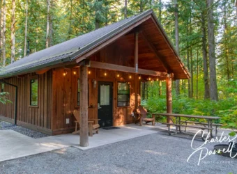
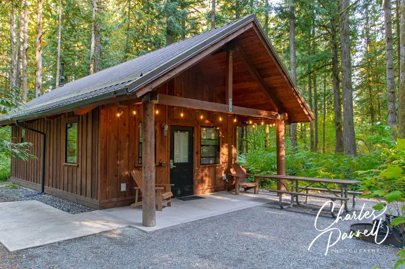
If you’d like to spend the night in Rasar State Park, but don’t want to pitch a tent, then check out one of their three wheelchair-accessible deluxe camping cabins. There’s accessible parking in front of the accessible Chinook Cabin, with paved access over to the front porch. Outside there’s an accessible picnic table and a raised grill, and two oversized Adirondack chairs.
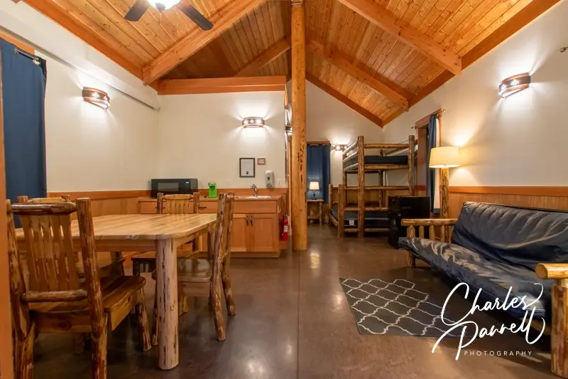
The cabin features a level threshold, wide doorways, lever handles, good pathway access and laminate floors for easy rolling. There’s a small kitchen counter area, with a few cabinets and a sink, with a dinning table and four chairs next to it. The kitchen includes a microwave, a small refrigerator and a K Cup coffee maker (bring your own K Cups).
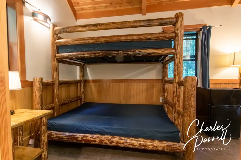
This rustic cabin features exposed beams and natural wood, and includes hand crafted log furniture. For sleeping, there’s a 16-inch high futon in the living area and a bunk bed near the bathroom. The bunk bed includes a 16-inch high double on the bottom and a single on the top. There’s a night table next to the bunk beds, and a floor lamp in the living area. Top it off with a roomy closet, overhead lights, heating and a ceiling fan, and you have a pretty comfortable setup.
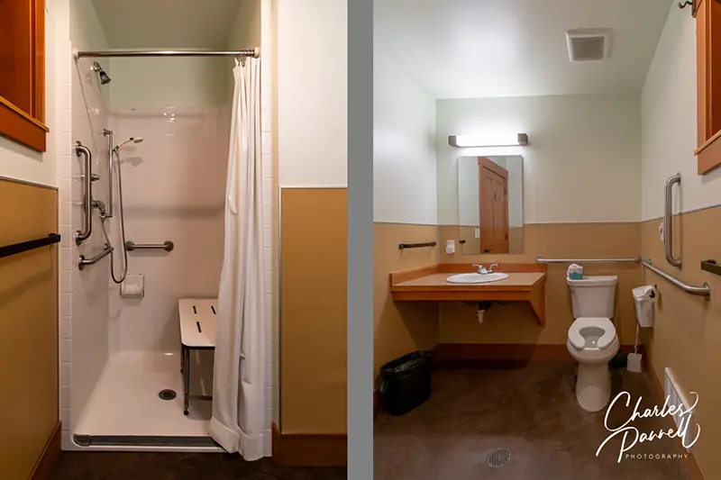
The bathroom features a full five-foot turning radius and includes a 36-inch-square transfer-type shower, with a fold-down shower bench, a hand-held showerhead and grab bars. The toilet grab bars are located on the back and left walls (as seated) and the bathroom also has a roll-under sink.
The Coho Cabin, which is located next door has the same access features, but if you want more privacy, choose the Skagit Cabin across the road. On the plus side, all of the cabins are surrounded by the lush forest.
Living Area in the Chinook Cabin at Rasar State Park
Bathroom in the Chinook Cabin at Rasar State Park
Bedroom in the Chinook Cabin at Rasar State Park
Take a Hike
Even though it’s fairly small, Rasar State Park offers a varied landscape with several accessible trails. Most of the trails are located in the south area of the park, near the Skagit River. There’s accessible parking near the picnic area, and level access over to the trailheads. There are also accessible picnic tables on the grass, if you’d like to stop for a short lunch break.
The paved Skagit River Access begins near the picnic area, and winds through the meadow out to the river. It’s about a .3-mile jaunt down to the river, and although you can walk a little further on the hard-packed sand beach, the wheelchair-access ends at that point. After that you’ll encounter steps, bumps, rocks, and a significant uphill climb. Still, it’s a nice accessible out-and-back trail to the river.
Skagit River Trail at Rasar State Park
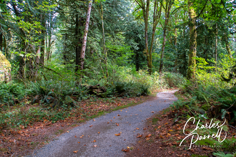
The Cedar Trail also starts in the picnic area. This hard-packed dirt trail leads through a canopy of trees, before the access ends at the .25-mile point. Still it’s another nice out-and-back walk, and there are a few shaded picnic tables along the way.
Cedar Trail at Rasar State Park
Another accessible trail option is located on the north side of the park. This hard-packed dirt trail loops through the second-growth forest, past the cabins and group campsites. This 1.5-mile trail begins across the road from the Chinook Cabin and to the right of the Skagit Cabin, and continues past the group camps and the private lands that border the park. And if you’d like a shorter hike, it’s easy to exit the trail at the halfway point.
Finally, if you’d like to hike through some old growth forest nearby, be sure to check out Rockport State Park and Baker Lake for some accessible options. It’s a great way to extend a Rasar State Park Visit.
Barrier-Free Travel Washington National Parks for Wheelers and Slow Walkers
There’s a certain seductive allure to Sedona. Some folks come for the mystical experience, while others enjoy gallery hopping. And then there’s the scenery. You just can’t beat the red rock formations that literally surround this Northern Arizona enclave. And the good news is, a good chunk Sedona’s red rock beauty is accessible to wheelchair-users and slow walkers.
Red Rock Scenic Byway
Red Rock Scenic Byway
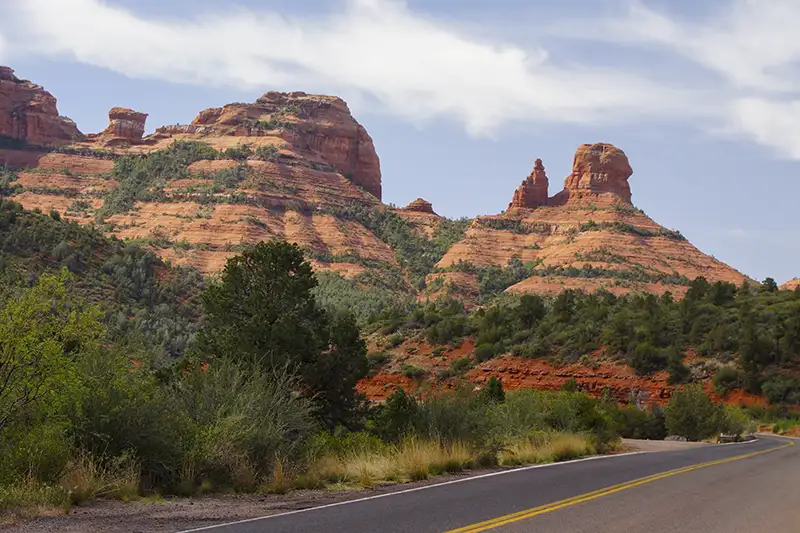
One of the best ways to enjoy Sedona’s red rock beauty is to take a drive on the Red Rock Scenic Byway. This popular route is located off of Interstate 17. Just take exit 298, and once you cross the Dry Beaver Creek bridge, the show begins.
The 7.5 mile scenic drive, which winds through the majestic landscape, is often referred to as a “museum without walls”. As you pass Oak Creek Village, the scenery becomes more dramatic. Bell Rock, one of Sedona’s four vortices, is located just past Oak Creek Village on the right. You can’t miss it. Bell Rock is one of the more accessible red rock formations, as the upper part of Bell Rock Trail is wide, level and made of hard-packed dirt. It’s doable for most wheelchair-users, however you can also get a great view of the iconic formation from the parking lot overlook.
Be sure to stop at nearby Courthouse Butte to admire the expansive scenery. And don’t miss the Chapel of the Holy Cross (chapeloftheholycross.com), which is built into the red rock buttes. There are a few accessible parking spots near the sanctuary, and golf cart transportation is available from the remote parking area. The chapel features ramp access, but some manual wheelchair-users may require assistance because of the pitch. Still it’s worth a stop even if it closed, just for a view of the impressive front facade.
Just up the road, the Red Rock Scenic Byway ends at Highway 89A. All in all it only takes 20 minutes to drive the route, but allow for extra time for lots of photo stops. And even though a Red Rock Pass is required for hikers, it’s not required for quick photo stops of 15 minutes or less.
Red Rock State Park
Mesquite Interpretive Loop
Red Rock State Park (www.azstateparks.com/red-rock), which is located on Highway 89A South is also worth a visit. There are a two accessible trails in the park, but they don’t offer much shade, so it’s best to go early in the day.
Accessible parking is located near the visitor center, with ramp access down to the building. Inside there’s plenty of room to maneuver a wheelchair around the gift shop, ranger information desk and interpretive exhibits. Accessible restrooms are located near the front door, and there’s also level access to the theater and classroom next door. And don’t miss the hummingbird garden on the back patio.
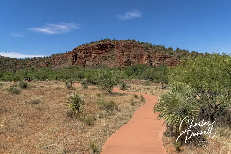
The accessible Mesquite Interpretive Loop begins near the parking lot. This short trail features a paved level pathway around garden filled with native plants. There’s a shaded picnic area with accessible tables near the trail; and there’s also a shade structure located in the middle of this quarter-mile trail.
The longer Bunkhouse Trail begins behind the visitor center. Although you can access it from the parking lot, that pathway has a steep grade. Alternatively, there’s level access to the trail from the hummingbird garden. The paved trail is fairly level, although there’s a bit of a grade in the beginning. Power wheelchair-users won’t have a problem, but some manual wheelchair-users may require assistance. There are also some cracks along the paved trail, but other than that it’s fairly smooth rolling.
At about the .2-mile mark there’s an accessible hard-packed dirt trail down to the Kingfisher Bridge, which provides a pleasant — and shaded — view of Oak Creek. From there a hard-packed dirt path follows the creek for another .2 mile before the trail loses its access. All in all it’s a pleasant mile-long out-and-back hike.
Slide Rock State Park
Pendley Homestead House on the Pendley Homestead Trail
Finally, if you’d like to hit a local favorite, head on over to Slide Rock State Park (azstateparks.com/slide-rock). It’s located 20 minutes north of Red Rock State Park on Highway 89A. This park provides access to Oak Creek, and it takes its name from the rocks that many folks use as slides to get into the water.
Unfortunately the path down to the creek is not accessible, but there is a short trail that offers a scenic overlook of the canyon. That said, the admission is pretty steep ($20 to $30 per car, depending on the season) for just that trail; however if you have an Arizona State Park Pass, this park makes a nice lunch stop.
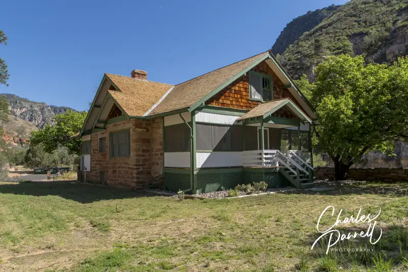
There’s accessible parking near the shaded picnic area — which has several accessible tables — and barrier-free access over to the Pendley Homestead Trail. This paved level trail leads past a small store, and by a display of vintage farming equipment, over to the old homestead which features a tractor display in the adjacent barn.
The trail then connects with the Cliff Top Trail which has a 75-foot paved path out to an accessible overlook that offers an expansive view of Oak Creek Canyon. All in all it’s about a quarter-mile round trip, and it makes for a nice stroll before of after lunch. And if you’d prefer to skip the hike, this piece of Sedona’s red rock beauty is easily visible from the the picnic area.
Barrier-Free Travel the Grand Canyon for Wheelchair-users and Slow Walkers
Located off Interstate 90 in Northwestern Washington, Olmstead Place State Park makes a nice road trip picnic stop. The GPS directions will take you to the old barn, but continue along Ferguson Road to the next driveway for the picnic area. There’s no striping in the small paved lot, but that’s OK because you’ll most likely have it to yourself. There are accessible vault toilets in the parking area, and a level gravel path leads over to several picnic tables on the grass. They aren’t any accessible tables, but there’s room at the end for wheelchairs. There’s a little freeway noise, but it’s a nice departure from the rest area picnic tables. And it’s not crowded.
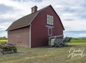
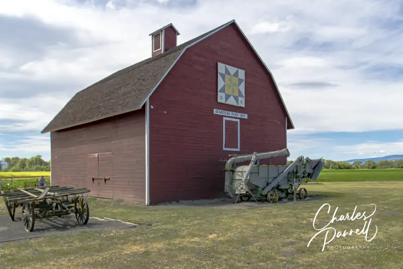
After lunch feel free to browse around the old homestead. The site is level and there are some gravel pathways but you’ll have to roll over the grass to get to a number of the buildings. There are a lot of farm out buildings as well as the old homestead to peruse. The barn area is also worth a look, and if you can’t manage the pathway, then it’s a short easy roll down Ferguson to get to it. There’s not much traffic on Ferguson, so it’s pretty safe. There’s a sizable display of farm implements next to the barn, and a decorative quilt square adorns the front. It’s a nice picnic spot, and a great place to dodge the crowds.
Dedicated to the rivers and fish of the Methow Valley, Homestream Park is a spot to pause, reflect and observe. And since it’s just off Highway 20, it makes for a good stop. That said, unless you have an accessible parking placard, there’s no vehicle parking in this urban oasis. There’s level access from the accessible parking area over to a covered and uncovered picnic area. And the good news is, both areas have accessible tables.
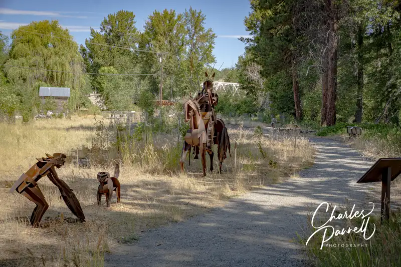
A short .2-mile trail runs along the river and loops back to the picnic area. And along the way it’s dotted with works by sculptor Smoker Marchand. These sculptures focus on the salmon and the original inhabitants of the Methow Valley. About half of the level hard-packed dirt trail is accessible, and there are several benches to sit down and take a break along the way. After the halfway point there are nine boulders along the trail, which represent the nine dams that the salmon encounter on their journey to the Pacific Ocean. Some slow walkers may be able to get around the boulders, but most spaces are too tight for wheelchair-users, so you’ll have to double back. Still it’s a nice spot to stop, enjoy a picnic, and peruse the sculptures.
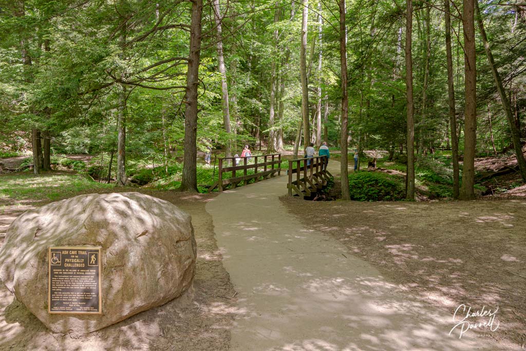
Logan is a required stop on any Hocking Hills road trip. It also makes a good home base for the further exploration of the area. The Inn and Spa at Cedar Falls (innatcedarfalls.com) offers several accessible options, including the secluded Redbud Cabin. This two bedroom cabin includes a ground-floor bathroom with a roll-in shower, and has level access to the spacious back porch. Another Logan favorite — Watersong Woods (www.watersongwoods.com) — offers the accessible Melody Cabin which includes a bathroom with a roll-in shower. And both places are right around the corner from one of the area’s biggest attractions — Hocking Hills State Park. It’s a lovely park to drive through, especially in the fall. It also boasts a quarter-mile wheelchair-accessible trail to Ash Cave, which winds through the woods and terminates at the misty waterfall. It’s also a nice choice for a picnic, as there are several accessible tables near the trailhead.
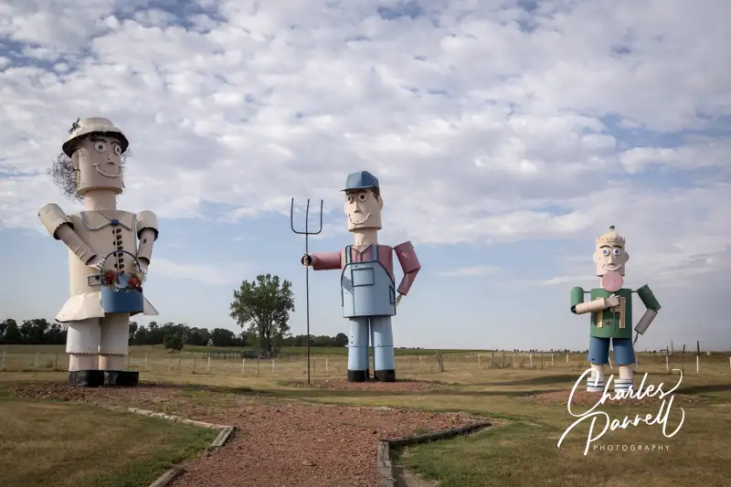
If you happen to be road tripping through North Dakota, a short detour on the Enchanted Highway is definitely a must-do. The brainchild of local resident Gary Greff, these larger-than-life sculptures dot the highway between Gladstone and Regent. Just take exit 72 off Interstate 94 and enjoy the ride. You can stop and picnic at most of the installations, or just pop in for a quick photo op. Either way, it’s definitely worth a short detour while motoring through the Peace Garden State.
There’s a certain seductive allure to Sedona. Some folks come for the mystical experience, while others enjoy gallery hopping. And then there’s the scenery. You just can’t beat the red rock formations that literally surround this Northern Arizona enclave. And the good news is, a good chunk Sedona’s red rock beauty is accessible to wheelchair-users and slow walkers.
Red Rock Scenic Byway
One of the best ways to enjoy Sedona’s red rock beauty is to take a drive on the Red Rock Scenic Byway. This popular drive is located off of Interstate 17. Just take exit 298, and once you cross the Dry Beaver Creek bridge, the show begins.
The 7.5 mile scenic drive, which winds through the majestic landscape, is often referred to as a “museum without walls”. As you pass Oak Creek Village, the scenery becomes more dramatic. Bell Rock, one of Sedona’s four vortices, is located just past Oak Creek Village on the right. You can’t miss it. Bell Rock is one of the more accessible red rock formations, as the upper part of Bell Rock Trail is wide, level and made of hard packed dirt. It’s doable for most wheelchair-users, however you can also get a great view of the iconic formation from the parking lot overlook.
Be sure to stop at nearby Courthouse Butte to admire the expansive scenery. And don’t miss the Chapel of the Holy Cross (chapeloftheholycross.com), which is built into the red rock buttes. There’s a few accessible parking spots near the sanctuary, and golf cart transportation is available from the remote parking area. The chapel features ramp access, but some manual wheelchair-users may require assistance because of the pitch. Still it’s worth a stop even if it closed, just for a view of the impressive front facade.
Just up the road, the Red Rock Scenic Byway ends at Highway 89A. All in all it only takes 20 minutes to drive the route, but allow for extra time for lots of photo stops And even though a Red Rock Pass is required for hikers, it’s not required for quick photo stops of 15 minutes or less.
Red Rock State Park
Red Rock State Park (www.azstateparks.com/red-rock), which is located on Highway 89A South is also worth a visit. There are a two accessible trails in the park, but they don’t offer much shade, so it’s best to go early in the day.
Accessible parking is located near the visitor center, with ramp access down to the building. Inside there’s plenty of room to maneuver a wheelchair around the gift shop, ranger information desk and interpretive exhibits. Accessible restrooms are located near the front door, and there’s also level access to the theater and classroom next door. And don’t miss the hummingbird garden on the back patio.
The accessible Mesquite Interpretive Loop begins near the parking lot. This short trail features a paved level pathway around garden filled with native plants. There’s a shaded picnic area with accessible tables near the trail; and there’s also a shade structure located in the middle of this quarter-mile trail.
The longer Bunkhouse Trail begins behind the visitor center. Although you can access it from the parking lot, that pathway has a steep grade. Alternatively, there’s level access to the trail from the hummingbird garden. The paved trail is fairly level, although there’s a bit of a grade in the beginning. Power wheelchair-users won’t have a problem, but some manual wheelchair-users may require assistance. There are also some cracks along the paved trail, but other than that it’s fairly smooth rolling.
At about the .2-mile mark there’s an accessible hard-packed dirt trail down to the Kingfisher Bridge, which provides a pleasant — and shaded — view of Oak Creek. From there a hard-packed dirt path follows the creek for another .2 mile before the trail loses its access. All in all it’s a pleasant mile-long out-and-back hike.
Slide Rock State Park
Finally, if you’d like to hit a local favorite, head on over to Slide Rock State Park (www.azstateparks.com/slide-rock). It’s located 20 minutes north of Red Rock State Park on Highway 89A. This park provides access to Oak Creek, and it takes its name from the rocks that many folks use as slides to get into the water.
Unfortunately the path down to the creek is not accessible, but there is a short trail that offers a scenic overlook of the canyon. That said, the admission is pretty steep ($20 to $30 per car, depending on the season) for just that trail; however if you have an Arizona State Park Pass, this park makes a nice lunch stop.
There’s accessible parking near the shaded picnic area — which has several accessible tables — and barrier-free access over to the Pendley Homestead Trail. This paved level trail leads past a small store, and by a display of vintage farming equipment, over to the old homestead which features a tractor display in the adjacent barn.
The trail then connects with the Cliff Top Trail which has a 75-foot paved path out to an accessible overlook that offers an expansive view of Oak Creek Canyon. All in all it’s about a quarter-mile round trip, and it makes for a nice stroll before of after lunch. And if you’d prefer to skip the hike, this piece of Sedona’s red rock beauty is easily visible from the the picnic area.
Barrier-Free Travel the Grand Canyon for Wheelchair-users and Slow Walkers