Located in Northwestern Washington, the Chinook Scenic Byway runs from the mountain community of Enumclaw to the fertile Naches Valley. This picturesque slice of Highway 410 winds through the Mt. Baker-Snoqualmie National Forest, snags the northeast corner of Mount Rainier National Park, and crosses over Chinook Pass, before it winds down to Naches. Dense forests line this mountain route; and if the cloud cover lifts, you’ll also get a magnificent Mount Rainier view. You can drive the route straight through in just two hours, but it’s best to budget a whole day, so you can fully enjoy the scenic wheelchair-accessible stops along the way. The Chinook Scenic Byway is much more than just a mountain highway — it’s a destination by itself.
Mount Rainier Gateway
Located about an hour southeast of Seattle, the mountain community of Enumclaw marks the beginning of the Chinook Scenic Byway. Known as the gateway to Mount Rainier National Park, Enumclaw is a good place to base yourself to explore the Sunrise section of the park, or to overnight before a Chinook Scenic Byway jaunt.
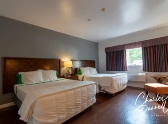
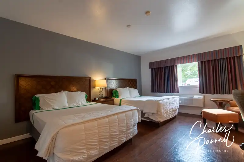
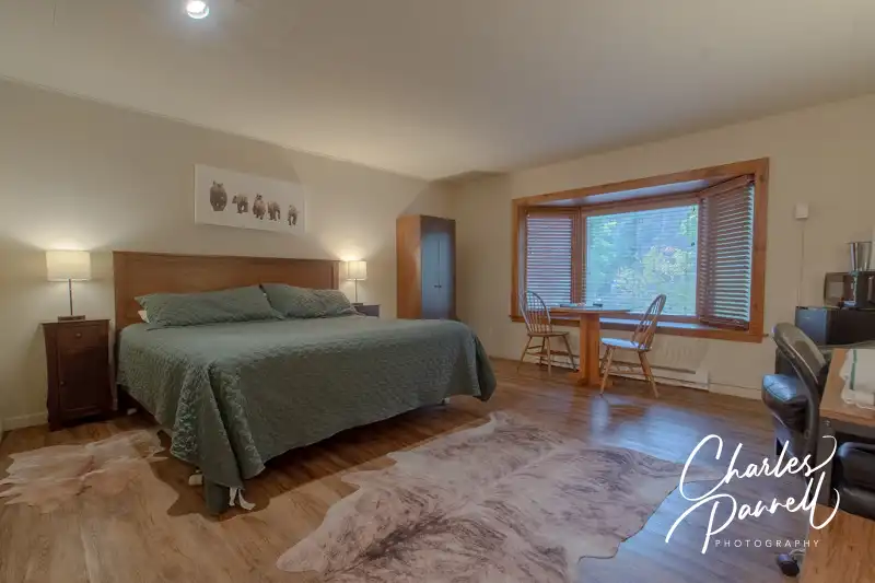
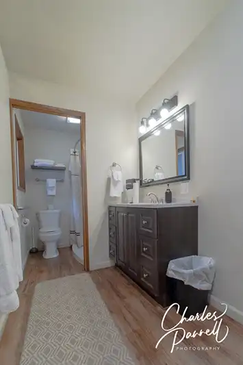
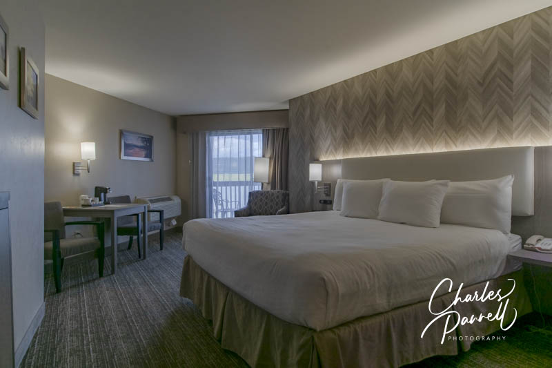
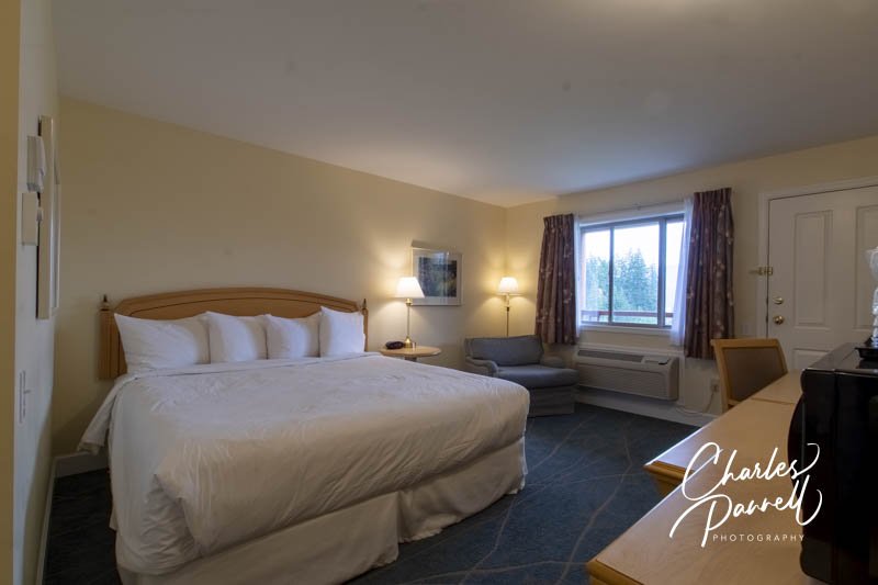
The GuestHouse Enumclaw (www.stayinns.com), which is located in the Enumclaw historic district, is a good choice for wheelchair-users and slow walkers. There’s an accessible drop-off area in front, with barrier-free access over to the front desk. Accessible room 1001 is located on the ground floor, just a short roll from the lobby.
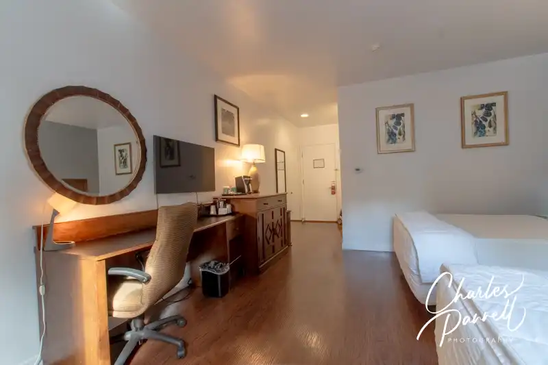
Access features include, wide doorways, lever handles, laminate flooring for easy rolling and good pathway access. It’s furnished with two 27-inch high open-frame queen-sized beds with an access aisle in the middle. Other furnishings include a nightstand, an easy chair, a desk with a chair and a chest of drawers. The room also has a refrigerator and a microwave.
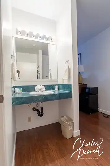
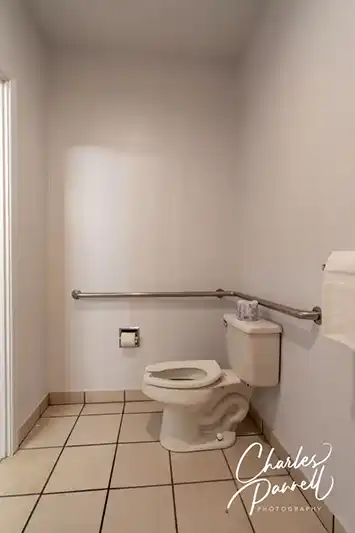
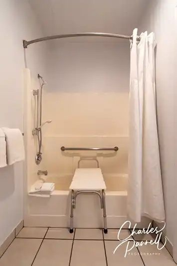
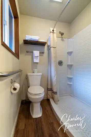
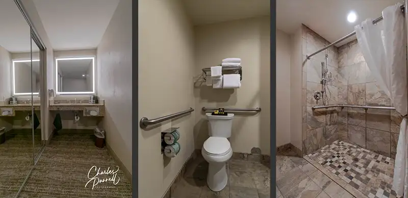
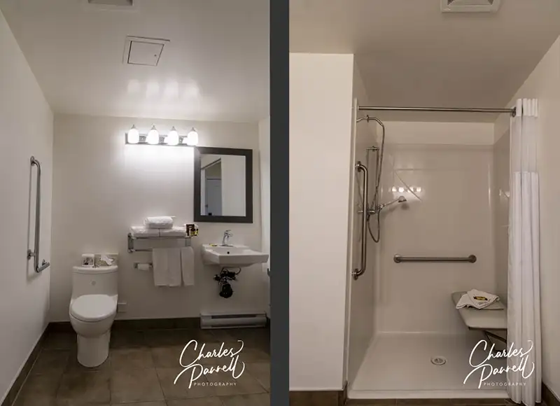
The bathroom has a tub/shower combination with grab bars and a hand-held showerhead. There’s also a portable shower bench in the bathroom. The toilet grab bars are located on the back and right walls (as seated), and there’s a roll-under sink just outside the bathroom.
A Continental breakfast is included with each stay, and it includes waffles, bread, cereal, fruit and beverages. Additionally, guests receive a 10% discount at Ranchitos Mexican Restaurant, which is located near the lobby. It’s a comfortable road trip property.
Room 1001 at the GuestHouse Enumclaw
Room 1001 at the GuestHouse Enumclaw (view 2)
Vanity in Room 1001 at the GuestHouse Enumclaw
Toilet in Room 1001 at the GuestHouse Enumclaw
Shower in Room 1001 at the GuestHouse Enumclaw
Hit the Road
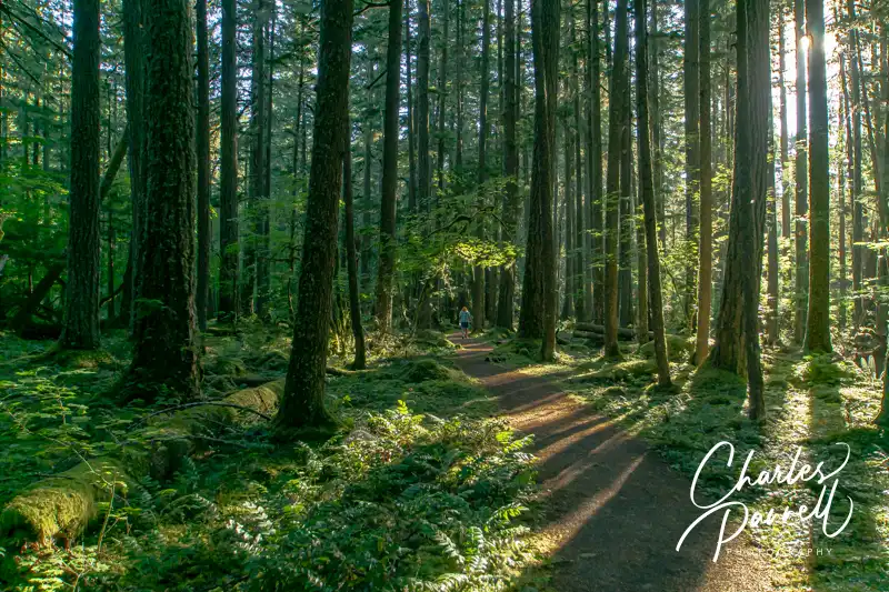
Whispering Hemlocks Loop Trail in Federation Forest State Park
From Enumclaw, head east on the Chinook Scenic Byway (Highway 410). Although it’s a beautiful route, with more than a fair share of windshield views, there are a few places worth a stop along this first stretch of the road. At the top of that list is Federation Forest State Park (parks.wa.gov/find-parks/state-parks/federation-forest-state-park), which is located about 15 miles east of downtown Enumclaw.
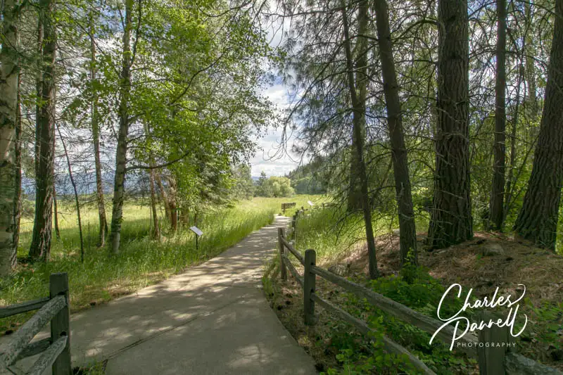
There’s accessible parking in the large lot, with level access over to the visitor center and the trailhead. The Whispering Hemlocks Loop Trail, which is the most accessible trail in the park, begins just to the left of the visitor center. This wide level hard-packed dirt trail is covered in crushed gravel, and winds through a shady slice of the forest. There are interpretive plaques along the way and a few benches tucked in secluded nooks here and there. This .3-mile loop trail offers a pleasant stroll through the forest, and it’s an excellent choice for wheelchair-users and slow walkers.
And if you’d like to stop for lunch, there’s also a nice picnic area in the park. The main park road loops through the picnic area, and about midway along there’s an accessible family restroom with accessible parking nearby. From there it’s just a short level walk to a shaded accessible picnic table.
As you continue east on the byway, be on the lookout for Skookum Falls Viewpoint on the right. It’s easy to miss as the signs aren’t always visible from the road, but it’s located about eight miles east of Greenwater. There’s a small paved parking lot at the viewpoint, with room for an adapted van to parallel park. To be honest, this is more of a river view; however you can usually spot the falls in the distance. Take your binoculars!
Mount Rainier Visit
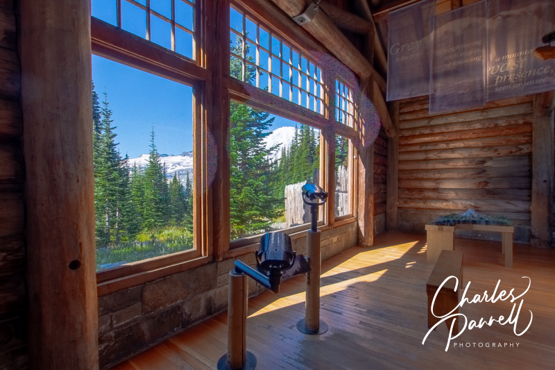
View from the Visitor Center at Paradise
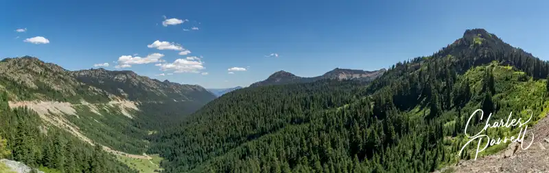
The byway continues south through the forest; and just after it passes the turnoff to Crystal Mountain Resort, it enters Mount Rainier National Park. At this point, keep your eyes peeled to the west for some impressive views of Mount Rainier. There’s a small turnout between mileage markers 63 and 64 that’s worth a stop. There’s no paved parking, but it’s easy to parallel park and get a great view of the mountain from your vehicle. But to be honest, you’ll catch some great views all along this leg of the trip.
Although it’s a slight detour off the byway, a stop at Mount Rainier National Park is highly recommend. Just take the The White River Entrance south of Crystal Creek, and follow the 11.5-mile road to Sunrise — the highest point in the park navigable by vehicle.
At the top of the road, you’ll find the visitor center on the far side of the parking lot. The accessible entrance is on the side, and there’s barrier-free access throughout the building which is filled with exhibits on the surrounding area. The highlight of the visitor center is the Mount Rainier view, which can be had from the far window. And if you’d like a closer look, there’s an accessible scope set up near the window. There’s an equally good view outside, near the picnic tables to the left of the building.
On the way back down the hill be sure and stop at Sunrise Point, which is located on the last switchback before the top. There’s a paved lot in the middle of the switchback, or you can pull over on the side of the road. Either way, you’ll get a beautiful view.
More Mount Rainier Views
Wildflowers at Tipsoo Lake
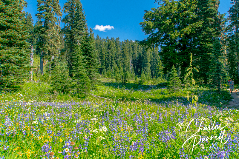
After you’ve explored the Sunrise area, head back down the mountain and rejoin Highway 410. Continue south through the park and be on the lookout for more gorgeous Mount Rainier views on the west side of the road. When you come to the junction oh Highway 410 and Highway 123, continue east on Highway 410 towards Chinook Pass. There’s no shortage of windshield views along this stretch of the byway, but make sure and stop at Tipsoo Lake for a closer look at the landscape.
Located near the summit, this stop boasts a large picnic area and trailhead. There’s accessible parking near the accessible vault toilet, and near a few usable tables in the picnic area. There’s no view of the namesake lake from the parking area; however there are some great mountain views. Even if you don’t park the car, it’s worth a quick drive-through.
As you approach Chinook Pass (5,432 feet), you’ll pass under a pedestrian bridge that crosses the byway; and just up ahead there’ a pullout on the right. There are spots to parallel park in the lot, and there’s a lowered wall nearby to afford wheelchair-users a better view. And if you need to use the facilities, there’s an accessible vault toilet in the parking lot across the street.
A Scenic Drive
Mather Memorial Parkway
After Chinook Pass, the byway winds down the mountain, past the turnoff to Bumping Lake and through the evergreen forest. As it descends to a lower altitude, you’ll spot deciduous trees and the Naches River flowing alongside the road. It’s an especially scenic drive in the fall, with the changing colors.
There’s no shortage of pullouts along the route, so feel free to pull over and take in the scenery. It’s also a great route for photographers. Additionally, there’s a nice rest stop about 24 miles from Chinook Pass on the east side of the road. Technically it’s the trailhead for the Mather Memorial Parkway Nature Trail; however there are also accessible vault toilets near the accessible parking area at this site. It’s a nice spot to take a break, but keep in mind that it may be closed near the end of the season.
A Historic Lodge
Just down the road in Cliffdell, Whistlin’ Jack’s Outpost and Lodge (www.whistlinjacks.com), is also worth a stop. A Washington state icon since 1957, the lodge was named for the the whistling warning sounds made by marmots, which later became associated with the local lumberjacks. There’s accessible parking in front of the office with level access over to the gift shop and restaurant. It makes a nice lunch stop, or even a spot for a short break. There’s a pleasant river view from the restaurant, and a few picnic tables outside on a level grassy area.
And although the lodge doesn’t have any wheelchair-accessible rooms, Room 1 may work for some slow walkers. There’s standard parking in front of the room; however there’s some additional space on one side. The room has a one-inch lip at the threshold but it has a wide door, lever handles and laminate flooring. It’s furnished with a 26-inch high open-frame king-sized bed with plenty of room on both sides, two night stands, a wardrobe, an easy chair and a desk with a chair. There’s also a microwave, a refrigerator, a coffee maker and a table with two chairs.
The bathroom has a sliding pocket door with a 29-inch clearance, but there’s not enough room for a wheelchair inside the bathroom. It includes a large low-step shower (three inch lip) that measures 58 inches by 28 inches. There are no grab bars in the shower, but the toilet has a grab bar on the right side (as seated). And there’s a standard sink and mirror just outside of the bathroom. Again, the room is not wheelchair-accessible, but it may work for some slow walkers.
Room 1 at Whistlin’ Jack’s
Toilet and Shower in Room 1 at Whistlin’ Jack’s
Vanity in Room 1 at Whistlin’ Jack’s
Naches and Beyond
Autumn View at the Oak Creek Big Horn Sheep Feeding Station
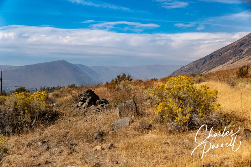
Although the Chinook Scenic Byway technically ends when Highway 410 transitions into Highway 12, there are still a few worthwhile stops past the official end point. The Oak Creek Big Horn Feeding Station is located on Old Naches Road, about a half-mile from the intersection of Highway 410 and Highway 12. Although they only put food out for the bighorn sheep in the winter months, you can sometimes catch a gander of them in the nearby hills. Plus the scenery is beautiful, so it’s worth the short detour even if you don’t spot any wildlife.
Natches Trading Post
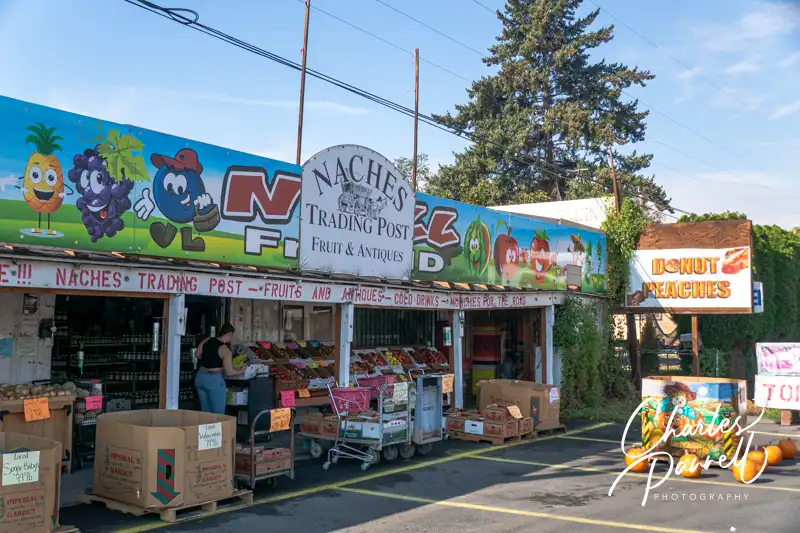
Just down the Road in Naches, the Naches Trading Post (www.facebook.com/nachestradingpost/) makes a good stop for some fresh produce, a collection of antiques and some yummy huckleberry fudge. There’s accessible parking in front, and level access to this huge fruit stand. Even if you don’t buy anything, it’s a fun place to stop and look at the antiques and collectables.
Be sure to take some time to enjoy the scenery on this stretch of the road, as orchards line both sides of the highway on this final part of the drive. And after you complete the route, you can continue on to the end of Highway 12 in Yakima, linger on and enjoy Washington wine country or continue along your way. Either way, the Chinook Scenic Byway is a must-drive route on any Northwestern Washington road trip.
Barrier-Free Travel Washington National Parks for Wheelers and Slow Walkers
Billed as America’s only multi-national scenic drive, the International Selkirk Loop (selkirkloop.org) traverses Northeastern Idaho and Washington, and dips into a swath of Southern British Columbia. This 280-mile loop is known for its spectacular scenery, big skies, crystal clear waterways and of course the namesake Selkirk Range.
Although it can be easily done as a stand alone trip, because of its proximity to Interstate 90, it can also be incorporated into a longer road trip. The scenery along the route is beautiful year-round; however summer is prime time for this drive, as many business and attractions are closed in the other seasons. Wheelchair-users and slow walkers are in luck too, as there are numerous accessible stops along the way. With that in mind, here’s a three-day wheelchair-accessible itinerary for this Pacific Northwest scenic drive.
Day 1 — Post Falls, ID to Bonners Ferry, ID
To get to the International Selkirk Loop from Interstate 90, take exit 5 in Post Falls, Idaho. From there, follow Highway 41 north through Rathdrum, Spirit Lake, and Blanchard to Highway 2 in Oldtown. To go directly to the Selkirk Loop, make a right on Highway 2; however if you’d like a fun little detour just a mile off the route, continue straight and follow the signs to Pioneer Park
An Accessible Forest Hike
The Kalispel Heritage Trail in Pioneer Park
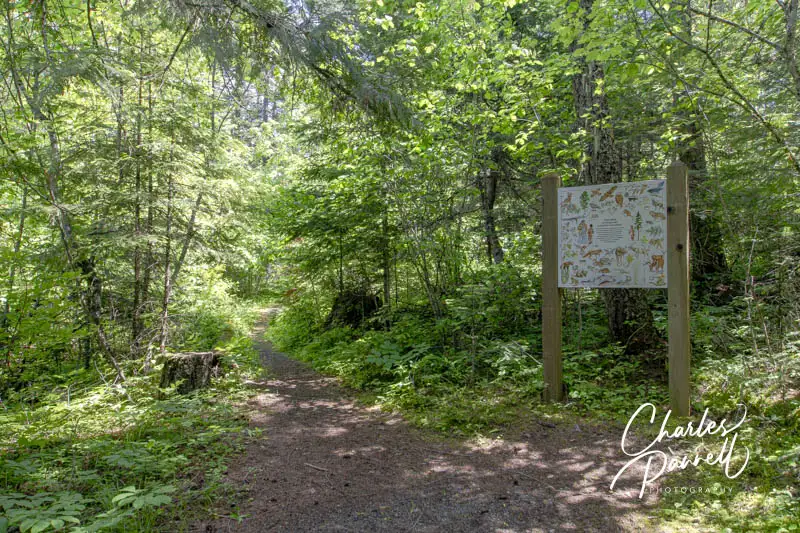
One of the great things about Pioneer Park is that since it’s a US Forest Service area, there’s no charge to enter if you have an America the Beautiful Access Pass. The other great thing about the park is the accessible Kalispel Heritage Trail. It’s easy to find — just take the first left after you enter the park, and look for the trailhead on the left, across from the campground.
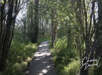
The hard-packed dirt loop is about .3 miles long, and although there are elevation changes here and there, it’s still within the access guidelines. The shaded trail winds through the forest, with interpretive plaques about the the language and culture of the native Kalispel people along the way. Important native vegetation is also identified. An accessible boardwalk that offers some great views of the Pend Oreille River is located halfway along the trail. And if you’d like to stop and enjoy the peaceful view, there are benches near the overlook.
A Great Dam Lunch on the International Selkirk Loop
Albeni Falls Dam
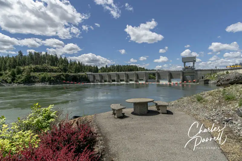
After your hike, head back out to Highway 2, then make a left to begin your journey on the International Selkirk Loop. About 15 minutes up the road, you’ll find Albeni Falls Dam (facebook.com/AlbeniFallsDam) on your right. Not only does it make a nice scenic stop, but it’s also a great place to enjoy a picnic lunch.
There’s level access to a shaded picnic area from the upper parking lot; however most folks completely miss the lower picnic choice down by the dam. The trail to the right of the upper picnic area is too steep for wheelchair-users and slow walkers to descend; however you don’t have to walk down as there is an accessible road to the left of the visitor center. Just follow the sign to the powerhouse.
At the bottom of the road there’s level access to a picnic area that offers an expansive view of the Pend Oreille River, Albeni Falls Dam, and of course the powerhouse. It’s a pleasant place to stop, even if you don’t plan to picnic. And if you need to use the facilities, accessible restrooms are located inside the visitor center near the upper parking area.
A Little History and Horticulture
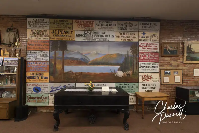
Exhibits in the Bonner County History Museum
Continue along Highway 2, through the pine and fir forest for about 40 minutes to get to your next stop — the Bonner County History Museum (bonnercountyhistory.org) and the North Idaho Native Plant Arboretum. Located in Lakeview Park in Sandpoint, both of these sites can be accessed from the parking lot on South Ella Avenue.
There’s a paved pathway from the accessible parking spot to the accessible entrance of the Bonner County History Museum. Inside there’s plenty of room to roll around the first-floor galleries; however the small second floor exhibit can only be accessed by stairs. There’s also a wheelchair-accessible family restroom downstairs.
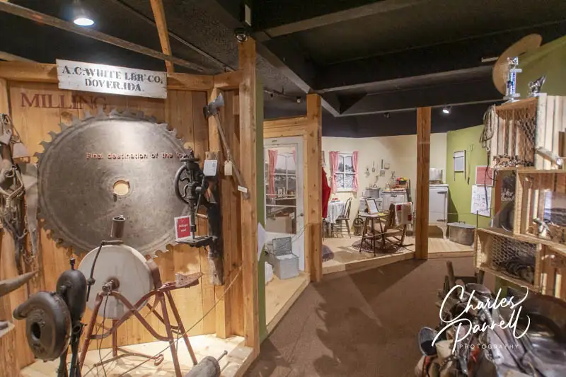
The first floor contains a mix of permanent and rotating exhibits; but perhaps the most interesting installation is “Digging into the Past”. When a nearby highway was widened in 2006, archeologists set to work to unearth treasures from the past. Their finds are showcased in this exhibit, which is arranged by the different geographical areas in town. Highlights include a Dr. Scholl’s Foot-Ezer, a collection of opium pipes discovered near the former Chinese laundry, and some interesting objects unearthed in the brothel district.
Add in some permanent installations about the work of the forest service, a little watercraft and railroad history, and a a primer on logging in North Idaho, for a comprehensive look at the history of the area.
Outside there are level pathways through the mostly shaded arboretum,. There are a few dips and ruts in the dirt pathways, but for the most part they are easy to dodge. The historic cabin is not accessible, but it’s usually locked. The five-acre arboretum features North Idaho native and medicinal plants, and also includes herbs, fruit trees and edibles. And there are lots of benches if you’d just like to sit and relax.
Walk on the Wild Side
Chickadee Trail in the Kootenai Wildlife Refuge
The next stop on the International Selkirk Loop — the Kootenai Wildlife Refuge (www.fws.gov/refuge/kootenai) — is just a 45-minute drive up the road. Continue east on Highway 2 for about 35 minutes, until you get to Bonners Ferry; then make a left on Pine Island Road (just past the ranger station). To be honest this turn is easy to miss, so it’s best to turn into the ranger station for easier access to the road. From there, make a right on Mirror Lake Road and and left on Riverside Drive. The refuge headquarters is about four miles up the road on the right.
There’s accessible parking near the refuge office and accessible restrooms next door. A sheltered accessible spotting scope is also located on the far side of the parking lot. The accessible Chickadee Trail begins just to the left of the refuge office. This 1,000-foot paved cement loop winds through the pines and around the pond, with interpretive plaques along the way.
The Myrtle Falls Trail is located across the street. This wide paved trail winds through the forest and out to a bridge that offers a great view of roaring Myrtle Creek below. The trail loses its access on the other side of the bridge, but it’s a nice .25-mile round-trip jaunt out to the roaring rapids.
Finally, make sure and drive the 4.5-mile auto loop before your leave the refuge. There are a number of interpretive plaques at pullouts along the way, and some great windshield views. Be on the lookout for Northern harriers, red-tailed hawks and American kestrels hunting over the wide open fields. And keep your eye out for the resident bald eagle pair that nests there in the spring.
A Blast From the Past
Exhibit in the Boundary County Museum
Finally, for a taste of local history on the International Selkirk Loop, make a stop at the Boundary County Museum (boundarycountymuseum.org) before you call it a day. Just backtrack on Riverside Drive along the levee for about 30 minutes until you get to town. Make a right on Main Street, and take the next left on Bonner Street. Although the museum is located on Main Street, the best accessible parking is behind the museum, next to the visitor center.
There’s barrier-free access throughout the museum, and accessible restrooms inside. This local mainstay includes a little bit of everything, from a large exhibit about the Kootenai Tribe and a collection of hand made clocks by Ned Dyer, to a still discovered nearby, lots of vintage furniture, appliances and dishes, and even some seats from the old Bonner County High School Auditorium. And don’t miss the recreation of the Historic White Caribou Saloon, which includes a variety of taxidermy, including the namesake white caribou.
Be aware that the museum has limited hours — usually Thursday through Saturday — so make sure and time your visit accordingly. Even if it’s not open, there is level access from the accessible parking in back to some outside exhibits that focus on early railroads and farming methods. There’s also level access to a covered picnic table on a cement pad. It’s just a fun — and educational — stop.
And if you’d like more maps and information on North Idaho and British Columbia, then pop in to the visitor center just across the parking lot from the museum. There’s level access to the lobby and accessible restrooms around the corner. To complete your first day 125-mile drive, hop back on Highway 2 and continue around the curve, to the Kootenai River Inn on your left.
Spend the Night
The Kootenai River Inn (kootenairiverinn.com) is a great place to overnight. Not only does it offer good access, but it also includes a few restaurants and a casino. Accessible parking is located near the lobby door, with barrier-free access over to the front desk. And although there’s a barrier-free pathway to accessible room 125 from the lobby, there’s also additional accessible parking closer to the room.
Room 125 at the Kootenai River Inn
Access features in room 125 include wide doorways, lever handles, low-pile carpet for easy rolling, a lowered closet rod and good pathway access. It’s furnished with a 28-inch high king-sized bed with wheelchair access on both sides, a chest of drawers and an easy chair with an ottoman. The spacious room also includes a table with two chairs, a microwave and a refrigerator.
There’s level access out to a private balcony that’s furnished with a table and two chairs. And although there’s room enough for a wheelchair out there, you’ll probably have to move the patio furniture around a bit. Best of all, the balcony boasts a peaceful river view.
The oversized bathroom includes a full five-foot turning radius and is equipped with a large roll-in shower with grab bars and a hand-held showerhead. A shower chair is also available upon request. The toilet grab bars are located on the back and right walls (as seated), and a roll-under sink is located right outside the bathroom.
Vanity area and Bathroom in Room 125
There’s good access to all the public areas of the property, including the Springs Restaurant, the Riverside Deli and the casino. Breakfast is also included with your stay. The staff is attentive, and the Kootenai River Inn is a comfortable and accessible place to spend the night.
Day 2 — Bonners Ferry, ID to Balfour, BC
After a good nights rest, continue along Highway 2 on the International Selkirk Loop. The route only covers 90 miles today; however it also involves a border crossing so it doesn’t hurt to get an early start.
Crossing the Border
From Bonners Ferry continue on Highway 2, cross the Kootenay River, then head east on Highway 95. About 75 miles up the road, take Highway 1 to the Porthill-Rykerts border crossing. It’s just under a two-hour drive.
Although Canadian entry requirements may vary due to COVID outbreaks, currently there are no restrictions, extra paperwork or health screenings required to enter Canada by car. All vehicle occupants are required to have a passport, and you will also be asked questions about alcohol, firearms, and other items you may be carrying.
Border crossing times can vary, depending on traffic and staffing. A list of wait times and delays at Canadian ports of entry can be found at cbsa-asfc.gc.ca/bwt-taf/menu-eng.html. And it’s also a good idea to keep updated on the latest border crossing requirements. More information can be found at cbsa-asfc.gc.ca/travel-voyage/menu-eng.html. The good news is that the once you arrive at the Porthill-Rykerts border crossing it’s a fairly expeditious process, as there’s not a lot of traffic there.
Creston Wildlife Management Area
Boardwalk at the Creston Discovery Center
After you enter Canada, US Highway 1 transitions into Canadian Highway 21. From the border it’s a short 20 minute hop up to the Corn Creek section of the Creston Wildlife Management Area (crestonwildlife.ca). It’s located off of Highway 3, just northeast of Creston.
There’s no striped parking in the paved lot next to the Discovery Center at Corn Creek, but there’s usually plenty of room to parallel park an adapted vehicle. The Discovery Center — which has exhibits and information — is ramped, and there’s an accessible porta-potty in the parking lot. The boardwalk trail is right behind the Discovery Center.
Theoretically the whole boardwalk loop is accessible, as it’s relatively flat; however a large patch of tall grass at the midway point makes it impassable for most wheelchair-users and slow walkers. That said, you can do this trail as two out-and-back sections.
To do the first section, make a left turn after you cross the bridge behind the Discovery Center. The short hard-packed dirt trail is level but narrow, and it soon transitions to a boardwalk over the marsh. The accessible part of this half-mile round trip jaunt ends at the end of the boardwalk, when you hit the tall grass, near the viewing tower. It’s a half-mile round-trip hike.
To access the second section of the boardwalk loop, turn right after you cross the bridge behind the Discovery Center. A .3-mile dirt and boardwalk trail leads to the viewing tower near the tall grass. From there you can continue on the .4-mile hard-packed dirt Songbird Stroll out to West Creston Road. If you do the whole length it’s a nice 1.4-mile out-and-back hike. And when you’re done, stop for lunch at the shaded picnic table near the Discovery Center.
Hop on a Ferry
To continue on the International Selkirk Loop, head east on Highway 3, then go north on Highway 3A. It’s about a 1.5-hour drive to Kootenay Bay, where you can catch the longest free ferry in the world. The drive along the way is nothing to sneeze at though, as the road winds through a lush forest and offers a peek at Kootenay Lake every now and again.
The Kootenay Lake Ferry www2.gov.bc.ca/gov/content/transportation/passenger-travel/water-travel/inland-ferries/kootenay-lake-ferry) runs from Kootenay Bay to Balfour year-round; however it operates on a reduced schedule in the winter. In the summer the ferry operates on a hourly schedule from 7:10 AM to 10:20 PM; however since this is the peak season there may be a wait for the next ferry, so allow some extra time. The summer schedule begins the third week of June, and ends after Labor Day.
The crossing itself takes just 35 minutes, and as indicated earlier, it’s free. Access isn’t really an issue as most folks just stay in their vehicles, roll down their car windows and enjoy the ride; in fact in some cases the cars are parked so close together that you can’t open your car door. Still it’s a pleasant crossing, and you just can’t beat the price.
Overnight in Canada on the International Selkirk Loop
View from room 206 at the Kootenay Lake Resort
Once you arrive in Balfour, it’s just a short drive to your home for the night — the Kootenay Lakeview Resort (kootenaylakeviewresort.com). Not only does it boast a nice accessible room, but as the name implies, it also has an impressive view of Kootenay Lake.
There are no stripes in the lower lobby parking lot, but there’s room enough to parallel park an adapted vehicle, and there’s level access over to the front door. Inside there’s plenty of room to maneuver a wheelchair over to the front desk and the adjacent breakfast area.
Room 206 — an accessible king — is located a short drive away, with accessible parking near the building. There’s ramp access up to the building, and a slight lip at the room door. Access features include wide doorways, lever handles, low-pile carpet for easy rolling and good pathway access.
Room 206 at the Kootenay Lake Resort
The room is furnished with a 26-inch high king-sized bed with wheelchair-access on the right side (as you face it). Other furnishings include a table, an easy chair, a desk with a chair and a chest of drawers. There’s also a microwave and a refrigerator in the room. A threshold ramp leads out to the balcony which includes two plastic chairs and a small table, and offers plenty of room for a wheelchair. And you just can’t beat that lake view!
The bathroom has a wide pocket door and a full five-foot turning radius. It’s equipped with a roll-in shower with grab bars, a hand-held showerhead and a fold-down shower bench. Other access features include toilet grab bars on the right wall (as seated), a lowered towel rod and a roll-under sink.
Bathroom in room 206 at the Kootenay Lake Resort
Top it all off with a light breakfast in the morning, and you have a very comfy place to rest your head.
Day 3 — Balfour, BC to Newport, WA
Get an early start on the final day of your International Selkirk Loop drive, as it’s the longest leg of the drive — 135 miles — with lots to see and do along the way.
Take a Hike
The Pond Flume Trail at the Mill Pond Historic Site
From Balfour, head west on Highway 3A to Nelson, then take Highway 6 south to the Nelway-Metaline border crossing. The drive takes about an hour and twenty minutes, and again, the lush forest lines the road for most of the trip.
The border crossing back into the US is pretty straightforward. No extra paperwork is required — you just need your passport or drivers license. There’s usually not much of a line at this outpost, but you can check wait times and operating hours at cbp.gov. It’s always a good idea to check the website before you travel, as entry requirements can change.
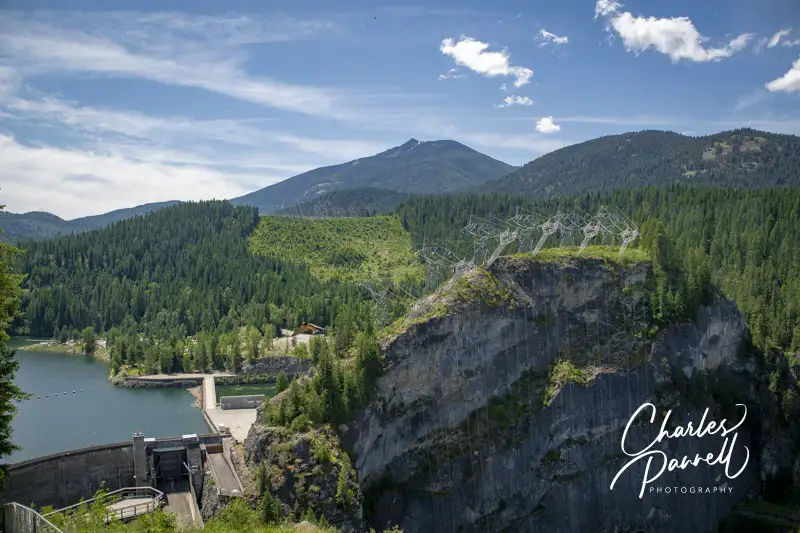
For a short — but scenic — side trip, make a right on East Side Road (about 2 miles from the border), and continue on to Vista House for a sweeping view of Boundary Dam on the Pend Oreille River. After you’ve enjoyed the view, head on back to Highway 31.
Boundary Dam on the Pend Oreille River Viewed From Vista House
Continue south on Highway 31 for about 8 miles, make a left on Sullivan Lake Road, then continue on for about three miles. The Mill Pond Historic Site (www.fs.usda.gov/r06/colville/recreation/mill-pond-historic-site) will be on your right. Go all the way down to the lower parking lot, where you will find accessible parking next to two trailheads.
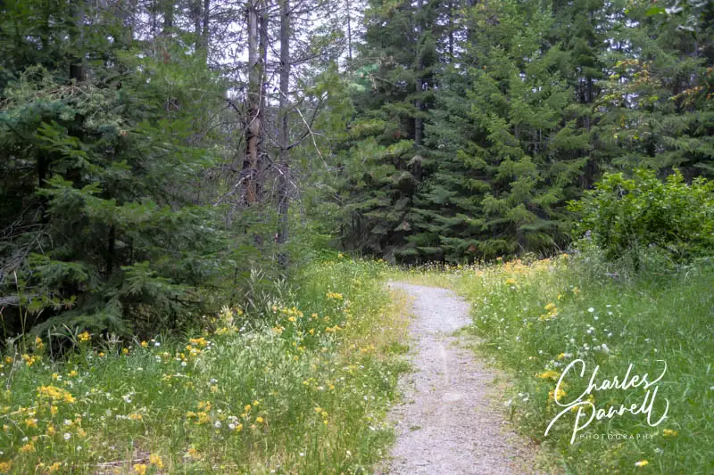
The most accessible trail — the Mill Pond Flume Loop — begins just across the bridge, about a quarter-mile from the parking lot. This level hard-packed dirt loop winds through the former work camp of the old mill. Interpretive plaques that describe the flume construction and maintenance procedures are located along the way. It’s a pleasant .6-mile loop through the forest, but be sure to apply insect repellent before you set out, as the mosquitoes are thick in the shady sections.
Additionally, if you’d like to dine alfresco there’s also a nice covered picnic area with accessible tables in the upper parking lot. An accessible vault toilet is also located nearby.
A Peaceful River View
Pend Oreille River View at Portage Park
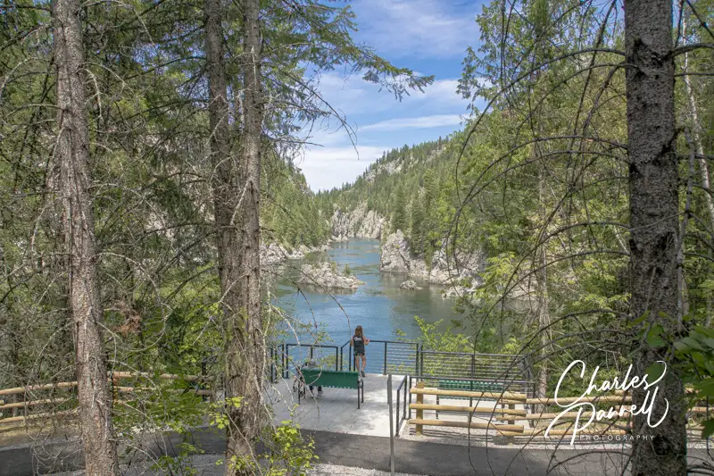
Located on the east side of Metaline Falls in the village area, Portage Park is worth a quick stop for the lovely river view, and wheelchair-accessible walkways. Take Larsen Boulevard off of Highway 31, then bear left at the fork and continue on down to the water.
There’s accessible parking next to the accessible vault toilets, and barrier-free access to the riverside trail. The short trail leads to two accessible viewing platforms and a gaggle of picnic tables. It’s a pleasant spot to sit and enjoy the river view and a nice space for a picnic lunch. This is one of the newer developments in the area, and great thought was put into the access.
Metaline Falls
If, on the other hand, you’d like to have someone else do the cooking, then head on down the road to the quaint hamlet of Metaline Falls. For the best access, parallel park on Washington Street, near the visitor center in Busta Park. From there, it’s a short level walk to the Farmhouse Cafe (facebook.com/farmhousecafe221), which is located across the street on 5th Avenue.
There’s ramp access to this local eatery, with plenty of room to maneuver a wheelchair inside. Menu choices range from burgers and hot or cold sandwiches, to plated dishes served with soup or salad. The servers are friendly and the portions are substantial. Make sure and save room for a slice of home made pie for dessert.
After lunch, save some time to browse through the visitor center in the park. There’s ramp access up to the old rail car that houses the visitor center, and room enough to maneuver a wheelchair around the exhibits. There’s lots of visitor information, maps, historic photos of the area, and some old relics. And if you are in need of reading material, there’s also a nice collection of books that are free for the taking.
Sweet Creek Falls
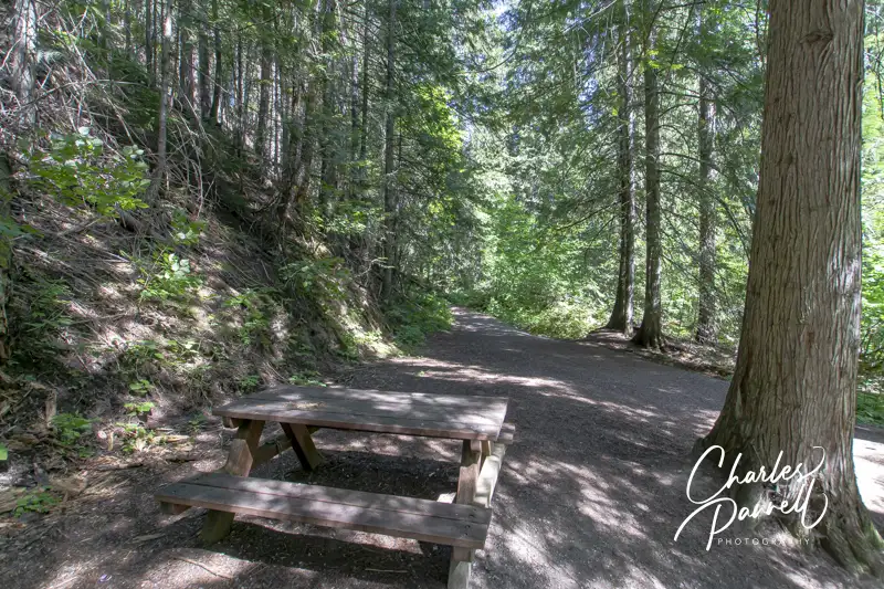
Picnic Table on the Trail to Sweet Creek Falls
After you’ve had a chance to explore Metaline Falls, continue south on Highway 31 for about three miles to the Sweet Creek Falls Rest Area. Although it’s designated as a rest area, there’s a bit more to see there than just toilets.
There’s accessible parking near the accessible vault toilets, with a paved pathway over to an accessible picnic table. There are also two short trails nearby that offer views of the falls. The most accessible option is located to the left of the vault toilets.
This short quarter-mile round-trip trail crosses over a bridge, then skirts the river until it ends at a viewpoint. The hard-packed dirt trail has a slight uphill grade for about 25 feet but other than that it’s fairly level. There’s a bench at the end of the trail with a decent view of Sweet Creek Falls. Wheelchair users will probably need assistance over a two-foot uneven patch of dirt near the end, but it’s still a pleasant stroll through the shaded forest. The quiet bench also makes a nice secluded picnic spot. Additionally, there’s a standard picnic table on a level patch of ground near the river, just after you cross the bridge.
The trail to the right of the vault toilets leads past several shaded picnic tables to an observation point above the falls. The first part of the trail is asphalt, but it transitions to dirt and gravel near the top. After the transition there’s about a 100-foot steep section before you get to the viewpoint. It’s not a realistic option for wheelchair-users, and many slow walkers may find it difficult. Still the standard picnic tables on this side of the rest area are shaded and secluded, and are doable for most wheelchair-users. Enjoy the view from the other side, and have a picnic on this side.
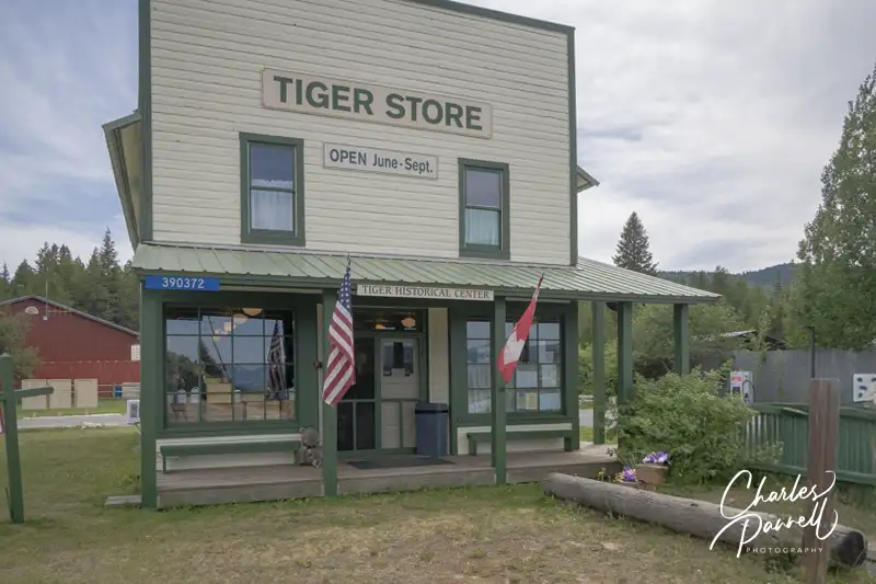
Tiger Store
The Tiger Store on Highway 20
From the Sweet Creek Falls Rest Area, continue south on Highway 31 for about 11 miles until you get to the Tiger Store, at the intersection of Highway 20. Constructed in 1912, this building once housed the general store and post office. Today it includes a mini museum operated by the Tiger Historical Society, as well a small store, information center and gift shop.
There’s accessible parking next to the store, with ramp access up to the front door. Inside there’s a collection of artifacts from the old post office, school and general store. They have a little bit of everything, from antique school desks, photos and old post office boxes filled with vintage letters, to assorted tools, kitchen items and even a mimeograph machine. And the folks that volunteer there are quite helpful with information about other things to see in the area. They also have a nice selection of local maps and brochures. Top it off with an ice cream bar or a soda and you’ve got more than enough reasons to make the Tiger Store a required stop on the International Selkirk Loop.
A Pend Oreille River View
Cusick Wetland Educational Trail
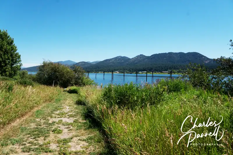
From the Tiger Store, continue south on Highway 31, then bear left when the road transitions to Highway 20. For a short walk and a nice view of the Pend Oreille River, make a left on Monument Way in Cusick. Continue down the road and bear left as you reach the water. There’s accessible parking next to the accessible restrooms, and level access over to the Cusick Wetland Educational Trail, near the boat ramp.
The best way to access this grassy trail is to go through the gate to the shaded shelter, then follow the pathway up to the arch which marks the beginning of the wetlands trail. The trail is wide, and relatively flat in the beginning, and it’s a combination of hard-packed dirt with some gravel and grassy areas. Later it transitions to mostly mowed grass, as it winds along the river, with interpretive signs and benches along the way. At about the .15-mile mark the trail forks off to left, but for the river views stay to the right. It’s a pleasant stroll, and if you’re lucky you’ll catch a glance of the bald eagles and osprey that frequent this area. Unfortunately the wheelchair-access ends at about the .45-mile point, where there’s a steep section followed by some uneven terrain. Still it’s worth the stroll for the river view.
If you’d like a longer walk, then head back to the fork in the trail and follow the left branch through the grassland forest for another quarter-mile. This is an excellent spot for birders and there are some shaded benches along the way to sit and take a break. The trail winds around and joins the original pathway to form a loop; however it loses it’s access after the last viewing meadow. Still it’s a nice out-and back walk, and it’s definitely a must-do for birders.
Where the Buffalo Roam
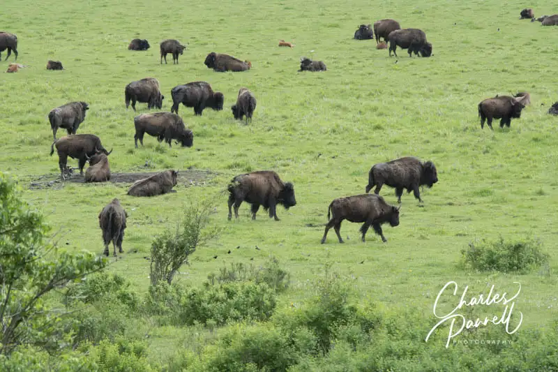
Kalispel Buffalo Herd
From the Cusick Wetland Educational Trail, head back to Highway 20 and continue south. For a gander at the Kalispel Tribe’s buffalo herd, make a left on Kings Lake Road in Usk, which is about three miles from Cusick. From there, cross the Pend Oreille River and make the first left on Le Clerc Road. It’s about 1.5 miles to Camas Center, which is near the area where the herd is located. The heard began with just 12 buffalo that were presented to the tribe by the National Park Service in 1974. Today it has grown to over 100 head, which roam throughout the reservation.
Of course, since the buffalo are mobile, they’re not in the same place every day. Sometimes you can spot them from the Camas Center parking lot, while other times you’ll get a better view a little further up the road. There’s a level place to pull over just north of Camas Center, which sometimes offers a close look at the massive beasts. And if they wander further south, there’s a nice wide level spot to pull out near the mailboxes.
Truth be told you never know where they will be grazing on any particular day. So just consider it a treasure hunt on the International Selkirk Loop. Actually, tracking them down is half the fun. And if you visit in spring, bring your binoculars and keep an eye out for the newborn calves.
A Little History and a Scoop
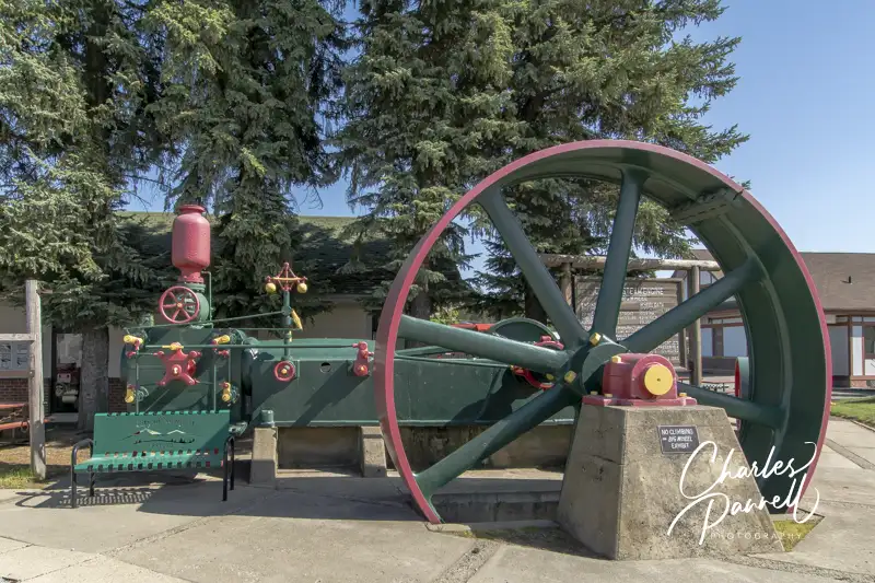
Corliss Steam Engine (The Big Wheel) at the Pend Oreille County Historical Museum
Newport, which is just 20 miles away, marks the official end to the International Selkirk Loop. That said, take some time to explore the history museum and have a sweet treat, before you head on your way.
Located next to the Newport Visitor Center on Highway 2 and Washington Street, the Pend Oreille County Historical Museum (pochsmuseum.org) offers visitors a peek into the past of Northeastern Washington. Accessible parking is located in front of the museum, at the far end of the parking lot across from the train depot.
There’s level access to the front door, with plenty of room to navigate around the first-floor and outdoor exhibits. Inside you’ll find everything from rodeo gear, vintage toys and cooking tools, to an old dentist office and even a Newport Miner printing press. Outside there are a variety of vintage buildings, including three log cabins, the Claire Howe Schoolhouse and a pioneer church. The ground around the exhibits is level, but there are a few rocks here and there. Vintage artifacts are tucked into every nook and cranny, and if you get tired there are plenty of places to sit and rest.
When you’re done browsing through the museum, be sure and stop in at Owen’s (facebook.com/owensgro), which is located across the street. There’s level access to this deli and grocery store, but the main attraction is the soda fountain, which offers a wide variety of ice cream treats. From a huckleberry ice cream cone to a hot fudge sundae or even a banana split, there’s something to please just about everyone. And it’s the perfect way to top off any International Selkirk Loop adventure.
Barrier-Free Travel Glacier, Yellowstone and Grand Teton National Parks for Wheelchair-Users and Slow Walkers
Population 243
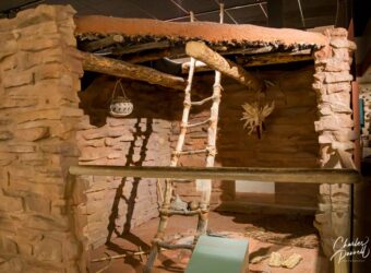
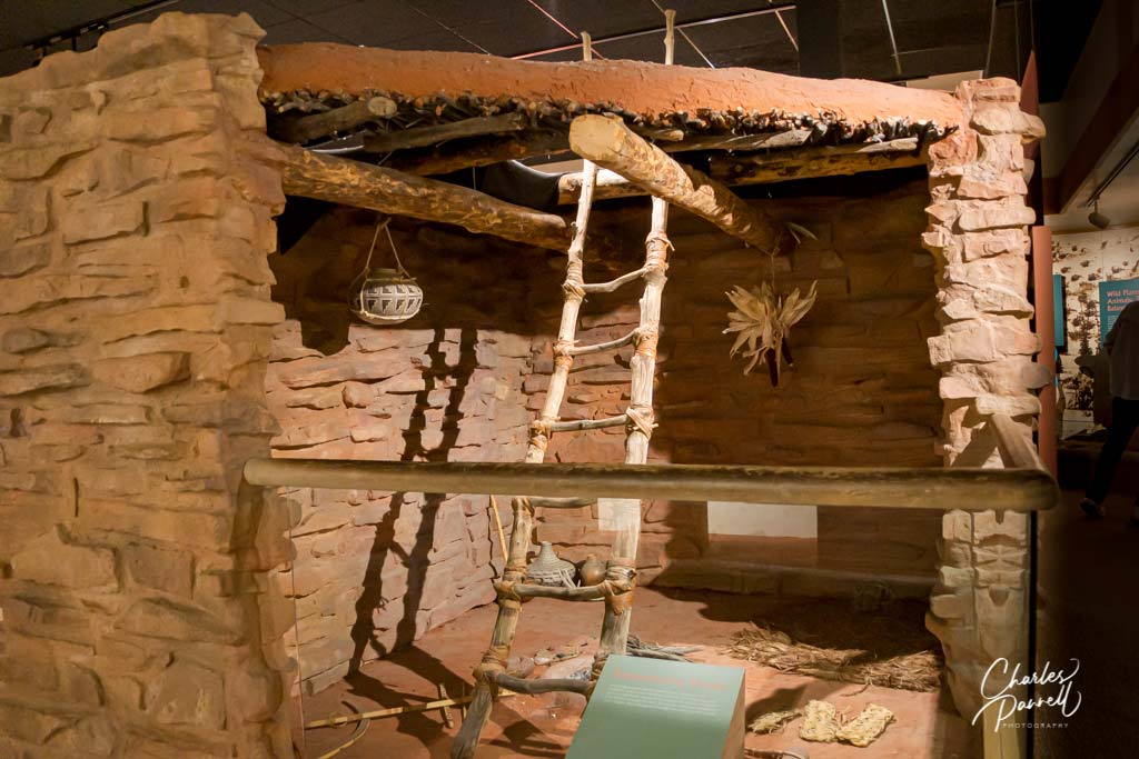
This Southern Utah town, which is located along Scenic Byway 12, connects Capitol Reef National Park and Bryce Canyon National Park. It’s home to the Anasazi State Park Museum (www.stateparks.utah/parks/anasazi) , which offers an intimate look at the Anasazi people who once inhabited the area. The highlight of the museum is the Coombs excavation site out back — where 97 rooms, 10 pit structures and hundreds of thousands of artifacts were unearthed. There’s a level walkway through the excavation site, with interpretive panels about the former residents along the way. While you’re in town, stop in and have a bite at the Burr Trail Grill — which features level access — and don’t forget to save room for a piece of their mouth-watering home made pie. Last but not least, save some time for a scenic drive on the Burr Trail, which begins next to the Burr Trail Grill and winds through Grand Staircase-Escalante National Monument.
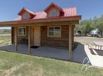
Located about 1.5 miles from the entrance to Red Canyon along Scenic Highway 12, Red Canyon Village (www.redcanyonvillage.com) makes a great home base for a Utah national park road trip. It’s just a 20 minute drive to Bryce Canyon National Park so you don’t have to get a 4 AM start to beat the rush. Plus, you can easily wander over to Red Canyon to enjoy the sunset at the end of the day. And since it’s a small complex with some RV spaces and cabins, Red Canyon village is a peaceful and secluded spot to spend the night. Even better — they also have a nice wheelchair-accessible log cabin.
Red Canyon Village
Although there’s a small step up to the front office in Red Canyon Village, just call (435) 676-2243 and the clerk will gladly bring out your key. Log Cabin 12 — the accessible unit — is located a short walk from the office. And although there aren’t any paved parking spaces in the complex, there’s plenty of room to park parallel next to the accessible cabin.
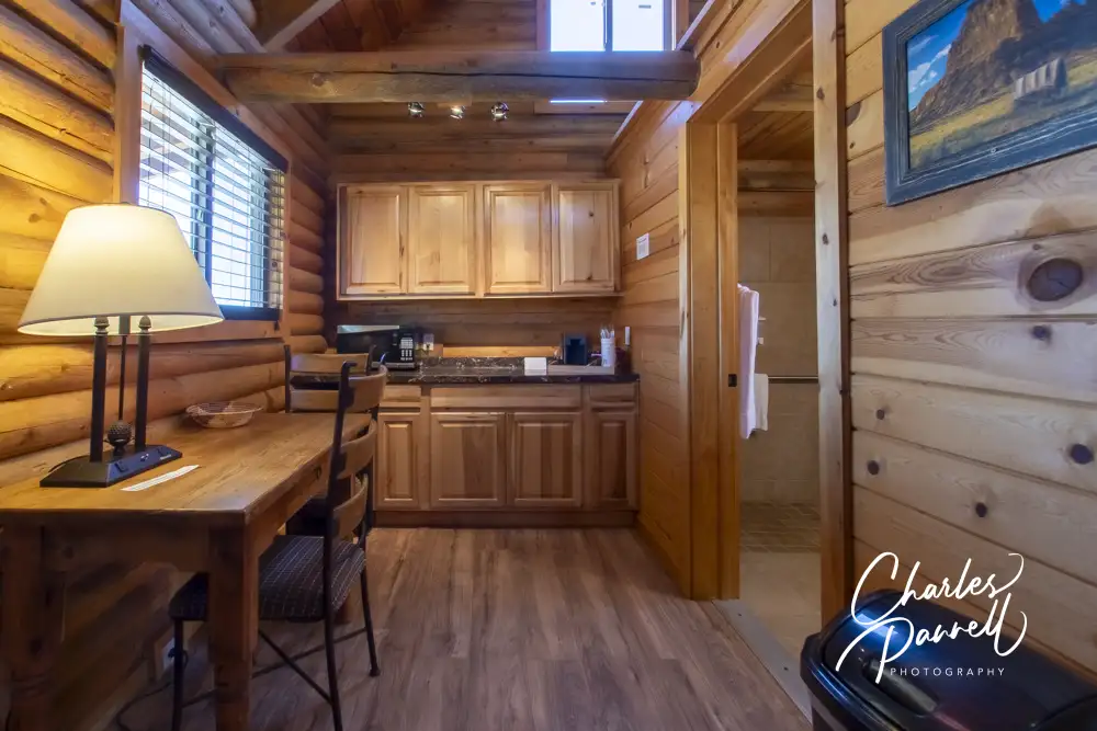
There’s level access to the cabin, which boasts open beams and a wood interior. Access features include wide doorways, laminate floors, lever handles, a lowered clothing rod and good pathway access. The main room is divided into two areas; with the bedroom and living area on one side and a small kitchenette on the other side.
Living area in Cabin 12 at Red Canyon Village
The living area is furnished with a 26-inch high open-frame king-sized bed, which can be moved to allow wheelchair access on either side. Other furnishings include, a nightstand, a mirror, a luggage rack and a loveseat. The kitchenette is furnished with a table, two chairs, a microwave, a refrigerator and a coffee maker. It has everything you need for a snack, a quick meal, or a morning coffee break.
Kitchenette in Cabin 12 at Red Canyon Village
There’s barrier-free access to the bathroom, which is equipped with a roll-in shower with grab bars, a hand-held showerhead and a portable shower bench. It also includes a roll-under sink, and a toilet with a grab bar on the left wall (as seated).
Bathroom in Cabin 12 at Red Canyon Village
Top things off with a roomy paved front porch with plenty of room for a wheelchair, and you’re good to go. There’s also a standard picnic table on a cement pad next to the porch, with room for a wheelchair on the end. And if you forget anything, there’s level access to the The Red Canyon Indian Store and Rock Shop next door.
Barrier-Free Travel
Utah National Parks for Wheelchair-users and Slow Walkers
Located in the Central California Sierras, Kings Canyon National Park is just a short drive from Sequoia National Park. It’s composed of two distinct regions — Grant Grove and Cedar Grove. These two regions are connected by the Kings Canyon Scenic Byway, which runs through a section of the Sequoia National Forest between them. Grant Grove is known for its giant sequoias, while Cedar Grove boasts some magnificent granite canyons. And both areas feature an abundance of wildlife and some spectacular windshield views.
Insider Tips
For a bird’s eye view of the park, head up to Panoramic Point. The two-mile road to the viewpoint is located on the far side of the visitor center parking lot. Just follow the signs to John Muir Lodge, and make a sharp right just before you reach the lodge. At the end of the one-lane winding road there’s accessible parking and a paved path out to the viewpoint, which also offers a glance at Hume Lake, Spanish Mountain and Mt. Goddard in the distance. It’s definitely worth the short walk.
Grant Grove Cabins offers a nicely accessible rustic cabin, which is furnished with two queen-sized beds and includes a covered patio with a picnic table and a small wood stove. An accessible bathhouse, with family restrooms and a roll-in shower, is located nearby. It’s a nice choice for folks who enjoy nature, but don’t really want to pitch a tent.
Grizzly Falls Picnic Area, which is located along the Kings Canyon Scenic Byway, makes an excellent lunch stop. A short paved loop leads from the parking area to several accessible picnic tables on cement pads. As an added bonus, there’s a great view of the falls from any of the picnic tables and even the parking area.