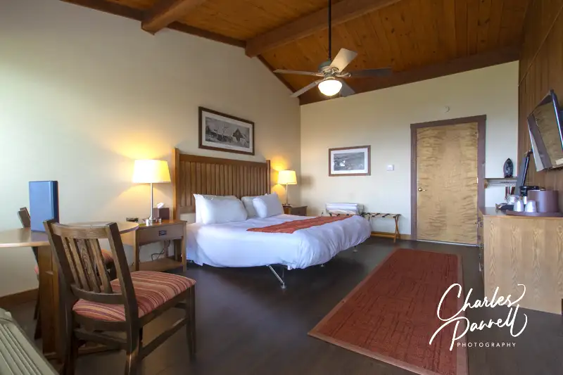
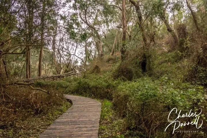
Logan is a required stop on any Hocking Hills road trip. It also makes a good home base for the further exploration of the area. The Inn and Spa at Cedar Falls (innatcedarfalls.com) offers several accessible options, including the secluded Redbud Cabin. This two bedroom cabin includes a ground-floor bathroom with a roll-in shower, and has level access to the spacious back porch. Another Logan favorite — Watersong Woods (www.watersongwoods.com) — offers the accessible Melody Cabin which includes a bathroom with a roll-in shower. And both places are right around the corner from one of the area’s biggest attractions — Hocking Hills State Park. It’s a lovely park to drive through, especially in the fall. It also boasts a quarter-mile wheelchair-accessible trail to Ash Cave, which winds through the woods and terminates at the misty waterfall. It’s also a nice choice for a picnic, as there are several accessible tables near the trailhead.
Population 4,070
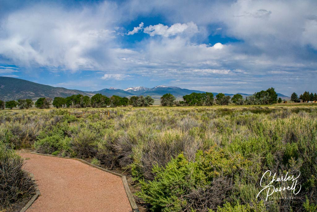
Located in Southern Colorado, about 50 miles north of the New Mexico border, Monte Vista is named for its spectacular mountain view. And although it’s a popular road trip stopover town, the big draw is is actually located on Highway 15 just south of town — the Monte Vista National Wildlife Refuge (www.fws.gov/refuge/monte_vista/). During the spring and fall thousands of Sandhill Cranes and migrating waterfowl descend on the surrounding wetlands, while song birds, shore birds and water birds nest there in the summer. Although most of the refuge can be seen in a car on the 2.5-mile auto loop, there’s also a short accessible trail near the entrance. This wide level pathway winds alongside the marsh and continues for 100 yards, and ends at an accessible overlook. It’s a nice spot to get some fresh air, and if you’d like to dine al fresco, there’s also a picnic table located near the trailhead.
118 Smokey Bear Boulevard
Capitan, NM
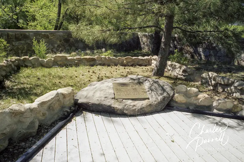
Located along Billy the Kid National Scenic Byway (nsbfoundation.com/nb/billy-the-kid-national-scenic-byway/) in Southwestern New Mexico, Smokey Bear Historical Park pays tribute to the popular fire prevention icon. Smokey was found in the nearby Capitan Mountains with burned paws, after a 17,000-acre wildfire destroyed his home in 1950. He quickly became a national poster child for the US Forest Service, and touted the catch phrase, “Only You Can Prevent Forest fires.” This park and museum was completed in 1979, and it’s conveniently located along the Capitan stretch of Highway 380 — also known as Smokey Bear Boulevard.
There’s good wheelchair access to the Visitors Center, which features exhibits about the history of Smokey Bear, fire prevention, ecology and forest health. Out back there’s level access to a nature trail that winds through native vegetation from six different climate zones. And of course, Smokey’s grave is prominently located along the trail. It’s a fun stop, especially if you have kids in tow.
Located near the Canadian border, Voyageurs National Park (www.nps.gov/voya/) was named for the Canadian oarsmen who once navigated the nearby waterways with beaver pelts in tow, on their way to the remote northern trading posts. Largely undeveloped, this secluded national park has a wide variety of natural environments, from hardwood forests and marshes, to rocky outcroppings and pristine lakeshores. The good news is, that even though there are physical obstacles in some areas, it’s still possible to enjoy a wheelchair-accessible Voyageurs National Park getaway.
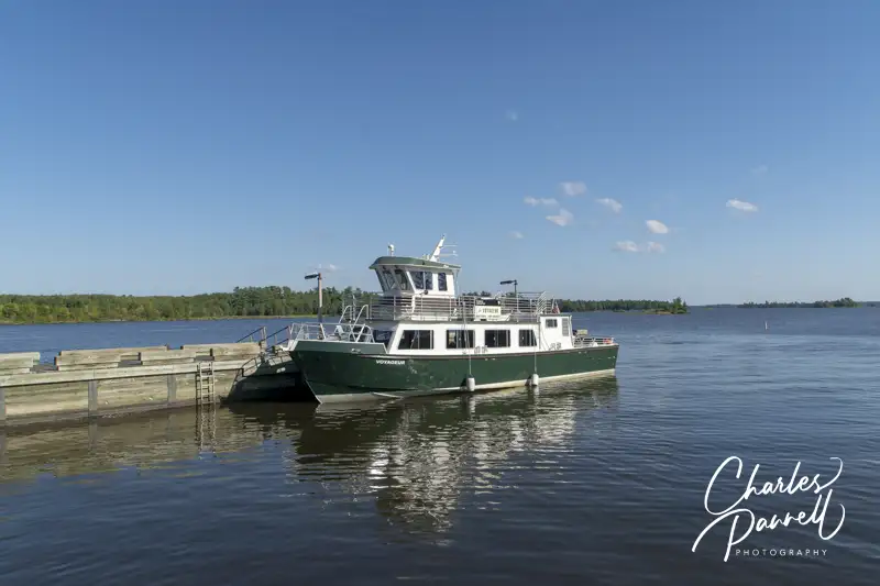
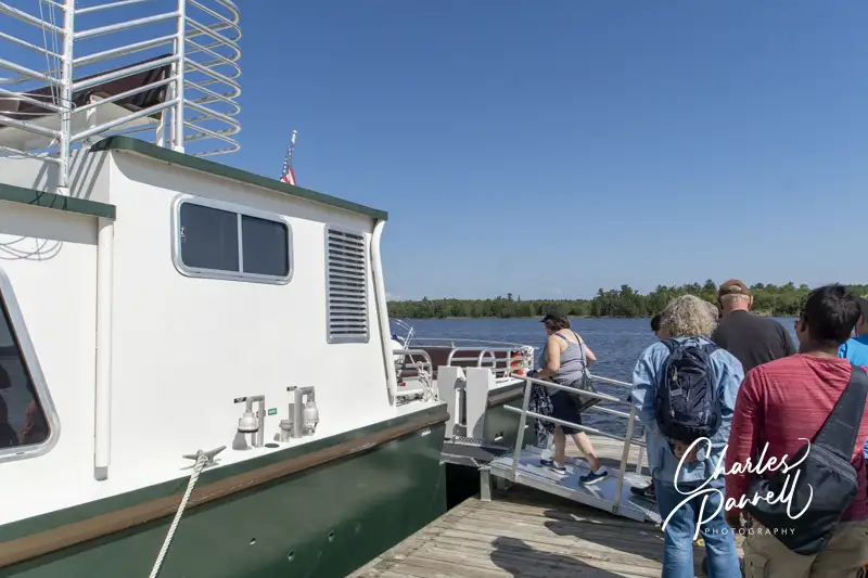
A Wheelchair-Accessible Voyageurs National Park Cruise
Boarding the cruise boat at Voyageurs National Park, Michigan
Since 40% of the park is composed of water, a good way to see Voyageurs National Park is on a cruise. And although there are several day cruise choices, the Grand Tour, is the best option for wheelchair-users and slow walkers.
This cruise departs from Rainy Lake Visitor Center. Accessible parking is available at the visitor center, with ramp access up to the front door. Inside there’s plenty of room to maneuver a wheelchair around the ticket counter, ranger information desk, gift shop and interpretive exhibits. There’s also barrier-free access to the theater, where a film about the park is shown. Accessible restrooms are located at the far end of the building, and there’s level access to the back deck, which is outfitted with several standard picnic tables.
The dock is located behind the visitor center, at the end of a short level path. There’s ramp access up to the first deck of the boat, but only stairway access to the top deck. Still you get a great view from below as large picture windows line both sides of the boat. There’s also a large accessible head (restroom) on the lower deck.
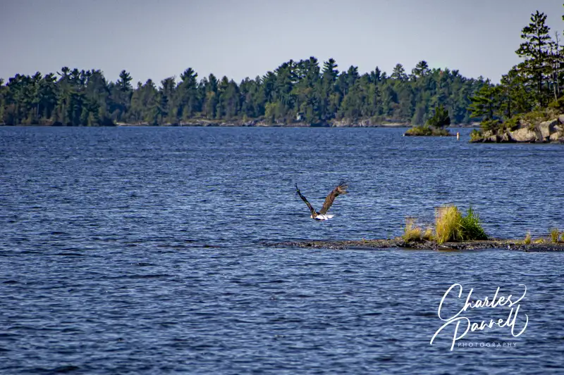
The 2.5-hour cruise includes lots of wildlife viewing, as the captain cruises close to the shore near bald eagle nests. There’s also a short stop on Little America Island, where gold was discovered in the 1890s. There’s one step down from the boat, and although most of the quarter-mile crushed gravel trail is wide and level, there is a steep section near the end. That said, if you’d like to sit out the short hike, shaded benches are available near the dock.
The Ethnobotanical Garden Trail at Voyageurs National Park
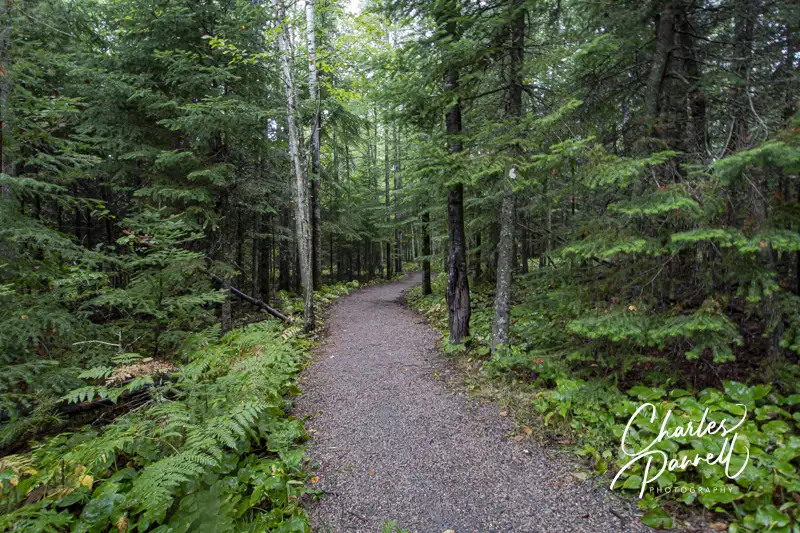
Another way to enjoy a slice of wheelchair-accessible Voyageurs National park is to take a hike on one of several accessible trails. The Ethnobotanical Garden Trail, which is just a quarter-mile long, is the shortest accessible trail in the park. This hard-packed dirt trail is located between the Rainy Lake Visitor Center and the dock, so it’s a good post-cruise option. This pleasant trail, which is lined with native plants, has a few undulations, but for the most part is fairly level. Best of all, there are several shady nooks along the route, which offer a welcome respite from the midday sun.
The longer Rainy Lake Recreation Trail begins across the street from the visitor center. This 1.7-mile paved multiuse trail parallels County Road 96, and connects to the bicycle trail at the intersection of Highway 11. From there it’s about a 10-mile hike to International Falls. That said, you can get a perfectly lovely view of Rainy Lake from the quarter-mile point, so give it a try even if you can’t do the whole length.
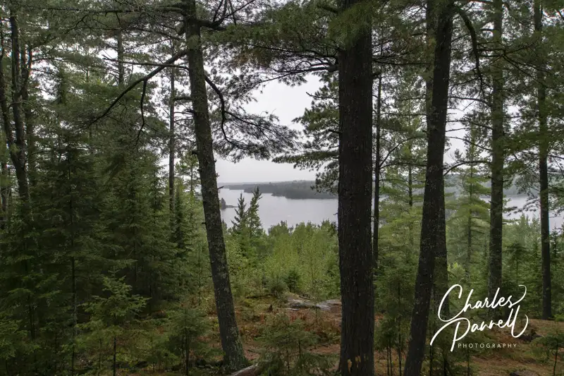
The final accessible trail is located just south of the Ash River Visitor Center on Kabetogama Lake. There’s accessible parking in the small lot, with barrier-free access to the hard-packed dirt trail that leads out to the Kabetogama Lake Overlook. This undulating trail has plenty of level patches, and there are several benches to sit and rest along the way. It’s a beautiful northwoods jaunt along a fern-lined route, and it just a .3-mile round trip hike. You just can’t beat the serene lake view at the overlook; and as an added bonus the drive along County Road 129 out to the trailhead is quite scenic. It’s the perfect way to top off a wheelchair-accessible Voyageurs National Park visit.
View from Kabetogama Lake Overlook at Voyageurs National Park
Barrier-Free Travel Glacier, Yellowstone and Grand Teton National Parks for Wheelchair-Users and Slow Walkers
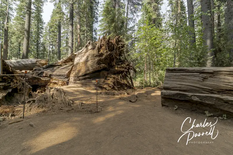
The fallen Pioneer Cabin Tunnel Tree in Calaveras Big Trees State Park
Make no mistake about it, California can have some brutal winters. Take 2017, for example. Between a record rainfall, mudslides and a late season snow it was definitely a challenge for many mountain communities. And unfortunately there were a few causalities, such as the loss of the Pioneer Cabin “tunnel tree” at Calaveras Big Trees State Park (www.parks.ca.gov/?page_id=551).
Sadly this giant sequoia was uprooted during a torrential downpour; however after a massive spring cleanup the grove reopened, with traffic routed around the fallen giant. Today the forest has evolved, however this Northern California state park is still worth a visit for a very accessible and intimate look at the remaining giant sequoias. And for a nice wheelchair-accessible place to spend the night, check out the nearby Black Bear Inn (emerginghorizons.com/sleep-near-the-big-trees-in-calaveras-county/) in Arnold.
The Majestic North Grove
North Grove Trail in Calaveras Big Trees State Park
Although the giant trees are scattered through the park, the North Grove has the most accessible concentration of them. Accessible parking is located near the visitor center, which offers barrier-free access and features a collection of interpretive exhibits. Accessible restrooms with flush toilets are located next to the visitor center.
The trail to the North Grove begins to the left of the visitor center. This hard-packed dirt tail winds around to the right to the Discovery Stump, the official beginning of the grove. This was the site of the first tree that Augustus T. Dowd found in 1852, while he was chasing a wounded grizzly bear. Sadly the tree was felled in 1853, but remnants of it can be found next to the stump.
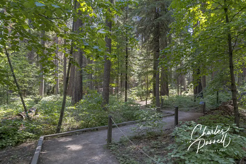
The Three Senses Trail — which is located just past the Discovery Stump on the left — is also worth a stop. This .13-mile hard-packed dirt trail features interpretive plaques about the native vegetation, and includes benches to sit and rest along the way. And although the trail has a few bumps here and there, it’s still a good choice for most wheelchair-users and slow walkers.
Three Senses Trail in Calaveras Big Trees State Park
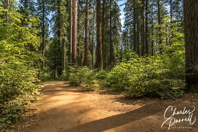
The hard-packed dirt North Grove Trail, continues past the Three Senses Trail, and winds around the Empire Tree, the Old Bachelor, the Mother-of-the-Forest and the Father-of-the-Forest. At times the dirt transitions to a level boardwalk, as this 1.7-mile trail snakes past the named and unnamed giants.
Just past the Abraham Lincoln Tree, there’s a detour around a fallen giant and through the remains of the Pioneer Cabin Tree. The fallen tree will remain on the ground to provide nourishment to new trees, and continue the forest cycle. And although the North Grove is accessible, it’s best to visit after the winter debris has been cleared in the early summer.
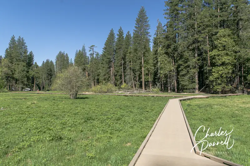
A Meadow Boardwalk
Meadow Boardwalk in Calaveras Big Trees State Park
Although the major focus is on the giant sequoias at Calaveras Big Trees, there’s also a nice accessible boardwalk through a meadow near the North Grove. The meadow itself is surrounded by the North Campground, which is just a short level walk from the visitor center. Follow the park road to the North Grove Campground, and if you hit the dump station, go back as you missed the campground.
Stay on the main campground road, and be on the lookout for accessible campsite 16 on the left. There’s an accessible showerhouse right behind the campsite, and the meadow boardwalk begins on the far side of that building.
There’s level access to this short boardwalk. It’s only .3-mile long, but when the wildflowers are in bloom it’s a sight to see. Lupine and corn lilies fill the meadow in June and July; although peak bloom time is weather dependent. And be on the lookout for Western Tanagers which also frequent the meadow. The boardwalk had low bumpers and no railings so wheelchair-users get an unobstructed view of all of natures beauty. And don’t forget to check at the visitor center to see if there are any wildflower walks scheduled.
The Quieter South Grove
Save some time to explore the South Grove at Calaveras Big Trees. Here you’ll find fewer visitors and the nicely accessible Beaver Creek Trail. It’s easy to find, as it’s near the end of the Walter W. Smith Memorial Parkway, about twenty minutes from the entrance station.
Accessible parking is located near the accessible vault toilet, and there’s level access over to several accessible picnic tables shaded by the surrounding forest. The .7-mile Beaver Creek Trail begins behind the vault toilet. This hard-packed dirt trail follows Beaver Creek, then passes the South Grove parking area, before it loops back to the Beaver Creek picnic area.
Make sure and stop at Beaver Creek along the trail, which is just .1 mile from the Beaver Creek picnic area. Not only are there some more picnic tables near the creek, but beach mats allow for access right up to the water.
Beaver Creek viewed from the Beaver Creek Trail in Calaveras Big Trees State Park
If you want to try a more challenging — yet still accessible — trail, then head on over to the River Picnic Area and try the Stanislaus River Trail. The trailhead for this .35-mile round-trip hike on a hard-packed dirt trail is is next to the parking area. The trail winds downhill to the river, however it still maintains an accessible grade. Make sure and take a good look at the trail in the beginning though, as it’s not flat, and you will have to make your way back up to the parking area.
Stanislaus River Trail in Calaveras Big Trees State Park
You’ll get a nice gander of the river from the end of the trail. It’s also pretty secluded and not frequented by a lot of park visitors. Granted this trail won’t work for everyone, but if you fancy a little workout it’s just what the doctor ordered.
Barrier-Free Travel California National Park Road Trips for Wheelchair-Users and Slow Walkers
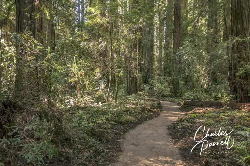
Located in sleepy Mendocino County, just east of the hamlet of Philo, Hendy Woods State Park (www.parks.ca.gov/?page_id=438) is home to an off-the-beaten-path wheelchair-accessible redwood grove. And although it’s easy to pass by this secluded park, it’s definitely worth a slight detour on any road trip along scenic Highway 128. Whether it’s for a picnic and a short stroll, a longer hike through the grove, or even a sleep-over in a camping cabin, a stop at Hendy Woods offers wheelchair-users and slow walkers an abundance of options.
Wander Through the Grove
All Access Trail in Hendy Woods State Park
There are several wheelchair-accessible hikes in Hendy Woods, but they all begin in the day use area parking lot. There’s accessible parking in the lot with level access over to the picnic area, where you’ll find several accessible tables under the trees. There’s also an accessible vault toilet near the parking area.
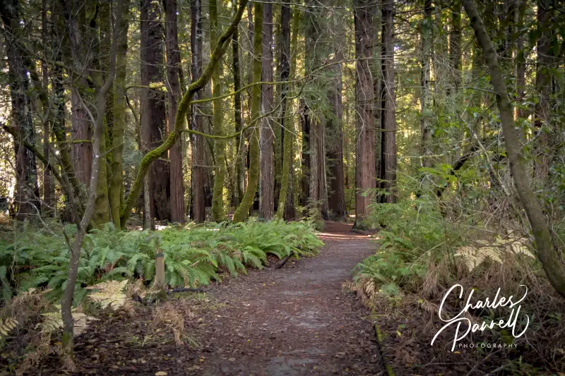
The shortest accessible trail begins on the other side of the picnic area. The .3-mile All Access Trail, is wide, level and doable for just about everyone. The hard-packed dirt trail, which winds through Big Hendy Grove, is lined with redwoods and ferns. The trail ends on the park road; and from there you can double back through the redwoods for a .6-mile hike, or roll along the paved park road back to the day use area.
The accessible Discovery Loop Trail, which branches off of the All Access Trail, is another good choice. This .45 mile hard-packed dirt trail travels through the grove for a nice .85-mile hike. And if you’re up for a longer stroll, then take the Upper Loop Trail which branches off the Discovery Loop for a nice 1.8-mile hike through the grove.
Camp in the Redwoods
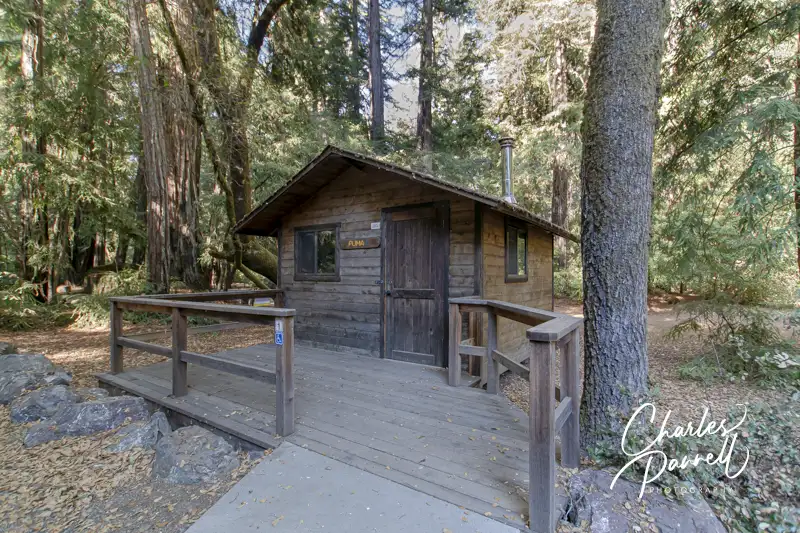
Puma Cabin in Hendy Woods Redwood State Park
Although spending the day at Hendy Woods is a treat, there’s nothing quite like spending the night surrounded by the giant redwoods. And although the Azalea Campground offers four accessible campsites, the adjacent Wildcat Campground also boasts a comfortable wheelchair-accessible camping cabin.
The Puma Cabin (1), which is located right across from the visitor center, is pretty basic, but it will save you from pitching a tent. There’s accessible parking on a cement slab in front of the unit, with level access over to the front door. Although there’s a slight lip on the threshold, most folks can bump over it easily. Inside there’s plenty of room to maneuver a wheelchair around the bunk bed (double on bottom, single on top), wood stove, table and bench. Bedding is not provided, and you’ll definitely want to bring an air mattress or an egg crate, as the wooden bunks are bare – and hard. Outside there’s level access to a raised grill and an accessible picnic table.
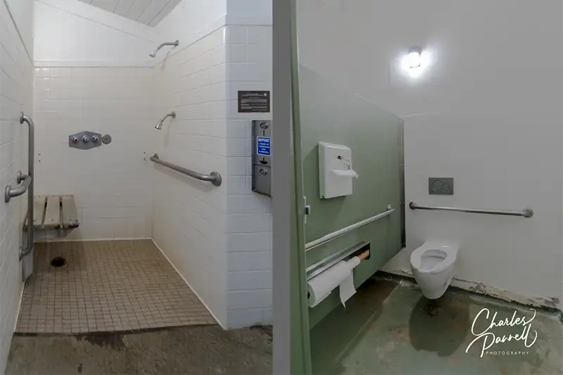
There’s no water or plumbing in the cabin, but an accessible showerhouse is just a short roll away. Both the men’s and women’s sides include a accessible stall, roll-under sinks, and roll-in showers with grab bars, a lowered showerhead and a built-in shower bench. The pay slots for the showers are within easy wheelchair reach, and the accessible shower stalls also feature enlarged changing areas.
Accessible Shower and Toilet in the Showerhouse at Hendy Woods Redwood State Park
All in all the Puma cabin is a rustic but comfortable wheelchair-accessible lodging option. After all, how often do you get to spend the night in an ancient redwood grove?
Barrier-Free Travel California National Park Road Trips for Wheelchair-Users and Slow Walkers
Located in Northwestern Virginia, Shenandoah National Park (www.nps.gov/shen) encompasses nearly 200,000 acres of protected lands, including 79,000 acres of wilderness, and a slice of the Appalachian Trail. Truly you don’t even have to get out of your car to enjoy Shenandoah’s majesty, as impressive windshield views can be had just about anywhere along the 105-mile length of Skyland Drive. That said, the park is worth more than a quick drive-through. The good news is, that if you’d like to stay and linger on, Skyland mountain lodge offers some nice wheelchair-accessible accommodations, close to one of the most accessible trails in the park.
A Room With a View
Located near milepost 41, Skyland (www.goshenandoah.com), which was originally known as Stony Mountain Camp, dates back to 1888. And although there have been a few changes to the property since George Freeman Pollock originally broke ground, the natural beauty of the surrounding forest remains unchanged. Listed on the National Register of Historic Places, this mountain lodge has also added numerous access upgrades over the years.
Accessible parking is located near the lodge office, with an accessible cement pathway down to the front door. Accessible room 14 is located near the office, with accessible parking nearby. This large corner room not only offers excellent access, but also boasts a lovely valley view.
Room 14 at Skyland in Shenandoah National Park
Access features include wide doorways, wood floors, lever handles, a lowered closet rod, and good pathway access. Furnishings include a 19-inch high open-frame king-sized bed with wheelchair access on both sides, two night tables, a chest of drawers and a table with two chairs. And if you want to catch up on the news, there’s also a television in the room.
The bathroom features a full five-foot turning radius, and it’s equipped with a roll-in shower with grab bars, a hand-held showerhead, and a fold-down padded shower bench. The toilet grab bars are located on the back and right walls (as seated), and the bathroom also has a roll-under sink and a lowered mirror. Add in shower controls located within easy reach of the shower seat, and a lowered towel hook near the sink, and you have a very accessible room.
Bathroom in Room 14 at Skyland in Shenandoah National Park
And out on the semi-private front porch, there’s plenty of room to maneuver even the largest wheelchair or scooter. It’s the perfect place to sit back and enjoy the sunset, or to just relax after a busy travel day.
Take A Hike
Access to the public areas of Skyland — which are located next to the office — is equally impressive. There’s barrier-free access to the day lodge, with level access over to the Mountain Room taproom, gift shop and grab-and-go food kiosk. Accessible restrooms are located just off the lobby; and there’s ramp access down to the Pollock Dining Room, which also offers a great view of Shenandoah National Park. Not only is Skyland a great place to spend the night, but it’s also a very accessible spot to grab a bite to eat during the day.
Limberlost Trail in Shenandoah National Park
Additionally, Skyland is located close to the nicely accessible Limberlost Trail. There’s accessible parking near the trailhead, with level access over to this hard-packed dirt trail covered with decomposed granite. The 1.3-mile trail begins in an oak-filled wooded area with ferns and mountain laurels; before it transitions to a wetlands boardwalk, and then crosses the river and loops back to the trailhead.
This area is especially beautiful in June, when the mountain laurels are in bloom, but it also makes for a pleasant hike in the spring and fall. And you can enjoy all of this beauty, just steps from the lodge. It’s definitely worth an overnight stay at Skyland, on your next visit visit to Shenandoah National Park.
Barrier-Free Travel 22 Accessible Road Trips for Wheelers and Slow Walkers
Located 2.5 hours northeast of Bryce Canyon National Park, Capitol Reef National Park is named for two of its prominent geological features. Take the name of a dome-like formation that resembles the US Capitol, and combine it with a massive rock wall that was likened to a barrier reef by early explorers, and voila, you have Capitol Reef. Today the 100-mile long Waterpocket Fold still presents a formidable reef-like obstacle, while Capitol Dome is one of the most recognizable park landmarks. Highway 24 bisects the park, which has a west entrance near Torrey and an east entrance 10 miles west of Caineville.
Insider Tips
If you have little ones in tow, be sure and stop in at the Ripple Rock Nature Center, which offers interpretive programs for children from Memorial Day to Labor Day. Activities include wool spinning, fossil identification and cornmeal grinding. Junior Ranger booklets and Family Fun Packs are also available there. Best of all, the nature center is wheelchair-accessible.
Most visitors completely miss Panorama Point, which offers one of the best views in the park. The turnout to the viewpoint is located west of the visitor center, at milepost 77 on Highway 24; and the overlook features a comprehensive and very scenic overview of the park. And although the trail to the upper viewpoint is steep and not wheelchair-accessible, there’s level access out to the lower viewpoint, and even a great windshield view from the parking lot.
Don’t miss the Petroglyph Boardwalk, which offers good views of the petroglyphs carved into the canyon walls along Highway 24. There’s level access to the viewing platform, which has an accessible scope trained on the canyon wall. The adjacent boardwalk also features level access, as it passes by another collection of petroglyphs believed to have been made by the Hopi and Paiute people.
There’s a certain seductive allure to Sedona. Some folks come for the mystical experience, while others enjoy gallery hopping. And then there’s the scenery. You just can’t beat the red rock formations that literally surround this Northern Arizona enclave. And the good news is, a good chunk Sedona’s red rock beauty is accessible to wheelchair-users and slow walkers.
Red Rock Scenic Byway
One of the best ways to enjoy Sedona’s red rock beauty is to take a drive on the Red Rock Scenic Byway. This popular drive is located off of Interstate 17. Just take exit 298, and once you cross the Dry Beaver Creek bridge, the show begins.
The 7.5 mile scenic drive, which winds through the majestic landscape, is often referred to as a “museum without walls”. As you pass Oak Creek Village, the scenery becomes more dramatic. Bell Rock, one of Sedona’s four vortices, is located just past Oak Creek Village on the right. You can’t miss it. Bell Rock is one of the more accessible red rock formations, as the upper part of Bell Rock Trail is wide, level and made of hard packed dirt. It’s doable for most wheelchair-users, however you can also get a great view of the iconic formation from the parking lot overlook.
Be sure to stop at nearby Courthouse Butte to admire the expansive scenery. And don’t miss the Chapel of the Holy Cross (chapeloftheholycross.com), which is built into the red rock buttes. There’s a few accessible parking spots near the sanctuary, and golf cart transportation is available from the remote parking area. The chapel features ramp access, but some manual wheelchair-users may require assistance because of the pitch. Still it’s worth a stop even if it closed, just for a view of the impressive front facade.
Just up the road, the Red Rock Scenic Byway ends at Highway 89A. All in all it only takes 20 minutes to drive the route, but allow for extra time for lots of photo stops And even though a Red Rock Pass is required for hikers, it’s not required for quick photo stops of 15 minutes or less.
Red Rock State Park
Red Rock State Park (www.azstateparks.com/red-rock), which is located on Highway 89A South is also worth a visit. There are a two accessible trails in the park, but they don’t offer much shade, so it’s best to go early in the day.
Accessible parking is located near the visitor center, with ramp access down to the building. Inside there’s plenty of room to maneuver a wheelchair around the gift shop, ranger information desk and interpretive exhibits. Accessible restrooms are located near the front door, and there’s also level access to the theater and classroom next door. And don’t miss the hummingbird garden on the back patio.
The accessible Mesquite Interpretive Loop begins near the parking lot. This short trail features a paved level pathway around garden filled with native plants. There’s a shaded picnic area with accessible tables near the trail; and there’s also a shade structure located in the middle of this quarter-mile trail.
The longer Bunkhouse Trail begins behind the visitor center. Although you can access it from the parking lot, that pathway has a steep grade. Alternatively, there’s level access to the trail from the hummingbird garden. The paved trail is fairly level, although there’s a bit of a grade in the beginning. Power wheelchair-users won’t have a problem, but some manual wheelchair-users may require assistance. There are also some cracks along the paved trail, but other than that it’s fairly smooth rolling.
At about the .2-mile mark there’s an accessible hard-packed dirt trail down to the Kingfisher Bridge, which provides a pleasant — and shaded — view of Oak Creek. From there a hard-packed dirt path follows the creek for another .2 mile before the trail loses its access. All in all it’s a pleasant mile-long out-and-back hike.
Slide Rock State Park
Finally, if you’d like to hit a local favorite, head on over to Slide Rock State Park (www.azstateparks.com/slide-rock). It’s located 20 minutes north of Red Rock State Park on Highway 89A. This park provides access to Oak Creek, and it takes its name from the rocks that many folks use as slides to get into the water.
Unfortunately the path down to the creek is not accessible, but there is a short trail that offers a scenic overlook of the canyon. That said, the admission is pretty steep ($20 to $30 per car, depending on the season) for just that trail; however if you have an Arizona State Park Pass, this park makes a nice lunch stop.
There’s accessible parking near the shaded picnic area — which has several accessible tables — and barrier-free access over to the Pendley Homestead Trail. This paved level trail leads past a small store, and by a display of vintage farming equipment, over to the old homestead which features a tractor display in the adjacent barn.
The trail then connects with the Cliff Top Trail which has a 75-foot paved path out to an accessible overlook that offers an expansive view of Oak Creek Canyon. All in all it’s about a quarter-mile round trip, and it makes for a nice stroll before of after lunch. And if you’d prefer to skip the hike, this piece of Sedona’s red rock beauty is easily visible from the the picnic area.
Barrier-Free Travel the Grand Canyon for Wheelchair-users and Slow Walkers
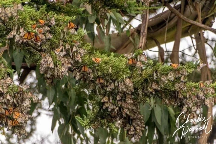
Let’s face it, it’s been a long winter. And there’s no better harbinger of spring than butterflies — more specially Monarch butterflies as they emerge from hibernation along the Northern California coast. After spending several months clumped together in clusters in eucalyptus trees, these migratory Monarchs become more active as they fly around, mate, and prepare for their flights inland to lay their eggs. So check out these three wheelchair-accessible Northern California sites this month, and enjoy a colorful taste of the migratory Monarchs as they emerge from hibernation. But don’t tarry, as these winter visitors will be long gone by the end of March.
Monarch Grove Sanctuary
Monarch Grove Sanctuary in Pacific Grove, California
This popular Monarch stopover is located off of Lighthouse Avenue, just south of the Pacific Grove Municipal Golf Course. Keep an eye out for the Butterfly Grove Inn, then turn south on Ridge Road. A white picket fence marks the path to the grove, but accessible parking is located further down Ridge Road on the left. From there; it’s a level roll up the street to the sanctuary entrance.
A .15-mile hard-packed dirt path leads through the grove and dead-ends in the adjacent neighborhood. There is an accessible porta-potty near the end of the path; and although the trail has level spots every 20 to 30 feet, some manual wheelchair-users may require assistance up the slight grade on the return trip.
The best time to hit the Monarch Grove Sanctuary is in the afternoon, because as temperatures warm up, the butterflies become more active and start to fly around through the grove. Although they might not be apparent at first, take some time to scan the tips of the pine and cypress trees, as those are their favorite landing places. Also keep an eye out for what looks to be clumps of dead leaves, as these might be clusters of the overwintering Monarchs. Docents are on duty in the season to help point out the butterflies, but for the best experience bring a pair of binoculars to get a closer look at the Monarchs.
Natural Bridges State Beach
Monarch Boardwalk at Natural Bridges State Park
Another favorite spot to view the migratory Monarchs is located up the coast in Santa Cruz, at Natural Bridges State Beach (www.parks.ca.gov/?page_id=541).
It’s pretty easy to find too. From Pacific Grove follow Highway 1 north, until it turns into Mission Street in Santa Cruz. Turn left on Swift Street, which is the first traffic light after the Safeway, then follow the road until it dead ends on West Cliff Drive. From there, turn right and follow the road along the ocean to the park entrance.
The day use area is located a short drive up the park road. There’s accessible parking in the large lot with level access over to the visitor center. Inside, there’s barrier-free access around a number of interpretive exhibits about the butterflies, their habitat, and of course their migration. Accessible family restrooms are located just outside the front door of the visitor center.
The Monarch Boardwalk is located across the service road from the visitor center. This .15-mile trail winds through a eucalyptus grove, and although it does have a slight downhill grade, there are level spots every 20 to 30 feet. That said, some manual wheelchair-users may need a bit of assistance on the uphill journey.
This is one of the top spots to find the overwintering Monarchs, however it’s usually a hit or miss proposition. Weather plays a big factor in their presence and activity, and you’ll probably strike out after a big storm or on a windy day. That said it is one of their favorite haunts.
Lighthouse Field State Beach
Monarch Butterflies at Lighthouse Field State Beach
Last but not least, don’t forget to stop at Lighthouse Field State Beach, (www.parks.ca.gov/?page_id=550). From Natural Bridges State Beach, back track on West Cliff Drive, pass the lighthouse, and turn into the parking lot for Lighthouse Field on the left. Alternatively, accessible parking is also available across the street in front of the Santa Cruz Surfing Museum.
You’ll find the Monarchs in the Monterey cypress and eucalyptus trees in the grassy field near Pelton Avenue. Although there’s a sizable population during the winter months, getting there can be difficult in rainy years, as the accessible hard-packed dirt paths to the grove flood easily. It’s about a half-mile walk to the grove on the dirt paths.
Bottom line — this is an excellent spot in dry years, as you’ll not only spot the clumps of butterflies, but there are also individual butterflies flying around near the end of the season. Give it a go and see what the dirt paths look like; and if they’re not a mucky mess, then go for it. After all, it’s on the way from Natural Bridges, and it’s definitely worth a quick stop.
Barrier-Free Travel California National Park Road Trips for Wheelchair-Users and Slow Walkers

 Population 7,166