If you’re planning to visit some Washington State Parks in 2026, and you want to save a few bucks, then plan your visit for one of the fee-free days. Normally a Discover Pass is required in order to enter Washington State Parks, but on these 2026 dates you don’t need a pass and you don’t need to pay an entry fee.
Thursday, Jan. 1 – New Year’s Day and First Day Hikes
Monday, Jan. 19 – Martin Luther King Jr. Day
Monday, March 9 – Billy Frank Jr.’s Birthday
Thursday, March 19 – State Parks 113th Birthday
Wednesday, April 22 – Earth Day
Saturday – Sunday, June 6-7 – Free Fishing Weekend
Friday, June 19 – Juneteenth
Sunday, Aug. 9 – Smokey Bear’s Birthday
Saturday, Sept. 26 – National Public Lands Day
Saturday, Oct. 10 – World Mental Health Day
Wednesday, Nov. 11 – Veterans Day
Washington has a lot to offer state-park wise, and here are some of our favorites. And we’ve really been impressed with their wheelchair access too.
If you’d like to visit a Washington State Park at other times during the year, and you happened to have a disability, then you can get a free Washington State Disability Pass. This pass can be used in place of a Discover Pass. Pass holders get the following benefits at Washington state lands.
Free parking and entrance to all state parks (no Discover Pass needed)
The form is pretty simple to fill out, but you do need to submit a few things with it.
Proof of Residency
This can be your drivers license or a Washington state ID card, but it must list your Washington address. You must be a Washington resident for at least three consecutive months in order to apply.
Proof of Disability
A copy of an accessible parking placard (not expired) is acceptable for proof of disability. If you don’t have that, then an eligibility letter for state or federal disability benefits will suffice.
There’s no charge to apply for the pass, and it’s good for either one or five years. So get yours today, and start exploring the accessible Washington national parks.
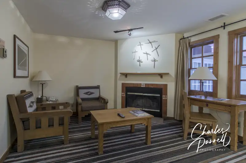
Romantic retreats come in all shapes and sizes, From a secluded cabin in the woods to a lakeside lodge, or even a Moroccan retreat, there’s something out there for just about everyone. And today slow walkers and wheelchair-users don’t have to be left out, as many of these choices are now accessible. So with Valentines Day just around the corner, here are some wheelchair-accessible romantic retreats to share with your sweetheart.
Skamania Cabin
Cabin 744 at Skamania Lodge
emerginghorizons.com/relax-in-a-skamania-lodge-wheelchair-accessible-cabin Located on the fringe of Skamania Lodge in Southwestern Washington, this cozy cabin is perfect for a romantic getaway. It’s got a nice fireplace in the living room, a compact kitchen, a large bedroom, and a bathroom with a roll-in shower. And you can even order room service and enjoy it on the private deck.
Mendocino Retreat
Sunset View from Room 166 at the Little River Inn
emerginghorizons.com/a-wheelchair-accessible-mendocino-coast-retreat Next up on our list of wheelchair-accessible romantic retreats is The Little River Inn on California’s Mendocino Coast. This wheelchair-accessible room overlooks the ocean and has a luxurious bathroom with a roll-in shower. And if you get a little chilly, there’s also a cozy fireplace in the front room. A great choice for folks who love the coast.
Tenaya Lodge Cabin
Cabin 9 at Tenya Lodge
emerginghorizons.com/wheelchair-accessible-explorer-cabins-at-tenaya-lodge If you prefer the mountains, then head up to Yosemite and spend a few nights in this accessible Explorer Cabin at Tenaya Lodge. The cabin is located on a remote slice of the lodge property, which is just a short drive from the national park. And it has two bedrooms, a compact kitchen and a living area with a fireplace. The bathroom is nicely accessible with a roll-in shower, and there’s also a cozy private deck off the master bedroom.
Historic Harvey House
Room 204 at the Castaneda Hotel
emerginghorizons.com/the-castaneda-hotel-a-wheelchair-accessible-harvey-house History buffs with love this former Harvey House property, which is located in Las Vegas, New Mexico. The Castaneda Hotel, which was originally opened in 1898, was restored and reopened in 2019. And although access wasn’t really a thing back in the days of the Harvey Girls, the new rendition has a nice accessible room with a roll-in shower. It’s a fun property in a historic town.
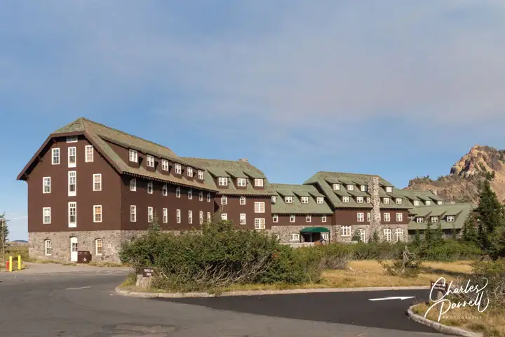
Crater Lake Lodge
Crater Lake Lodge
emerginghorizons.com/spend-the-night-at-wheelchair-accessible-crater-lake-lodge Next up on our list of wheelchair-accessible romantic retreats is a rustic lodge that sits on the shore of a mountain lake – Crater Lake to be more specific. The historic lodge is a great place to spend a romantic weekend. The spacious wheelchair-accessible room is located on the ground floor, just steps from the lobby, dining room and terrace. After a day of exploring the lake, settle in for a nice dinner and top it off with drink on the terrace. You just can’t beat the lake view. It’s also a great spot to enjoy a romantic sunset.
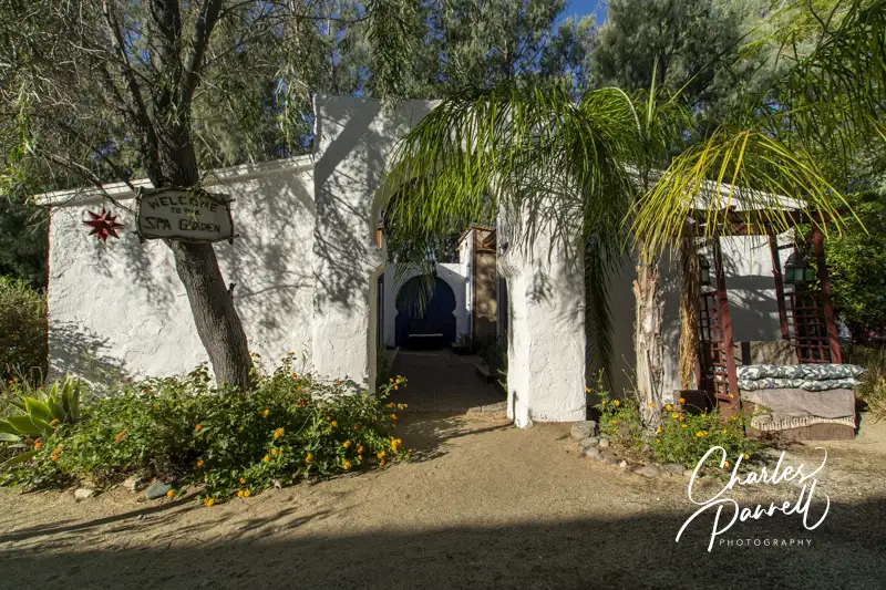
A Desert Oasis
Spa Garden at the El Morocco Inn
emerginghorizons.com/the-el-morocco-inn-a-wheelchair-accessible-oasis-in-the-california-desert For a taste of Morocco without leaving the US, check out the El Morocco Inn in the California desert. Located in Desert Hot Springs, this accessible oasis includes a nice wheelchair-accessible room with a roll-in shower. There’s also good access to the public areas, including the swimming pool and the spa. And if you’d just like to chill, you can kick back in the library and enjoy a book or DVD. Truly there’s something for everyone at this relaxing retreat.
Santa Fe Suite
Suite 102 at the Chimayo Hotel
emerginghorizons.com/a-wheelchair-accessible-santa-fe-lodging-choice This Santa Fe Hotel offers a nice wheelchair-accessible suite, just steps from the historic Plaza. The Hotel Chimayo features a spacious accessible suite with a large bathroom and a roll-in shower. And there’s also a cozy fireplace in the living room to snuggle up with your sweetheart. Don’t forget to stop in at the Low n’ Slow Bar while you are there. Not only do they have a wide selection of beverages and snacks, but you just can’t beat the retro low rider décor.
Red Canyon Cabin
Cabin 12 at Red Canyon Village
emerginghorizons.com/spend-the-night-in-red-canyon-village Last but not least on the list of wheelchair-accessible romantic retreats is this Bryce Canyon cabin at Red Canyon Village. Located just a few miles from the national park entrance along scenic Highway 12, this log cabin is just a short walk from the office. It includes a king-sized bed, a compact kitchen and a large bathroom with a roll-in shower. And if you’d like to dine al fresco there’s a picnic table outside and a few chairs on the front porch. A perfect Red Canyon getaway.
Barrier-Free Travel California National Parks Road Trips Travel Ideas for Wheelchair-users and Slow Walkers
www.mermaidmuseum.org This eclectic museum is worth a stop while exploring Northwestern Washington. It’s located off Highway 105, between Aberdeen and Westport. The building is set back off the road and easy to miss, so look for the signs for Westport Winery, which is located next door. There’s accessible parking out front, with barrier-free access over to the museum. Inside, there’s plenty of space to maneuver a wheelchair around the mounds of memorabilia, photos, artwork and ocean treasures.
The exhibits range from a sea glass collection to clips from the Little Mermaid, to shark jaw bones, sea creature photos and a sizable art collection. As you browse through the artifacts, you’ll learn about the anatomy of a mermaid, see objects that illustrate the siren sea stories, hear about hoaxes and learn about different cultural views of mermaids. These mythical creatures were described by Christopher Columbus as “not half as beautiful as they are painted”, and seafarers who captured them reportedly received three wishes. Myth or mystery, it’s a fun and fanciful stop. And don’t miss the gift shop that’s bursting with mermaid memorabilia.
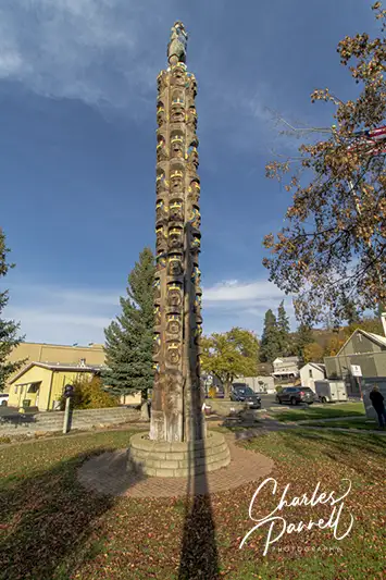
This local landmark has a fun history, and it’s a nice spot to take a break while driving along Highway 195 in the Palouse. It’s a small site, so if you have an adapted van it’s best to parallel park on the street in front of the tiny park that surrounds the Codger Pole. There’s also standard parking in the Farmers Insurance lot next door. From either point there’s level access to this unusual monument, which also has a picnic table on a cement pad.
The story behind the Codger Pole dates back to a historic 1938 football game between the Colfax Bulldogs and the St. John Eagles. The Colfax team lost, but 50 years later the “old codgers” asked for a rematch, and this time they won. This monument stands to commemorate the resolve and determination of that team. The pole, which is actually comprised of five 65-foot tall cedar poles, was carved with a chainsaw by John LaBenne. It includes the faces of all 51 players along with their original leather football helmets. It’s a fitting tribute to codger-hood.
What’s not to like about a road trip? After all you get to set your own pace, explore a few off-the-beaten-track sights, and take in some gorgeous scenery. And although the highways and byways across the US offer a plethora of gorgeous windshield views, these seven western drives top my must-do list. Not only are they all easily doable in one day, but each route also features one don’t-miss wheelchair-accessible scenic highlight, where you can get out of the car and get up-close-and-personal with Mother Nature.
Tioga Road
Tenaya Lake on the Tioga Road in Yosemite National Park, California
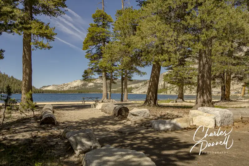
At the top of the Western road trips list is Tioga Road. This classic drive across the high country of Yosemite National Park (emerginghorizons.com/barrier-free-travelyosemite-sequoia-and-kings-canyon-national-parksfor-wheelers-and-slow-walkers/#itins), connects Crane Flat near Yosemite Valley with Highway 395 in Lee Vining. Along the way you’ll be treated to some great views of Tenaya Lake and Tuolumne Meadows, as you pass by isolated snowfields and travel over the 9,943-foot high mountain pass.
Take some time to get out of your car at the east end of Tenaya Lake. Located at 8,150 feet, this alpine lake offers a short wheelchair-accessible path down to the lakeshore, where you’ll find an accessible picnic table on an asphalt pad. It’s the perfect spot for a secluded picnic lunch.
Keep in mind that timing is extremely important along this route though, as heavy snow makes the road impassable during the winter months. Fall is a lovely time on Tioga Road, but try and hit it before the end of October. Mountain weather is unpredictable and this road has closed as early as mid-October.
Kings Canyon Scenic Byway
Grizzly Falls Picnic Area on the Kings Canyon Scenic Byway in Kings Canyon National Park, California
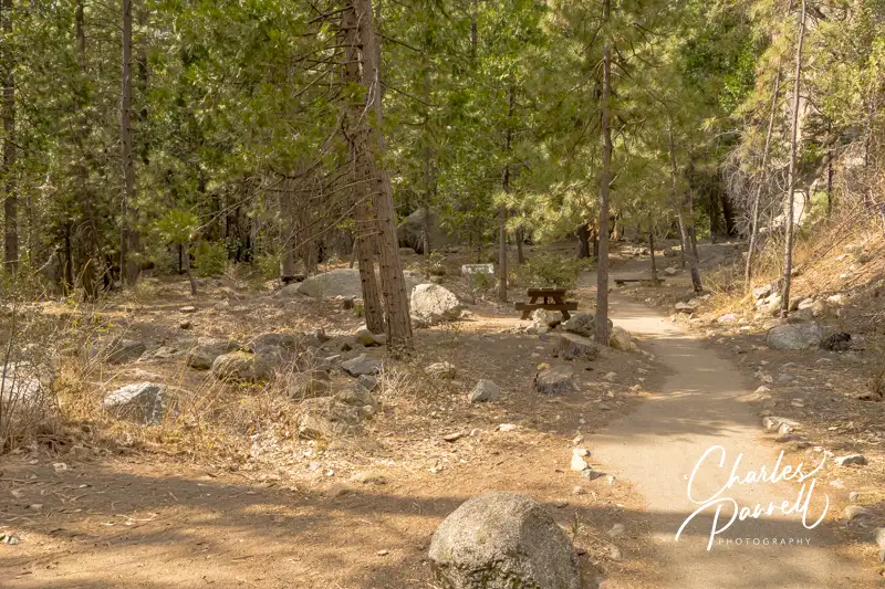
Located in the National Forest just outside of Kings Canyon National Park, The Kings Canyon Scenic Byway begins just north of Grant Grove on Highway 180. This scenic route travels through a pine forest before it descends alongside granite walls deep into magnificent Kings Canyon. After the road reaches the canyon floor, it follows the roaring Kings River and then it re-enters the park just past Grizzly Falls Picnic Area.
There are several viewpoints with interpretive plaques along the way, and although none of them have striped parking, all of them are paved and level, with plenty of room to deploy a ramp when parked parallel. McGee View offers a look at the destruction and rebirth of the forest since the 2015 Round Fire, while Yucca Point and Junction View give visitors a close look at the massive canyon walls. The Boyden Cave site is worth a stop too, as even though the cave tours haven’t operated for many years (and they are not accessible), you’ll still get a good view of the mighty Kings River from either side of the road.
And don’t miss the Grizzly Falls Picnic Area . A short paved loop leads from the parking area, up around several accessible picnic tables on cement pads. It’s about 100 feet up to the interpretive plaque near the base of the falls, but after that you’ll have to scramble over the rocks to get any closer. Still, there’s a great view of the falls from the plaque, the picnic tables and even the parking area. Even if you don’t stop for lunch, be sure and pop in for the view.
Newton B. Drury Parkway
Prairie Creek Foothill Trail in the Newton B. Drury Parkway in Prairie Creek Redwoods State Park, California
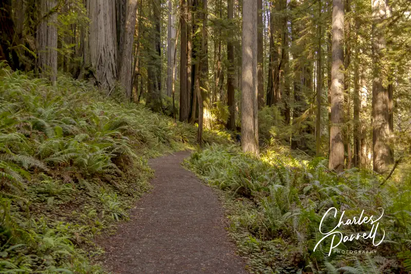
Next up on our Western road trips list is a drive through some old growth redwoods on the Newton B. Drury Parkway, which bisects Prairie Creek Redwoods State Park (www.parks.ca.gov/?page_id=415) in Northern California.
Although there are some nice windshield views along the 10-mile route, you’ll definitely want to stop for a close look at the Big Tree, near the visitor center. There’s accessible parking and restrooms near this wayside exhibit, and a 100-yard paved path to the tree. There’s also ramp access up to this 304-foot giant, which towers over the surrounding forest.
If you’d like to take a hike through the grove, the accessible Prairie Creek Foothill Trail is the perfect choice. This 2.3-mile loop trail starts just to the right of the visitor center and follows fern-lined Prairie Creek for 1.2 miles. The trail is hard-packed dirt, and although it’s not totally level, the grade is up to code and there are level spots every 30 feet, with benches to rest along the way.
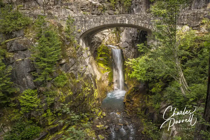
Christine Falls on the Longmire to Sunrise Drive in Mount Rainier National Park
One of the most accessible things to do in Mount Rainier National Park (emerginghorizons.com/barrier-free-travel-washington-national-parks-for-wheelers-and-slow-walkers/#itins) is to take the 56-mile scenic drive from Longmire to Sunrise. Although the drive takes about two-and-a-half hours straight through, it’s best to allow a whole day for it, as you’ll want to stop and enjoy the views along the way, as well as spend some time on top. And although the windshield views are breathtaking on the drive up, they are even more spectacular on the trip back down the hill.
Highlights along the way include Ricksecker Point Loop Drive, Narada Falls and Reflection Lakes; however, the pièce de résistance is Christine Falls. It’s located on the left side of the road, just past Longmire; but if you take time to admire it from your car, you’ll completely miss the parking area on the right side.
Up at the top, be sure and stop in at the Sunrise Visitor Center. The front entrance has steps, but there’s good signage to the accessible side entrance. Inside, there’s plenty of room to navigate a wheelchair around the interpretive exhibits. Best of all, you can get an absolutely amazing view of Mt. Rainier from the scope that’s trained on the mountain inside the visitor center.
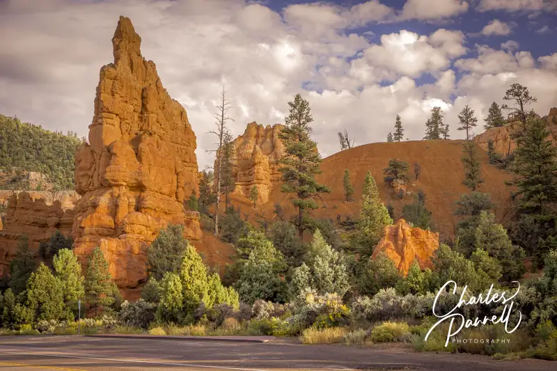
Scenic Byway 12
Roadside View in Red Canyon on Scenic Byway 12, Utah
Located in Southern Utah, Scenic Byway 12 travels west from Torrey to Highway 89, and offers views of Kodachrome Basin, Grand Staircase-Escalante National Monument, Glen Canyon National Recreation Area and the Dixie National Forest. And although this byway was a dirt road until 1985, the 124-mile route has been repeatedly described as one of the most diverse, remote and ruggedly beautiful landscapes in the country.
From Torrey to Boulder the road winds through a Ponderosa Pine and Aspen forest, where the fall foliage show is second-to-none. And from Boulder west, the route passes through Grand Staircase-Escalante National Monument and offers a breathtaking canyon view.
One of the most striking sights along the route is Red Canyon (emerginghorizons.com/spend-the-night-in-red-canyon-village/) , which is located near Highway 89. Often called “Little Bryce”, Red Canyon is filled with pullouts, and there’s even a nice paved bicycle trail on the south side of the highway. The eight-mile bicycle trail is paved and fairly level for most of the way, but there are also a few undulating and steeper sections. It’s not technically wheelchair-accessible because of the grade, but some handcyclists and manual wheelchair-users with good upper body strength may be able to manage it. That said, since a good chunk of the trail is level, it’s worth a try, and you can always turn back if it becomes too steep.
And just off Highway 12 in Boulder, there’s the scenic Burr Trail which offers a lovely drive through Grand Staircase-Escalante National Monument. And as with most scenic drives, the view is entirely different on the return trip.
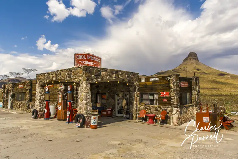
Historic Route 66
Cool Springs, Arizona on Route 66
Rounding out our Western road trips is Historic Route 66. Fondly known as the Mother Road, Route 66 (www.historic66.com) began as a series of dirt trails and unnamed roads cobbled together to create America’s first interstate highway. Today, the road has been replaced by Interstate 40; however you can still jump off the interstate and explore sections of the old road (emerginghorizons.com/wheelchair-accessible-route-66-a-great-grand-canyon-side-trip/). And one of the best places to begin this drive is in Kingman, Arizona.
Take the West Beale Street exit from Interstate 40, bear right at the Y, and follow the signs through Kingman to Oatman on Historic Route 66. Once outside of town, you’ll notice a pleasant lack of traffic as you make your way across the Sacramento Wash to Cool Springs, which is scantily more than a wide spot in the road.
From Cool Springs the Mother Road climbs up Gold Hill to Sitegreaves Pass. Hairpin turns and sheer drop-offs are commonplace on this stretch of the road, and there’s a noticeable lack of guard rails along the way. On the plus side, there’s no shortage of awesome views, including a great one near the 30-mile marker. After you reach the summit, the downhill drive is just as exhilarating, with plenty of twists and turns along the way. As you breathe that final sigh of relief, you’ll roll into Oatman. Years ago, the miners used burros to work the gold mines, and today their descendants roam the streets. Take an apple or two to feed them and you’ll be the center of attention.
From Oatman it’s another 26 miles to Topock, where you can rejoin Interstate 40. Although this Route 66 detour is just 140 miles long, it’s a wonderful opportunity to turn back the clock and step into the past.
Barrier-Free Travel Yosemite, Sequoia and Kings Canyon National Parks for Wheelers and Slow Walkers
Located on the quieter northern side of the Columbia River, Skamania Lodge has long been a top choice for a relaxing nature getaway. But make no mistake, you’re not exactly roughing it at this upscale mountain lodge. That said, even with the luxurious touches and attentive service, you’re still connected to the outdoors in just about any space on the property.
Skamania Lodge has also been proactive about wheelchair access. Not only do they offer some beautiful accessible lodge rooms, but they also have a secluded wheelchair-accessible treehouse (emerginghorizons.com/sleep-in-a-wheelchair-accessible-treehouse-at-skamania-lodge/). The former is great for family visits, while the latter is excellent for a romantic getaway. The newest addition to the Treehouse Village is a collection of luxury cabins, including a nice wheelchair-accessible unit. So, pack your bags, leave the big city behind you and relax in a Skamania Lodge wheelchair-accessible cabin.
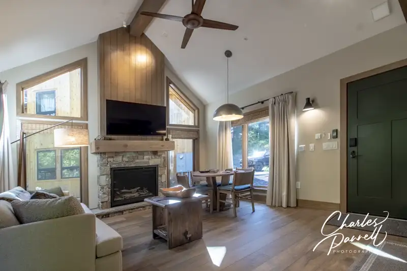
Skamania Lodge Wheelchair-Accessible Cabin
Cabin 744 at Skamania Lodge
There’s level access to the lobby at this outdoor-themed lodge, with plenty of room to maneuver a wheelchair to the front desk. From there, it’s a short drive to the gated treehouse section of the property, where the wheelchair-accessible cabin is located. Cabin 744 (also known as Horsetail Falls) includes a private parking space in front, with plenty of room for an adapted van. And if you happen to drive an EV, there’s also a charging station there.
There’s barrier-free access to the spacious front porch, and a comfy Adirondack chair in front. Access features in this one-bedroom cabin include wide doorways, lever handles, good pathway access and laminate floors for easy rolling.
The great room includes a stone gas fireplace, a king size sofa bed, a dining table with four chairs and a compact kitchen. The kitchen features a roll-under sink, and a lowered microwave and refrigerator. The whole cabin exudes a woodsy ambiance, with high ceilings, wood beams and natural wood accents.
A large barn door leads into the bedroom, which is furnished with two 22-inch high open-frame queen-sized beds, with wheelchair access in the middle and the right side (as you face them). Other furnishings include a nightstand, a wardrobe and a chest of drawers. And to make you feel welcome, there’s a stuffed mini-Sasquatch on the bed.
There’s excellent access in the cavernous bathroom, which includes barn door access and features a full five-foot turning radius. It’s outfitted with a roll-in shower with a fold-down shower seat, grab bars and a hand-held showerhead (as well as a traditional showerhead). It also includes a roll-under sink and a toilet with grab bars on the back and right walls (as seated).
(click thumbnail to see full size image)
Living Area in cabin 744 at Skamania Lodge
Living Area and Kitchen in cabin 744 at Skamania Lodge
Bedroom in cabin 744 at Skamania Lodge
Bathroom in cabin 744 at Skamania Lodge
Enjoy the Outdoors!
But the good access doesn’t end on the inside of the Skamania Lodge cabin — it continues out on the private deck. There’s level access out to the deck from both the great room and the bedroom, and it’s a beautiful place to relax as it borders the forest. Furnishings include a table and four chairs, and a sofa. And there’s plenty of room for a wheelchair-user to roll around and enjoy it all.Smores on the DeckThere’s also a propane fire pit on the deck, which offers some light and warmth on those chilly nights. And the folks at Skamania Lodge thought of everything, as they included a s’mores kit, so you can enjoy a tasty treat around the fire. The deck is also a great place to have your morning cup of coffee, and enjoy the songs of the local avian residents.
Truly this cabin has all the bells and whistle for access — including remote control blinds and drapes — and the secluded space to relax with that special someone. It’s really the best of both worlds.
If you’d like to take a hike, there are three accessible trails located nearby (emerginghorizons.com/wheelchair-accessible-columbia-river-hikes/). Sam’s Walker Trail is about 15 minutes west of the lodge, while the Catherine Creek Universal Trail and the Balfour Klickitat Loop are about 40 minutes in the other direction. Pack along a picnic lunch and make it a day excursion.
The Columbia Gorge Museum (www.columbiagorgemuseum.org), is also worth a stop, and it’s just up the street from Skamania Lodge. This family friendly museum houses an extensive collection of artifacts that chronicle the history and culture of the Columbia River Gorge. There’s excellent access throughout the museum, and the building itself is a work of art. Exhibits about history of the gorge line the first floor, while the unique Don Brown Rosary Collection occupies a substantial chunk of the upper gallery. This unusual exhibit includes nearly 4,000 rosaries, and it was the catalyst for the formation of the Skamania Historical Society in 1926. It’s a fitting — if not somewhat eerie — way to top off a Columbia Gorge Museum visit.
Finally, be sure and save some time for a quick side trip to Schreiner Farms (emerginghorizons.com/schreiner-farms/) on your way to or from Skamania Lodge. There’s no charge to drive through this family farm, which houses everything from antelope and camels to bison, giraffes and even zebras. It’s located about 45 minutes west of the lodge in Lyle, and it’s a fun road trip diversion. You never know what you’ll see.
Barrier-Free Travel Washington National Parks for Wheelers and Slow Walkers
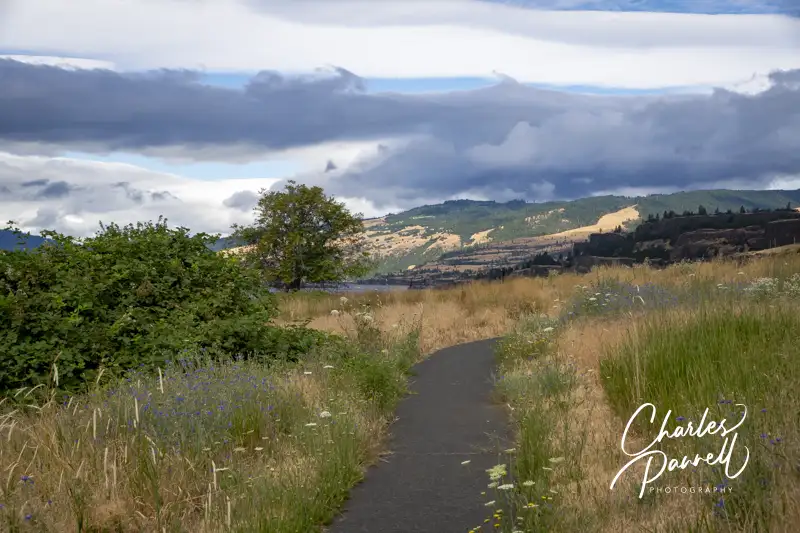
The majestic Columbia River flows through the Pacific Northwest and forms the border between Washington and Oregon. On the Oregon side of the river, Interstate 84 travels through several mid-sized cities as it skirts the waterway. That said, Highway 14 on the north side of the river offers a bucolic view of the Washington landscape. Even better, the northern route boasts several wheelchair-accessible hikes. So take the time to hop off the interstate, cross the river, and enjoy these scenic wheelchair-accessible Columbia River hikes on your next Pacific Northwest road trip.
Sam’s Walker Trail
Sam’s Walker Trail
While traveling on the western part of Interstate 84, the best — and frankly the most scenic — river crossing is at the Bridge of the Gods (www.portofcascadelocks.gov/bridge-of-the-gods), in Cascade Locks. After you cross this two-lane toll bridge, head west on Highway 14 for about 10 miles to get to the first accessible hike on the list — Sam’s Walker Trail. When you hit Skamania Landing Road, turn south and and follow the signs to the trailhead. It should be noted that Skamania Landing Road is a loop, so be sure and take the western turnoff.
There’s no accessible parking in the gravel lot, but there’s plenty of room to parallel park an adapted van. An accessible vault toilet sits on one side of the parking lot, and an accessible shaded picnic table graces the other side. There’s level access over to the 1.2-mile hard packed dirt trail. It winds through a sweeping meadow, then passes through a shady cedar forest before it loops back to the trailhead,.
Sam’s Walker Trail is pretty well maintained, but there may be some slight vegetation overgrowth depending on the season. It’s mostly a flat trail, although there are some slight elevation changes along the way. Still it’s well within the ADA guidelines for accessible trails; as the steepest grade is only 4%, and that’s just for a few feet. It’s a great spot for a spring wildflower hike, and the meadow is an excellent birding venue. As an added bonus, there’s an accessible picnic table set off the trail under a few trees, about halfway along the hike If the table in the parking lot is occupied, it’s a great spot for a picnic lunch. And even if the parking lot table is available, the trail table offers more privacy. Sam’s Walker Trail makes for a nice accessible hike throughout the year.
Catherine Creek Universal Trail
Catherine Creek Universal Trail
Next up on the list of wheelchair-accessible Columbia River hikes is the Catherine Creek Universal Trail. From Sam’s Walker Trail, head east on Highway 14, then turn north on Old Highway 8, about 40 miles up the road. The Catherine Creek Universal Trail is about 1.5 miles up Old Highway 8.
There’s a small dirt parking area on the north side of the street; and although there are no lined spaces, there’s room enough to parallel park in the level lot. There’s another trailhead near the parking area on the north side of the street, but the Catherine Creek Universal Trail begins across the street, near the accessible porta potty.
You can take the trail in either direction, but most folks choose to head east (left). The trail winds through a meadow and over to the Catherine Creek Falls viewpoint. It’s just a quarter-mile walk to the falls, and the area is filled with lilies, poppies and balsamroot blooms in the spring. The waterfall decreases to just a trickle in the summer months, but it’s rather impressive earlier in the year . And if you’d like to stay a spell, there’s also a bench in the waterfall viewing area. As an added bonus, there’s also a nice Columbia River view.
The next part of the route crosses a small footbridge and then an accessible boardwalk, before it splits into two trails. The trail to the right is the half-mile shortcut, and it’s a bit steeper than the longer route. The trail to the left winds along the Columbia River and then intersects with the shortcut, before it returns to the starting point for a 1.2-mile stroll. Although neither route is level, they both are accessible. And don’t forget to bring a hat, as there’s not much shade along the way.
Balfour Klickitat Loop
Balfour Klickitat Loop
The final trail on our north shore collection of wheelchair-accessible Columbia River hikes is the Balfour Klickitat Loop. From the Catherine Creek Universal Trail, continue east along Old Highway 8 for about 4.5 miles. The trailhead is on the left, and although it’s marked, it’s east to miss. If you hit Highway 14, turn around and backtrack for about .2 mile.
This land was originally farmed by the Thomas Balfour family in the 1800s, and remnants of the Osage orange trees they planted are still visible along the trail today. There’s accessible parking near the trailhead, with level access over to an accessible vault toilet.
The .75–mile wide paved trail winds through a meadow and offers a panoramic Columbia River view, complete with parasailers. There are turn outs along the way for wheelchair-users, and this is also a great spot for wildflower viewing in the spring. At about the halfway point there’s a single accessible picnic table on a pad, with plenty of room for a wheelchair. It’s a great place for a picnic as it’s tucked off the trail in a private cove, but still offers a nice river view.
The trail then crosses a small bridge and continues along the meadow, with a view of the peaceful Klickitat River. It’s a great birding place, and bald eagles are known to congregate here during the salmon run in January and February. When you reach a fork in the trail, bear left to the return to the parking area. Although there is some elevation gain there, it’s within code, with resting spots every 20 feet. It’s a pleasant trail, that’s definitely worth a stop while road tripping along Highway 14.
Stay a Spell
After you finish exploring the Balfour-Klickitat Loop, head out Highway 14 to continue your trek east. Alternatively, you can extend your stay and explore this less-touristed side of the Columbia River.
Maryhill State Park is located about 20 miles east of the Balfour-Klickitat Loop, and it’s a nice place to stop for a picnic or even spend a night or two. The Maryhill Museum, Maryhill Winery and Maryhill Stonehenge are also all worth a visit while you’re in the area. (emerginghorizons.com/linger-on-in-maryhill-state-park/).
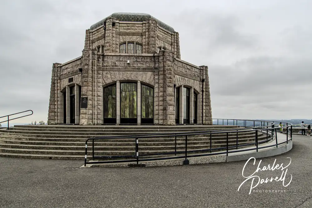
Vista House on the Columbia River Waterfall Corridor
And finally, if you’d prefer to camp out, then check out Beacon Rock State Park. It offers a nicely accessible campsite, as well as a few accessible hikes. Either way these wheelchair-accessible Columbia River hikes only take a few hours, and the scenery is most definitely worth the slight detour.
Barrier-Free Travel Washington National Parks for Wheelers and Slow Walkers
Named for the 848-foot tall basalt feature that towers over the area, Beacon Rock State Park (parks.wa.gov/find-parks/state-parks/beacon-rock-state-park) overlooks the Columbia River and sits in the middle of the Columbia Gorge National Scenic Area. The namesake rock was originally called Che-Che-op-tin (the navel of the world) by the natives, and was given its modern moniker by William Clark when his expedition passed through the area in 1805. Today Beacon Rock State Park is a must-see stop on the Lewis and Clark National Historic Trail; and with a nice campground, some beautiful surroundings and a few wheelchair-accessible trails, it’s the perfect spot for a short nature break.
The Lay of the Land
Beacon Rock State Park is divided into four separate areas, divided by Highway 14. The namesake rock can be spotted from several miles away, with parking located on the south side of Highway 14. Although the trail to the top isn’t accessible, it’s still worth a brief stop at the base.
The historic CCC Upper Campground, two picnic areas and Hadley Grove are located on the north side of Highway 14, directly across from Beacon Rock. Be on the lookout for the turn (a very sharp right) as soon as you spot the Beacon Rock parking area.
The Doetsch Area is located to the west of Beacon Rock, on the south side of Highway 14. This area has moorage sites, accessible camping, the Doetsch Trail and a nice picnic area. This is the newest area of the park, and it has the best wheelchair-access.
Finally, the group camp and the equestrian trailhead are located on the north side of Highway 14, between the Upper Campground and the Doetsch Area.
Spend the Night
The best wheelchair-accessible camping option in the park is located in the Woodard Creek Campground, near the moorage sites in the Doetsch Area. There are only two campsites there (A and B), and although both are in a level area, campsite B is the designated accessible site.
There’s accessible parking next to campsite B, which has a paved driveway, and a level site with a fire ring and picnic table. Campsite A is also doable for many folks, but it lacks a paved driveway. The accessible shower house is located across the parking lot, about 50 feet away. It includes accessible bathrooms with large stalls, grab bars, and roll-under sinks, as well as individual accessible shower rooms. There’s barrier-free access to the shower rooms, which each include a roll-in shower with a fold-down shower bench, a lowered showerhead, grab bars and a second seat for changing. It’s all very nicely done access-wise.
Additionally, there are five RV sites located in a level area near the end of the road in the Doetsch Area. That said, the sites near the moorage area are a much better choice, as they offer more privacy than the RV sites.
Unfortunately, the historic Upper Campground presents some obstacles for wheelchair-users and slow walkers. It’s a hilly campground and there are no designated accessible spaces. That said, campsites 19 and 20 are the closest sites to the bathrooms; however it’s still a uphill trek to get to them. Some slow walkers may be able to use these sites, but it’s not a realistic option for most wheelchair-users. The Woodward Creek Campground is newer, and includes modern access features.
Explore Hadley Grove
Hadley Grove
Named for the first superintendent of Beacon Rock State Park, Hadley Grove is just a short hike from the Upper Campground. This lovely slice of a second-growth fir forest is a pleasant spot to linger, especially on a hot day. And although the trail is rated as wheelchair-accessible, it’s not a flat level path.
The trail to Hadley Grove begins near campsite 11 in the Upper Campground. The designated parking area for the trail is small, and it’s covered with chunky gravel. Although the official trail description says there are two steps up to the trailhead, it’s more of a short steep pathway. After that, there are several switchbacks before you reach Hadley Grove, about 500 feet down the trail.
Accessible trails are allowed running slopes of 8% to 10% as long as there are resting intervals every 30 feet. And that pretty much describes the first part of the trail to Hadley Grove. That said, once you reach the grove, a level well-maintained trail winds through it. It’s a beautiful and peaceful spot to stop and linger, and take in the beauty of Mother Nature.
To be honest the steepest part of the trail is the slope up from the parking area, and if you can manage that, there’s a good chance the trail won’t offer any obstacles to you. That said, manual wheelchair-users will probably need some assistance on at least the first slope. Give it a try, and if it doesn’t work for you, you can always turn back.
Enjoy the Doetsch Trail
Doetsch Walking Path
In contrast to the trail to Hadley Grove, the Doetsch Trail offers excellent wheelchair-access. Located in the Doetsch Day-Use Area, there’s accessible parking and barrier-free access to the trailhead. There are also accessible restrooms near the parking area.
The 1.2-mile paved trail winds through a meadow bordered by mountains and the Columbia River. There are benches to sit and take a break along the way, and it’s an excellent birding site. About halfway along the trail, you’ll get a nice river view before the trails loops back through a shady forest to the parking area.
As an added bonus there are several accessible picnic tables in the meadow, near the parking area. So pack along a lunch and enjoy it al fresco. Not only is it a scenic spot to enjoy lunch, but it’s also the most accessible picnic area in the park. It’s a great way to top off any visit to Beacon Rock State Park.
Picnic Tables on the Doetsch Walking Path
Barrier-Free Travel Washington National Parks for Wheelers and Slow Walkers
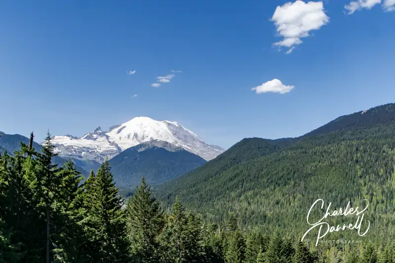
Located in Northwest Washington, Mount Rainier towers 14,410 feet over the surrounding alpine meadows. And when the “mountain is out” it’s visible from as far away as Seattle, Portland and even Vancouver. That said, there’s nothing like a close look at this active volcano, which can be had from Mount Rainier National Park , as well as aboard a local rail excursion. Although it’s only possible to access these sites in the summer season, due to snow and road closures; they are definitely worth a visit. So take some time to to check out these wheelchair-accessible Mount Rainier views on your next Washington national park road trip.
Kautz Creek Boardwalk
Located about three miles east of the Nisqually Entrance to Mount Rainier National Park, the Kautz Creek Boardwalk is one of the newest accessible trails in the park. There’s accessible parking near the picnic area, with level access to the .1-mile boardwalk across the street. The boardwalk leads through a section of forest that’s still recovering from a 1947 glacier generated debris flow, and it ends in a crushed granite viewing area with a few benches. And on a clear day, you just can’t beat the Mount Rainier view from there.
Henry M. Jackson Visitor Center
Henry M. Jackson Visitor Center
Next up on our list of wheelchair-accessible Mount Rainier views is the Henry M. Jackson Visitor Center, which is located about 14 miles up the road in Paradise. This area of the park was named by an early settler who reportedly exclaimed “Oh, what a paradise!” when she first saw it. And it’s a fitting description. There’s accessible parking in front of the building, with barrier-free access to all areas of the visitor center. The visitor center offers a 360-degree panoramic view of the area, but you’ll also get a great Mount Rainier view if you just step out the back door. And if you hit this stop at the right time in the summer, you’ll also be treated to a nice view of the wildflower-filled meadows.
Reflection Lake Pullout
The next stop is about 3.5 miles up the road at the Reflection Lake Pullout. Although the lake is on the left side, the most accessible viewpoint is located on the right. The small parking area includes an accessible parking place with curb-cut access out to the viewpoint. And you just can’t beat the stunning reflection of Mount Rainer in the water. This is also a great stop for folks who have trouble walking, as you can get a nice windshield view from the pullout.
Sunrise Visitor Center
Mount Rainier viewed from Sunrise Visitor Center
The highest point in Mount Rainier National Park which can be reached by vehicle is located in Sunrise, about 60 miles northeast of the Nisqually Entrance. And it just makes sense that you’ll get a good mountain view from this 6,400 foot vantage point. Although the front entrance to the Sunrise Visitor Center has steps, there’s an accessible side entrance. There are a number of interpretive exhibits inside, but the main attraction is the view. You’ll get an absolutely jaw-dropping glimpse of the mountain from the spotting scope on the far side of the room. It’s definitely worth the drive! Plan ahead though, as the visitor center is generally only open from July through mid-September, as the road closes after the first substantial snowfall.
White Pass Scenic Byway
Mount Rainier viewed from White Pass Scenic Byway at Milepost 147.6
This scenic route, which is also known as Highway 12, is located south of Mount Rainier National Park. It runs from Naches in the east to Interstate 5 in the west. The shady lane is relatively uncrowded and there are several places to stop along the way for views of the forest and river. That said, there’s a killer Mount Rainier view at the pullout near mile marker 147.6. This is an undeveloped viewpoint with no striped parking and a gravel parking lot; however you can still get an excellent view of the mountain from your car. Additionally, if there’s room you can always parallel park next to the viewpoint and lower your ramp on the sidewalk. There are a few interpretive plaques there, but the real star of the show is Mount Rainier. And if you want to connect to the park, just take Highway 123, which goes up to the Ohanapecosh.
Highway 410
This viewpoint is nestled away on Highway 410 south of Snoquera, shortly after you enter Mount Rainier National Park. It can easily sneak up on you, so be on the lookout for it as you see fewer and fewer trees on the west side of the road. The small turnout is located between mileage markers 63 and 64. There’s no paved parking, but you can park parallel in the wide turnout near the viewpoint. The parking area is mostly gravel, but you can still get a good view from inside your vehicle. If you don’t stop, then at least slow down to admire the impressive mountain view. And if you miss it, no worries, as there’s no shortage of Mount Rainier views as your continue south. Just keep your eyes open.
Mt. Rainier Scenic Railroad
The Nisqually River Viewed from Mount Rainier Railroad
Last but not least on our list of wheelchair-accessible Mount Rainier views, is the impressive vista that can be seen aboard the Mt. Rainier Scenic Railroad (mtrainierrailroad.com). This seasonal train excursion departs from the Elbe depot, which is just 15 minutes from the Nisqually Entrance. There’s accessible parking near the depot, with barrier-free access to the building. Accessible restrooms are located next door, and there are plenty of accessible pathways around the outside depot area, and lift access to the train. This scenic excursion travels along the Nisqually River and offers no shortage of photo worthy views. And there’s an announcement right before you round the corner for that iconic Mount Rainier view. It’s a great excursion to add to any Mount Rainier visit.
Barrier-Free Travel Washington National Parks for Wheelers and Slow Walkers
Created by Jane Orleman and Dick Elliott, this downtown Ellensburg home is decorated in a conglomeration of reflectors and other common items. And it’s more than just a work of art, as Jane still lives there. Sadly Dick passed away in 2008, but his artistic creation lives on in this house that the couple purchased in 1978.
The home is surrounded by a fence with posts adorned with everything from nails and keys, to bottle caps, insulators and even a few cooking implements here and there. A “Life is But a Dream” mural graces one side of the fence, and a nook with a guest book sits near the end. Add in a few insulators on the side, a racy mannequin with reflectors for boobs (Big Red), and a man with a camera for a face and you have everything but the kitchen sink — all artistically done of course. And don’t miss the gigantic hand that adorns the front, near the doorway. Dick and Jane’s Spot is truly a work of art, and everywhere you look, you find something different — and sometimes it’s pretty subtle. Other times, it’s hard to miss.
Access is good around the house, with sidewalks lining the venue, and curb-cuts at the corner. And there’s a little side alley that gives folks access to another aspect of the decorated home. There’s a parking lot that’s adjacent to the house, but there are no accessible parking spaces. Best bet is to park in the accessible street parking spots in front of the police station across the street. If you need accessible parking, set your GPS to 100 N. Pearl Street, as otherwise you’ll be routed through a few parking lots to the side of the house. Worth a quick stop for sure — an excellent photo-op.


 101 N. Pearl Street