Located on Highway 14 near the town of Lyle in Southwestern Washington, Schreiner Farms is home to a number of exotic animals. Even better, they welcome visitors as long as they abide by a few simple rules. They ask visitors to stay in their own vehicles, remain on the main main road, yield to farm traffic and refrain from smoking and littering. Best of all — there’s no admission charge.
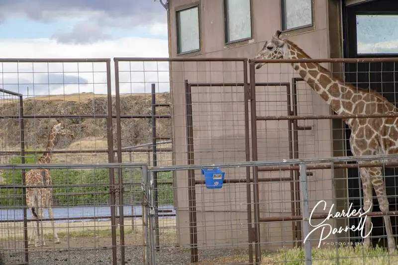
A working cattle ranch, Schreiner Farms also raises a variety of exotic animals. As you cruise along the main ranch road you’ll see enclosures on each side, filled with antelope, emu, ostrich, deer, elk, zebra and llamas. Sometimes the animals get close to the fence, and sometimes they don’t, so sightings are truly the luck of the draw. That said, at the turn-around spot — which is clearly marked — you’ll probably get a good gander of the resident giraffes. Their barn is close to the road and more often than not they hang out there. Either way, this is a great quick road trip stop along Highway 14, as you never know what you’ll see.
Sometimes wheelchairs and Mother Nature just don’t mix. Although access to natural areas has greatly improved over the years, some panoramic views are still out of reach to wheelchair-users and slow walkers. Fortunately that’s not the case on the Pend Oreille River in Northeastern Washington. In fact, thanks to the efforts of Seattle City Light and the US Forest Service, there are three well developed wheelchair-accessible Pend Oreille River viewpoints near Metaline Falls. Add in a few short trails, some interpretive exhibits and a nice mix of wildlife, and it’s a great place to slip away and enjoy mother nature for a few hours.
Vista House
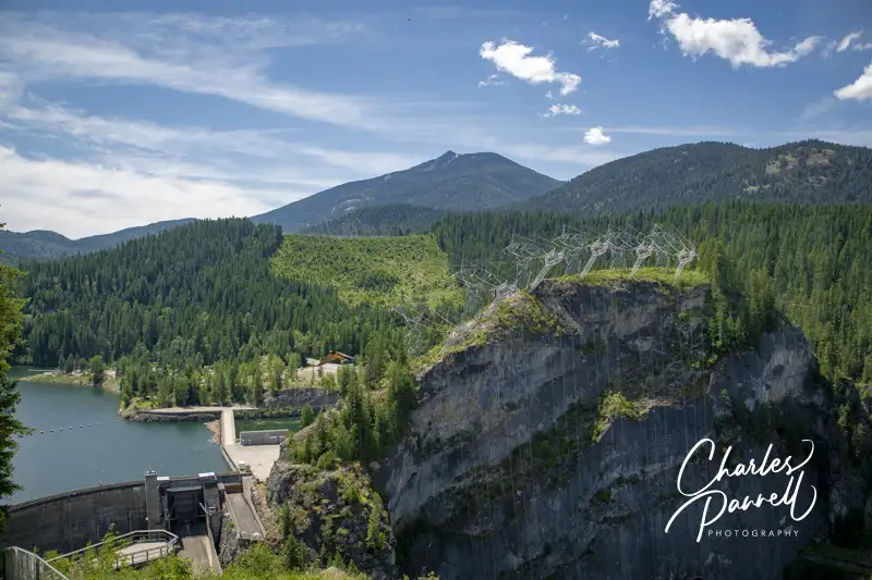
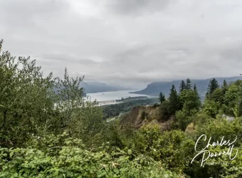
Boundary Dam on the Pend Oreille River Viewed From Vista House
Vista House, which is the first wheelchair-accessible Pend Oreille River view, is located just south of the Nelson-Metaline border crossing along the International Selkirk Loop (emerginghorizons.com/the-international-selkirk-loop-for-wheelchair-users-and-slow-walkers/). From Highway 31, (the International Selkirk Look) turn west on East Side Road near Crescent Lake. As soon as you turn on to East Side Road you’ll be captivated by the view of Crescent Lake on the left, and as you drive through the forest, you’ll see bits and pieces of it along the way. Continue along the road for about two miles, until you reach Vista House at the end of the line.
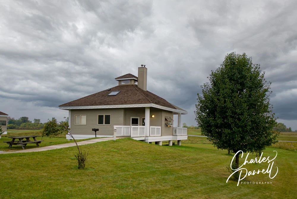
There’s plenty of accessible parking in the lot, with barrier-free access to Vista House and the nearby accessible restrooms. Vista House is a small interpretive center that overlooks Boundary Dam. There’s level access to the building, which houses a few exhibits; but to be honest the best views can be had from the outside.
There’s a standard picnic table on the left side of the building, with room at the end for a wheelchair. There are also built-in benches that line the deck area which can be used for a picnic. From the left side of Vista House you’ll get a view of the dam, and if you roll around to the right side of the building you’ll get a nice view of the Pend Oreille River.
There’s also a quarter-mile trail that leads down to a lower viewpoint, but because of the elevation change it’s really not doable for wheelchair-users. Some slow walkers may be able to do it, but take some time to evaluate the slope before you give it a try. Still, the view from top is reason enough to put this stop on your list. Even better — it’s not crowded.
Peewee Falls Overlook
Viewpoint at Peewee Falls
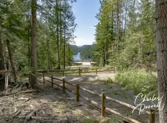
As you head back to Highway 31, be sure and stop at the Peewee Falls Overlook, which is about a mile from Vista House. The turn is well marked, and the dirt road is maintained and doable in a standard vehicle. It may be a bit dusty, but that’s just part of the rustic ambiance.
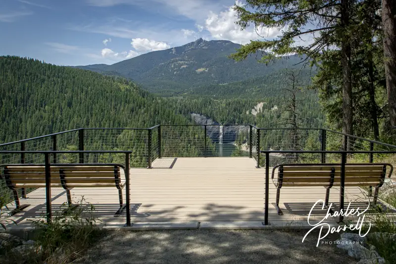
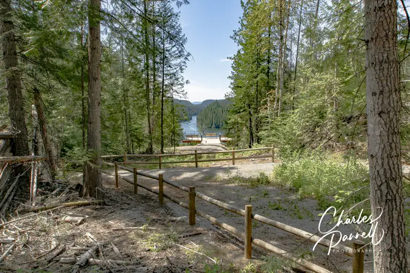
There’s plenty of accessible parking at the Peewee Falls Overlook in the large paved lot, with barrier-free access to the nearby accessible vault toilets and accessible picnic tables. From the picnic area, a hard-packed dirt trail covered in crushed gravel leads down to the viewpoint.
Peewee Falls cascades down into Boundary Lake, which was formed by the creation of the Boundary Dam on the Pend Oreille River. It’s not a massive waterfall — hence the name — but the lake isn’t very crowed and the whole view is rather calming. It’s a pleasant quarter-mile round trip stroll to the viewpoint; and again, this stop is minus the crowds.
Riverside Canyon Overlook
Trail to Riverside Canyon Overlook
Last but not least, save time for a stop at Riverside Canyon Overlook on your Pend Oreille River drive. From Peewee Falls, continue back to Highway 31 and head south. Make a right on Forest Road 172, about five miles down the road. Although it’s hard to spot the street sign, the turn is well marked by a brown “Riverside Canyon Overlook” sign. Continue down the dirt road for another mile and follow the signs to the overlook parking lot.
There’s accessible parking near the accessible vault toilets, and a level path over to the accessible picnic tables. From the picnic area a hard-packed dirt trail covered in crushed gravel leads down to the viewpoint. It’s a .4-mile one-way hike, although you can get a slight glimpse of the view from the half-way point. That said, the best view of the river is from the accessible viewing platform at the end of the trail. Although the trail is accessible it’s not level, and there are several uphill and downhill sections along the way. Still it’s within code, with spaces to rest in between the uphill sections. Additionally, you can get a good view of Hooknose Mountain from the parking lot.
After you’ve had a good dose of Mother Nature along the Pend Oreille River, you can continue on along the International Selkirk Loop, take a hike at the Mill Pond Site, and maybe even stop for a bite to eat in Metaline Falls. There’s really no shortage of accessible choices in this scenic neck of the woods.
Barrier-Free Travel Washington National Parks for Wheelers and Slow Walkers
There’s no shortage of scenic beauty in the Pacific Northwest, but the Mount Hood Infinity Loop in Northwestern Oregon offers more that its fair share of eye candy. The route begins about 20 miles east of Portland as it follows Highway 84 alongside the Columbia River, then heads south through vineyards and farmland to majestic Mount Hood. Finally it circles back north through conifer forests, and offers a picturesque side trip through a waterfall corridor.
The 135-mile loop takes about three hours to drive straight through; however it’s best to spend a few nights in the area, take your time and enjoy the stops along the way. And although the route travels through the mountains and other harsh terrain, there are plenty of wheelchair-accessible stops along the way. So get ready to hit the road and enjoy a wheelchair-accessible slice of the scenic Mount Hood Infinity Loop.
Well Dam!
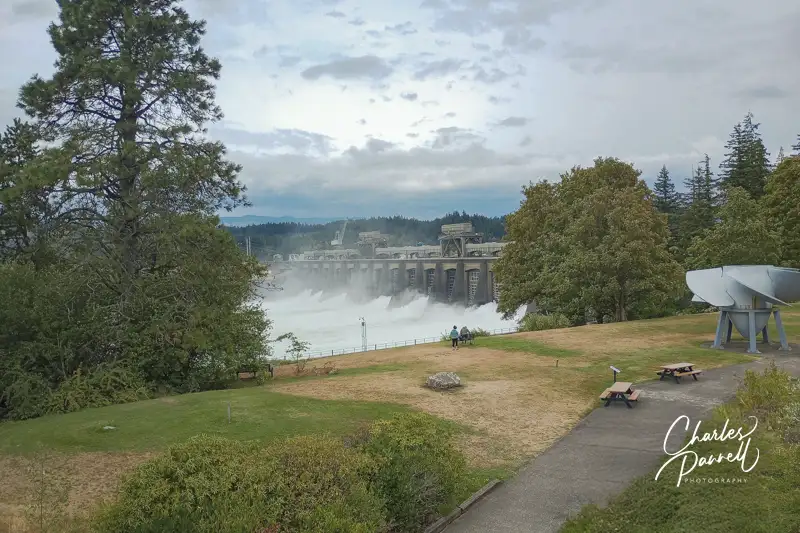
Bonneville Dam on the Mount Hood Infinity Loop
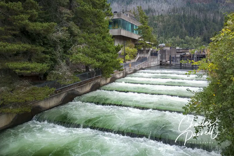
The first stop stop on this accessible Mount Hood Infinity Loop is Bonneville Dam (www.nwp.usace.army.mil/bonneville/). Built in 1938 by the Army Corps of Engineers, the site features the dam, two powerhouses, a spillway, a navigation lock, fish ladders and a fish hatchery. Just take exit 40 from Highway 84 and follow the signs. Bear right at the security gate and head over to the Bradford Island Visitor Center.
There’s accessible parking in the visitor center lot, with level access to the building. Inside, there’s plenty of room to navigate a wheelchair and there are accessible restrooms around the corner. This fourth-floor lobby serves as an information and welcome center. Start your visit with an elevator ride down to the third floor to watch a movie about the dam; then continue on down to the first floor to see some interpretive exhibits and viewing windows on the fish ladders. Complete your visit with a trip to the roof for a birds-eye view of the dam.
The navigation locks are located a short drive away, with accessible parking in front. There’s ramp access up to the viewing platform and lock visitor center. The visitor center has a collection of exhibits that explain the operation of the locks. And if you’re lucky, a ship will pass through and you’ll see them in operation.
Save some time for a stop at the fish hatchery, which includes accessible parking and paved access around the outside display ponds. There’s barrier-free access to the visitor center, which details the operations of the hatchery. There’s also level access to the nearby gift shop. It’s a pleasant and accessible walk through the shaded grounds around the ponds — and don’t forget to feed the trout.
Fish ladder at the Bonneville Dam on the Mount Hood Infinity Loop
The View From Washington
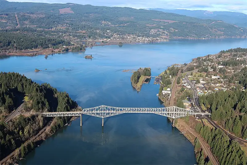
Bridge of the Gods
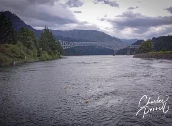
As you continue east on Highway 84, you can’t miss the Bridge of the Gods (www.portofcascadelocks.gov/bridge-of-the-gods). Originally constructed in 1926, this cantilever bridge had to be raised 44 feet after Bonneville Dam was completed. Subsequently, Charles Lindbergh flew under it in true daredevil fashion in 1927.
Although you’ll get a better view of it from afar, it’s also worth a short detour to cross this historic structure. From Highway 84, take exit 44 and follow the signs. This two-lane toll bridge, which is just 22 feet wide, spans the Columbia River and connects Oregon with Washington.
Of course once you cross over to the Washington side, you’ll have good view of the bridge, the Columbia River, and the Oregon side of things. A pleasant place to enjoy that view is Skamania Lodge (www.skamania.com), more specifically the Cascade Dining Room at Skamania Lodge. It’s a nice spot for a leisurely brunch, as it overlooks the Columbia River with views of the lush pine forests on the Oregon side. Menu offerings range from brioche bread French toast and a crab eggs Benedict to steelhead tacos, a pacific crab roll and a delicious seafood salad. The choices are tasty and the view is exceptional.
Stay a Spell
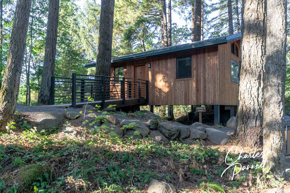
Angels Rest Accessible Treehouse Suite at Skamania Lodge, Oregon
Skamania Lodge also makes an ideal home base for a multi-day Mount Hood Infinity Loop excursion. Access is excellent throughout the property, which offers accessible lodge rooms with either a roll-in shower or a tub/shower combination. And if you’d like something a little different, spend the night in the treetops in a wheelchair-accessible treehouse (emerginghorizons.com/sleep-in-a-wheelchair-accessible-treehouse-at-skamania-lodge/).
The newest addition to the accessible lodging inventory at Skamania Lodge is a luxurious wheelchair-accessible cabin. https://emerginghorizons.com/relax-in-a-skamania-lodge-wheelchair-accessible-cabin/. Nestled away in the treehouse section of the property, this spacious cabin includes a large bathroom with a roll-in shower, a compact kitchen, a separate bedroom, a cozy fireplace and a spacious deck with a firepit — and it’s all wheelchair-accessible.
Vintage Autos & Aircraft Galore
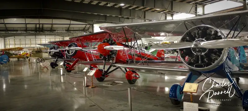
Planes at The Western Antique Aeroplane and Automobile Museum
After a Skamania Lodge visit — or overnight stay — cross back over the Bridge of the Gods and continue east on Highway 84. Take exit 62 about 20 miles down the road, then follow Country Club Drive and Barrett Road to the Western Antique Aeroplane and Automobile Museum www.waaamuseum.org. It’s a pleasant 25 mile drive, as the scenery transitions from the Columbia River landscape to the farming and agricultural region around Mount Hood.
There’s accessible parking near the museum entrance, with level access over to the building. The large collection is housed in three adjacent hangers, which have cement floors and plenty of room to maneuver a wheelchair. There’s also an accessible restroom on site, barrier-free access to the gift shop, and a power wheelchair available to rent.
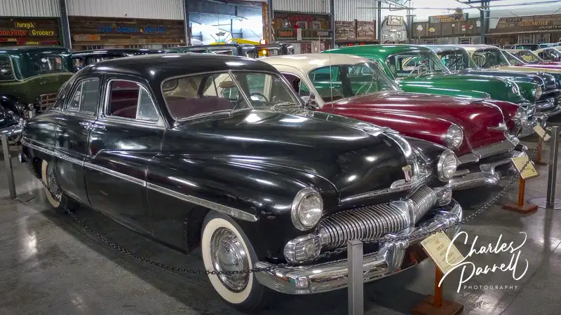
The thing that makes this massive auto, aircraft and motorcycle museum unique, is that most of the collection is flyable or drivable. And besides the aircraft and autos, you’ll find vintage furniture, appliances, toys and decorations woven between them. This museum houses much more than airplanes — it includes everything that flies, from balloons to gliders — and it also features a substantial Wright Brothers exhibit. And don’t miss the oldest Boeing aircraft, a 1928 40C mail plane — and yes it still flies.
A second hangar is devoted to military planes and includes a large collection of military equipment, from radios and MREs to bicycles, scooters and even a jeep. The final hangar is filled with over 130 cars, including a 1914 electric car, a Studebaker and a Locomobile. And if you get tired, there are plenty of spots to sit and take a break along the way. It’s an excellent and often overlooked museum.
Autos at the Western Antique Aeroplane and Automobile Museum
At the Summit
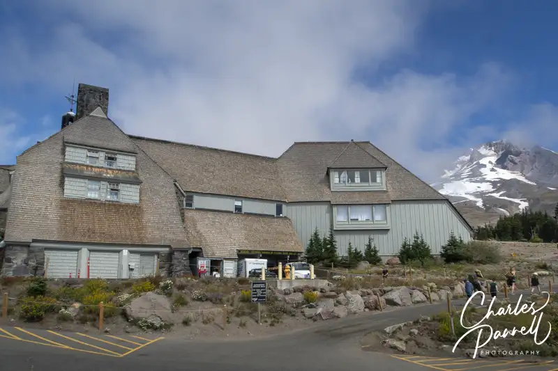
Timberline Lodge at Mount Hood, Oregon
One of the highlights of the Mount Hood Infinity Loop, is a visit to Timberline Lodge (www.timberlinelodge.com) at the summit. From the Western Antique Aeroplane and Automobile Museum follow Odelle and Davis Drive to Highway 35 south, then take Highway 26 east to the Timberline Highway. From there it’s just a six mile drive; however the road has up to a 10% grade with numerous switchbacks along the way. Timberline Lodge is located at 6,000 feet, and it’s not unusual to see snow there, even in the summer.
Known as the showplace of Works Projects Administration projects, Timberline Lodge was dedicated in 1935 by President Roosevelt. The consulting architect, Gilbert Stanley Underwood, who designed national park lodges in Yosemite and Bryce Canyon, was known for using natural materials to help his buildings blend in with their surroundings. The Underwood style caught director Stanley Kubrick’s eye, and he ultimately used aerial shots of the property in the opening scenes of The Shining.
And although the drive is certainly scenic, the best plan of action is to enjoy a little time on top, look around the lodge and have lunch. There are two different parking areas on top. The lot close to the lodge is reserved for overnight guests, while the one further away is for day visitors. And the walk to the lodge is uphill from the day-use parking. Still if you stop at the guard shack and tell them you have a disabled passenger they will let you drive in and drop them off. Although there are steps up to the front entrance, there’s plenty of accessible parking near an elevator that takes you up to the lobby level. It’s a pleasant place for a midday break.
Mount Hood History
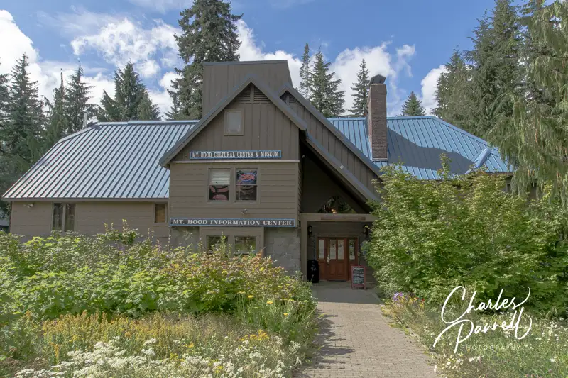
Mount Hood Cultural Center & Museum
After you get descend from the mountaintop, take a little time to learn about some local history at the Mt. Hood Cultural Center & Museum mthoodmuseum.org. To get there, continue east on Highway 26, then make a right on Government Camp Loop, about a quarter-mile down the road. The Mt. Hood Cultural Center & Museum is on the left, with street parking in front.
Accessible parking is located near the museum, with level access over to the building. And although the museum occupies several floors, there’s elevator access between them.
Downstairs, there’s an information center and a gallery that focuses on the history of the ski area and the local ski and recreation clubs. Upstairs there’s a gallery that showcases the works of Mount Hood area artists, and another one that boasts a large collection of skis and details the history of skiing. There’s also a gallery that focuses on the early exploration of the area and one that includes exhibits about the natural history and the regional flora and fauna. All in all this small museum offers a good primer of the area, with volunteers on hand to help you plan your visit, and loads of free brochures available to map out your travels.
Take a Hike
Cascade Streamwatch Trail in the Recreation Area
If you’d like to get out and enjoy a hike or two, head on over to the Wildwood Recreation Site www.blm.gov/visit/wildwood-recreation-site, which is on Highway 26 about 13 miles east of the Mt. Hood Cultural Center & Museum. This site has two accessible trails and a nice picnic area. And although there is a day-use fee at this area, the America the Beautiful Access Pass (emerginghorizons.com/how-to-get-a-lifetime-national-park-pass/) is also good there.
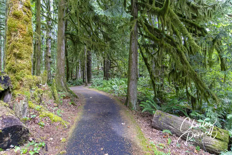
The Cascade Streamwatch Loop is located all the way at the end of the the main park road. There’s accessible parking near the accessible restrooms, and level access over to the trail. Make a right just past the amphitheater and follow this .75-mile paved loop through the alder and conifer forest. Be sure and take a slight detour near the beginning of the trail to the underwater viewing window, where you can see the hidden side of the river ecosystem. After you rejoin the main trail, continue alongside the Salmon River and loop back to the beginning. There are benches to rest along the way, and the picnic area near the pavilion includes an accessible table on level ground. It’s shaded by the trees, and a very pleasant place to take a break.
The equally accessible Wetlands Loop can be accessed from the next parking lot. Although there is a connector trail from the Cascade Streamwatch Loop, it’s steep and not accessible. Accessible parking and restrooms are located near the trailhead, with level access over the .75-mile trail. It begins as a paved trail, crosses the river and continues as a boardwalk through the cattail marsh, before it reconnects to the paved trail and loops back to the parking area.
Million Dollar View
Jonsrud Viewpoint on Highway 36
You’ll catch fleeting glimpses of Mount Hood from Highway 26, but for a great photo op continue east along the thoroughfare to an often overlooked viewpoint. It’s located about four miles down the road in Sandy. Turn north at the Walgreens on Bluff Road, then continue on for about a mile to the Jonsrud Viewpoint, on the right.
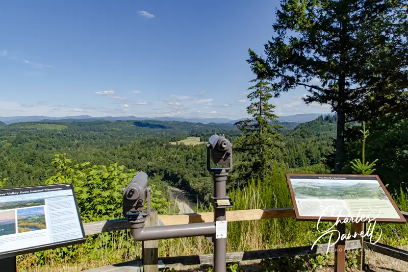
There’s accessible parking near the viewpoint, with curb-cut access to a brick path to the overlook. From there you’ll get what’s billed as “one of the best views of Mount Hood in Oregon.” There’s also a wheelchair-height viewing scope, which allows folks who are color blind to view the vivid scenery of the Sandy River Valley. This neighborhood overlook is also the perfect spot to wait out the clouds and for an unobstructed view of Mount Hood. It’s a great little detour.
Tracking Sasquatch
North American Bigfoot Center
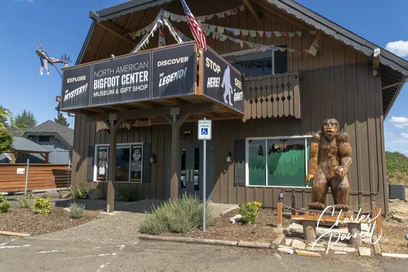
Once you’re back on Highway 26, continue east for five miles to Boring, and make a stop at the North American Bigfoot Center northamericanbigfootcenter.com. Located just off the highway it’s easy to find — turn in at the Chevron, then wind past Chester’s Pub to the back of the parking lot. You can’t miss this eclectic attraction, as the entrance is marked with a giant Bigfoot statue.
There’s accessible parking and a level entrance to the museum, which houses Bigfoot evidence and artifacts from around the world. There’s plenty of room to navigate a wheelchair throughout the galleries, and to roll up to a life-sized Sasquatch (named Murphy) for a photo.
The galleries are filled with photos, films and descriptions of first-person sightings of Bigfoot from around the world. From Vietnam and Australia, to Western Sumatra, California and of course the Pacific Northwest, there are Bigfoot stories from nearly every corner of the world. There’s also a robust collection of Bigfoot artifacts, including, footprints, handprints, fingerprints and even hair (in a Nutella jar). And if you’d like some first-hand information on Bigfoot, the museum is staffed with experienced field researchers who are happy to share their stories. Don’t miss the gift shop, which has a solid collection of Bigfoot books, clothing and assorted trinkets. Even if you don’t buy anything, it’s quite entertaining to browse through the assorted offerings.
A Waterfall Detour & More
Bridal Veil Falls
After you’ve had your Sasquatch fix, continue east on Highway 26 to Troutdale and make a quick stop at Barn Hall (www.facebook.com/THSkingofroads/). Although this small museum has limited hours (check the website), it includes some interesting exhibits about the history of the area. The barn itself was constructed in 1988 by the Troutdale Historical Society, and 10 years later they opened their doors. The exhibits change up a bit every few years, but they always focus on the history of the Columbia River Gorge.
There’s no striped parking in the gravel lot, but depending on the crowds, it’s usually possible to parallel park an adapted van, with room to deploy the ramp. There’s barrier-free access to the museum, and plenty of room to maneuver a wheelchair inside. Although it’s a small museum, it’s definitely worth a stop if you can catch it open when you’re in the area.
To complete the Mount Hood Infinity Loop, hop on Highway 84 and continue east. There is, however, a highly recommended short scenic waterfall detour along the way (emerginghorizons.com/explore-the-historic-columbia-river-highway-waterfall-corridor/). From Highway 84 take exit 22 at Corbet, then follow Corbet Hill Road south on this short section of the Columbia River Highway. The two-lane road meanders past five waterfalls, and it’s especially scenic during the spring runoff. You can drive straight through or stop and linger along the way. Either way, it’s a worthy side trip. And when you’re through, hop back on Highway 84 and continue on your way. It’s the perfect ending to any Mount Hood Infinity Loop scenic drive.
Barrier-Free Travel Washington National Parks for Wheelers and Slow Walkers
Located just west of Spokane, Way Out West Statue Farm is worth a stop on any Interstate 90 road trip. Owned by two brothers who relocated from downtown Spokane, this rural property allows them plenty of room for expansion. You get your first glance of the property on the north frontage road while driving east on Interstate 90. Fortunately it’s not hard to backtrack. Just take the next exit (272), cross the freeway, then head west on the frontage road. The parking lot is not paved and it has gravel to fill in the low spots, so it’s not that great for most wheelchairs. That said, the whole area where the metallic works of art are displayed is level. The pathways are narrow and not paved, but it’s still a great choice for slow walkers. But if you have a little help it may also work for some wheelchairs.
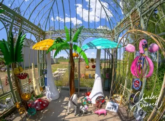
The selection of yard art is second-to-none at the Way out West Statue Farm. You’ll find a little bit of everything, from signs and metal sculptures to small decorations and larger works of art. A chicken here, an alligator there, flamingos planted in the flowerbeds and a cactus or two are just a few examples of the offerings; but trust me, there’s much more. Everything is for sale, but browsers are also welcome. There are no pushy salespeople there; in fact if you want to buy something you’ll have to flag down one of the owners who are usually roaming the grounds in golf carts. If you can’t find them, then just ask — the other tenants are usually out and about and they will go and fetch them for your. As one friendly guy told me “It’s part of our job”. Either way it’s a fun stop, and I came home with a cool “welcome rooster”. And had a wonderful conversation with the owner, who wanted to make sure the rooster was going to a good home. This fun roadside attraction is also worth a revisit, as the selection constantly changes, but the owners are always friendly. And don’t miss their trademark alien spaceship.
Population 43
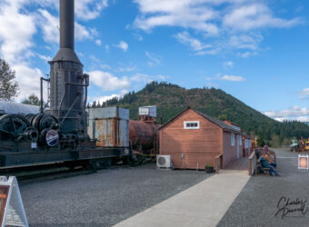
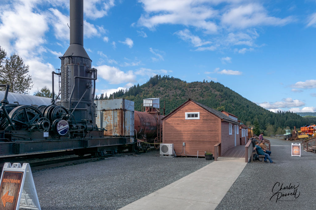
Elbe makes a good stop on the way to Mount Rainier National Park, as it’s just 13 miles from the Nisqually Entrance. One of the big attractions in town is the Mount Rainier Railroad (https://mtrainierrailroad.com/), which operates daily excursions. The Elbe Depot features accessible parking with level access to the ticket office. Lift access is available to the train, which travels through the forest and gives passengers an excellent view of Mount Rainier — if it’s not obscured by clouds. It’s a fun, scenic and educational excursion; and a must-do for train buffs.
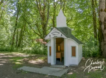
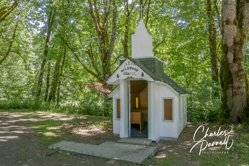
Constructed in 1997, Wildwood Chapel makes a good stop on the way to North Cascades National Park. This tiny chapel is located along Highway 20 near mile-marker 103.5, across the street from Glacier Peak Winery.
There’s a level spot to parallel park near the nondenominational chapel and level access over to the pint-sized building. Constructed by local Tootsy & Rudy Clark, the chapel seats nine, with three two-person pews and three single seats. There’s a slight lip at the 28-inch doorway, but be careful if you wheel inside, because there’s no room to turn around. All in all, the best view is from the doorway.
It’s a pleasant shaded site near the Skagit River, and today many folks use it as a wayside chapel. And yes there have been weddings there.
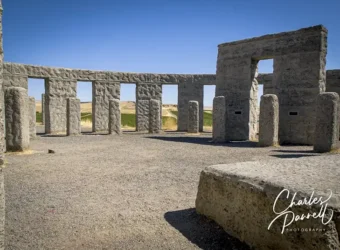
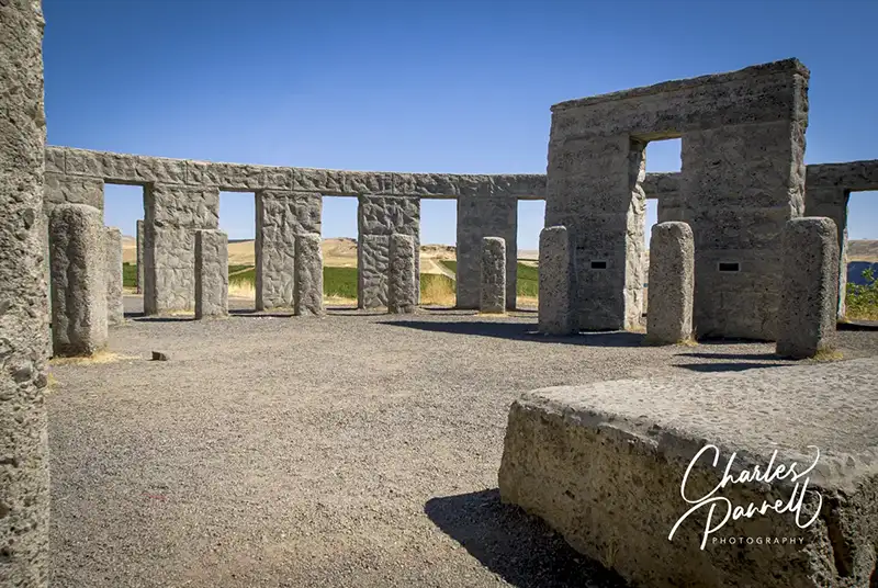
This full-size Stonehenge Memorial is located on the south bank of the Columbia River, just off of Interstate 84, near Biggs Junction, Oregon. Take exit 131, then head north on Highway 97, and make a right on Highway 14. Stonehenge Drive is located just a mile up the road. This monument was erected in 1918 as a memorial to local soldiers who died in World War I. A small memorial ceremony is held on the anniversary of the death of each of the 14 soldiers honored at the monument.
There’s no striped parking at the Stonehenge Memorial, but there’s usually plenty of room to parallel park an adapted vehicle near the monument. Some wheelchair-users may need assistance over the first 15 feet of gravel, but after that it’s hard-packed dirt. There’s plenty of room to explore in and around the monument, which is all on level ground. And if you don’t want to get our of your car, you can also get a great windshield view from the parking area. It’s a nice stop to or from the Columbia River Highway (emerginghorizons.com/explore-the-historic-columbia-river-highway-waterfall-corridor/).
Located in Newport, near the end of the International Selkirk Loop (emerginghorizons.com/the-international-selkirk-loop-for-wheelchair-users-and-slow-walkers/), the Pend Oreille County Historical Museum offers a fun glance into the past. Look for it on the right just as you enter Newport on Highway 2, right next to the Newport Visitor Center, There’s accessible parking in the lot, with level access to the museum. Although the first building is filled to the brim with everything from vintage rodeo gear, an old printing press and even some dental tools from a bygone era, that’s only the beginning. There’s ramp access to the other building that houses even more inside exhibits; and level access around the outside exhibits which include everything from an old schoolhouse to a pioneer church. And if you want to learn about the history of the area, there are knowledgeable volunteers on duty. After you’re done, be sure and slip across the street to Owens (facebook.com/owensgro), for a tasty scoop of homemade huckleberry ice cream.
February is the month of love, and many folks celebrate it with a Valentine’s Day romantic retreat with their sweetheart. And although most chain hotels have at least minimal wheelchair access, that can’t always be said for quaint inns, rustic lodges and cozy cabins. With that in mind here’s a selection of some unique wheelchair-accessible picks that will simply wow your sweetie this Valentine’s Day.
Black Bear Inn
The Black Bear Inn in Arnold, California
emerginghorizons.com/sleep-near-the-big-trees-in-calaveras-county/
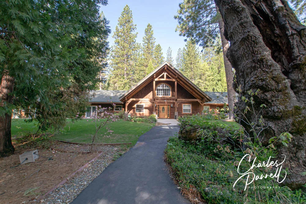
Located in the logging town of Arnold, this Central California mountain lodge is surrounded by the forest. The accessible Calaveras Suite is furnished with a comfy king-sized bed and includes a spacious bathroom with a roll-in shower. Add in a cozy fireplace in the gathering room and you have the perfect romantic package.
Asilomar
The “Stuck-Up” Inn at Asilomar Conference Center
emerginghorizons.com/escape-to-the-monterey-peninsula/
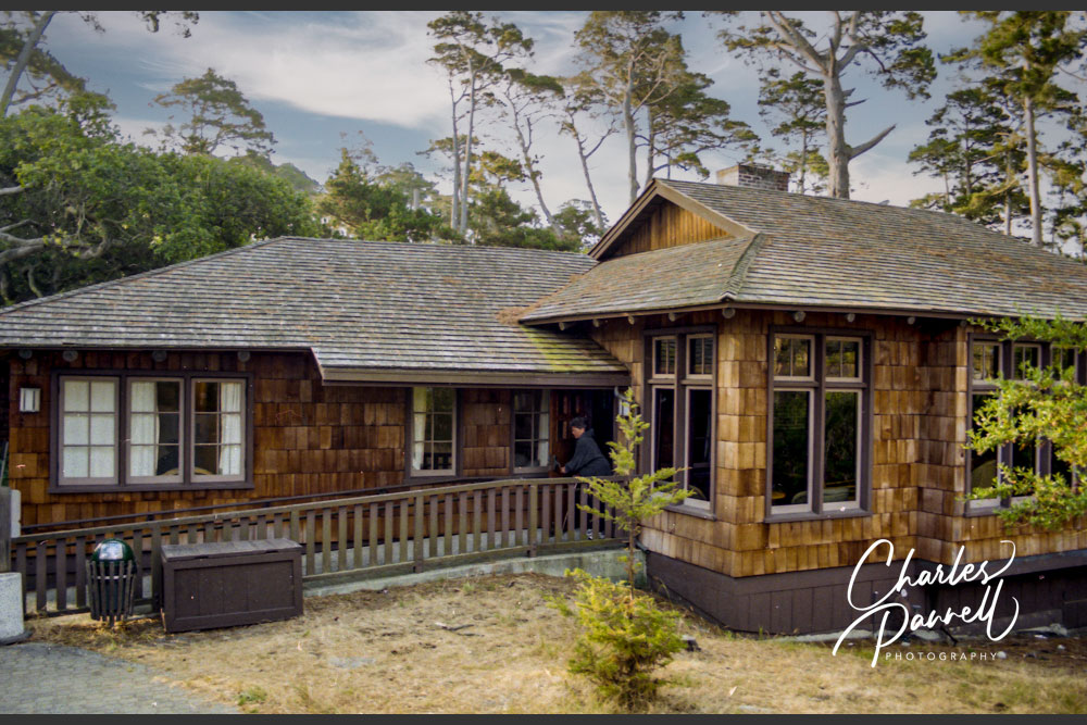
If you’d prefer a coastal escape, then look no further than Asilomar, which is located near Monterey in Northern California. Two accessible rooms are located in the historic section of this property, and they both include a bathroom with a roll-in shower. It’s not unusual to look out your window to see deer grazing outside; and there’s nothing better than a romantic stroll along the beach on the accessible Dunes Boardwalk.
Jim Bridger Cabins
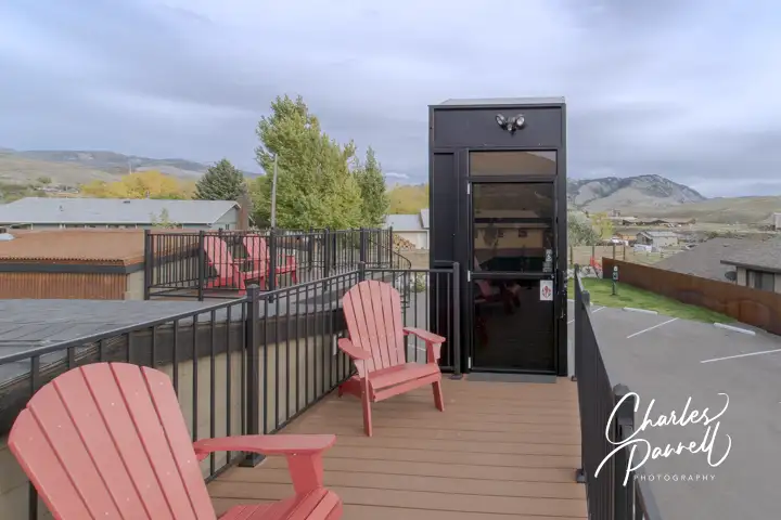
Rooftop deck on Cabin 2 at the Jim Bridger Explorer Cabins
emerginghorizons.com/wheelchair-accessible-yellowstone-lodging-at-jim-bridge-explorer-cabins/
Located in the northern gateway to Yellowstone National Park, this small complex of nine cabins includes an accessible unit. It features two bedrooms, a small kitchen and living area, and a bathroom with a roll-in shower. Enjoy s’mores around a nearby fire circle or watch the sunset from the accessible rooftop deck. Or just snuggle up next to the fire inside.
Victoria Inn
Entry to room 15 at the Victoria Inn
emerginghorizons.com/spend-the-night-at-the-murphys-victoria-inn/
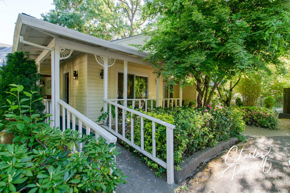
This California Gold Country Inn exudes a decidedly old world ambiance. The accessible unit is located a short walk from the main building, and has its own private entrance. It’s furnished with a queen-sized bed and the bathroom includes a 36-inch square transfer-type shower. And there’s a cozy front porch where you can enjoy a glass of wine, before you stroll down Main Street for dinner.
Maumee Bay Cabin
Cabin 17 at Maumee Bay Lodge
emerginghorizons.com/wheelchair-accessible-maumee-bay-cabin/
This northern Ohio cabin is located a short drive from the main lodge. There’s an accessible bedroom with a king-sized bed downstairs, as well as a bathroom with a roll-in shower. Other features include a spacious deck which overlooks the adjacent marsh, and a large fireplace in the great room. Even better, it offers plenty of privacy for a romantic retreat.
Skamania Lodge Treehouse
Angels Rest Accessible Treehouse Suite at Skamania Lodge, Oregon
emerginghorizons.com/sleep-in-a-wheelchair-accessible-treehouse-at-skamania-lodge/
Last but not least in our Valentine’s Day picks is this romantic treehouse at Skamania Lodge. It’s located in a quiet corner of this Washington property, and it offers ramp access to the front door. Inside, windows line the walls, so you feel surrounded by the forest. It’s furnished with a king-sized bed, and the bathroom includes an oversized roll-in shower. Top it off with a spacious deck and an indoor-outdoor fireplace and you have the perfect romantic retreat. So perfect, that a segment of The Bachelorette was filmed at this property!
Barrier-Free Travel California National Park Road Trips for Wheelchair-Users and Slow Walkers
Located in Northern Oregon, the Historic Columbia River Highway parallels Interstate 84 and runs from Troutdale to The Dalles. This scenic two-lane road, which is also known as Highway 30, snakes through the Columbia River Gorge and offers some spectacular windshield views. And although Interstate 84 is the quicker way to traverse the gorge, Highway 30 is definitely the more picturesque choice.
Granted, there’s no shortage of bold scenery along the entire length of the 75-mile route; however the 10-mile segment between Vista House and Horsetail Falls is a don’t-miss side trip for wheelchair-users and slow walkers. Known as the waterfall corridor, this segment includes a number of wheelchair-accessible viewpoints, trails and historic stops, and offers a closer look at some of the beautiful cascades along the way.
Vista House
The Vista House on the Columbia River Highway Waterfall Corridor
Finding the waterfall corridor is easy. Head east from Portland on Interstate 84, then take exit 22 at Corbett and turn right. From there just follow the signs, and make a left on the Historic Columbia River Highway. This portion of the road winds through the forest for about three miles, before it heads uphill to Vista House at Crown Point (www.vistahouse.com).
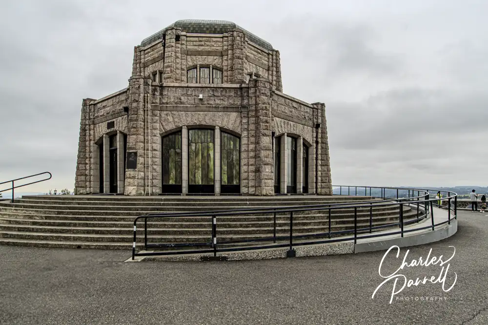
Built in 1916 as a rest stop and observation tower, Vista House is a fitting starting point for the drive, as it was also the site of the 1916 dedication of the highway. There’s accessible parking near the front, with ramp access around to the back entrance. There’s level access through the automatic doors and plenty of room to maneuver around the main floor of this architectural treasure. Perched some 600 feet above the Columbia River, Vista House is lined with marble floors and filled with stained glass windows.
Listed on the National Register of Historic Places, this historic building also includes a cleverly hidden wheelchair lift. Designed to blend in with the architecture, the lift allows wheelchair-users and slow walkers access to the restrooms, exhibits, gift shop and cafe that are housed in the lower level. The building is usually open from Friday to Monday, but it depends on available staffing. And even if the building isn’t open you can still peer inside. There’s also a great river view near the back entrance.
Latourell Falls
Latourell Falls is located 2.5 miles up the road, in the verdant Guy W. Talbolt State Park. There’s accessible parking with level access over to a viewing area, where you can get a gander at the majestic falls, as it tumbles 224 feet down over columnar basalt pillars. There’s a trail to an upper viewing area, but it’s steep and not wheelchair-accessible. Still you can get a great view from below.
There’s also an accessible vault toilet at this stop. And if you’d like to enjoy lunch alfresco, there’s an accessible picnic table located near the parking lot.
Bridal Veil Falls
Bridal Veil Falls, which is located two miles up the road, is also worth a stop. Although the trail to the the falls is steep and has steps, there’s another accessible trail that offers a good river view. There’s accessible parking in the large lot, with level access over to the trailhead. The trail to the right goes up to the falls, while the accessible Overlook Trail on the left leads over to the river. There’s also an accessible vault toilet near the trailhead.
The half-mile Overlook Trail has a few bumps along the way, but it’s still doable for most wheelchair-users and slow walkers. It winds through the woods, passes a picnic table and then skirts the river. There are a few places where you can get good view of the Columbia River, before the trail winds back through the woods to the beginning. It’s a pleasant stroll, and definitely worth a stop.
Wahkeena Falls
As you continue along Highway 30, Wahkeena Falls is located three miles up the road. Accessible parking is available on the left, above the picnic area. There’s also an old restroom with an accessible stall in the picnic area; however it’s best to drive down if you need to use it, as the road is pretty steep.
The accessible trail to the falls viewpoint is located across the street. The 200-foot paved trail is fairly level and winds over to the perfect vantage point. You can’t see these falls from the road, but there’s a great view of them at the end of the accessible trail.
Multnomah Falls
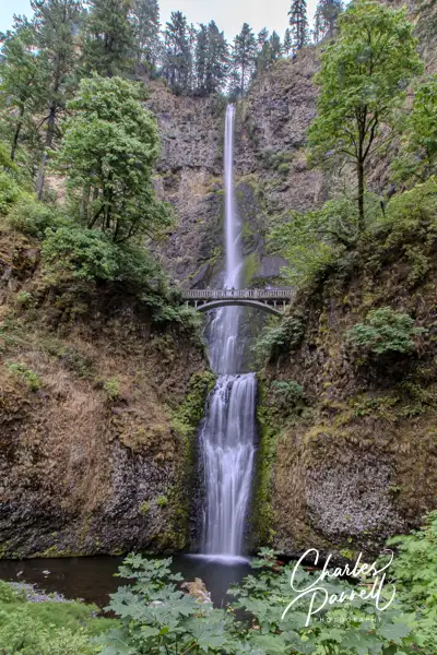
By far the most popular waterfall along the route is Multnomah Falls, which is located a half-mile from Wahkeena Falls. There’s accessible parking in the small lot across from Multnomah Falls Lodge, with level access over to the lower viewing area. Across the street, there’s a paved walkway that leads about 200 yards to the upper viewing area. Although this is a good option for power wheelchair-users, it’s a bit steep for manual wheelchair-users and slow walkers. Still you can get a nice view from the lower vantage point.
There’s level access to the lodge, which houses a visitor center and a gift shop on the lower level; and offers elevator access up to the restaurant on the second floor. Accessible restrooms are also located on the lower level. And if you drive by slowly, you can get a nice view of the falls from Highway 30.
There’s also a parking area located off of Interstate 84 for this popular stop. Just take exit 31 and follow the signs. There’s plenty of accessible parking in the lot; however the path over to the Highway 30 parking area is steep — especially near the bridge — so it’s not a viable option for most folks. The best bet is to park in the Highway 30 parking area. It should also be noted that there is no vehicular access from the Interstate 84 parking area to the Highway 30 parking area; so if you use the Interstate 84 parking area you won’t be able to drive to the Historic Columbia River Highway from there.
Multnomah Falls Timed Use Permit
During the peak summer season, a Multnomah Falls Timed Use Permit is required in order to park in the parking lot off of Interstate 84. The permit is required from late May to early September from 9 AM to 6PM. One permit per car is required, and the permits are checked on the path from the parking lot to the falls.
The permits are available for $2 at www.recreation.gov. They are valid for entry during a one-hour time frame, and if not used they will expire at the end of the issued time. For example, if you buy a permit for 1:00 PM and have not used it by 2:00 PM it will expire at that time. That said, you can spend as much time at the falls as you want, as long as you enter within the specified time frame.
The bulk of the permits are available 14 days in advance; while a smaller batch is released two days prior to the arrival date. Permits are not sold on site, so make sure to get one ahead of time. Additionally, just because you have a permit, does not mean you are guaranteed a parking space.
Horsetail Falls
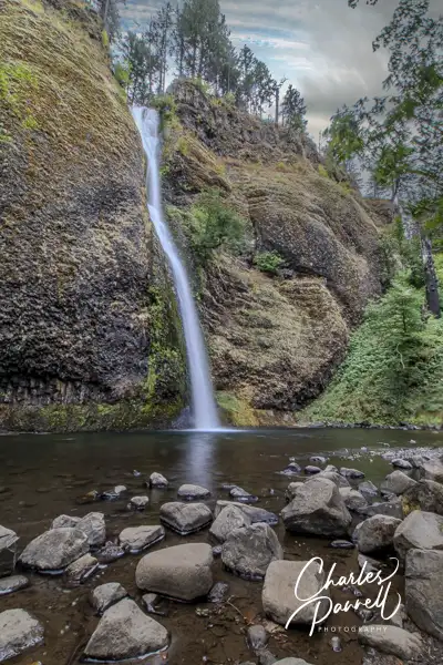
Last but certainly not least on this Historic Columbia River Highway drive is Horsetail Falls, which is located 2.5 miles from Multnomah Falls. There’s accessible parking in the lot across the street from the falls. From there a short paved level trail leads 150 feet over to a nice viewpoint. There are also a few picnic tables near the viewpoint, and although there are no services at this stop there’s a bench to sit and enjoy the falls. As an added bonus, you can also get an excellent view of Horsetail Falls from Highway 30 or even from the adjacent parking lot.
After you’d had time to enjoy the falls, continue east on Highway 30 to Dodson, and hop on Interstate 84. From there you can either circle back to Portland, or continue east to explore more of Oregon. Either way, this scenic drive is well worth the short detour.
Latourell Falls
Bridal Veil Falls
Multnomath Falls
Horsetail Falls
Historic Columbia River Highway Travel Tips
Although the scenic waterfall corridor is a must-do on any Oregon road trip, there are a few things you can do to make your visit go smoother.
First and foremost, try and arrive early in the day. The route gets extremely crowded in the afternoon, and parking places — even accessible spots — are hard to come by.
The early bird rule applies double for the Multnomah Falls area. Even if you don’t plan to stop, that section of the route routinely backs up after 11 AM, as people sit in the road and wait for available parking spots.
It’s also a good idea to travel from west to east along the route. Most of the e-bike rentals begin at Cascade Locks and head west along Highway 30; and since there aren’t any alternative trails they have to ride in the road along the waterfall corridor. This tends to slow down the traffic that’s going in the westerly direction, and even backs it up at some spots.
There aren’t many services along the waterfall corridor, so pack along water and snacks. There are however a lot of pleasant picnic spots to enjoy a quiet breakfast or lunch.
Summer is the most crowded season along the Columbia River Gorge, so try to visit in the off season. The peak flow seasons for the waterfalls are winter and spring, which are usually less crowded.
Fall is also becoming a busy time along the route, as the fall foliage show is spectacular. It’s especially crowded on the weekends, so try to visit mid-week if possible.
Finally, take your time and stay a while to enjoy the Columbia River Gorge. For a fun getaway, spend the night in an accessible treehouse at nearby Skamania Lodge.
Barrier-Free Travel Washington National Parks for Wheelers and Slow Walkers

 Lyle, WA 98635