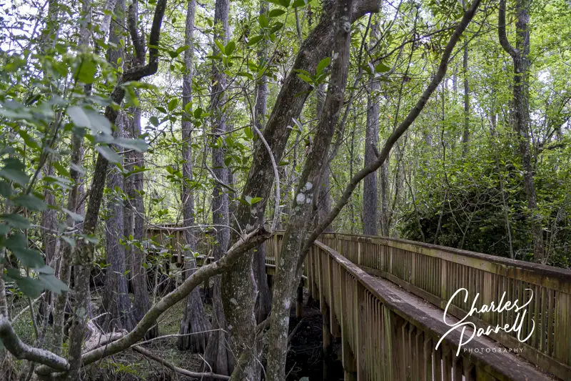
Eagle Lake Bridge on Historic Carriageway in Acadia National Park, Maine
Acadia National Park is known for its historic carriage roads. They were commissioned by John D. Rockefeller Jr., who preferred to travel on motor-free byways by horse and carriage. Built between 1913 and 1940, the roads feature stone-faced bridges, impressive waterfalls and scenic cliff side views. And then there are the granite stones that were used as guardrails, which are known a “Rockefeller’s teeth”. Today 45 miles of these auto-free roads still traverse the park; and although you can certainly walk or roll along them,there are also two wheelchair-accessible Acadia National Park excursions that everyone can enjoy.
Ride A Trike
First up in the wheelchair-accessible Acadia National Park excursions are the wheelchair-accessible trike rides presented by MDI Wheelers (mdiwheelers.org). These rides are conducted on electric assist trikes piloted by volunteers. The pilots peddle and maneuver the trikes from the back, and the passengers sit in the front in a passenger seat that looks somewhat like a wheelchair.
The rider transfers from their wheelchair to the passenger seat, and is then secured with a safety harness. The rider also wears a helmet. The trikes have a weight limit of 225 pounds, and if a rider cannot transfer independently they must provide their own assistance.
The rides begin at Eagle Lake, and family members and friends are invited to ride along on their own bikes. And just to make sure everything goes off as planned, two volunteer safeties ride along next to the MDI Wheelers trike on standard bicycles. The trike rides are only offered during the summer months, weather permitting, and they are free.
For more information about the rides, visit the MDI Wheelers website. And to schedule a ride, use their contact form on the website or give MDI Wheelers a call at (207) 288-3511.
A Wheelchair-Accessible Acadia National Park Carriage Ride
If you’d prefer a more traditional tour on the carriage roads in Acadia National Park, then schedule an outing with Acadia by Carriage (acadiabycarriage.com). This company offers wheelchair-accessible carriage rides along this historic park roads; and thanks to a generous donor, wheelchair-users and their companions get a discounted rate.
The accessible horse-drawn carriage features ramp access in back, and plenty of room for a wheelchair. There’s also room for an additional two to three passengers on board on the bench seats. And since safety is a top priority, there’s a tie-down to secure the wheelchair. The folks at Acadia by Carriage are huge proponents of inclusion, and they can accommodate both manual wheelchairs and power wheelchairs.
The carriage rides depart from Wildwood Stables, which is located just off Park Loop Road. The Island Explorer Bus, which is wheelchair-accessible, also stops at Wildwood. The wheelchair-accessible carriage rides last between one and two hours. For more information or to book a ride, call Acadia by Carriage at (207) 600-7204 , or drop them an e-mail at info@acadiabycarriage.com.
So make it a point to explore the carriage roads on your next visit to Acadia National Park. They’re more accessible than you think.
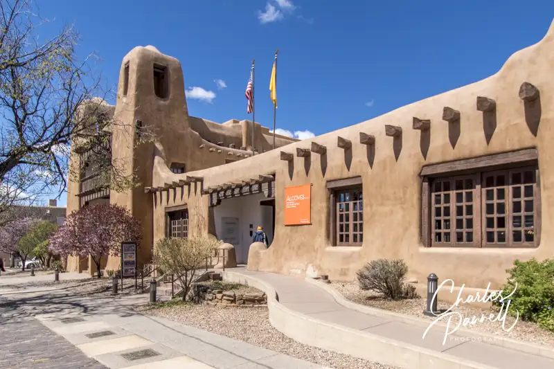
The best way to see old town Santa Fe is on foot. That said, there are more than a few access obstacles in the historic heart of the city near the Plaza — an area that dates back some 400 years. On the other hand, with a little advance planning and careful route selection, it’s still possible to see the cultural highlights of this area with minimal walking. With that in mind, here’s a barrier-free Santa Fe walking — or rolling — tour, with stops at a number of accessible cultural attractions along the way.
St. Francis Cathedral
Inside The Cathedral Basilica of St. Francis of Assisi
First up on the wheelchair-accessible Santa Fe walking tour is St. Francis Cathedral (cbsfa.org/), which is just a block from the Plaza. Just head east on Palace Avenue, then turn south on Cathedral Place. St. Francis Cathedral is on the left — you can’t miss it.
Built by Archbishop Jean Baptiste Lamy between 1869 and 1886, this Santa Fe landmark is the mother church of the Archdiocese of Santa Fe. And although there are steps up at the front of this Romanesque Revival building, there’s also ramp access on the left side. Inside, there’s barrier-free access throughout the church, with accessible seating in the chapel.
The center aisle is lined with Corinthian columns, and accented with graceful arches. A massive baptismal fountain sits near the center of the church, and the intricately carved main altar is a sight to behold. Top it off with the stations of the cross, an impressive collection of historic paintings, and stained glass windows that were imported from France, and you have a truly magnificent sanctuary.
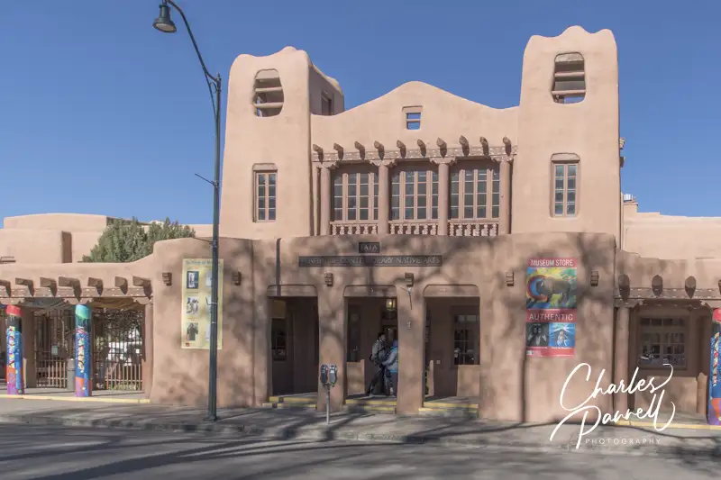
Museum of Contemporary Native Arts
The Museum of Contemporary Native Arts
The Museum of Contemporary Native Arts (iaia.edu/mocna/), which is located across the Street from St. Francis Cathedral, is often overlooked by visitors, but it’s truly a must-see on any Santa Fe visit. And there’s a discounted admission for disabled visitors, and no charge for caregivers.
Although there are steps up to the front entrance, there’s curb-cut access and a barrier-free pathway to that same entrance from San Francisco Street. Inside, there’s plenty of room to maneuver a wheelchair through the spacious galleries which display select works from a 7,500-object collection of contemporary native art. From paintings, textiles and cultural arts, to sculptures, ceramics and jewelry, there’s something for just about everyone.
There’s also level access out to the first-floor courtyard which boasts an impressive collection of public art, and to the adjacent galleries which host a wide variety of rotating exhibits. And if you like what you see, don’t forget to stop in at the well-stocked gift shop on the way out.
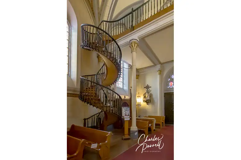
Loretto Chapel
The Miraculous Staircase of the Loretto Chapel
From the Museum of Contemporary Native Arts, head south on Cathedral Place and take a right on Water Street and a left on the Old Santa Fe Trail, to what many folks consider one of the most mysterious sights in town — the Loretto Chapel (lorettochapel.com/). There’s level access to this beautiful chapel, where visitors can also admire the stained glass windows, the stations of the cross, the Italian-made altar, and of course the famous staircase to the choir loft that lacks any visible support.
The story behind the creation of the staircase is an age-old mystery. According to legend, the sisters of the chapel prayed to St Joseph — the patron saint of carpenters — for a way to access the then stair-less choir loft. Shortly thereafter an unknown carpenter appeared and constructed the spiral staircase, and left without payment. That was in 1878, and although a railing was added over the years for safety, the staircase remains as it was constructed — without any center or side support. Visitors can linger on as long as they want in the chapel, and enjoy the beauty of it all.
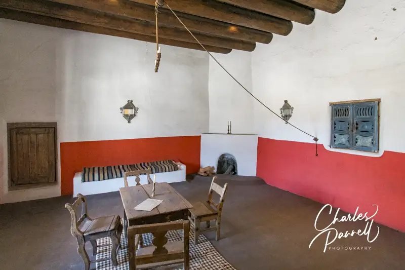
Palace of the Governors
Old Governors Office in the Palace of the Governors
One of the highlights of old Santa Fe is the Palace of the Governors (palaceofthegovernors.org), which was constructed in the early 17th century as Spain’s seat of government over what’s now known as the American Southwest. Designated as a Registered National Historic Landmark in 1960, today this historic building houses part of the state’s history museum.
As an added bonus, the stroll from the Loretto Chapel is very scenic. Just follow the Old Santa Fe Trail north past San Francisco Street, along the Plaza and over to the Palace of the Governors. Alternatively, you can cut through the Plaza; however even though the Plaza pathways are wide and level, there are some uneven brick sections that may be problematic for wheelchair-users.
You can’t miss the Palace of Governors, as it’s usually lined with a gaggle of Native American vendors selling their wares. And although that’s certainly worth a stop itself, it’s also worth a look inside. Access to the interior of this historic adobe structure is through the Lincoln Street entrance to the New Mexico History Museum, which is located next door on Lincoln Street. So save some time to the peruse the inside of this historic building which is filled with objects that have been unearthed by archaeologists, including pottery, utensils and weapons. The exhibits span two floors, with elevator access to the second floor, and there’s always an interesting rotating exhibition or two in the mix.
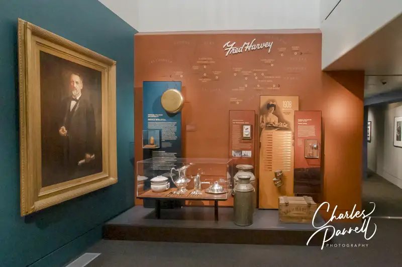
New Mexico History Museum
Fred Harvey exhibit in the New Mexico History Museum
The New Mexico History Museum (nmhistorymuseum.org), which is located just around the corner, offers an equally impressive historic collection. There’s level access to the front door and ramped access to the exhibits. Wheelchairs are available for loan at the front desk, and there’s plenty of room to maneuver a wheelchair through the exhibition spaces, which feature a variety of artifacts that chronicle the history of the state.
Starting with the early settlers and Coronado, and moving on to the Mew Mexico Missions, the Santa Fe Trail and even the Santa Fe Harvey House, the museum offers a comprehensive look at the history of the indigenous people, Spanish Colonization and early travel and commerce in New Mexico. And combined with the Palace of the Governors, this modern museum gives visitors a good overview of the colorful — and sometimes contentious — state history.
New Mexico Museum of Art
New Mexico Museum of Art
The New Mexico Museum of Art (nmartmuseum.org), which is located just a block west of the Palace of the Governors, is also worth a stop. It’s just a short level roll down the street, and there’s curb-cut access to the wide level sidewalk along Palace Avenue, and level access over to the museum’s front entrance. There’s barrier-free access to all the galleries, and elevator access to the second floor.
This museum first opened in 1917, and many of the works that were exhibited on opening day are still part of the permanent collection. A good variety of rotating exhibitions are also presented throughout the year. And don’t miss the courtyard, which is dotted with murals by William Shuster. These frescoes, which were commissioned by the Federal Emergency Relief Agency in 1934, were created to honor the Pueblo Indians. It’s quite an impressive collection.
Georgia O’Keeffe Museum
Georgia O’Keefe’s paint box in the Georgia O’Keefe Museum
Last but not least on this wheelchair-accessible Santa Fe walking Tour is the Georgia O’Keefe Museum (www.okeeffemuseum.org). From the New Mexico Museum of Art, continue west on Palace Avenue, take a right on Grant Street, and then turn left on Johnson Street. The Georgia O’Keeffe Museum is just a half-block up on the right.
Although O’Keeffe was born in Wisconsin, she fell in love with New Mexico when she visited Santa Fe in 1917. By 1934 she was spending her summers at Ghost Ranch, about an hour north of Santa Fe; and in 1949 she took up permanent residence in the state. To say she was a local favorite is an understatement. The museum was opened 11 years after her death in 1997, to honor her art and share it with the public.
Today there’s excellent wheelchair access throughout the galleries in the adobe building, which is a work of art itself. Admission is free for people with a disability, and half-price for their caregivers. There’s also a loaner wheelchair available at the front desk.
The museum’s permanent collection consists of over 3,000 O’Keeffe works which span the length of her career, from 1915 to 1984. The galleries are divided by decade and the works include everything from paintings of her beloved New Mexico, and large scale depictions of flowers, leaves and other natural forms, to New York cityscapes. Add in some rotating exhibits and you have a truly spectacular museum — and reason enough to add Santa Fe to your cultural bucket list.
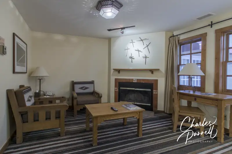
Stay Near the Plaza
Living Area in Suite 102 at the Chimayo Hotel
If you’re looking for an accessible hotel near this wheelchair-accessible Santa Fe walking tour, then look no further than the Chimayo Hotel emerginghorizons.com/a-wheelchair-accessible-santa-fe-lodging-choice/. It’s just a two-minute walk from the Palace of the Governors, on Washington Street. This historic property boasts a comfortable accessible suite, and it’s a great place to base yourself to explore old town Santa Fe. You can start this walking tour in the morning, have lunch, then take midday break at the hotel, before continuing your tour in the afternoon. Comfort, convenience and access, the Hotel Chimayo has it all. So check it out on your next Santa Fe visit.
Barrier-Free Travel Utah National Parks for Wheelchair-users and Slow Walkers
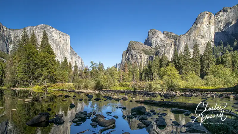
Although there’s no train station in Yosemite National Park, with a little advance planning it is possible to plan a wheelchair-accessible Yosemite rail excursion. Here’s what you need to know to ride the rails to Yosemite National Park.
Hop Aboard Amtrak
Amtrak Gold Runner
The best way to take a wheelchair-accessible Yosemite rail excursion is to hop aboard Amtrak’s Gold Runner. This route runs through the Central Valley from Oakland to Bakersfield, and offers bus connections from Los Angeles, Sacramento and San Francisco. The train also stops in Emeryville, Richmond, Martinez, Antioch, Lodi, Stockton, Modesto, Denair, Merced, Madera, Fresno, Hanford, Corcoran and Wasco. And it’s easy to transfer to Yosemite via YARTS at the Merced Amtrak Station.
All Amtrak trains feature ramp or lift boarding, wheelchair-accessible seating and large accessible restrooms. Wheelchair-users can remain in their own wheelchair or transfer to a coach seat for the journey. The Gold Runner can accommodate manual and power wheelchairs up to a maximum width of 29.5 inches, and an occupied weight of up to 600 pounds. Special accessibility requests can be submitted at www.amtrak.com/contact-us/email.html (click on accessibility request) at least 72 hours prior to travel, or by calling (800) 872-7245. On-the-spot accessibility requests can usually be accommodated if they do not present a safety issue.
The Gold Runner route features coach seating, free WI-FI, and food for sale on board. Amtrak offers a 10% discount to passengers with a disability and one companion. For more information about Amtrak’s Gold Runner route, visit www.amtrak.com/san-joaquins-train.
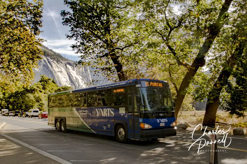
Take YARTS to Yosemite
YARTS bus in Yosemite Valley
It’s about a three-hour trip from Oakland to Merced, and a two-hour trip from Bakersfield; plus an additional, 3.5-hour bus connection from Bakersfield to Los Angeles. Amtrak has partnered with YARTS to provide a bus connection from the Merced Amtrak Station to Yosemite, and that transfer is included with your Amtrak ticket.
All YARTS buses feature lifts and accessible seating; however it’s important to note on your Amtrak reservation that wheelchair-accessible seating is required. Alternately, call (877) 989-2787 at least 48 hours in advance to secure an accessible seat. Additionally, reduced fares are available to people with a disability and seniors over 62 years old.
The Highway 140 YARTS route runs from the Merced Amtrak Station to Yosemite Valley with stops in Catheys Valley, Mariposa, Midpines and El Portal. Stops in Yosemite Valley include the Yosemite Valley Visitor Center, Yosemite Valley Lodge and Curry Village. This route runs year-round, and it takes 2.5 hours to get from the Merced Amtrak station to Yosemite Valley.
The Highway 140 YARTS route is an excellent choice for folks with lodging reservations at Yosemite Valley Lodge or Curry Village; however this route also stops at accessible properties outside of the park. Two excellent accessible lodging choices on the route are the Yosemite Bug and AutoCamp Yosemite.
The Yosemite Bug (www.yosemitebug.com/) is located in Midpines and features a large wheelchair-accessible guest room with a roll-in shower. Located nearby, AutoCamp Yosemite (autocamp.com/location/yosemite/) offers wheelchair-accessible accommodations in custom designed luxury travel trailers. And both properties have daily YARTS connections to the national park.
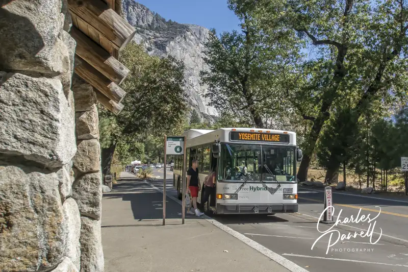
Getting Around Yosemite
Yosemite Shuttle
Passengers who take a wheelchair-accessible Yosemite rail excursion have several options to get around the park. First and foremost is the free Yosemite shuttle system.
There are currently two shuttle routes in the valley — the Valleywide Shuttle and the East Valley Shuttle. The former stops at Yosemite Valley lodges, campgrounds, restaurants and trailheads, while the latter calls on Yosemite Village, Curry Village, the Pines Campgrounds and the eastern Yosemite Valley trailheads. All shuttle buses are equipped with wheelchair lifts and tie-downs, and can accommodate wheelchairs up to 24 inches wide and 46 inches long. The lifts have a weight limit of 750 pounds.
Aramark (www.travelyosemite.com) — a Yosemite lodging concessionaire — also operates several tours. The popular Valley Floor Tour is conducted in an open-air tram and offers good views of the surrounding landscape. Although not all trams are accessible, wheelchair-users can request a lift-equipped one with 48 hours notice. And if you’d like to explore more of the park, opt for four-hour Glacier Point Tour or the day-long Yosemite Grand Tour. Accessible buses for these tours are also available with 48 hours advance notice.
Finally, if you’d like to get a little exercise, then rent a handcycle at the bike stands at Yosemite Valley Lodge or Curry Village and explore the 12 miles of bicycle paths in Yosemite Valley. Most of the bicycle paths are wheelchair-accessible except for a short patch near Housekeeping Camp.
So leave the car at home, and get out and ride the rails to Yosemite National Park. It’s a fun and wheelchair-accessible way to travel.
Barrier-Free Travel Yosemite, Sequoia and Kings Canyon National Parks for Wheelers and Slow Walkers
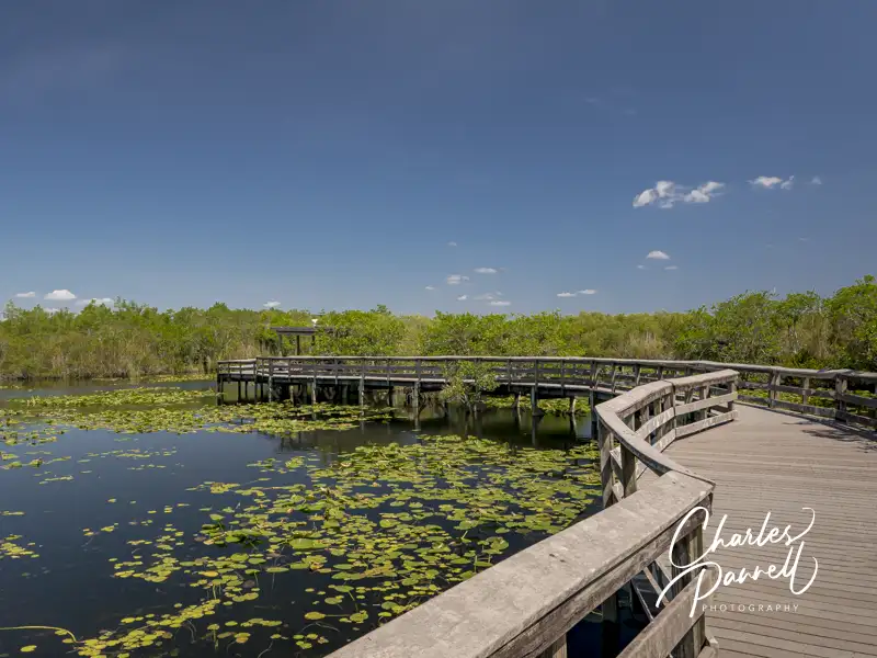
Although swamps are generally not a top destination choice for wheelchair-users, Everglades National Park (www.nps.gov/ever) may well be the exception. Located in South Florida, this vast track of protected wetlands spans over 1.5 million acres and attracts backcountry enthusiasts from around the world. Granted, the undeveloped areas of the park are not wheelchair-accessible; however there are still plenty of Everglades options for wheelchair-users and slow walkers. In fact, two particular areas of the park – Royal Palm and Shark Valley – boast a bevy of boardwalks and trails for visitors of all abilities.
Royal Palm
The Anhinga Trail in Everglades National Park
First up on our wheelchair-accessible Everglades visit is Royal Palm, which is located about 20 miles southwest of Florida City. Named for the former state park that grew into the Everglades, this area offers two accessible trails that give visitors a good overview of the native wildlife. There’s plenty of accessible parking in the large lot, with level access to the accessible restrooms, visitor center and gift shop.
The Anhinga Trail – one of the most popular trails in the park — is located behind the visitor center. This .8-mile loop trail begins as a paved path, before it transitions to a wide level boardwalk around the sawgrass marsh. A shaded viewing platform is located midway along the boardwalk, and there’s ample opportunity to catch a glimpse of alligators, turtles and a wide variety of wading birds. And if you get tired, no worries, as there are plenty of benches along the way too. Keep a lookout for the namesake Anhingas, that can be seen in abundance drying their colorful wings in the sun, or perched peacefully in the trees along the trail.
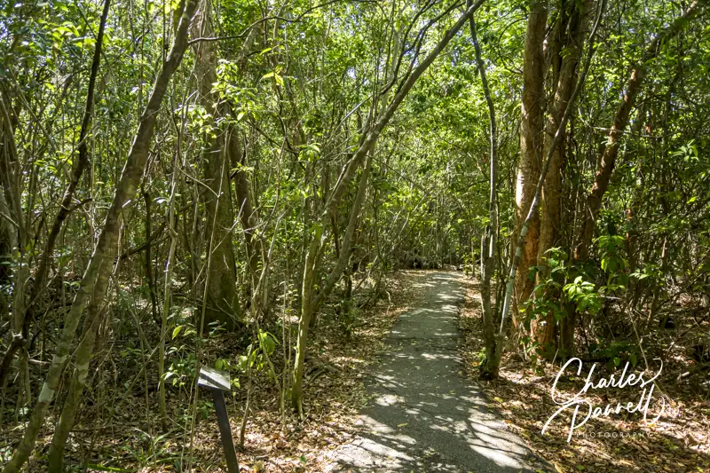
The Gumbo Limbo Trail is also worth a stop while you’re in the area. This .4-mile loop trail begins behind the visitor center, and travels through a tropical hardwood hammock. There are plenty of interpretive plaques along this paved trail; and although the pavement has a few cracks here and there, it’s still quite doable for most folks. The gumbo limbo trees, with their unique peeling red bark, offer shelter to a variety of avian life; and the royal palms, ferns and air plants add a bit of diversity to the forest. It’s a refreshing stroll, especially on a hot day.
The Gumbo Limbo Trail in Everglades National Park
Take a Tram Tour
The Shark Valley Tram in Everglades National Park
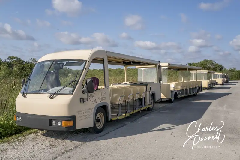
Shark Valley is another area of the park worth a visit on a wheelchair-accessible Everglades itinerary. It’s located north of Royal Palm, on the Tamiami Trail (Highway 41), about 40 miles west of Miami. And although it doesn’t have any sharks, and it’s really not much of a valley, the sawgrass marsh supports a healthy freshwater ecosystem.
There’s barrier-free access from the accessible parking area to the visitor center, which is the departure point for the popular Shark Valley Tram Tour (www.sharkvalleytramtours.com). This two-hour tour is led by a naturalist who points out some of the hidden treasures in the Everglades. The tour stops at the halfway point at a 45-foot high observation tower, where visitors can get a bird’s eye view of the surrounding swamp. Even better, the tower includes a gently sloping ramp that allows wheelchair access to the top deck.
The tour is conducted in an open-air tram, which can be configured for wheelchair access. There’s ramp access up to the accessible car, which features two wheelchair spaces with tie-downs. Advance notice is required for accessible tours, and reservations can be made by calling (305) 221-8455. And since there are no facilities along the way, it’s a good idea to use the accessible restrooms at the visitor center before the tour. It’s also a good idea to bring along some water and a snack, as there aren’t any concession areas along the tour route either.
Explore Shark Valley
Shark Valley Trail
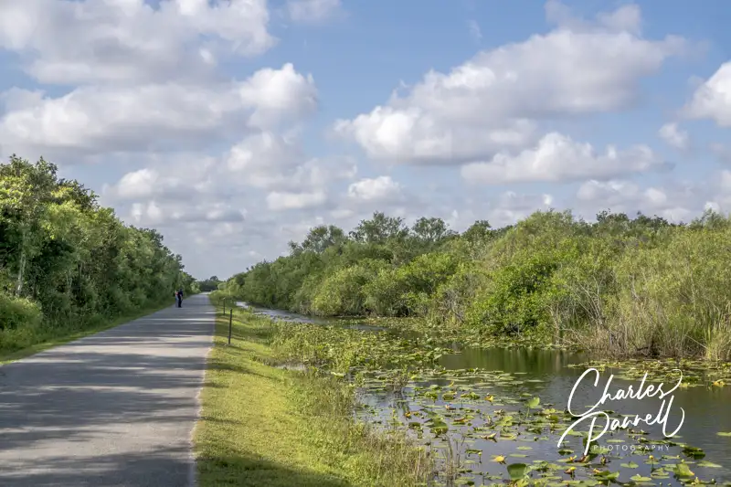
The road that the tram tours runs along — Shark Valley Loop Road — is flat and paved, and it’s also a good choice for wheelchair-users who don’t opt for the tram tour. There’s a fair amount of bicycle traffic along the road, but it’s pretty wide, so there’s plenty of room for everyone. Be sure and stop and look in the grass alongside the road, as it’s not unusual to find alligators there. And if you hear something growling at you from the water, don’t be alarmed, as it’s probably only the mating call of the harmless pig frog.
The Bobcat Boardwalk, which is located behind the visitor center, is also a good place to get a look at – and have a listen to – the swamp inhabitants. This wide level .5-mile boardwalk winds over the marsh and through a mature gumbo limbo forest. There’s a wheelchair accessible overlook along the way, and although you may hear bobcats rustle in the underbrush, they are usually pretty shy. That said, it’s still a good place to spot alligators, and the forest canopy provides a welcome respite on sunny days.
Big Cypress National Preserve
The Kirby Storter Boardwalk in Big Cypress National Preserve
Although it’s not part of the Everglades, save some time to stop at the Kirby Storter Roadside Park on your way to or from Shark Valley. Part of the Big Cypress National Preserve (nps.gov/bicy/), this accessible rest area is located about 30 miles west of Shark Valley. It features accessible parking, with accessible vault toilets nearby, and level access to a shaded picnic area.
After you’ve had a bite to eat, take a stroll along the half-mile accessible Kirby Storter Boardwalk. There’s level access to the boardwalk which travels through a young cypress marsh, before it transitions to a mature pop ash and red maple forest dotted with orchids. The forest canopy shades the trail until it opens up to a full swamp at the end of the boardwalk. There are interpretive signs along the way, and a bench to enjoy the swamp view at the end. It’s a good place to spot alligators, especially during mating season. And since many people pass right on by this scenic stop, you may even have it all to yourself. It’s a great way to top off a wheelchair-accessible Everglades visit.
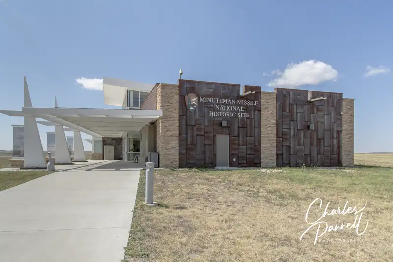
Visiting the Minuteman Missile National Historic Site (www.nps.gov/mimi) is like taking a step back in time. Back to the days of the Cold War, the threat of Communism, duck and cover drills and fallout shelters. It’s difficult to comprehend today, but ballistic missiles that had the capability to destroy humanity were once buried in missile silos across the Great Plains. These Minuteman Intercontinental Ballistic Missiles were poised to launch at a moments notice, and the facilities were manned around the clock in case the launch command ever came down. Luckily it never did.
Today the launch facilities have been shut down and the weapons have been disarmed. That said, in an effort to preserve a piece of American history and help visitors understand this often confusing era, one South Dakota minuteman missile site has been preserved and is open to visitors. And although wheelchair access is difficult if not impossible in a missile silo, the National Park Service has made access improvements so wheelchair-users and slow walkers can now explore a portion of this historic site.
A Little Background
There are actually three separate attractions, which are a short drive apart, at the Minuteman Missile National Historic Site. The visitor center is the best place to begin your visit. It’s located off of Interstate 90, about 75 miles east of Rapid City South Dakota. And although it’s a bit off-the-beaten track it’s just four miles north of the Northeast Entrance to Badlands National Park (emerginghorizons.com/explore-wheelchair-accessible-badlands-national-park/).
Accessible parking is available in front, and a sidewalk that leads over to the front door. Inside there’s ample room to maneuver a wheelchair in the galleries, and over to the information desk and gift shop. An accessible restroom is also located in the building. There’s level access to the theater, which shows the 30-minute film “The Minuteman Missile on Alert”. Wheelchair seating and adjacent companion seating is available in the theater.
The interpretive exhibits focus on the missiles and the men and women who manned the launch control facility, as well as the history of the nuclear weapons and arms race. Add in photos of fallout shelters, information about duck and cover drills and a vintage video clip of the US Civil Defense film “Bert the Turtle”, and you have a comprehensive look at the Cold War. And don’t forget to pick up a brochure, which has a map of the other stops at the site.
Tour the Launch Control Facility
The historic Delta-01 Launch Control facility is located four miles west of the visitor center, at exit 127 off of Interstate 90. The facility is behind a locked gate, but visitors are welcome to peer through the gate and take the cell phone tour to learn more about operations at the launch control facility. The pathway from the parking area to the launch facility is level, but it does cross a dirt road at one point.
Guided tours are also available for a fee, but advance reservations are required. The standard tour is not accessible as this Cold War era facility was built to house two missile officers and has a tiny elevator and restrictive space underground. A wheelchair-accessible topside tour was added in 2019, to make this site partially accessible. This tour does not go to the underground area, but instead focuses on the topside structures and uses technology to offer a virtual visit to the underground space.
To insure adequate staffing, this tour must be booked at least five days in advance. The minimum number of participants required for the accessible tour is two. This tour can be booked on the park website or by calling (605) 717-7629.
Visit the Silo
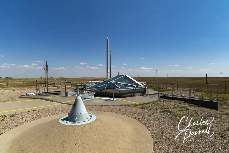
Minuteman Missile National Historic Site Delta-09 Missile Silo
The final stop at the Minuteman Missile National Historic Site is the Delta-09 Missile Silo. It’s located 11 miles west of the launch site, at exit 116 off of Interstate 90. Although the missile in the silo today is disarmed, a fully operational missile which contained a 1.2 megaton nuclear warhead was housed here until the early 1990s. In fact, this Delta-09 missile silo was one of 120 buried across western South Dakota.
Parking is available in a level area, and although the path to the silo itself is level, the gravel driveway may be problematic for some wheelchair-users. There’s also an accessible porta-potty near the silo. The silo, which is made of reinforced concrete with a steel plate liner, is 12 feet in diameter and 80 feet deep. The top of the silo has been removed and replaced with a glass roof, so visitors can peer down inside.
There is a small step up to the concrete apron that surrounds the silo, so most wheelchair-users won’t be able to get close enough to see the missile. It’s still worth a stop while you’re in the area though, as you can see the support building, personnel access hatch, the ultra high frequency antenna, and the interpretive panels. There’s also an excellent cell phone tour available which touches on everything from why South Dakota was chosen as a launch site, to how they installed the missiles in the silos, and even some details about the technology on board these 1963 vintage weapons. It’s a comprehensive presentation, and a good way to conclude your visit at the Minuteman Missile National Historic Site.
Barrier-Free Travel Washington National Parks for Wheelers and Slow Walkers
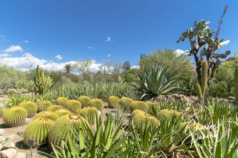
Located three miles west of Superior, Boyce Thompson Arboretum (btarboretum.org) is Arizona’s oldest and largest botanical garden. The 323-acre parcel is filled to the brim with plants from deserts around the world, and offers visitors an up-close-and-personal look at desert flora and fauna in the a variety of landscapes. From sheer mountain cliffs to a streamside forest, there’s a wide selection of habitats for wheelchair-users and slow walkers to explore. And since the park is just 65 miles east of Phoenix, it makes an excellent day trip from the city, as well as a fun Arizona road trip stop.
Plan a Picnic
Butterfly in the Demonstration Garden
Access is relatively good throughout this popular Arizona botanical garden, with accessible parking in front and barrier-free access over to the visitor center. Inside, there’s plenty of room to maneuver a wheelchair around the exhibits, and to the accessible restrooms, which are located in the rear of the building. There’s also barrier-free access to the gift shop, which offers souvenirs, gifts, drinks, snacks and sandwiches.
If you’d prefer to bring you own picnic lunch, accessible picnic tables are located near the Demonstration Garden, across from the visitor center. Accessible parking is located nearby, with a level path over to the shaded tables. It’s a pleasant, peaceful spot to enjoy a noontime repast.
Save some time to visit the Demonstration Garden after lunch. There’s level access throughout the garden which offers design and plant selection ideas for a variety of landscapes. Before you set out to explore the rest of the botanical garden, make sure you have an ample supply of water and a hat, as shade is in short supply, and the midday sun can be harsh.
Explore the Main Trail
Most of the Main Trail through the botanical garden is doable for wheelchair-users and slow walkers, as this hard-packed dirt trail is wide and fairly level. It begins near the visitor center and allows visitors access to a number of other gardens along the route.
The nearby Heritage Rose Garden also level pathways, and even though they are made of brick they’re still manageable. And don’t miss the Children’s Garden which features level access and boasts a fun water feature. The Taylor Family Desert Legume Garden is another good choice, as it’s is paved and showcases plants from the pea family. And although the trails in the outdoor Cactus Garden are a bit steep and bumpy, there are a few areas near the Main Trail that are doable for wheelchair-users and slow walkers.
The accessible section of this part of the Main Trail ends in about a mile, near Ayer Lake. From there it travels through the Upper Sonoran Natural Area, which has steep grades and a rocky pavement.
Another Main Trail Branch
Along the Main Trail at Boyce Thompson Arboretum
Even though Ayer Lake is the end of the line for one accessible trail, there’s still more for wheelchair-users and slow walkers to explore. From Ayer Lake, you can also double back and explore another branch of the main trail. Just head back toward the Taylor Family Desert Legume Garden, and connect to the other part of the Main Trail loop.
This section of the trail first trail passes through a patch of eucalyptus forest, with level pathways around the trees. The Herb Garden, which is just up the trail, is also fairly level, with plenty of room for wheelchair-users and slow walkers to navigate around the aromatic herbs. Just past the Herb Garden there’s barrier-free access to the suspension bridge, but the High Trail on the other side of the bridge is not accessible. The access on the Main Trail ends just past the pumphouse, where the trail connects to the rugged Upper Sonoran Natural Area.
All in all it’s about a three-mile round trip jaunt from the visitor center to Ayer Lake, over to the the Main Trail branch, and back to the visitor center. That said, if that’s too long, you can always explore the gardens near the visitor center, which offer a good overview of desert habitats. Either way Boyce Thompson Arboretum makes a fun and educational day trip for wheelchair-users and slow walkers.
Barrier-Free Travel the Grand Canyon for Wheelers and Slow Walkers
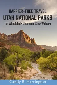
If you’re planning to visit Utah’s Mighty Five National Parks, and wondering if they are wheelchair-accessible, then pick up the newest edition of Candy B. Harrington’s Barrier-Free Travel; Utah National Parks for Wheelchair-Users and Slow Walkers. This essential resource offers essential insider tips to plan a wheelchair-accessible Utah national parks getaway.
Wheelchair-Accessible Utah National Parks
This new edition includes:
Updated information on new access additions.
Fly-drive trip planning information, including accessible van rentals.
Access details and photographs of 33 wheelchair-accessible properties, including all in-park lodging options.
Information about ranger-led tours, loaner wheelchairs and the free America the Beautiful Access Pass.
The scoop on how to nab free accessible bus tours in Bryce Canyon National Park and Zion National Park.
Detailed access information on accessible trails, viewpoints, picnic areas and attractions — in and near the parks.
Information about barrier-free camping options in all the parks.
Insider tips on where to go for the best windshield views, accessible picnic spots and sunset photos.
This inclusive title is the most recent addition to Harrington’s national park series; and although it’s written for wheelchair-users and slow walkers, stroller moms will also appreciate the access information in this guide. It will help everyone plan a truly accessible Utah national parks vacation.
Says Harrington, “I’m very excited to report that Utah National Parks not only added more accessible features since my last edition, but they also maintained the ones they already had. I’m particularly happy to see the access improvements in the Pa’rus Trail as well as the continued upkeep of the accessible Bryce Canyon Shared Use Path.”
For more information wheelchair access in Utah’s National Parks, visit emerginghorizons.com/barrier-free-travel-utah-national-parks-for-wheelchair-users-and-slow-walkers/ and order your copy of Harrington’s newest access resource today.
Barrier-Free Travel Utah National Parks for Wheelchair-users and Slow Walkers
Located about an hour east of Winslow, Petrified Forest National Park (www.nps.gov/pefo/) boasts the largest concentration of petrified wood in the world. Not only does this Arizona gem offer some dazzling desert scenery, but it also includes a number of accessible trails and overlooks for wheelchair-users and slow walkers. And since the park is located right off Interstate 40, it’s an excellent addition to any Grand Canyon road trip.
The Basics
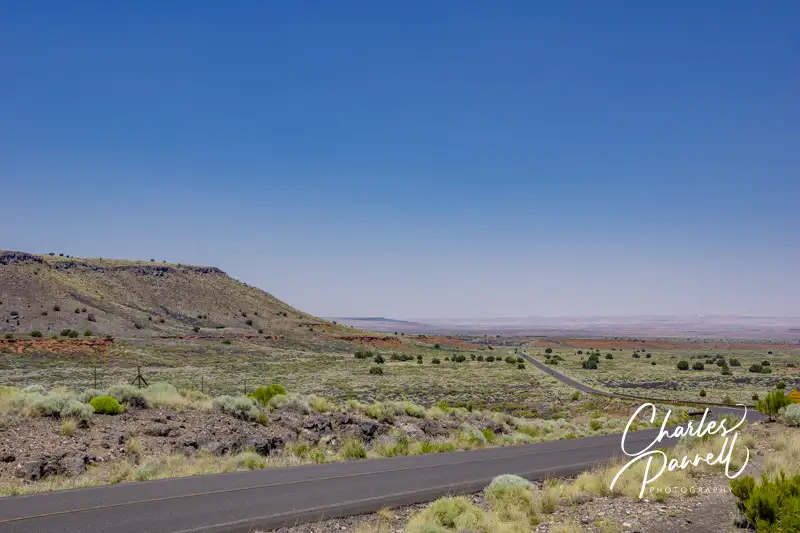
Windshield View on Highway 180
It’s easy to do a one-way jaunt through the park, stop at a few trails and viewpoints along the way, then reconnect to the highway and continue on your journey. If you’re traveling east, take the Highway 180 exit (exit 285) and use the south entrance of the park; and if you’re traveling west, take exit 311 and use the north entrance. Either way, after you’ve explored the 28-mile route, it’s simple to hop back on the interstate.
The whole drive takes an hour without any stops, and although there are some wonderful windshield views along the way, there are also some very scenic turnouts and sights that are definitely worth a stop. It should also be noted that the gates to this national park open at 8:00 a.m. and close at 5:00 p.m., so plan accordingly to avoid disappointment.
The Painted Desert Visitor Center, which is located near the north entrance, makes a good first stop in the park. Accessible parking is located near the entrance, with level access to the building. Inside there’s a small gift shop, a ranger information desk and accessible restrooms. Pick up a park map, then head out to explore this national treasure.
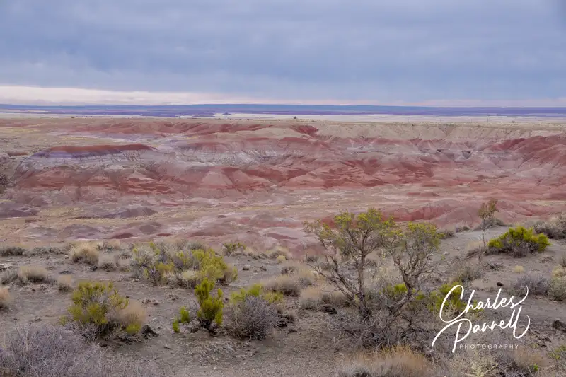
Views and More
View at Tawa Point
Although there are no shortage of scenic views in the Petrified Forest National Park, make sure and stop at Tawa Point, just past the north entrance, for that first expansive view of the Painted Desert. Accessible parking is located near curb-cut access up to a short .1-mile paved trail out to the viewpoint. The last 20 feet of this path is a bit steep for manual wheelchair-users; however you can get a good view of the colorful desert from any place along the trail, or even from the parking lot.
The Painted Desert Inn, which is located just a half-mile up the road, is also worth a stop. This former Harvey House features accessible parking, and level access to the building. There inn houses a number of historic exhibits, but you just can’t beat the panoramic desert view from the second floor of this split-level structure. Additionally, there’s a 300-foot paved level pathway out to nearby Kachina Point, which offers an equally impressive desert view.
Painted Desert Inn
Another worthwhile stop is Puerco Pueblo, which is a few miles up the road, just past the railroad tracks. Accessible parking with curb-cut access up to the sidewalk is located near the accessible vault toilets. From there it’s about a 200-foot walk out to a .3-mile paved trail that circles the ruins of these ancestral Puebloan homes which were occupied from 1250 to 1380.
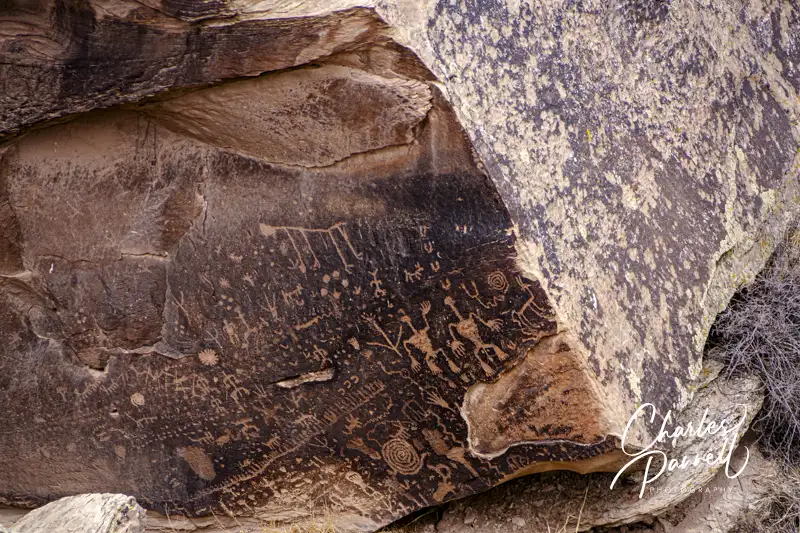
And don’t miss Newspaper Rock, which is short drive down the road. That site features a 200-foot paved level trail out to some Puebloan petroglyphs, which were created 2,000 years ago. There’s an accessible spotting scope at the overlook, which offers a good view of the 650-plus petroglyphs.
Petroglyphs on Newspaper Rock
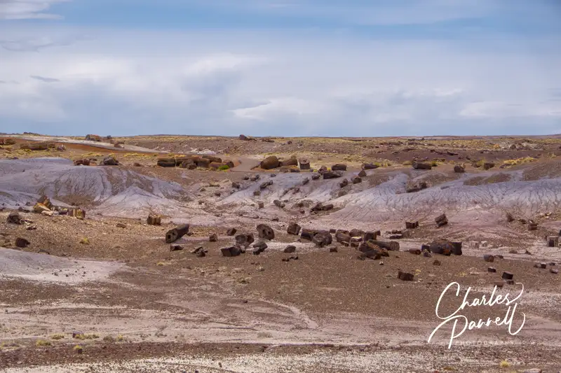
Petrified Wood Galore
Crystal Forest
There’s also a substantial collection of petrified wood sites — such as the Crystal Forest — along the main park road. Although a paved .8-mile trail leads past the petrified logs at this site, it’s got a section or two of 20% grade, so it’s not a good choice for wheelchair-users and slow walkers. That said there is a 400-foot paved level path that leads out to the trailhead, that offers a good overview of the remains of this ancient forest.
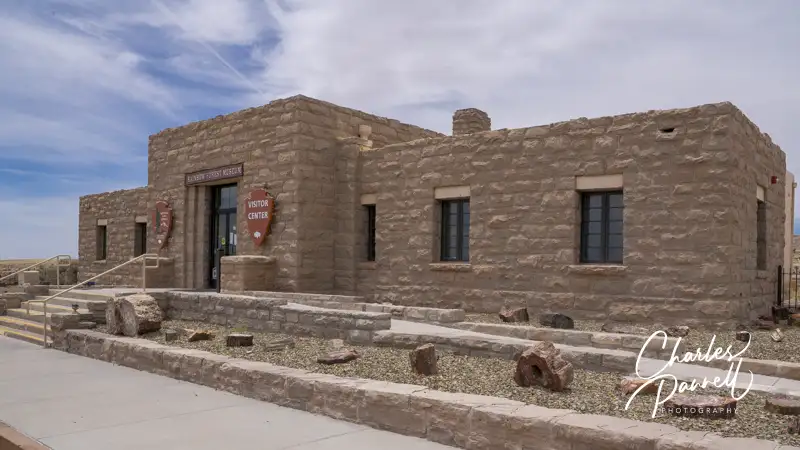
Rainbow Forest Visitor Center
Finally, don’t miss the Rainbow Forest, which is located just north of the south entrance. There’s accessible parking near the Rainbow Forest Visitor Center, with ramp access up to the front door. Inside there’s barrier-free access to the interpretive exhibits, ranger information desk and accessible restrooms. There’s also plenty of room for wheelchairs and scooters in the theater, where a movie about the park is shown throughout the day.
The Giant Logs Trail is located out back, and although this paved trail starts out level, the access ends 600 feet later at the Mather plaque, where steps block the rest of the route. Still, there’s a good view of the site from this point, or even from the back of the visitor center.
And if you’d like to grab a bite to eat before you hit the road, stop in at the curio shop at the far end of the parking lot. There’s level access to the shop, which offers snack items, gifts and souvenirs. All in all, Petrified Forest National Park is well worth the short detour off the interstate.
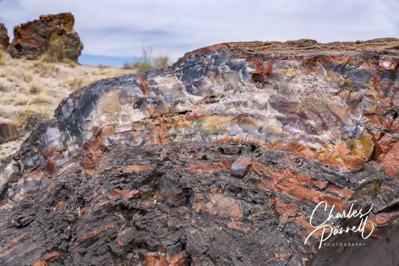
Petrified Tree in the Crystal Forest
Barrier-Free Travel the Grand Canyon for Wheelers and Slow Walkers
Every fall Sandhill Cranes take to the Pacific Flyway in a mass migration from their breeding grounds in Alaska and British Columbia, to travel to their wintering areas in California. And one of their favorite places to winter is in the California Delta near Lodi. In fact, from October to February masses of these majestic birds can be seen feeding in the fields that line the roads of this rural agricultural area.
And to celebrate their yearly return, the Lodi Sandhill Crane Association presents the annual Lodi Sandhill Crane Festival. Now in its 27th year, the 2025 event will run from Friday November 7 to Sunday November 9, with most of the events happening over the weekend. And the good news is, not only are the festival venues wheelchair-accessible, but there’s no admission charge to many of the festival events.
Exhibits, Presentations and More
The bulk of the festival events take place at the Hutchins Street Square Community Center in downtown Lodi. There’s barrier-free access to the building, with plenty of room for wheelchairs and scooters to maneuver. For a full schedule of the downtown exhibits and educational presentations, visit lodisandhillcrane.org.
The festival kicks off with the opening night reception on Friday evening. Attendees can nosh on hors d’oeuvres and beer and wine, while enjoying a program that includes the presentation of the Lodi Sandhill Crane Association Conservation Award. Top it off with a silent auction and for a fun opening event.
The educational presentations about the life and habits of the Sandhill Cranes are a perennial favorite of festival attendees. These weekend sessions include speakers, videos, and hands-on projects. And there’s even a few activities for kids. Additionally there’s a variety of vendors and exhibitors that focus on birding, wildlife, and of course the Sandhill Cranes. Box lunches will be for sale in the exhibit hall, while snacks will be available to purchase in the rotunda.
One of the highlights of the Lodi Sandhill Crane Festival is the Art Show. There are two divisions. One division is photography and the other is fine arts, which includes oils, watercolors, pastels and sculptures. There are two subject areas within each division — Sandhill Cranes in California and other California wildlife in their natural habitat. There are lots of creative entries, and the best part is that the winners are picked by the attendees. So be sure and stop by and vote for your favorites.
Take a Tour
A more remote aspect of the Lodi Sandhill Crane Festival are the local tours. Led by naturalist guides, these tours cover all aspects of the migratory cranes, and include a variety of landscapes. Although some tours are not a good choice for wheelchair-users and slow walkers because of the rough terrain, several other tours are doable.
At the top of the list is the Consumnes River Preserve Guided Wetlands Walk. Led by Mary DuBose, this three-hour morning walk begins at the Consumnes River Preserve Visitor Center. It includes a one-to-two-mile walk over a smooth level trail and some boardwalks. You’ll not only see the Sandhill Cranes on this walk, but also find a nice selection of ducks, geese, raptors and woodland birds along the way. There is a $20 charge for this tour.
The Crane Fly-In tours are also good choices for wheelchair-users and slow walkers. They take place at the North and South Units of the Woodbridge Ecological Preserve. These offerings include a short presentation, before the Sandhill Cranes descend en masse to their nightly resting spots. It’s quite a sight to see! Both the North and South Units have level access to a wheelchair-accessible viewing area for the program. The South Unit Tours are priced at $30, while the North Unit tours are $40. And if you’d like to get up early, there’s also a Fly-Out tour at the North Unit that’s priced at $45.
It’s also important to note that all participants in the North and South Unit tours must also posses a current hunting or fishing license, or purchase a Lands Pass at wildlife.ca.gov/licensing/lands-pass.
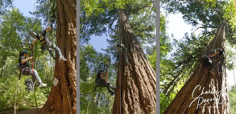
Old growth trees are magnificent. Standing near the base of one of these stately giants, you can gaze up and see its branches reach skyward; and if you’re lucky, you might also spot a forest creature frolicking among them. But have you ever wondered what the view is like from some 200 feet up one of these ancient trees? Well, thanks to Leo Fisher, founder of Tree Climbing at Silver Falls (www.treeclimbingatsilverfalls.com/adaptivetreeclimbing), everybody — including wheelchair-users, slow walkers and folks with multiple mobility issues — can experience the splendor of life in the forest canopy in Northwestern Oregon.
An Innovative Concept
Leo comes from a long line of Swiss mountaineers, so it’s no surprise that he started rock climbing at an early age and then became an arborist. After a short stint in law school, he decided he preferred the forest to the courtroom, so he set out to share his love of these stately giants with others. And that’s why he founded Tree Climbing at Silver Falls.
Make no mistake about it, Leo didn’t just hang up his shingle and proceed to offer recreational climbs in Silver Falls State Park. It took over two years of environmental reviews and extensive work with the park management before they could even begin. In the end, because Leo and his crew respect and protect the fragile old growth ecology, they were given the green light. And inclusion was on Leo’s mind from the beginning, as he wants everyone to be able to enjoy this sport.
For most climbs, wheelchair-users are transferred from their wheelchair to a full body harness, with adequate back and neck support. The ascender, which is also attached, is controlled by climbers on a phone app, and they can go up and down at their own speed. And if they lack hand control the ascender can be remotely controlled by the leader. If for whatever reason you cannot get our of your wheelchair, the team can attach a harness to your wheelchair to enable you to climb; however this rarely happens, as most folks can be accommodated in the full body harness.
Most slow walkers who don’t need extra back or neck support can usually use a standard harness and a power ascender. In the end, wheelchair-users and slow walkers can be accommodated in a variety of ways, with everything customized to each individual participant.
The Wheelchair-Accessible Tree Climbing Experience
Tree Climbing at Silver Falls State Park, Oregon
Leo’s wheelchair-accessible tree climbing experience begins on his website, with a detailed questionnaire about each climber’s abilities. It’s important to be honest about your abilities and limitations (especially the weight questions), so that the the team can craft the most optimal experience for you.
The tree used for the accessible climbs is located near the Howard Creek trailhead in Silver Falls State Park. There’s a large level parking lot nearby with an accessible porta-potty; and folks can drop off wheelchair-users and slow walkers near the trailhead close to the tree. It’s a short 50-foot walk or roll on a wide level dirt trail to the accessible climbing site.
All climbs begin with a short orientation and then a safety briefing. Then folks start with a short 10-15 foot climb, with an assistant at their side. The climbers set their own pace, and go up and down at a speed comfortable for them. Each climb is different, and the assistant is there to help out when needed, mostly for guiding climbers and getting branches out of their way. Climbers spend about two hours in the tree, and the whole experience lasts between three and four hours. And of course, there’s plenty of time for photos.
Participants are encouraged to bring along some water and snacks, and of course a sense of adventure. Additionally, if you want to get a group of friends together, there’s room for eight climbers at the accessible climbing site. So get ready to enjoy a day in a old growth giant and learn about the forest ecosystem. It’s truly a once in a lifetime experience — and it’s accessible.