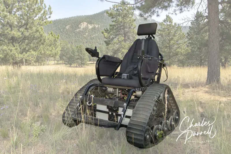
Track chairs are great for getting out and enjoying Mother Nature and exploring trails that may not be accessible in standard wheelchairs. They are made by a variety of manufacturers, but unlike standard wheelchairs, these heavy duty power chairs have tank tracks rather than wheels. In sort, they are an excellent solution for inaccessible trails.
Disabled hunters can also appreciate the strengths of a track chair, especially while navigating wet and uneven terrain. Unfortunately these track chairs come with a high price tag, and depending on the options they can easily cost in upwards of $20,000. And although that price may put these unique adaptive devices out of the reach of many folks, a Vermont-based LLC now has a program that offers track chair grants to disabled game bird hunters.
Track2wing Track Chair Grants
Track2wing (https://www.track2wing.com/) was founded in 2020 by Terry Wilson and Nancy Anisfield. It’s a self-funded corporation that’s run by a volunteer board. Their mission is to provide a way for disabled game bird hunters to participate in hunting activities with sporting dogs. To that end they offer track chair grants for disabled game bird hunters. And as of 2026, Track2Wing has provided 61 disabled hunters with a track chair.
Applying for a track chair grant is pretty easy. The application period runs from January 1 to March 31. Applicants are asked to fill out a simple form detailing their physical needs as well as their game bird hunting and sporting dog experience. Upon receipt of the application, more information – such as medical documentation or a phone interview – may be requested. The applications are reviewed by the advisory committee, and applicants are notified of their status by the end of April.
Grant recipients are referred to a local Trackchair (https://thetrackchair.com/) dealer to complete the ordering process. Track2wing pays for the full cost of the track chair and even provides funds for accessories and a trailer.
It’s a great program, so get your application in now if you’re interested. Applications can be requested from Track2wing at (802) 482-2561 or track2wing@gmavt.net.
If your travels take you to the Volunteer State, then check out the loaner all terrain wheelchairs in Tennessee state parks. The list is growing, but currently over 30 state parks offer these loaner wheelchairs. They are available to both adults and children, and they can be operated independently or with caregiver assistance. And each park has a list of specific trails you can try out in their loaner all terrain wheelchairs. The wheelchairs are available at these Tennessee state parks.
West Tennessee
Chickasaw State Park
Fort Pillow State Historic Park
Meeman-Shelby Forest State Park
Natchez Trace State Park
Nathan Bedford Forrest State Park
Paris Landing State Park
Pickwick Landing State Park
Pinson Mounds State Archaeological Park
Reelfoot Lake State Park
T.O. Fuller State Park
Middle Tennessee
Bledsoe Creek State Park
Cedars of Lebanon State Park
Cumberland Mountain State Park
Cummins Falls State Park
David Crockett State Park
Fall Creek Falls State Park
Henry Horton State Park
Long Hunter State Park
Radnor Lake State Park
Alvin C. York State Historic Park
Tims Ford State Park
East Tennessee
Booker T. Washington State Park
Cove Lake State Park
Cumberland Trail State Park
Harrison Bay State Park
Indian Mountain State Park
Panther Creek State Park
Red Clay State Historic Park
Roan Mountain State Park
Rocky Fork State Park
Sycamore Shoals State Historic Park
Warriors’ Path State Park
Reservations for the all terrain track chairs are available at stateoftennessee.formstack.com/forms/all_terrain_wheelchair_request. Alternatively, you can call the parks directly with your reservation request. This method is preferred when the anticipated visit is less than three days away. And although reservations are preferred, the all terrain wheelchairs are available on a walk-up basis, if they are not already reserved.
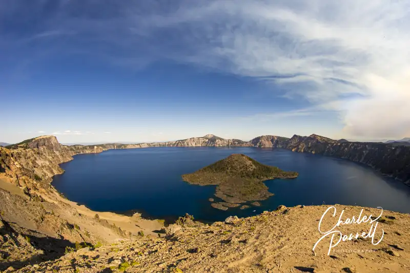
Located at 7,100 feet along Southern Oregon’s Cascade Crest, Crater Lake was created over 7,700 years ago after a massive eruption of Mount Mazama. The resulting caldera filled with melted snow and rainwater, and subsequently the 1943-foot-deep lake took on a deep blue — if not somewhat ethereal — hue. Add in the surrounding cliffs that are nearly 2,000-feet high, two picturesque islands, and an old growth forest, and you have all the ingredients for a scenic national park experience. And although the lake itself isn’t wheelchair-accessible, there are many other areas in Crater Lake National Park (www.nps.gov/crla) that wheelchair-users and slow walkers can enjoy.
The Rim Drive
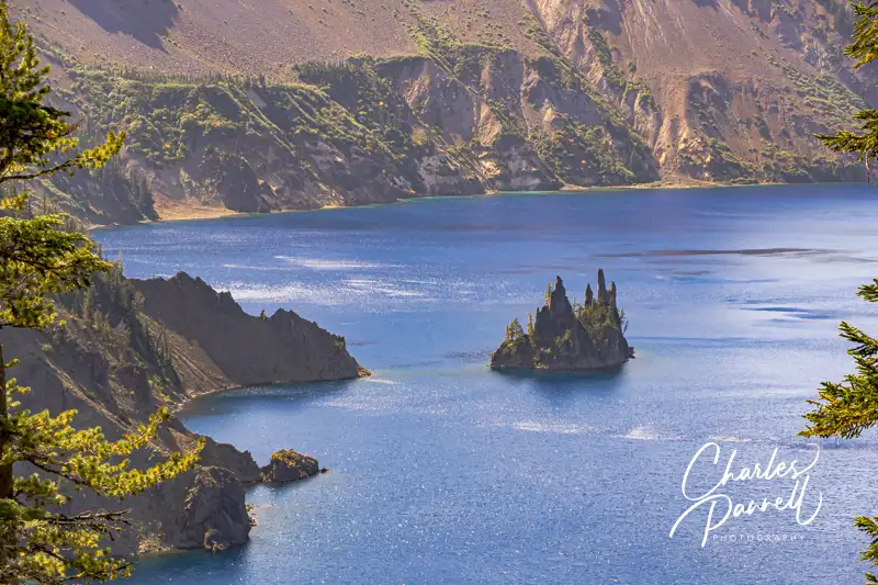
View from the Phantom Ship Overlook
A good way to enjoy Crater Lake National Park is to take the 31-mile Rim Drive that circles the caldera. For the best windshield views take the drive in a counterclockwise direction starting on West Rim Drive. There are a number of overlooks and pullouts along the drive, but the windshield views are also spectacular.
Be sure and stop at Watchman Overlook, which offers an excellent view of Wizard Island. There’s accessible parking near the accessible vault toilet, with curb-cut access to a sidewalk over to the lower overlook. The upper overlook is only accessible by stairs or a steep path, but don’t fret if you can’t make it to the top, as you’ll catch some of the best views from the road. Cloudcap Overlook and Phantom Ship Overlook also offer some great windshield views of the lake. And don’t miss Vidae Falls on the last section of East Rim Drive, as this 100-foot waterfall can be easily seen from the pullout.
If you’d like to leave the driving to someone else, Crater Lake Trolley (craterlaketrolley.net) offers an accessible tour which travels along Rim Drive and stops at five to seven viewpoints. This two-hour tour departs from Rim Village, and the lift-equipped trolley has space for one wheelchair. At least 24-hours advance notice is required for wheelchair accessibility (541-882-1896). It should be noted that wheelchairs must be no wider than 28-inches and have a combined weight limit of no more than 400 pounds.
Explore the Forest
The Godfrey Glen Trail
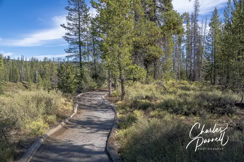
Although the lake is the crown jewel of the park, the surrounding forest also offers some impressive vistas. To that end, one of the most accessible trails in the park– the Godfrey Glen Trail — is located near the south park entrance, on Munson Valley Road between Mazama Village and Park Headquarters.
This hard-packed dirt trail passes through an old growth hemlock and fir forest; and although there are some ruts and roots along the way, most are easy to dodge. The biggest obstacle along this 1.1-mile loop is the steep grade at the halfway point. Best bet it to travel in a clockwise direction, and double back when it gets too steep. Even if you can’t complete the whole trail, you’ll still get some nice canyon views along the way.
Pinnacles Road Trails
View from the First Overlook on the Pinnacles Trail
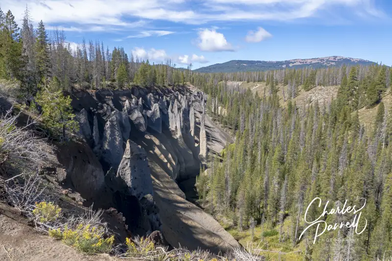
Although the Rim Drive is a must-do on any Crater Lake National Park visit, save some time to hop off-the-beaten-path and explore two accessible trails off of Pinnacles Road. Located on the south side of the lake, this seven-mile road begins near Phantom Ship Overlook, and runs out to Pinnacles Overlook, near the southeastern border of the park. The road and the overlook are named for the spire-like pumice formations that dot this river valley. Accessible parking is located next to the Pinnacles Trail, which offers a closer look at these unusual formations, that were created when hot volcanic gases shot up through the ash.
The Pinnacles Trail passes by several overlooks that offer good views of the formations. The hard-packed dirt trail is covered in crushed rock, and although it’s not entirely level, the undulations are doable for most wheelchair-users. Even if you can’t manage the whole half-mile hike to the park boundary, at least take the level 250-foot walk out to the first overlook. You won’t be disappointed.
The Plaikni Falls Trail, which is located near the beginning of Pinnacles Road is also worth a stop. Accessible parking is located near this trail that winds through an old growth forest to the base of the falls. That said, the last quarter-mile is extremely steep, and probably not doable for most wheelchair-users and slow walkers. On the other hand, the stroll through the forest is fairly level, and there are numerous wheelchair turn-outs and benches located along the way.
And although Pinnacles Road makes a nice outing, be forewarned that there are no accessible toilets at either trailhead. Best bet is to plan ahead and make a rest stop at White Bark Pine Picnic Area or the Crater Peak Trail Picnic Area before hitting the trails.
Rim Village
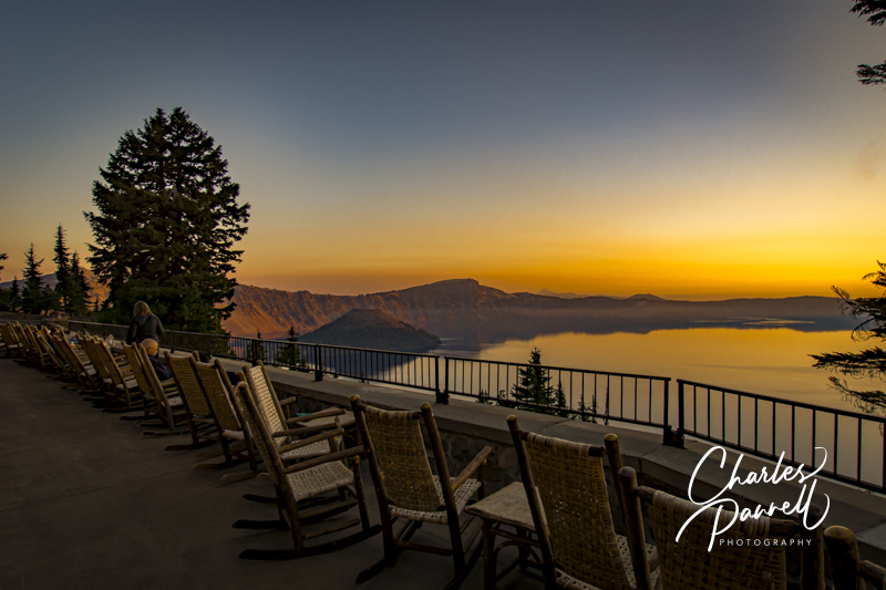
Sunrise on the Back Terrace at Crater Lake Lodge
Last, but certainly not least, save some time to enjoy the rim view on foot on the accessible section of the Rim Village Promenade. This level trail runs alongside the rim from the Rim Village Café and Gift Shop to the back terrace of Crater Lake Lodge. Accessible parking is located near the gift shop, with paved access to the trail behind the gift shop. When you get to the rim, make a right and continue along .3-miles until you hit the lodge.
Interpretive plaques are located along the way, and it’s the perfect spot for a selfie or two, as the views are grand. The trail is mostly paved, and undulating, with a slight change in elevation just past Kiser Studio. Still, most manual wheelchair-users can manage the grade with a little assistance. Alternatively, there’s ramp access down to the trail from the back terrace at Crater Lake Lodge. Either way, the views at both ends of the trail are equally impressive. Alternatively, if you don’t feel like hiking, then just sit and enjoy the lake view from the terrace. And, if you’d like to spend the night at the lodge, they do have a wheelchair-accessible room. (emerginghorizons.com/spend-the-night-at-wheelchair-accessible-crater-lake-lodge/). So pack your bags, and head to Crater Lake – it’s a great accessible destination.
If you’d like to explore some of the more rugged trails and beaches in Southeastern Texas, then pick up this Texas Tow & Go track chair from David’s Chair in Huntsville. Although most track chairs are required to be used in specific places, this loaner comes with a trailer so you can tow it to the location — or locations — of your choice.
This track chair, which has a maximum capacity of 350 pounds, is located at the 10 Mile Ranch in Huntsville, Texas. Reservations are required to borrow the track chair, which comes with a fully enclosed trailer that has ramp access in the rear. In order to tow this trailer you’ll need a vehicle with at least a 1,500-pound towing capacity, that has a 2-inch ball and a straight 4-prong trailer hookup with safety chains. The driver must provide a current drivers license and proof of insurance. Tow & Go reservations must be submitted at least two weeks in advance, and the reservations may not exceed seven days. This Texas Tow & Go track chair is a great option for an active vacation. For more information or to make a reservation, visit davidschair.org/request-tow-n-go-chair/.
Barrier-Free Travel 22 Accessible Road Trips Driving Vacations for Wheelers and Slow Walkers
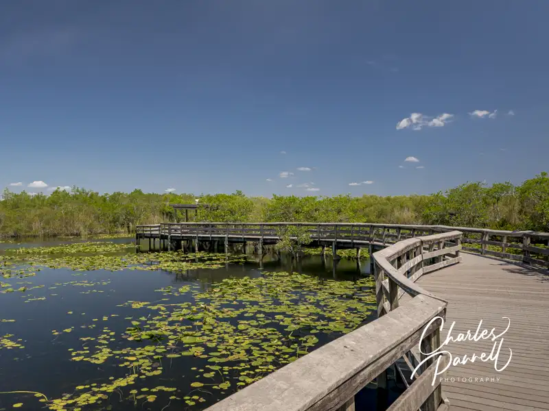
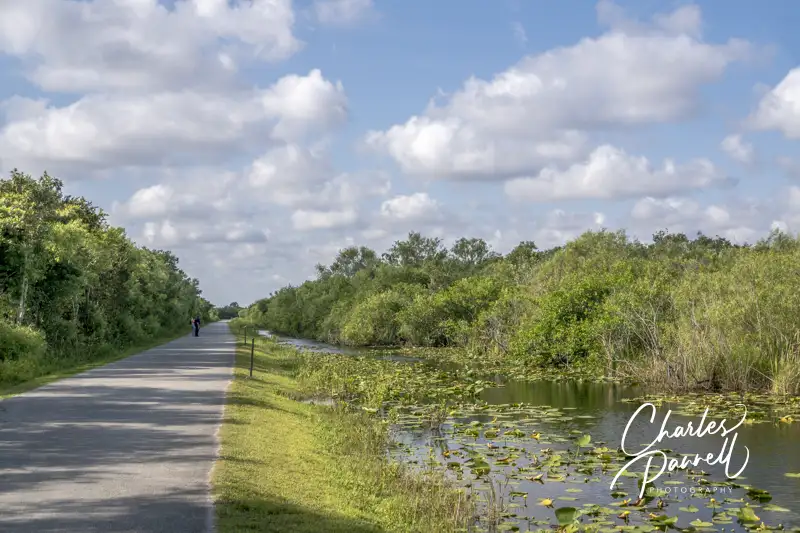
Although swamps are generally not a top destination choice for wheelchair-users, Everglades National Park (www.nps.gov/ever) may well be the exception. Located in South Florida, this vast track of protected wetlands spans over 1.5 million acres and attracts backcountry enthusiasts from around the world. Granted, the undeveloped areas of the park are not wheelchair-accessible; however there are still plenty of Everglades options for wheelchair-users and slow walkers. In fact, two particular areas of the park – Royal Palm and Shark Valley – boast a bevy of boardwalks and trails for visitors of all abilities.
Royal Palm
The Anhinga Trail in Everglades National Park
First up on our wheelchair-accessible Everglades visit is Royal Palm, which is located about 20 miles southwest of Florida City. Named for the former state park that grew into the Everglades, this area offers two accessible trails that give visitors a good overview of the native wildlife. There’s plenty of accessible parking in the large lot, with level access to the accessible restrooms, visitor center and gift shop.
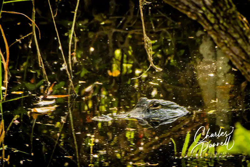
The Anhinga Trail – one of the most popular trails in the park — is located behind the visitor center. This .8-mile loop trail begins as a paved path, before it transitions to a wide level boardwalk around the sawgrass marsh. A shaded viewing platform is located midway along the boardwalk, and there’s ample opportunity to catch a glimpse of alligators, turtles and a wide variety of wading birds. And if you get tired, no worries, as there are plenty of benches along the way too. Keep a lookout for the namesake Anhingas, that can be seen in abundance drying their colorful wings in the sun, or perched peacefully in the trees along the trail.
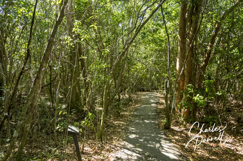
The Gumbo Limbo Trail is also worth a stop while you’re in the area. This .4-mile loop trail begins behind the visitor center, and travels through a tropical hardwood hammock. There are plenty of interpretive plaques along this paved trail; and although the pavement has a few cracks here and there, it’s still quite doable for most folks. The gumbo limbo trees, with their unique peeling red bark, offer shelter to a variety of avian life; and the royal palms, ferns and air plants add a bit of diversity to the forest. It’s a refreshing stroll, especially on a hot day.
The Gumbo Limbo Trail in Everglades National Park
Take a Tram Tour
The Shark Valley Tram in Everglades National Park
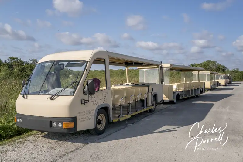
Shark Valley is another area of the park worth a visit on a wheelchair-accessible Everglades itinerary. It’s located north of Royal Palm, on the Tamiami Trail (Highway 41), about 40 miles west of Miami. And although it doesn’t have any sharks, and it’s really not much of a valley, the sawgrass marsh supports a healthy freshwater ecosystem.
There’s barrier-free access from the accessible parking area to the visitor center, which is the departure point for the popular Shark Valley Tram Tour (www.sharkvalleytramtours.com). This two-hour tour is led by a naturalist who points out some of the hidden treasures in the Everglades. The tour stops at the halfway point at a 45-foot high observation tower, where visitors can get a bird’s eye view of the surrounding swamp. Even better, the tower includes a gently sloping ramp that allows wheelchair access to the top deck.
The tour is conducted in an open-air tram, which can be configured for wheelchair access. There’s ramp access up to the accessible car, which features two wheelchair spaces with tie-downs. Advance notice is required for accessible tours, and reservations can be made by calling (305) 221-8455. And since there are no facilities along the way, it’s a good idea to use the accessible restrooms at the visitor center before the tour. It’s also a good idea to bring along some water and a snack, as there aren’t any concession areas along the tour route either.
Explore Shark Valley
Shark Valley Trail
The road that the tram tours runs along — Shark Valley Loop Road — is flat and paved, and it’s also a good choice for wheelchair-users who don’t opt for the tram tour. There’s a fair amount of bicycle traffic along the road, but it’s pretty wide, so there’s plenty of room for everyone. Be sure and stop and look in the grass alongside the road, as it’s not unusual to find alligators there. And if you hear something growling at you from the water, don’t be alarmed, as it’s probably only the mating call of the harmless pig frog.
The Bobcat Boardwalk, which is located behind the visitor center, is also a good place to get a look at – and have a listen to – the swamp inhabitants. This wide level .5-mile boardwalk winds over the marsh and through a mature gumbo limbo forest. There’s a wheelchair accessible overlook along the way, and although you may hear bobcats rustle in the underbrush, they are usually pretty shy. That said, it’s still a good place to spot alligators, and the forest canopy provides a welcome respite on sunny days.
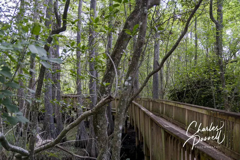
Big Cypress National Preserve
The Kirby Storter Boardwalk in Big Cypress National Preserve
Although it’s not part of the Everglades, save some time to stop at the Kirby Storter Roadside Park on your way to or from Shark Valley. Part of the Big Cypress National Preserve (nps.gov/bicy/), this accessible rest area is located about 30 miles west of Shark Valley. It features accessible parking, with accessible vault toilets nearby, and level access to a shaded picnic area.
After you’ve had a bite to eat, take a stroll along the half-mile accessible Kirby Storter Boardwalk. There’s level access to the boardwalk which travels through a young cypress marsh, before it transitions to a mature pop ash and red maple forest dotted with orchids. The forest canopy shades the trail until it opens up to a full swamp at the end of the boardwalk. There are interpretive signs along the way, and a bench to enjoy the swamp view at the end. It’s a good place to spot alligators, especially during mating season. And since many people pass right on by this scenic stop, you may even have it all to yourself. It’s a great way to top off a wheelchair-accessible Everglades visit.
Looking back on my career, I think that the first national park I covered for accessibility was Yosemite National Park. Back then there weren’t any accessible trails, and I remember scrambling up the slippery path to the base of Yosemite Falls, and just wondering, “Why can’t this trail be made to be wheelchair-accessible?”
Many years later access improvements were made to that trail, and now it is truly wheelchair-accessible. I remember talking to Mark Wellman at the “grand opening ceremony, and saying that I really wished more national parks would follow suit with improved access. He just nodded in agreement,
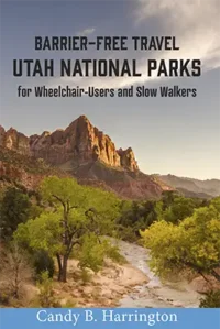
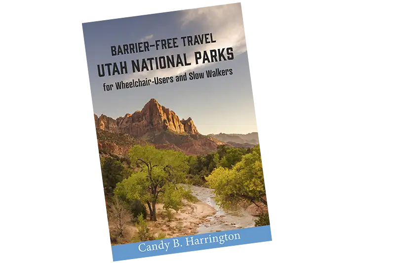
And although it’s taken some time, and a lot of work by advocates, I’m thrilled to see the access improvements at more national lands across the country. In fact, it’s kind of fun to look back and see how much access really has improved whenever I release a new edition of a national park access guide. So as the second edition of Barrier-Free Travel; Utah National Park for Wheelchair-Users and Slow Walkers, (https://emerginghorizons.com/barrier-free-travel-utah-national-parks-for-wheelchair-user-and-slow-walkers/) hits the streets, I’d like to reflect on the improved access in the Utah national parks.
Truly Accessible Trails
At the top of my list for improved wheelchair access in Utah national parks is the creation of more truly accessible trails. Trails that offer folks more than just a short walk near the visitor center – longer accessible trails so wheelchair-users can truly explore the parks.
One of my favorite Utah accessible trails is the Bryce Canyon Shared Use Path. This five-mile trail is paved, and it runs from Inspiration Point all the way down to the shuttle staging area at Ruby’s. The great thing about this trail – besides the access – is that you can do as little or as much of it as you like, as it passes several shuttle bus stops along the way. If you get tired, then just hop on the wheelchair-accessible shuttle.
And then there’s the Pa’rus Trail over in Zion National Park. It’s 1.8 miles long and it runs from the Visitor Center up to Canyon Junction. You can’t beat the scenery along this paved trail, as it crosses the Virgin River several times and offers some impressive red rock views. And if you just want to take the trail one-way, it also connects with the park shuttle bus. Scenic, accessible and convenient – what could be better?
Upkeep is Equally Important
Although developing accessible trails is essential, trail upkeep, repair and improvements are also important factors in the national parks accessibility equation. And in that respect, Utah gets great marks.
For example, there was once a slight access issue over at the Petroglyph Boardwalk in Capitol Reef National Park. The boardwalk itself is nicely accessible, and it offers slow walkers and wheelchair-users a close look at the ancient petroglyphs. Unfortunately time and weather had deteriorated the curb-cut that allowed wheelchair-users access to the boardwalk. Well, I’m happy to report that the curb-cut was repaired and this site is once again accessible to everyone.
And over in Zion there was an issue with one of the access points to the Pa’rus Trail. Formerly there was a short section of a steep grade near the Canyon Junction trailhead. But again, that’s all been repaired to make it accessible to everyone.
And then there’s the annual weather damage. This area of the country gets some pretty severe weather, including snow, heavy rains and sometimes even floods. And of course that can take a toll on the trails. That said, I’m happy to report that the weather damage in the Utah National Parks is usually repaired as soon as possible. And that’s a huge thing.
The Little Things
Finally, there are the little improvements that help with the wheelchair access in Utah national parks. First and foremost is the trail signage. I noticed new and more detailed signs at the trailheads – not just for the accessible trails, but all the trails.
And the interesting thing about the signs is the amount of information that they have. They include important details about the length, surface, width, cross slope and grade of the trails. They also list any possible obstructions. I think this is great for some slow walkers who don’t need a totally accessible trail, but would like one with a gentle grade. These signs really paint an accurate picture of the trail conditions.
And then there are the picnic tables. On my last visit to the parks, there was a problem with folks moving the accessible picnic tables to inaccessible areas. This was done not to be vindictive, but merely because it was shadier in the inaccessible areas. I talked to many rangers about this issue, and the tried different solutions. Unfortunately visitors even managed to cut the chains on secured accessible tables in order to move them to shady spots. Sad, but true.
Fast forward to this year, when now more and more picnic tables are covered, so there’s no need to relocate them. I realize this wasn’t done because of access issues, but the result benefits wheelchair-users who need an accessible picnic table. And that’s a very positive change.
All in all, there’s a sustained move to improve access in our national parks, And I look for that that trend to continue over the years. So make plans to go out and enjoy our national parks – and take one of my access guides along with you!
Barrier-Free Travel
Utah National Parks for Wheelchair-users and Slow Walkers
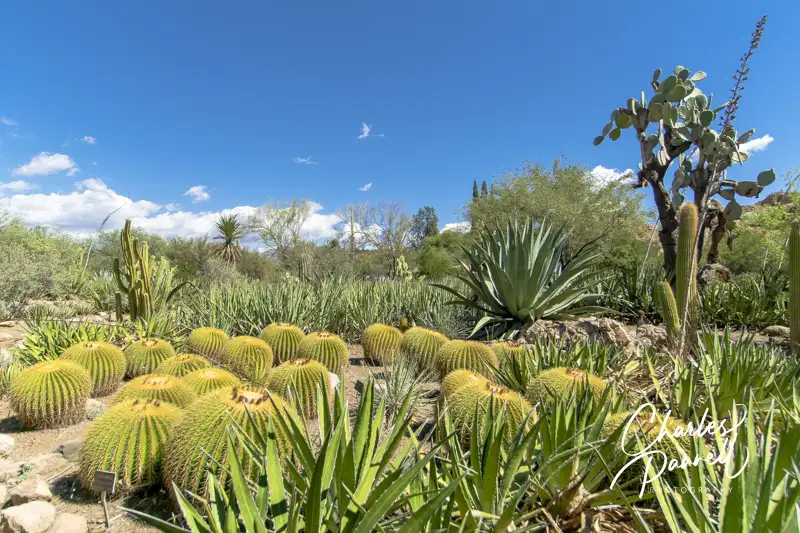
Located three miles west of Superior, Boyce Thompson Arboretum (btarboretum.org) is Arizona’s oldest and largest botanical garden. The 323-acre parcel is filled to the brim with plants from deserts around the world, and offers visitors an up-close-and-personal look at desert flora and fauna in the a variety of landscapes. From sheer mountain cliffs to a streamside forest, there’s a wide selection of habitats for wheelchair-users and slow walkers to explore. And since the park is just 65 miles east of Phoenix, it makes an excellent day trip from the city, as well as a fun Arizona road trip stop.
Plan a Picnic
Butterfly in the Demonstration Garden
Access is relatively good throughout this popular Arizona botanical garden, with accessible parking in front and barrier-free access over to the visitor center. Inside, there’s plenty of room to maneuver a wheelchair around the exhibits, and to the accessible restrooms, which are located in the rear of the building. There’s also barrier-free access to the gift shop, which offers souvenirs, gifts, drinks, snacks and sandwiches.
If you’d prefer to bring you own picnic lunch, accessible picnic tables are located near the Demonstration Garden, across from the visitor center. Accessible parking is located nearby, with a level path over to the shaded tables. It’s a pleasant, peaceful spot to enjoy a noontime repast.
Save some time to visit the Demonstration Garden after lunch. There’s level access throughout the garden which offers design and plant selection ideas for a variety of landscapes. Before you set out to explore the rest of the botanical garden, make sure you have an ample supply of water and a hat, as shade is in short supply, and the midday sun can be harsh.
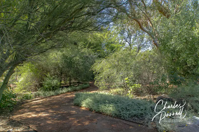
Explore the Main Trail
Most of the Main Trail through the botanical garden is doable for wheelchair-users and slow walkers, as this hard-packed dirt trail is wide and fairly level. It begins near the visitor center and allows visitors access to a number of other gardens along the route.
The nearby Heritage Rose Garden also level pathways, and even though they are made of brick they’re still manageable. And don’t miss the Children’s Garden which features level access and boasts a fun water feature. The Taylor Family Desert Legume Garden is another good choice, as it’s is paved and showcases plants from the pea family. And although the trails in the outdoor Cactus Garden are a bit steep and bumpy, there are a few areas near the Main Trail that are doable for wheelchair-users and slow walkers.
The accessible section of this part of the Main Trail ends in about a mile, near Ayer Lake. From there it travels through the Upper Sonoran Natural Area, which has steep grades and a rocky pavement.
Another Main Trail Branch
Along the Main Trail at Boyce Thompson Arboretum
Even though Ayer Lake is the end of the line for one accessible trail, there’s still more for wheelchair-users and slow walkers to explore. From Ayer Lake, you can also double back and explore another branch of the main trail. Just head back toward the Taylor Family Desert Legume Garden, and connect to the other part of the Main Trail loop.
This section of the trail first trail passes through a patch of eucalyptus forest, with level pathways around the trees. The Herb Garden, which is just up the trail, is also fairly level, with plenty of room for wheelchair-users and slow walkers to navigate around the aromatic herbs. Just past the Herb Garden there’s barrier-free access to the suspension bridge, but the High Trail on the other side of the bridge is not accessible. The access on the Main Trail ends just past the pumphouse, where the trail connects to the rugged Upper Sonoran Natural Area.
All in all it’s about a three-mile round trip jaunt from the visitor center to Ayer Lake, over to the the Main Trail branch, and back to the visitor center. That said, if that’s too long, you can always explore the gardens near the visitor center, which offer a good overview of desert habitats. Either way Boyce Thompson Arboretum makes a fun and educational day trip for wheelchair-users and slow walkers.
Barrier-Free Travel the Grand Canyon for Wheelers and Slow Walkers
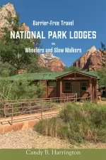
If you’re planning to visit Utah’s Mighty Five National Parks, and wondering if they are wheelchair-accessible, then pick up the newest edition of Candy B. Harrington’s Barrier-Free Travel; Utah National Parks for Wheelchair-Users and Slow Walkers. This essential resource offers essential insider tips to plan a wheelchair-accessible Utah national parks getaway.
Wheelchair-Accessible Utah National Parks
This new edition includes:
Updated information on new access additions.
Fly-drive trip planning information, including accessible van rentals.
Access details and photographs of 33 wheelchair-accessible properties, including all in-park lodging options.
Information about ranger-led tours, loaner wheelchairs and the free America the Beautiful Access Pass.
The scoop on how to nab free accessible bus tours in Bryce Canyon National Park and Zion National Park.
Detailed access information on accessible trails, viewpoints, picnic areas and attractions — in and near the parks.
Information about barrier-free camping options in all the parks.
Insider tips on where to go for the best windshield views, accessible picnic spots and sunset photos.
This inclusive title is the most recent addition to Harrington’s national park series; and although it’s written for wheelchair-users and slow walkers, stroller moms will also appreciate the access information in this guide. It will help everyone plan a truly accessible Utah national parks vacation.
Says Harrington, “I’m very excited to report that Utah National Parks not only added more accessible features since my last edition, but they also maintained the ones they already had. I’m particularly happy to see the access improvements in the Pa’rus Trail as well as the continued upkeep of the accessible Bryce Canyon Shared Use Path.”
For more information wheelchair access in Utah’s National Parks, visit emerginghorizons.com/barrier-free-travel-utah-national-parks-for-wheelchair-users-and-slow-walkers/ and order your copy of Harrington’s newest access resource today.
Barrier-Free Travel Utah National Parks for Wheelchair-users and Slow Walkers
Track chairs are now available for loan at many Louisiana State Parks. Outfitted with tank tracks, these all terrain power wheelchairs allow folks to navigate trails that standard wheelchair can’t handle.” These specially-designed all-terrain chairs can really open up a world of new experiences for people with limited mobility,” said Lieutenant Governor Billy Nungesser. The track chairs were purchased with donations made to the Louisiana Park Foundation.
The Louisiana State Park track chairs are available at the following locations.
Fontainebleau State Park
Bogue Chitto State Park
Jimmie Davis State Park
Lake D’Arbonne State Park
North Toledo Bend State Park
Port Hudson State Historic Site
Sam Houston Jones State Park
Louisiana State Arboretum
Reservations for the track chairs must be made at least 48 hours in advance. The user must be accompanied by a companion that is at least 18 years old, and both the user and the companion must present a photo ID when picking up the track chair. A liability waiver must also be signed in order to borrow a track chair. Additionally, users under 16 must wear a helmet while operating the track chair.
Named for the 848-foot tall basalt feature that towers over the area, Beacon Rock State Park (parks.wa.gov/find-parks/state-parks/beacon-rock-state-park) overlooks the Columbia River and sits in the middle of the Columbia Gorge National Scenic Area. The namesake rock was originally called Che-Che-op-tin (the navel of the world) by the natives, and was given its modern moniker by William Clark when his expedition passed through the area in 1805. Today Beacon Rock State Park is a must-see stop on the Lewis and Clark National Historic Trail; and with a nice campground, some beautiful surroundings and a few wheelchair-accessible trails, it’s the perfect spot for a short nature break.
The Lay of the Land
Beacon Rock State Park is divided into four separate areas, divided by Highway 14. The namesake rock can be spotted from several miles away, with parking located on the south side of Highway 14. Although the trail to the top isn’t accessible, it’s still worth a brief stop at the base.
The historic CCC Upper Campground, two picnic areas and Hadley Grove are located on the north side of Highway 14, directly across from Beacon Rock. Be on the lookout for the turn (a very sharp right) as soon as you spot the Beacon Rock parking area.
The Doetsch Area is located to the west of Beacon Rock, on the south side of Highway 14. This area has moorage sites, accessible camping, the Doetsch Trail and a nice picnic area. This is the newest area of the park, and it has the best wheelchair-access.
Finally, the group camp and the equestrian trailhead are located on the north side of Highway 14, between the Upper Campground and the Doetsch Area.
Spend the Night
The best wheelchair-accessible camping option in the park is located in the Woodard Creek Campground, near the moorage sites in the Doetsch Area. There are only two campsites there (A and B), and although both are in a level area, campsite B is the designated accessible site.
There’s accessible parking next to campsite B, which has a paved driveway, and a level site with a fire ring and picnic table. Campsite A is also doable for many folks, but it lacks a paved driveway. The accessible shower house is located across the parking lot, about 50 feet away. It includes accessible bathrooms with large stalls, grab bars, and roll-under sinks, as well as individual accessible shower rooms. There’s barrier-free access to the shower rooms, which each include a roll-in shower with a fold-down shower bench, a lowered showerhead, grab bars and a second seat for changing. It’s all very nicely done access-wise.
Additionally, there are five RV sites located in a level area near the end of the road in the Doetsch Area. That said, the sites near the moorage area are a much better choice, as they offer more privacy than the RV sites.
Unfortunately, the historic Upper Campground presents some obstacles for wheelchair-users and slow walkers. It’s a hilly campground and there are no designated accessible spaces. That said, campsites 19 and 20 are the closest sites to the bathrooms; however it’s still a uphill trek to get to them. Some slow walkers may be able to use these sites, but it’s not a realistic option for most wheelchair-users. The Woodward Creek Campground is newer, and includes modern access features.
Explore Hadley Grove
Hadley Grove
Named for the first superintendent of Beacon Rock State Park, Hadley Grove is just a short hike from the Upper Campground. This lovely slice of a second-growth fir forest is a pleasant spot to linger, especially on a hot day. And although the trail is rated as wheelchair-accessible, it’s not a flat level path.
The trail to Hadley Grove begins near campsite 11 in the Upper Campground. The designated parking area for the trail is small, and it’s covered with chunky gravel. Although the official trail description says there are two steps up to the trailhead, it’s more of a short steep pathway. After that, there are several switchbacks before you reach Hadley Grove, about 500 feet down the trail.
Accessible trails are allowed running slopes of 8% to 10% as long as there are resting intervals every 30 feet. And that pretty much describes the first part of the trail to Hadley Grove. That said, once you reach the grove, a level well-maintained trail winds through it. It’s a beautiful and peaceful spot to stop and linger, and take in the beauty of Mother Nature.
To be honest the steepest part of the trail is the slope up from the parking area, and if you can manage that, there’s a good chance the trail won’t offer any obstacles to you. That said, manual wheelchair-users will probably need some assistance on at least the first slope. Give it a try, and if it doesn’t work for you, you can always turn back.
Enjoy the Doetsch Trail
Doetsch Walking Path
In contrast to the trail to Hadley Grove, the Doetsch Trail offers excellent wheelchair-access. Located in the Doetsch Day-Use Area, there’s accessible parking and barrier-free access to the trailhead. There are also accessible restrooms near the parking area.
The 1.2-mile paved trail winds through a meadow bordered by mountains and the Columbia River. There are benches to sit and take a break along the way, and it’s an excellent birding site. About halfway along the trail, you’ll get a nice river view before the trails loops back through a shady forest to the parking area.
As an added bonus there are several accessible picnic tables in the meadow, near the parking area. So pack along a lunch and enjoy it al fresco. Not only is it a scenic spot to enjoy lunch, but it’s also the most accessible picnic area in the park. It’s a great way to top off any visit to Beacon Rock State Park.
Picnic Tables on the Doetsch Walking Path
Barrier-Free Travel Washington National Parks for Wheelers and Slow Walkers
")