Population 4,529
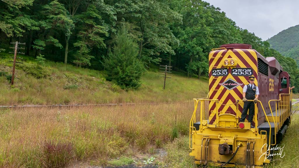
Billed as one of the most beautiful small towns in America, Jim Thorpe was named after the 1953 Olympic medal winner, James Francis Thorpe. And although the town does have some access problems, with a shortage of curb-cuts and accessible sidewalks, it’s worth a stop for a ride on the Lehigh Gorge Scenic Railway (www.lgsry.com ). There’s accessible parking at the station, with level access to the ticket window. Lift boarding is available for the coach car or the open-air car, and wheelchair-users can stay in their own wheelchair or transfer to a seat for the 70-minute narrated tour. The train travels into Lehigh Gorge State Park, with plenty of scenic views along the way. And if you’d like a closer look at the scenery after the excursion, there’s a 2.5-mile section of the Lehigh Gorge Trail that’s wheelchair-accessible. This paved multiuse trail runs alongside the river, and it’s especially beautiful in the fall.
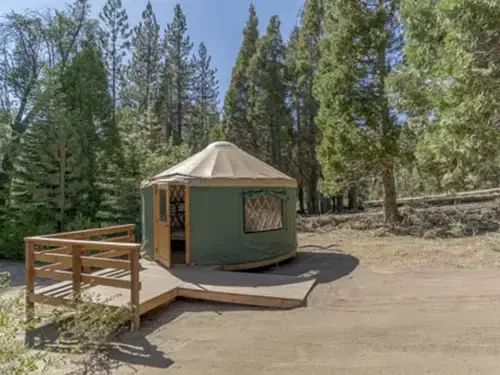
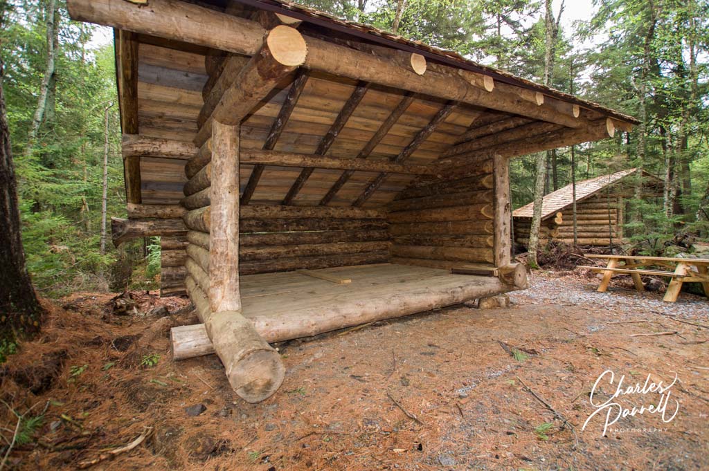
Lea-to at John Dillon Park – a Ramp Has Been Added
Population 3,328
Located in upstate New York, Tupper Lake is a nice stop for nature lovers. The anchor attraction is the Wild Center, which is designed to inspire visitors to explore the great outdoors ( emerginghorizons.com/a-wheelchair-accessible-adirondack-adventure) . Access is excellent throughout the museum, which features a number of outdoor habitats and interactive exhibits that introduce visitors to Adirondack ecosystems. Outside, an accessible half-mile trail winds around Greenleaf Pond, with interpretive panels along its length. And if you want to get serious about the outdoors, then spend the night in an accessible lean-to in nearby John Dillon Park (www.paulsmiths.edu/john-dillon-park). Designed from the get-go to be barrier free, the park features trails, a fishing and kayak dock and a pontoon boat — all of which are wheelchair-accessible. Although there’s no charge to spend the night at John Dillon Park, usage is limited to disabled campers. Day-use visitors don’t need to make advance arrangements, however reservations are required for overnight stays.
Population 16,850
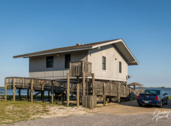
Located about 30 miles off of Interstate 10, Gulf Shores is worth the short detour for Gulf State Park (www.alapark.com/gulf-state-park) alone. This 6,100-acre state park occupies a prime piece of beach real estate, and offers three two-bedroom wheelchair-accessible cabins on the shore of Lake Shelby. The cabins each includes a full kitchen, a spacious great room, a screen porch, and two bathrooms with a roll-in shower. And the cabins are just a short drive from Gulf Oak Ridge Trail — a 3-mile paved level trail that winds through the woods. Accessible restrooms are located along the trail, and there are plenty of spots to stop and take a break. And don’t forget to visit the Fishing and Education Pier, while you’re in the park. There’s accessible parking close to the pier and barrier-free access to the 1,500 foot-long pier, which features a nice water view, with wayside wildlife exhibits along its length.
Located in Eastern Utah just five miles north of Moab, Arches National Park is known for its more than 2,000 natural stone arches. The main park road runs from the visitor center to the Devils Garden Trailhead, and connects with side roads to the Windows Section and Wolfe Ranch. And although the major sites are marked on the park map, there are also a number of unmarked pullouts along the way that offer spectacular windshield views of the beautiful red rock landscape.
Insider Tips
Don’t miss Balanced Rock – one of the most accessible sites in the park. It offers a nice .2-mile out-and-back accessible stroll around the seemingly precariously perched namesake rock, with a killer view from an overlook located midway along the route.
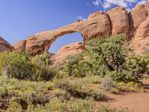
Although the main trail to Skyline Arch is not accessible, due to steps and rocks. wheelchair-users and slow walkers can easily access the other side of the arch from the Needles Campground. Just drive to the amphitheater, park in the accessible parking area, and take the level sidewalk over to the amphitheater. There’s an absolutely beautiful close-up view of Skyline Arch from just about anywhere in the amphitheater.
In addition to an entrance fee or a park pass, a day use vehicle entrance reservation is also required for Arches National Park, for visits from April through October between 7 AM and 4PM. Reservations are released in monthly blocks on recreation.gov beginning in January. Print out the reservation or do a screen capture, as cell phone service is spotty in the park. Entry reservation are not available at the park, and visitors who don’t have one will not be admitted.
If you don’t have an entrance reservation, consider entering the park before 7 AM. You’ll dodge the crowds and the park is absolutely beautiful as things begin to come to life for the day.
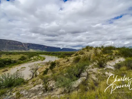
El Capitan, the southern-most point of the Guadalupe Mountains
Named for the mountain range that dominates the landscape, Guadalupe Mountains National Park (www.nps.gov/gumo/) contains the four highest peaks in Texas, and boasts an impressive share of backcountry acreage. If all that sounds a little foreboding for wheelchair-users and slow walkers, then think again.
The park also contains a historic stage stop as well as the ruins of an 1800s ranch — both of which are wheelchair-accessible. They can be easily reached from Highway 62/180, which runs from El Paso to Carlsbad and passes through the southwest section of the park. Not only is Guadalupe Mountains National Park a destination by itself, but it also makes a nice add-on to a Carlsbad Caverns visit. Either way, it’s a good choice for wheelchair-users and slow walkers who want to explore a bit of southwest history.
Pinery Stage Station
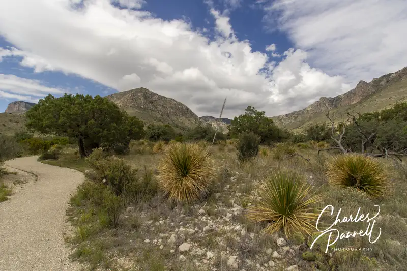
The Pinery Trail in Guadalupe Mountains National Park
The Pinery Visitor Center makes a good first stop in the park. Located just off the highway, there’s accessible parking in front, with barrier-free access to the building. Inside there’s plenty of room to maneuver a wheelchair around the exhibits and ranger information desk, and level access to the accessible restrooms.
But the real attraction — The Pinery Trail — starts just outside the visitor center and leads over to the site of the former Pinery Stage Station. The paved accessible trail is dotted with benches, while interpretive plaques that detail the desert plants line the walkway.
The trail ends at an interpretive plaque that explains the importance of this one-time stage stop. Built in 1858, the stop was named for a nearby stand of pines, and since it had an abundant water source it was one of the most favored stations along the 2,800-mile mail route from St, Louis to San Francisco. It’s about a .7-mile round trip hike from the visitor center, however if you can’t manage the distance, there’s also a pullout along the highway near the stage stop. Although the Butterfield Overland Mail Coach only operated for a little over two years, it should be noted that it never missed a run — even in adverse weather.
Ruins of the Pinery Stage Station
Frijole Ranch History Museum
Another must-see in Guadalupe Mountains National Park is the Frijole Ranch site, which is located just up the highway. Accessible parking is located near the accessible vault toilet. And since there are accessible picnic tables in a nearby covered pavilion, this stop is also a good spot for a lunch break.
The accessible Manzanita Spring Trail begins near the parking area, and leads over to the Frijole Ranch History Museum — an open-air exhibit which focuses on the history of this parcel, which was first settled by the Radar brothers in 1876. It was later acquired by the John Thomas Smith family in 1906. They grew apples, peaches, apricots and other fruits, and transported their harvest by wagon to Van Horn — a two-day ride away. The Smith farmhouse still stands, and it’s furnished as it would have been in the early 1900s. The Smith family operated the orchard until 1942, and it later served as a ranger residence, before it was added to the National Register of Historic Sites.
The paved undulating trail continues on past the old farmhouse and ends at Manzanita Spring. It should be noted that there’s a short 15-foot section of the trail that has rocks and dirt along it, from a washout. The good news is, that section is at the beginning of the trail, and if you can make it past that, you won’t have any problems completing the trail. On the other hand, if it’s been repaired, this trail is entirely passable for wheelchair-users and slow walkers. All it all, it’s a one-mile round trip hike that offers an interesting look at the farming history of the area.
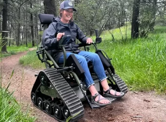
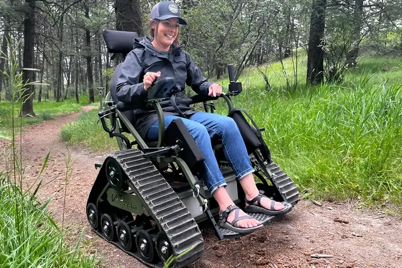
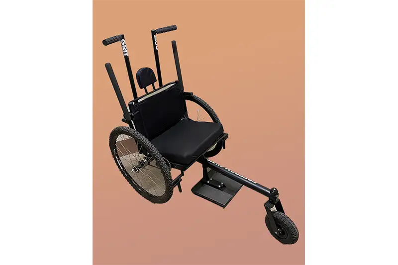
Thanks to Friends of Sleeping Bear Dunes, the Sleeping Bear Dunes National Lakeshore offers three loaner track chairs for use by wheelchair-users and slow walkers. The Mama Bear Chair and the Baby Bear Chair can be used on the Bay View Trail. The Mama Bear Chair is 24 inches wide between the armrests and can carry up to 350 pounds; while the Baby Bear Chair is 18 inches wide between the armrests and can carry up to 300 pounds. The newest track chair, The Platte Bear Chair, is 22 inches wide between the armrests and can carry up to 300 pounds. It can be used on the Platte Plains Trail.
Reservations are required to borrow the Sleeping Bear Dunes track chairs, and they are available Friday through Monday, during the summer season. A waiver of liability must also be signed. Minors are required to be accompanied by an adult. Track chair-users must be able to transfer independently or bring a companion to assist with transfers. After a short orientation a volunteer host will accompany the track chair-user on a hike.
The hottest, driest and lowest point in North America, Death Valley is the largest national park in the lower 48 states. And with over three million acres of wilderness area, there’s a huge diversity in the flora and fauna throughout the park. From majestic sand dunes and salt flats, to snow capped peaks, a lush oasis and even a massive crater, there’s something for just about everyone at this remote national treasure.
Insider Tips
A stop at Badwater – the lowest point in the US — is a must do on any Death Valley itinerary. There’s boardwalk access out to the salt flats, and from there you can roll as far as you like. It’s best to hit this area in the morning though, as it can get quite hot later in the day. Additionally, don’t forget the insect repellent, as the biting flies that are common in Death Valley really like this area of the park – especially in the summer.
Many visitors flock to Zabriskie Point and Dantes View, off of Highway 190; while most folks entirely pass up the scenic 20 Mule Team Canyon Drive, which is located between the two. This 2.5-mile scenic drive winds up and down the colorful eroded badlands, and offers an off-the-beaten-track experience without having to trek through the desert for days.
Although there’s no shortage of food offerings at Furnace Creek, head on over to Timbisha Shoshone land and try something different for lunch. Just follow the signs to Timbisha Village Tacos from highway 190, between the Furnace Creek Inn and Furnace Creek Ranch. There aren’t many choices on the menu – Indian tacos, burritos, taco salad and shaved ice – but the food is tasty and the prices are reasonable. And although their hours vary, they are usually open for lunch. To-go food is also available.
Located on the east side of the state, about five hours from Zion, Canyonlands National Park is the largest of Utah’s “mighty five”. That said, it’s also a pretty rugged park, and you’ll need a four-wheel-drive vehicle to access some of the more remote areas. There are however two sections of the park that are easily accessible in a standard car or truck — the Needles District and the Island in the Sky District. Both of these areas offer scenic drives on paved roads, with overlooks and viewpoints along the route.
Insider Tips
Don’t miss Newspaper Rock which is located just outside the Needles District, about 12 miles from the intersection of Highway 191 and Highway 211. This massive rock contains an impressive collection of historic petroglyphs, which date back some 1,500 years. There’s a 30-foot long level trail next to the petroglyph panels that offer visitors an up-close-and-personal look at these Puebloan and Ute relics.
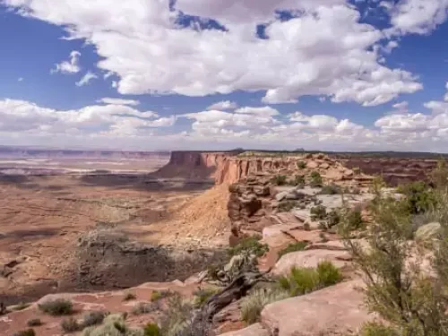
For the best view in the park, head over to Grand View Point Overlook. From there, you’ll get a very accessible view of the La Sal Mountains and the Colorado River Canyon, and you can even catch a gander of The Needles District in the distance.
Be sure and stop at Shafer Canyon Overlook on your way out of the park. Although there are also turnouts near this overlook on the way in, it’s best to catch the view as you head north– near where the final scene of Thelma and Louise was filmed. Impressive is an understatement.
Named for Ebenezer Bryce, a Scottish immigrant who settled in the Paria Valley in 1875, Bryce Canyon National Park is known for the spire-like hoodoos that seem to magically rise from the canyon floor. Created by a combination of freezing, thawing and erosion, these unusual limestone formations were sculpted over millions of years. Today, this Utah national park is often described as a cave without a ceiling; as the hoodoos bear a striking resemblance to stalagmites found on cavern floors.
Insider Tips
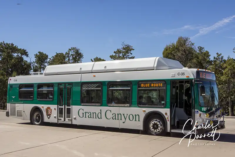
Free wheelchair-accessible shuttle bus transportation through the park amphitheater is available from April through the end of September. Although cars are allowed along this route, parking is at a premium during the busy summer season, so taking the shuttle bus is the easiest way to see the park.
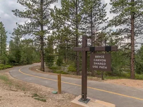
Don’t miss the Bryce Canyon Shared Use Path – the longest accessible trail in the park. This paved trail begins outside of the park at the shuttle staging area at Ruby’s in Bryce Canyon City, and travels 2.4 miles to the park entrance, then continues another 2.6 miles to Inspiration Point. It also connects with the shuttle system at the visitor center, general store, lodge, Sunset Point, Sunset Campground and Inspiration Point, so you can do as much of the trail as you like, then hop on the accessible shuttle to return to your car.
The historic Lodge at Bryce Canyon, which dates back to 1925, offers four wheelchair accessible rooms – two with roll-in showers and two with tub/shower combinations. This rustic property was the brainchild of Gilbert Stanley Underwood who also designed Old Faithful Lodge at Yellowstone, the Ahwahnee at Yosemite, and Jackson Lake Lodge at Grand Teton National Park.
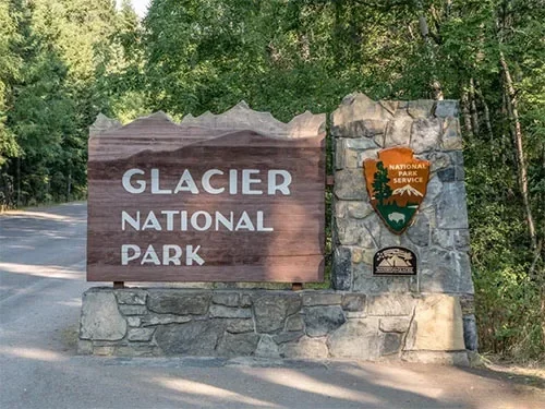
Known as the “Crown of the Continent” because the Continental Divide bisects the park, Glacier National Park encompasses more than a million acres of coniferous forests, alpine meadows, pristine lakes and glacier-carved peaks. The wildlife in the park is just as diverse at the landscape that supports it, and it includes elk, bighorn sheep, moose, and one of the largest remaining grizzly populations in the lower 48 states.
Insider Tips
A well kept secret along Going-to-the-Sun Road, Red Rock Point offers a beautiful view of McDonald Creek cascading down over the massive red rocks. The turnout is located about a mile north of the Trail of the Cedars on the left side of the road. Keep your eyes peeled when you get close, as there is absolutely no signage to mark the overlook. There’s accessible parking near a hard-packed dirt path that leads .06 miles out to a boardwalk viewing platform.
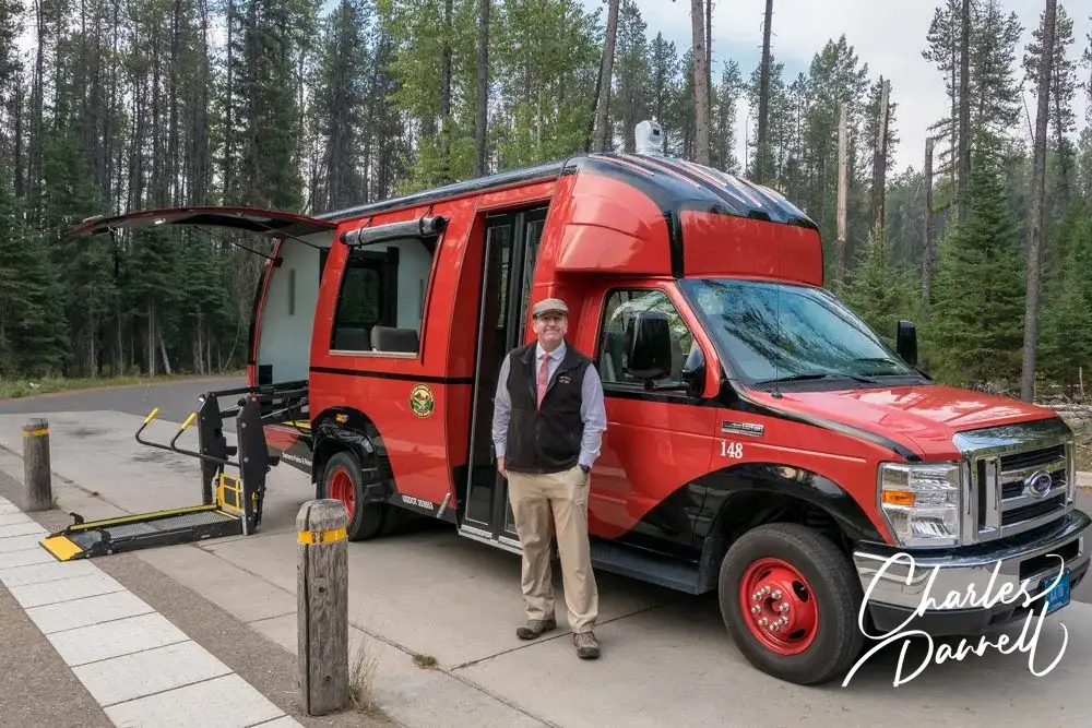
Although the historic Red Buses of Glacier National Park are not wheelchair-accessible, Xanterra Parks and Resorts has two wheelchair-accessible vehicles in their. The lift-equipped buses have roll-up plastic flaps on the windows, and passengers get a full view of everything around them, thanks to an on-board camera and monitors Even better — the accessible vehicle is booked solely for your party, so you get a private tour at the regular tour price.
In addition to an entrance fee or a park pass, a day use entrance reservation is also required for Glacier National Park visitors during peak visitation periods in the summer. Entrance reservations are currently required for the West Entrance Station, the Camas Entrance Station and Many Glacier Valley. That said the park adjusts the system annually, so check the park website for the most current information. Entrance reservations are not available at the park. They must be purchased at recreation.gov in advance. Visitors without an entrance reservation will not be admitted.