Wheelchair-Accessible Romantic Retreats
Bryce, California, Crater Lake, getaway, lodging, New Mexico, Oregon, romantic, Santa Fe, Skamania, Utah, Washington, wheelchair-accessible, Yosemite
Romantic retreats come in all shapes and sizes, From a secluded cabin in the woods to a lakeside lodge, or even a Moroccan retreat, there’s something out there for just about everyone. And today slow walkers and wheelchair-users don’t have to be left out, as many of these choices are now accessible. So with Valentines Day just around the corner, here are some wheelchair-accessible romantic retreats to share with your sweetheart.
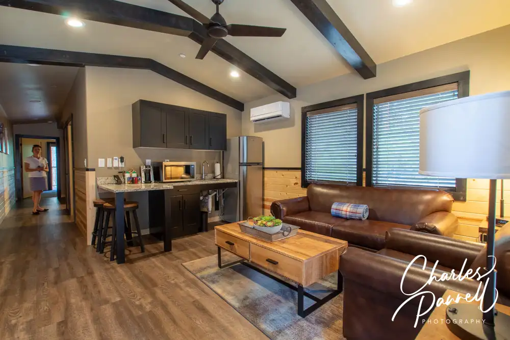
Skamania Cabin
emerginghorizons.com/relax-in-a-skamania-lodge-wheelchair-accessible-cabin
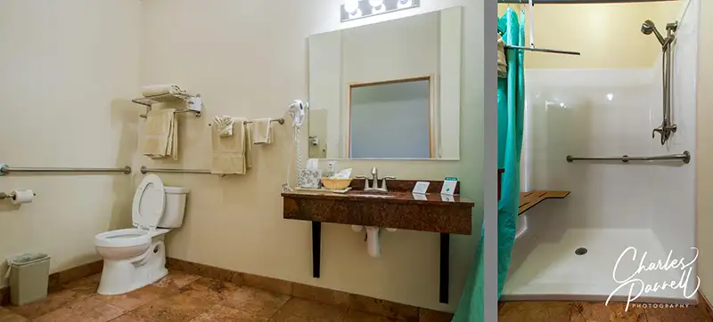
Located on the fringe of Skamania Lodge in Southwestern Washington, this cozy cabin is perfect for a romantic getaway. It’s got a nice fireplace in the living room, a compact kitchen, a large bedroom, and a bathroom with a roll-in shower. And you can even order room service and enjoy it on the private deck.
Mendocino Retreat

emerginghorizons.com/a-wheelchair-accessible-mendocino-coast-retreat
Next up on our list of wheelchair-accessible romantic retreats is The Little River Inn on California’s Mendocino Coast. This wheelchair-accessible room overlooks the ocean and has a luxurious bathroom with a roll-in shower. And if you get a little chilly, there’s also a cozy fireplace in the front room. A great choice for folks who love the coast.
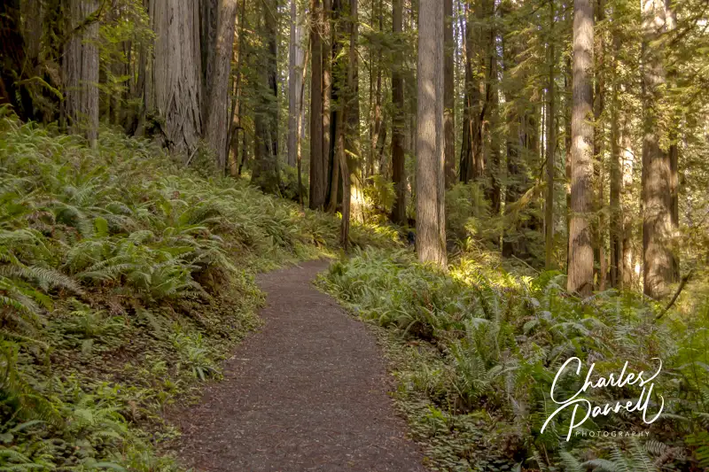
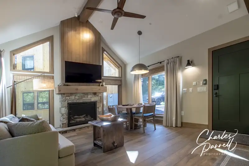
Tenaya Lodge Cabin
emerginghorizons.com/wheelchair-accessible-explorer-cabins-at-tenaya-lodge
If you prefer the mountains, then head up to Yosemite and spend a few nights in this accessible Explorer Cabin at Tenaya Lodge. The cabin is located on a remote slice of the lodge property, which is just a short drive from the national park. And it has two bedrooms, a compact kitchen and a living area with a fireplace. The bathroom is nicely accessible with a roll-in shower, and there’s also a cozy private deck off the master bedroom.
Historic Harvey House
emerginghorizons.com/the-castaneda-hotel-a-wheelchair-accessible-harvey-house
History buffs with love this former Harvey House property, which is located in Las Vegas, New Mexico. The Castaneda Hotel, which was originally opened in 1898, was restored and reopened in 2019. And although access wasn’t really a thing back in the days of the Harvey Girls, the new rendition has a nice accessible room with a roll-in shower. It’s a fun property in a historic town.
Crater Lake Lodge
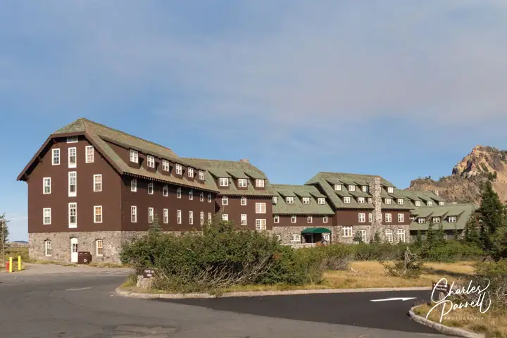
emerginghorizons.com/spend-the-night-at-wheelchair-accessible-crater-lake-lodge
Next up on our list of wheelchair-accessible romantic retreats is a rustic lodge that sits on the shore of a mountain lake – Crater Lake to be more specific. The historic lodge is a great place to spend a romantic weekend. The spacious wheelchair-accessible room is located on the ground floor, just steps from the lobby, dining room and terrace. After a day of exploring the lake, settle in for a nice dinner and top it off with drink on the terrace. You just can’t beat the lake view. It’s also a great spot to enjoy a romantic sunset.
A Desert Oasis
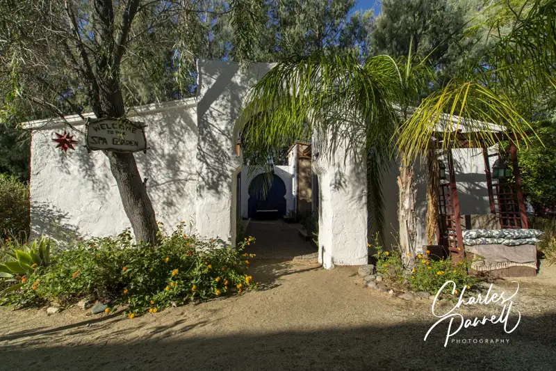
emerginghorizons.com/the-el-morocco-inn-a-wheelchair-accessible-oasis-in-the-california-desert
For a taste of Morocco without leaving the US, check out the El Morocco Inn in the California desert. Located in Desert Hot Springs, this accessible oasis includes a nice wheelchair-accessible room with a roll-in shower. There’s also good access to the public areas, including the swimming pool and the spa. And if you’d just like to chill, you can kick back in the library and enjoy a book or DVD. Truly there’s something for everyone at this relaxing retreat.
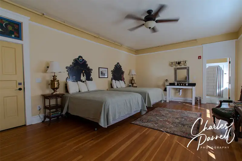
Santa Fe Suite
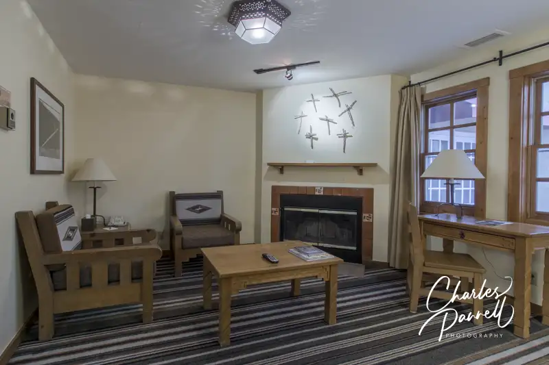
emerginghorizons.com/a-wheelchair-accessible-santa-fe-lodging-choice
This Santa Fe Hotel offers a nice wheelchair-accessible suite, just steps from the historic Plaza. The Hotel Chimayo features a spacious accessible suite with a large bathroom and a roll-in shower. And there’s also a cozy fireplace in the living room to snuggle up with your sweetheart. Don’t forget to stop in at the Low n’ Slow Bar while you are there. Not only do they have a wide selection of beverages and snacks, but you just can’t beat the retro low rider décor.
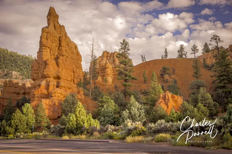
Red Canyon Cabin

emerginghorizons.com/spend-the-night-in-red-canyon-village
Last but not least on the list of wheelchair-accessible romantic retreats is this Bryce Canyon cabin at Red Canyon Village. Located just a few miles from the national park entrance along scenic Highway 12, this log cabin is just a short walk from the office. It includes a king-sized bed, a compact kitchen and a large bathroom with a roll-in shower. And if you’d like to dine al fresco there’s a picnic table outside and a few chairs on the front porch. A perfect Red Canyon getaway.
Barrier-Free Travel
California National Parks
Road Trips
Travel Ideas
for Wheelchair-users and Slow Walkers