Known as the “Crown of the Continent” because the Continental Divide bisects the park, Glacier National Park encompasses more than a million acres of coniferous forests, alpine meadows, pristine lakes and glacier-carved peaks. The wildlife in the park is just as diverse at the landscape that supports it, and it includes elk, bighorn sheep, moose, and one of the largest remaining grizzly populations in the lower 48 states.
Insider Tips
A well kept secret along Going-to-the-Sun Road, Red Rock Point offers a beautiful view of McDonald Creek cascading down over the massive red rocks. The turnout is located about a mile north of the Trail of the Cedars on the left side of the road. Keep your eyes peeled when you get close, as there is absolutely no signage to mark the overlook. There’s accessible parking near a hard-packed dirt path that leads .06 miles out to a boardwalk viewing platform.
Although the historic Red Buses of Glacier National Park are not wheelchair-accessible, Xanterra Parks and Resorts has two wheelchair-accessible vehicles in their. The lift-equipped buses have roll-up plastic flaps on the windows, and passengers get a full view of everything around them, thanks to an on-board camera and monitors Even better — the accessible vehicle is booked solely for your party, so you get a private tour at the regular tour price.
In addition to an entrance fee or a park pass, a day use entrance reservation is also required for Glacier National Park visitors during peak visitation periods in the summer. Entrance reservations are currently required for the West Entrance Station, the Camas Entrance Station and Many Glacier Valley. That said the park adjusts the system annually, so check the park website for the most current information. Entrance reservations are not available at the park. They must be purchased at recreation.gov in advance. Visitors without an entrance reservation will not be admitted.
Generally speaking, caves are not usually a great recreational choice for wheelchair users-and slow walkers. That said, there are a few exceptions. And in that respect Mammoth Cave National Park tops the list. Not only do wheelchair-users and slow walkers have their choice of several accessible trails above ground; but thanks to some recent repairs and renovations, they can also explore the subterranean chambers of this Southwestern Kentucky national park.
A Wheelchair-Accessible Mammoth Cave Tour
Elevator to the accessible Mammoth Cave tour
Mammoth Cave has something that most caves lack — an elevator. Unfortunately it was out of service for several years; but after a massive $2.2 million repair project, it’s once again operational. And after the repairs were completed, an Accessible Cave Tour was added to the roster.
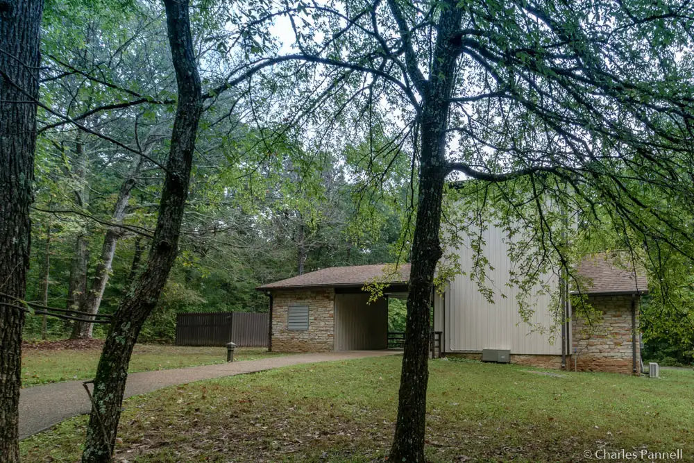
This two-hour tour begins at the visitor center, where participants then drive their own vehicles to the elevator on Cave City Road. There’s accessible parking in the lot, and barrier-free access over to the elevator. The tour of this gypsum cave travels over level cement pathways and visits the Snowball Room, and includes portions of Cleveland Avenue. This accessible tour is an extremely manageable half-mile in length, and it can also accommodate large power wheelchairs and scooters. Additionally, there are benches along the way for slow walkers who need to take a break.
Tickets for the Accessible Cave Tour can be purchased at recreation.gov or by calling (877) 444-6777. They are available up to six months in advance, and it ‘s best to purchase them as soon as possible to avoid disappointment. Some walk-up tickets may be available; however due to the popularity of the tour that’s not always the case. For more information about the Accessible Cave Tours, contact the visitor center at (270) 758-2180.
Accessible River and Forest Trails
The Heritage Trail at Mammoth Cave National Park
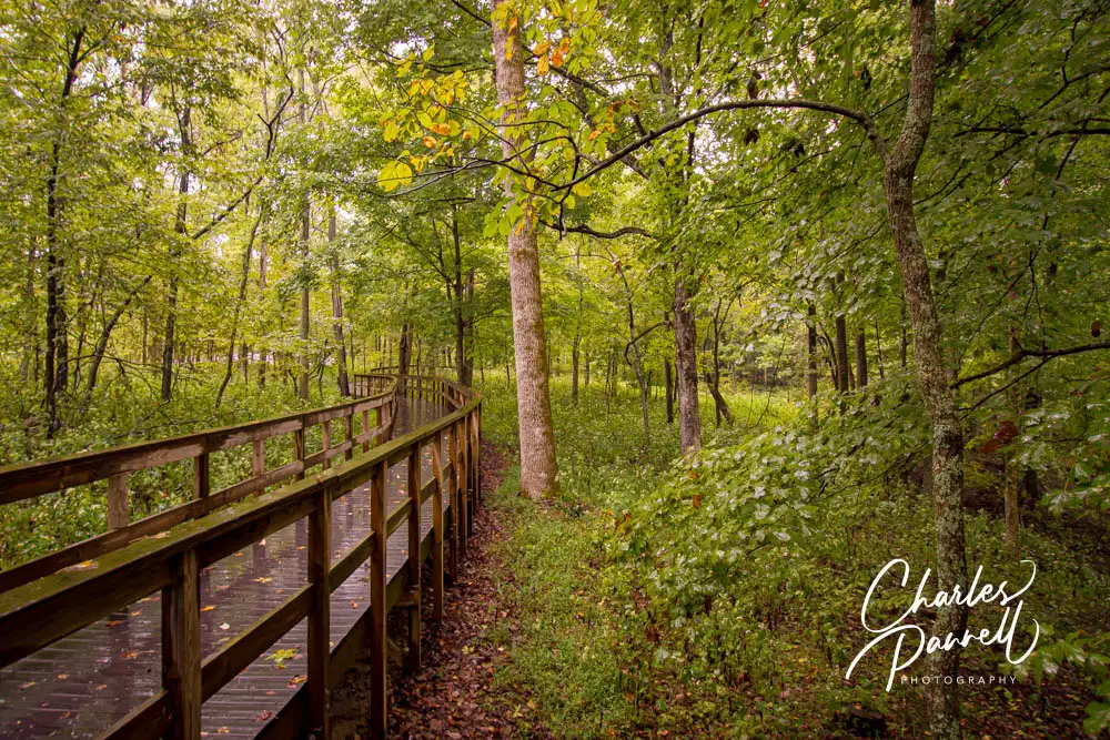
There are also a number of trails to include on a wheelchair-accessible Mammoth Cave itinerary. The Heritage Trail, which begins near the visitor center, tops the list. This three-quarter-mile trail starts off as a wide level path, before it transitions to a boardwalk that loops through the forest. There are several scenic stops along the way, including Sunset Point, which offers a panoramic view of the rolling hills of the Green River drainage basin.
There’s also a short 300-foot trail out to the Old Guides Cemetery from the Heritage Trail. The level trail leads over to a abandoned graveyard, where Stephen Bishop — a guide who died in 1857 — was laid to rest. Even if you can’t do the entire trail, it’s still a pleasant stroll, and there are plenty of benches to stop and take a break and enjoy the view along the way.
Echo River Spring Trail at Mammoth Cave National Park
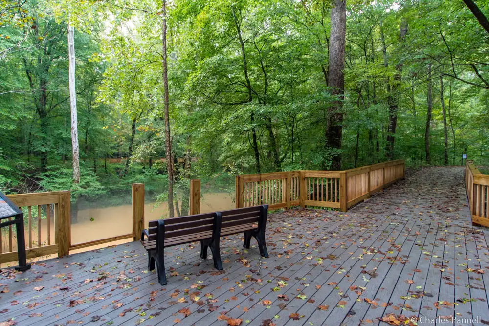
The Echo River Spring Trail is also a good choice for wheelchair-users and slow walkers. The trailhead is located a short drive from the visitor center, in the Green River Ferry parking lot. Accessible parking is available near the trailhead, and there’s also an accessible porta-potty and an accessible picnic table nearby. This .6-mile trail begins as a wide cement walkway, before it transitions to a short boardwalk through the forest. Along the way it passes Echo River Spring, before it loops back to the parking lot. It’s a pleasant stroll, and there are several overlooks with benches to sit back and enjoy the peaceful forest.
More Wheelchair-Accessible Trails!
Sloan’s Crossing Pond Walk at Mammoth Cave National Park
Another couple of wheelchair-accessible trails are located a little further from the visitor center. At the top of that list is Sloan’s Crossing Pond Walk. From the visitor center follow Mammoth Cave Parkway for about three miles, and look for the trailhead on the right, just past Brownsville Road.
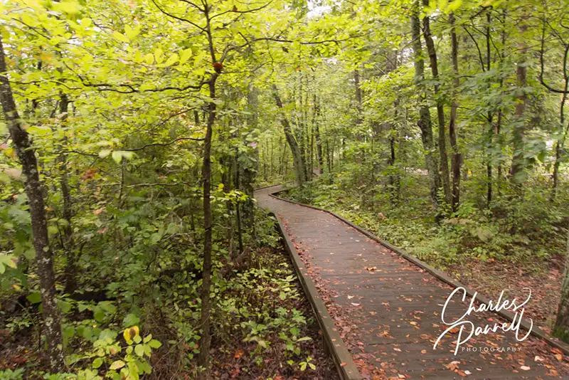
This .4-mile boardwalk that circles the shaded pond was completely renovated in 2023. It’s wide and level, and dotted with accessible viewing platforms, benches and interpretive plaques. Even if you can’t do the whole trail, there’s an excellent pond view from the first overlook, which is just steps from the parking area. As an added bonus there’s also an accessible picnic area there.
Last but certainly not least on our wheelchair-accessible Mammoth Cave National Park itinerary, is a stop at the Sand Cave Trail. Located near southeast park entrance, this short trail makes a good stop if you are heading towards Cave City. The .1-mile boardwalk winds through the forest and features low bumpers which open up the views for wheelchair-users. The trail terminates at an overlook, which has a view of the Sand Cave rescue site.
Floyd Collins, who was an avid cave explorer, was trapped at that site for 17 days in 1925. Unfortunately rescuers were not able to reach Collins before he succumbed from exposure. His body was later removed and interred near his family’s Crystal Cave home. Today the story of his life and death is detailed at the wayside exhibit near the Sand Cave Trail. Although it’s a sad — and somewhat gruesome — tale, the trail actually offers a pleasant stroll; and it’s a great way to top off a Mammoth Cave visit.
Located about 240 miles north of Anchorage and 120 miles south of Fairbanks, Denali National Park (www.nps.gov/dena/index.htm) is one of the crown jewels of the 49th State. One of Alaska’s eight national parks, Denali occupies just over six million acres of wild land bisected by a seasonal road. And if all that sounds a bit rugged for your taste, rest assured it is possible to plan a wheelchair-accessible Denali visit. Granted, scaling the 20,310 namesake mountain may not be on your to-do list; however the park also offers a nice selection of wheelchair-accessible trails, attractions and tours suitable for non-mountaineering visitors.
Getting There
A top concern about a wheelchair-accessible Denali National Park visit is actually getting to the park. Although there’s no airport there, Denali is easily accessible by rail and car. The peak visit time is from late May through early September, but that’s primarily because of the train schedules and the unpredictable weather. Still if you have a vehicle, and a bit of a sense of adventure, late spring and fall can also be beautiful times to enjoy Mother Nature’s majesty in Denali.
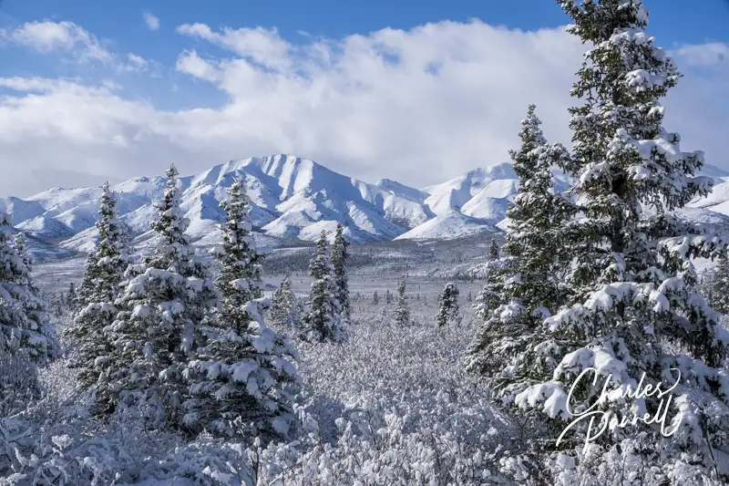
Alaska Railroad
Daily train service is available from Anchorage and Fairbanks on Alaska Railroad’s (www.alaskarailroad.com) Denali Star during the summer months. The northbound train departs from Anchorage, and takes three hours to get to Denali. It stops in Wasilla and Talkeetna along the way. The southbound Fairbanks to Denali nonstop route takes four hours to get to Denali. And the good news is, all the stations include lift boarding, and the GoldStar Dome Cars feature elevator access, accessible seating and accessible lavatories downstairs. Additionally, most of the major cruise lines also offer cruise tour packages that include a Denali stop, on their own accessible railcars.
If you’d prefer to drive, accessible rental vans are available in Anchorage from Alaska Mobility (www.alaskamobility.com). After you pick up your van, just hop on The George Parks Highway (Highway 3). Also designated as a National Scenic Byway, this well traveled route runs between Fairbanks and Anchorage, and offers access to the park. The drive on this well maintained paved road is doable in a day from Anchorage; but plan for extra time as there’s no shortage of viewpoints and roadside stops along the way. And for information on places to stop en route, visit themilepost.com, an excellent Alaska road trip resource.
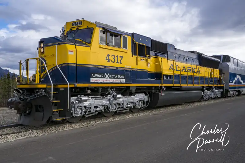
Wheelchair-Accessible Denali Shuttles
Accessible shuttle bus
Another wheelchair-accessible Denali feature is the free accessible shuttle bus system. After the winter snow is cleared in late spring, the road into Denali National Park is open to private vehicles to the Savage River area. Transportation further into the park is only available from concessionaires, and it’s largely dependent on road conditions.
That said, the free shuttle bus system operates in the Riley River area near the park entrance, and in the Savage River area 15 miles down the road. And all of the shuttle buses and shuttle bus stops wheelchair-accessible. The Savage River Loop and the Riley Creek Loop shuttles run all day and stop at a number of trails and attractions along the way. The Sled Dog Demonstration Shuttle, which runs from the Denali Visitor Center to the sled dog kennels, departs 40 minutes prior to the demonstrations, and returns shortly after they are completed.
The shuttle bus schedule is available at www.nps.gov/dena/planyourvisit/courtesy-shuttle-buses.htm, and it’s also posted at all the shuttle stops. Printed schedules are not available in the park, and cell phone service is limited, so it’s best to save a screen shot of the schedule for planning purposes.
Riley Creek Hikes
McKinley Station Trail
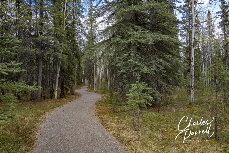
If you’d like to try a hike in the Riley Creek area, then hop on the shuttle, get off at the Riley Creek Campground and explore the McKinley Station Trail. This 1.6-mile hard-packed dirt trail runs from the campground to the visitor center. Although it’s not completely level, it offers an undulating — and accessible — route through the forest. There are also a few accessible boardwalk sections along the way. Be forewarned though — there’s a short cut to the visitor center about half-way along the route, but it goes straight uphill. Stick to the original trail for a gradual accessible path to the visitor center.
If you’d prefer a shorter walk, check out the Spruce Forest Loop, which is located right behind the visitor center. This .15-mile trail meanders through the forest, and offers visitors a good introduction to the vegetation and wildlife found in the park. It’s also very convenient, as you can just take the shuttle to the visitor center and hop on the trail from there.
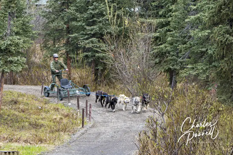
Sled Dog Demonstration
Sled dog demonstration
The Sled Dog Demonstration is another wheelchair-accessible Denali must-do. Although accessible shuttle service is available from the visitor center, you can also drive over to the kennels. There’s plenty of accessible parking available at the kennels; however it’s a longer jaunt from the parking lot than it is from the bus stop, so slow walkers might want to opt for the shuttle. It should also be noted that the Roadside Trail that runs from the visitor center to the kennels has a steep grade and numerous obstructions, and it’s definitely not an accessible option to get to the kennels.
The sled dog demonstration is fun to watch, as the team is hitched to a wheeled sled that speeds around a dirt track. Accessible seating for wheelchair-users and slow walkers is available in the front, so everyone is guaranteed a good view. A ranger is on hand to answer questions about the sled dogs — which are still used in the winter in the park — and folks can walk though the sled shed and around the kennels after the demonstration. Best of all, there’s no charge for this educational demonstration.
Savage River Hikes
Mountain Vista Trail
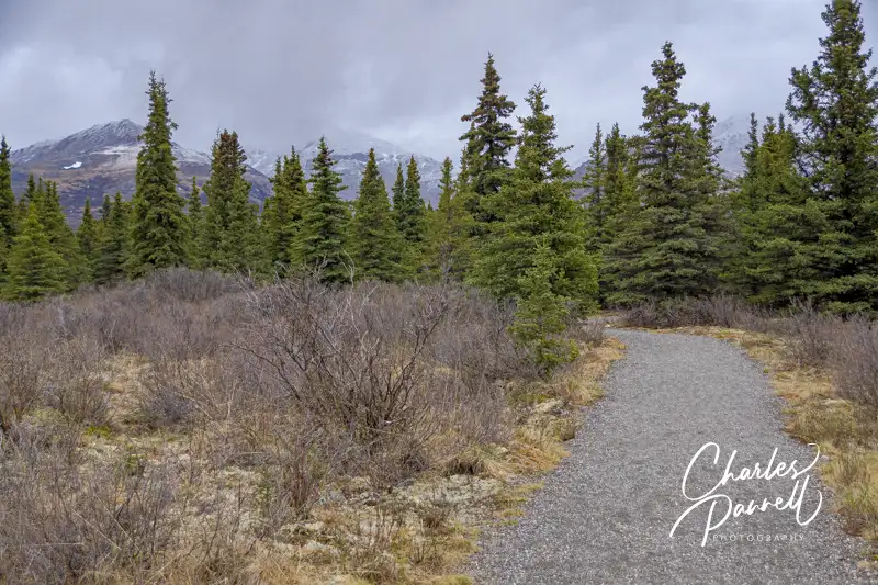
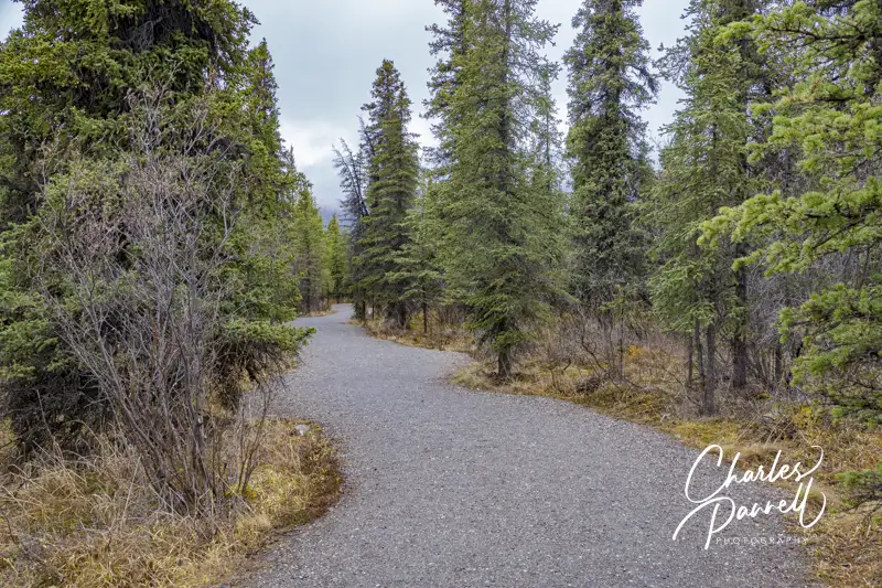
Last but not least, save some time to explore the Savage River area of the park, which offers a few accessible trails, and some great scenery. The shuttle stops at the Mountain Vista and Savage trailheads; and if Mount Denali is “out” (not obscured by cloud cover), you’ll get a great view from several vantage points along the way.
The Mountain Vista Trail is the most accessible trail in the area. This .6-mile hard-packed dirt trail begins near the shuttle stop, behind the accessible vault toilets and picnic shelter. It winds through the tundra, and offers several impressive views of the Alaska Range along the way. And you never know what wildlife you’ll run across, so keep your ryes peeled. Pack along a picnic lunch and enjoy it at one of the accessible tables at the picnic shelter, while you wait for the shuttle to Savage River.
Savage Cabin Trail
The shorter Savage Cabin Loop begins just to the left of the Savage River Campground shuttle bus stop, near the accessible vault toilet. The .3-mile loop is fairly level — with a few undulations — and is covered in compacted gravel. Midway along the route, you’ll find a historic cabin that was constructed by the Alaska Road Commission in 1924. It was originally used as a ranger cabin, but today it’s an interpretive site. Although the cabin isn’t accessible, you can still get a good glance at the inside from the doorway. And the docent programs are usually presented outside, in an accessible space. Even if there aren’t any docents at the cabin it still make a nice stop on this short jaunt.
Wheelchair-Accessible Denali Lodging Resource
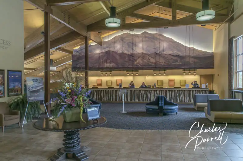
Lobby at the Denali Princess near Denali National Park
Of course, the final piece of the access puzzle in Denali National Park is lodging. There are no hotels or lodges in the park, but the campground has accessible spaces, and there are a number of accessible lodging choices nearby. Visit emerginghorizons.com/wheelchair-accessible-denali-lodging-options for more information.
Barrier-Free Travel Glacier, Yellowstone and Grand Teton National Parks for Wheelers and Slow Walkers
Jointly managed by the National Park Service and California State Parks, this park includes the original federal land plus three Northern California State Parks. The federal area — Redwood National Park — is located southeast of the Thomas H. Kuchel Visitor Center in Orick. The California additions include Jedediah Smith Redwoods State Park, Del Norte Coast Redwoods State Park and Prairie Creek Redwoods State Park. They are located along Highway 101 between Orick and the Oregon border. Highlights of this 131,983-acre preserve include several stands of ancient coastal redwoods, prairies dotted with Roosevelt Elk and 40 miles of scenic coastal drives. As an added bonus, there’s no admission charge or day-use fee for this park.
Insider Tips
Although there’s certainly no shortage of majestic redwoods along Newton B. Drury Parkway in Prairie Creek Redwoods State Park, make sure and stop at the nicely accessible Big Tree Wayside. Going south on the parkway it’s on the left and marked simply as “Big Tree”, and going north it’s not marked at all, but it’s the first turn on the right after Cal Barrel Road. From the accessible parking area it’s a short 100-yard walk on a paved level path to this 304-foot giant. And there’s even ramp access up to the tree.
Hop off of Highway 101 just south of Crescent City and enjoy a scenic drive along Enderts Beach Road. This winding route is lined with redwoods and offers a coastal view every now and then. It’s just a five minute drive to the end of the road, where there’s an accessible ocean overlook. Try and hit this short detour in the afternoon though, as the thick coastal fog hangs over the area in the mornings.
Spend the night in a redwood forest in one of four accessible cabins in Jedediah Smith Redwoods State Park. Each cabin can each sleep six, with two bunk beds with a single bunk on the top and a double bunk on the bottom. Other cabin features include a small counter, electricity, lights and a heater. There’s also a raised grill, an accessible picnic table and a bear box in a level area outside each of the cabins. And the accessible showerhouse near the visitor center is equipped with a spacious roll-in shower.
Located 100 miles southeast of Seattle, Mount Rainier National Park is situated in one of the most rugged areas of Washington state. At 14,410 feet, the namesake mountain towers over the park; and not only is this active volcano the most glaciated peak in the contiguous US, but it’s also a popular climb, with over 10,000 attempts each year. That said, you can certainly enjoy the park without attempting the summit, as there are also several developed areas that offer accessible trails, museums, campsites and overnight lodging.
Insider Tips
Be sure and stop at Christine Falls, which is located just past Longmire on the left side of the road. It’s easy to miss, and if you take time to admire it from the road, you’ll drive right by the pullout on the right side, which offers the best view of the falls. Unfortunately there are only stairs down to the lower viewing area, but you can still get a nice view of the top part of the 40-foot high waterfall from the 1928 masonry bridge near the pullout.
The most accessible trail in the park – the Kautz Creek Trail – is located across the street from the Kautz Creek Picnic Area. This level boardwalk trail winds through a section of the forest which was devastated by a 1947 glacier generated debris flow, and leads out to an overlook that offers an excellent view of Mount Rainier.
A timed entry reservation is required for visits to the Paradise Corridor and the Sunrise Corridor of the park, during the peak summer season. Reservations are released 90 days in advance and are available a www.recreation.gov. Plan ahead, because entry reservations are not available at the park; and if you don’t have one you won’t be admitted. And remember, even if you have a national park pass, you still need an entry permit.
Located in Northwestern Arizona, the Grand Canyon is 277 miles long, up to 18 miles wide and a mile deep. Carved by the Colorado River and the forces of nature, the majority of this geological formation lies within the borders of the national park. That said, the West Rim, which boasts a horseshoe shaped glass walkway out over the canyon, is located on Hualapai land. But no matter what area of the park you visit, there’s no shortage of breathtaking views at this national treasure.
Insider Tips
For an interesting look at the history of the Fred Harvey Company, El Tovar Hotel and Bright Angel Lodge, pop into the Bright Angel History Room on the South Rim. Exhibits include artifacts from these two Harvey Houses, as well as old photos, an 1880 Harvey House dinner gong, and even a vintage Harvey Girl uniform. It also includes information and photos from a Harvey Indian Detour excursion, which took train passengers on a five-night trip to nearby Native American sites. Both the canyon entrance and the main entrance of the Bright Angel Hotel are wheelchair-accessible.
All the in-park lodges, except Bright Angel Lodge, have accessible rooms. That said, Kachina Lodge is the only property with an elevator, so it’s a good choice for slow walkers who want an upper floor standard room, but cannot do stairs.
Grand Canyon Scenic Airlines offers accessible flightseeing excursions over the Grand Canyon in fixed-wing aircraft from the Grand Canyon Airport in Tusayan. There are six stairs up to the aircraft door, but a portable ramp is available for anyone who can’t manage the climb. Wheelchair-users must transfer to a seat near the aircraft door, and wheelchairs are stored at the airport. It’s a great choice for a scenic overview of the park.
Located in Southwestern Utah, Zion National Park was the Beehive State’s first national park. Although a good percentage of the park is designated as wilderness, there are many developed areas which can be visited with a minimal effort. At the top of the list is Zion Canyon, a 15-mile drive bordered by spectacular sandstone cliffs. Over on the west side of the park, Kolob Canyons offers a more bucolic view of the Colorado Plateau; while the eastern Zion-Mt. Carmel Highway connects Zion with Bryce Canyon and the Grand Canyon. No matter where you look, there’s no shortage of breathtaking scenery in this national park.
Insider Tips
Don’t miss the free Ride with a Ranger Tours that are offered twice daily on the park shuttle buses. These two-hour narrated tours include several stops along the Zion Canyon Scenic Drive. Advance reservations are required, and they can be made up to three days in advance. And the good news is, all park shuttle buses are lift-equipped, so everyone can enjoy these tours.
If you want to dodge the crowds, then explore the five-mile long Kolob Canyons Scenic Byway, located in the northwestern corner of the park. This scenic route climbs 1,000 feet in elevation and offers great views of the red Navajo sandstone canyon walls along the way. There are a number of paved pullouts on the route, and although none of them are striped, they are strategically placed so you can get good windshield views.
For a very accessible place to rest your head, consider staying in cabin 529 at Zion Lodge. This historic cabin dates back to the 1920s, and it includes a queen-sized bed and a bathroom with a roll-in shower. As an added bonus, this lodge is one of the most scenic national park properties around, as it’s surrounded by Zion Canyon.
Set aside as a national park in 1890, Yosemite includes over 1,200 square miles of scenic beauty in the rugged Sierra Nevada Mountains. From glaciated granite formations to verdant meadows and ancient giant sequoias, there’s something for everyone in this Central California national park. And although Yosemite boasts a large wilderness area, there’s no shortage of accessible trails and attractions in Yosemite Valley, where the lion’s share of visitor services are located.
Insider Tips
The historic Yosemite Cemetery, which dates back to the 1870s, is often overlooked by visitors. Located across the street from the Yosemite Museum, it’s a must-see for history buffs. The hard-packed dirt paths through the cemetery are level, and although there are a few bumps near the entrance, the route is navigable for most wheelchair-users and slow walkers. A guide to the cemetery is available at the Yosemite Valley Visitor Center — and don’t miss the special ranger program and campfire at the cemetery on Halloween.
Although Hetch Hetchy Valley is the starting point for a number of inaccessible wilderness hikes, Hetch Hetchy Road also offers some beautiful windshield views along the drive. The road travels through gray pine, incense cedar and black oak forests, and features expansive views across the canyon once the road opens up. As an added bonus, you can catch glimpses of Hetch Hetchy Reservoir from almost the beginning of the road.
If you’d like a room with a spectacular view, then reserve room 421 at the Ahwahnee. Not only is this accessible room outfitted with a king-sized bed and a roll-in shower, but it also offers one of the best Half Dome views in the park.
America’s first national park spans nearly 3,500 square-miles, the bulk of which occupies the northwestern corner of Wyoming. Known for its geothermal wonders the park is a filled with gurgling geysers, bubbling mudpots and hidden hot springs. But Yellowstone is much more than geysers, as it also features dramatic canyons, lush forests, and fertile valleys that are home to bears, wolves, elk, antelope and an extremely healthy bison population. And with a handful of western highways leading to the park, there’s plenty of opportunity to explore this diverse ecosystem.
Insider Tips
Although there’s accessible parking near the Brink of the Upper Falls Viewpoint in the Grand Canyon of the Yellowstone, the viewpoint itself is not accessible due to stairs and a steep grade. That said, you can get a better – and quieter — view if you continue along the North Rim Trail, past the left turnoff to the brink. And if you’d like a short hike through the woods that crosses Canyon Bridge and offers excellent views of the Yellowstone River and the Chittenden Bridge, then just continue along this accessible trail for another half-mile.
For a break from the congested traffic along the road to Old Faithful, take a short detour along Firehole Lake Drive. This one-way loop begins about a mile south of Fountain Paint Pot, and features accessible stops at Firehole Spring, Giant Fountain Geyser and Firehole Lake. As an added bonus, this route is pleasantly devoid of the bus loads of tourists that frequent the other area attractions, as larger vehicles are prohibited on this road.
If you’d like to overnight in the park in an accessible room with a great view, then choose room 202 at the Yellowstone Lake Hotel. This corner room, which features a bird’s eye view of Yellowstone Lake, is furnished with a 25-inch high king-sized bed and is equipped with an accessible tub/shower combination.
Located in the Southern Sierra Nevada Mountains, Sequoia National Park is home to a large grove of stately giant sequoia trees, including the 275-foot tall General Sherman Tree, the largest tree on Earth. The park is about a four-hour drive from Yosemite Valley, via Highways 41, 99 and 198, through Visalia to the Ash Mountain park entrance. From there the Generals Highway travels through the foothills up to the Giant Forest, and then continues through the Sequoia National Forest and on to Kings Canyon National Park.
Insider Tips
The most accessible way to get to the General Sherman Tree is to park in the lower accessible parking lot on the Generals Highway, and take the quarter-mile paved trail over to the tree. And if you can’t manage the entire length of the trail, you can still get an excellent view of the towering giant about .1-mile up the trail.
You know you’ve found a good picnic spot when you see that the rangers also frequent it – and that’s exactly the case for Pinewood Picnic Area. Located on the Generals Highway just north of the Big Trees Trail, not only is this picnic area very pleasant, but it’s also one of the most accessible ones in the park. The shaded grove features a paved pathway over to the accessible tables and grills, with accessible vault toilets nearby. Additionally, there’s level access to many of the standard tables in the grove.
Wuksachi Lodge, which is located four miles north of the General Sherman Tree, offers a nice selection of accessible rooms. To be more specific, the property boasts eight accessible rooms, all of which have roll-in showers. There’s also good access to the main lodge building which houses the Peaks Restaurant, that offers patrons a panoramic view of the surrounding forest.