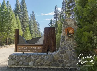
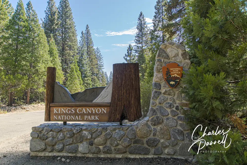
If a trip to the giant sequoias is on your spring travel agenda, then look no further than Kings Canyon National Park . Often overshadowed by the Giant Forest in nearby Sequoia National Park, the Kings Canyon section of the park offers an equally impressive stand of Giant Sequoias. And like its Sequoia National Park counterpart, the Kings Canyon grove boasts an accessible trail for wheelchair-users and slow walkers. So pack a picnic lunch, hit the road, and enjoy a visit to the Kings Canyon sequoias this spring.
Get Your Bearings
Known as the gateway to Kings Canyon National Park, Grant Grove is home to Giant Sequoia groves that were logged back in the 1800s, as well as stands of timber that were preserved for future generations. From Fresno, it’s just an hour drive on Highway 180 to the Big Stump Entrance of the park. From there it’s just a short drive to the Kings Canyon Visitor Center.
Accessible parking is located next to the Kings Canyon Visitor Center, with curb-cut access up to the sidewalk and level access over to the building. Inside, there’s plenty of room to maneuver a wheelchair around the ranger information desk, small book store and interpretive exhibits. There’s also level access to a small theater where a film about the park runs throughout the day.
From the visitor center, head over to Grant Grove Drive, which is located off Highway 180, across the street from the road to Crystal Springs Campground. This short but scenic route leads through a Giant Sequoia grove and terminates in the General Grant Tree parking lot. Even if you are unable to navigate any of the trails in the grove, this drive is a must-do, as it boasts several pullouts and offers some excellent windshield views of the grove. It’s a good way to get an up-close-and-personal look at the Giant Sequoias, even if you are unable to get out of your vehicle. The view from the General Grant Tree parking lot isn’t bad either.
Hike Around the Kings Canyon Sequoias
Trail to the General Grant Tree
One of the main attractions in this grove is the impressive General Grant Tree. This 1,700 year-old stately giant is 40 feet wide and towers 268 feet above the grove. And for a closer look, there’s a half-mile loop trail that leads out to the iconic tree.
The paved trail first passes a grove of young sequoias, then circles the gigantic Fallen Monarch sequoia, before it reaches the General Grant Tree midway along the route. Although the trail isn’t entirely level, it’s generally doable for most folks, with plenty of benches to sit and take a rest along the way. That said, the trail that leads around the back of the General Grant Tree is steep and not accessible, but you can still get a nice view from in front of the tree.
After the trail passes the General Grant Tree, it winds around the Gamlin Cabin, which was built in 1872 by a pair of brothers who grazed sheep in the area. The trail then edges by the Centennial Stump (a 16-foot section of this tree was displayed at the 1876 Centennial Exhibition in Philadelphia), and passes by the other end of the Fallen Monarch, before it returns to the parking area. As an added bonus, the grove is shaded, so it makes for a nice stroll even in the midday sun. And it’s the perfect way to top off a springtime visit to the Kings Canyon sequoias.
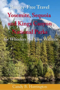
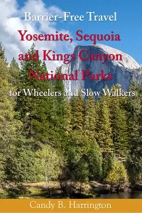
Barrier-Free Travel Yosemite, Sequoia and Kings Canyon National Parks for Wheelers and Slow Walkers
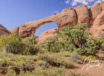
Skyline Arch viewed from the Devil’s Garden campground in Arches National Park
Arches National Park is filled to the brim with red rocks, arches and scenic beauty. So it comes as no surprise that it’s a top pick as a Hollywood filming location. The results are some stunning backdrops and jaw-dropping views added to the big screen. And the good news is, many of these sites are pretty easy to find. So take some time to scout out these Hollywood filming locations in Arches National Park on your next visit.
A Little Primer
Moab Museum of Film and Western Heritage
Before you visit the park, plan a stop at the Moab Museum of Film and Western Heritage (moabmfwh.com), which is just a short scenic drive down Highway 128 at Red Cliffs Lodge. Not only will it help you appreciate the complexities of filming on location, but it will also give you some fun inside stories on the productions filmed in the area.
There’s accessible parking in front of the lodge, and although the museum is located down a flight of stairs, there’s an alternate accessible entrance. From the accessible parking space, follow the sidewalk on the left, down around the building to the level back entrance. Inside you’ll find a hallway lined with movie posters, with the museum at the end of the hall on the right. There’s level access to the museum, with good pathway access to all the exhibits.
Take some time to watch the introductory video that details the history of filming in the area and includes some fun facts, stories and recollections about the flicks. The museum is jam packed with memorabilia from the over 120 movies shot in the area, including City Slickers II, Back to the Future III, Thelma and Louise and Indiana Jones and the Last Crusade. Don’t miss the Geena Davis stunt dummy that survived the final crash in Thelma and Louise, or the license plate from the Shaguar in Austin Powers Goldmember. Add in a large collection of photographs, movie posters and memorabilia and you have a complete picture of the filming history in the area. And the best part is – there’s no admission charge to this fun and funky museum.
Filming Locations in Arches
Park Avenue Viewpoint
Park Avenue Viewpoint in Arches National Park
Located about two miles from the park entrance, Park Avenue Viewpoint is the first stop on this filming locations in Arches scenic drive. The opening scenes of Indiana Jones and the Last Crusade were filmed here. Just picture a group of boy scouts — including a youthful Indy –riding their horses through the desert against this magnificent backdrop. There’s accessible parking near the paved 200-foot trail out to the upper viewpoint, where you’ll get a good view of the towering formations that resemble the skyscrapers of Manhattan.
Courthouse Towers
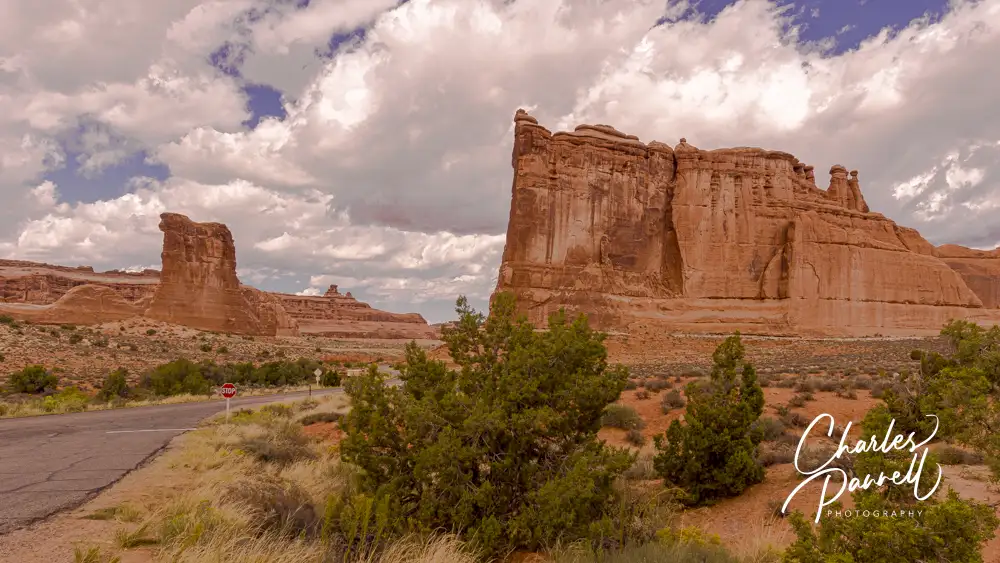
Courthouse Towers in Arches National Park
Just down the road you’ll find Courthouse Towers, the next stop on this Arches filming locations tour. A memorable scene from Thelma & Louse was filmed nearby. It begins as the pair is stopped by a police officer in the middle of nowhere, and concludes when the gals get the officer’s gun and later lock him in the trunk of his car. Just look down the road and try to imagine it all unfolding. There’s accessible parking in the small lot with level access to viewpoints on both sides, so you’ll have a variety of vantage points for a good view.
Balanced Rock
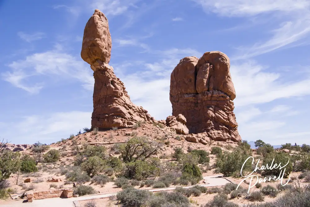
Balanced Rock in Arches National Park
Balanced Rock, which is located just south of the intersection of Arches National Park Road and The Windows Road, is one of the most popular stops in the park. It was also a filming site for Rio Conchos starring Stuart Whitman and Richard Boone in 1964. The infamous rock can be seen in the background in several scenes, but is most prominent in the camping scene. There’s accessible parking in the small lot near Balanced Rock, with curb-cut access up to the interpretive plaque. From there you’ll get an excellent view of this Arches favorite.
Double Arch
Double Arch in Arches National Park
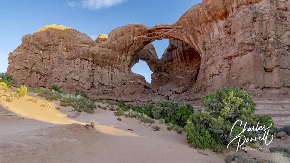
Located in the Windows Section of the park, Double Arch was another filming site for Indiana Jones and the Last Crusade. Again in the beginning of the movie, River Phoenix runs down the hill in front of the arch, after encountering some grave robbers. There’s accessible parking near the trailhead, and the .3-mile trail leads out to this unique arch. It may be doable for some slow walkers and power wheelchair-users, but manual wheelchair-users may require assistance with the first steep grade. And even if you can’t do the trail, you’ll still get a good view of Double Arch from the trailhead.
Devils Garden Trail
Devil’s Garden Trail in Arches National Park
Last but no least on our list of filming locations in Arches is the Devils Garden Trail, which is located at the end of the Arches National Park Road. Although the entire length of this tail is not accessible, the first 100 yards offers some dramatic views for wheelchair-users and slow walkers. It was also the filming site for Taza Son of Cochise. More specifically the scene where the US Calvary was ambushed by the Indians was shot here. Just imagine the troops advancing through the fin, only to be cut down in the attack. The first part of this trail is a must-see, as you don’t often find wheelchair-accessible canyon walks.
Insider Tip
In an effort to better manage the crowds at Arches National Park, entrance reservations are required during the peak visitation season. These reservations are not available for purchase at the park entrance. They must be purchased in advance at www.recreation.gov. And even if you have a national park pass you still need an entrance reservation to enter the park between 7AM and 4PM.
That said, the park is absolutely gorgeous in the early morning hours; so if you don’t happen to score an entrance reservation get there before 7AM. As an added bonus, you’re find fewer people there at that hour, and you won’t have to search in vain for parking at the popular stops. For more information about the required entrance reservations, visit emerginghorizons.com/national-park-entrance-reservations-required-in-2024/.
Barrier-Free Travel
Utah National Parks for Wheelchair-users and Slow Walkers
Located in Northern Oregon, the Historic Columbia River Highway parallels Interstate 84 and runs from Troutdale to The Dalles. This scenic two-lane road, which is also known as Highway 30, snakes through the Columbia River Gorge and offers some spectacular windshield views. And although Interstate 84 is the quicker way to traverse the gorge, Highway 30 is definitely the more picturesque choice.
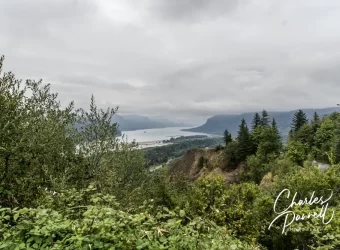
Granted, there’s no shortage of bold scenery along the entire length of the 75-mile route; however the 10-mile segment between Vista House and Horsetail Falls is a don’t-miss side trip for wheelchair-users and slow walkers. Known as the waterfall corridor, this segment includes a number of wheelchair-accessible viewpoints, trails and historic stops, and offers a closer look at some of the beautiful cascades along the way.
Vista House
The Vista House on the Columbia River Highway Waterfall Corridor
Finding the waterfall corridor is easy. Head east from Portland on Interstate 84, then take exit 22 at Corbett and turn right. From there just follow the signs, and make a left on the Historic Columbia River Highway. This portion of the road winds through the forest for about three miles, before it heads uphill to Vista House at Crown Point (www.vistahouse.com).
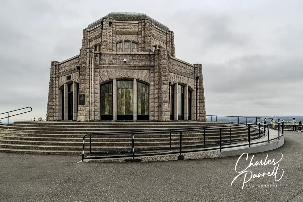
Built in 1916 as a rest stop and observation tower, Vista House is a fitting starting point for the drive, as it was also the site of the 1916 dedication of the highway. There’s accessible parking near the front, with ramp access around to the back entrance. There’s level access through the automatic doors and plenty of room to maneuver around the main floor of this architectural treasure. Perched some 600 feet above the Columbia River, Vista House is lined with marble floors and filled with stained glass windows.
Listed on the National Register of Historic Places, this historic building also includes a cleverly hidden wheelchair lift. Designed to blend in with the architecture, the lift allows wheelchair-users and slow walkers access to the restrooms, exhibits, gift shop and cafe that are housed in the lower level. The building is usually open from Friday to Monday, but it depends on available staffing. And even if the building isn’t open you can still peer inside. There’s also a great river view near the back entrance.
Latourell Falls
Latourell Falls is located 2.5 miles up the road, in the verdant Guy W. Talbolt State Park. There’s accessible parking with level access over to a viewing area, where you can get a gander at the majestic falls, as it tumbles 224 feet down over columnar basalt pillars. There’s a trail to an upper viewing area, but it’s steep and not wheelchair-accessible. Still you can get a great view from below.
There’s also an accessible vault toilet at this stop. And if you’d like to enjoy lunch alfresco, there’s an accessible picnic table located near the parking lot.
Bridal Veil Falls
Bridal Veil Falls, which is located two miles up the road, is also worth a stop. Although the trail to the the falls is steep and has steps, there’s another accessible trail that offers a good river view. There’s accessible parking in the large lot, with level access over to the trailhead. The trail to the right goes up to the falls, while the accessible Overlook Trail on the left leads over to the river. There’s also an accessible vault toilet near the trailhead.
The half-mile Overlook Trail has a few bumps along the way, but it’s still doable for most wheelchair-users and slow walkers. It winds through the woods, passes a picnic table and then skirts the river. There are a few places where you can get good view of the Columbia River, before the trail winds back through the woods to the beginning. It’s a pleasant stroll, and definitely worth a stop.
Wahkeena Falls
As you continue along Highway 30, Wahkeena Falls is located three miles up the road. Accessible parking is available on the left, above the picnic area. There’s also an old restroom with an accessible stall in the picnic area; however it’s best to drive down if you need to use it, as the road is pretty steep.
The accessible trail to the falls viewpoint is located across the street. The 200-foot paved trail is fairly level and winds over to the perfect vantage point. You can’t see these falls from the road, but there’s a great view of them at the end of the accessible trail.
Multnomah Falls
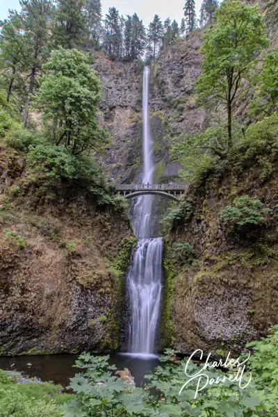
By far the most popular waterfall along the route is Multnomah Falls, which is located a half-mile from Wahkeena Falls. There’s accessible parking in the small lot across from Multnomah Falls Lodge, with level access over to the lower viewing area. Across the street, there’s a paved walkway that leads about 200 yards to the upper viewing area. Although this is a good option for power wheelchair-users, it’s a bit steep for manual wheelchair-users and slow walkers. Still you can get a nice view from the lower vantage point.
There’s level access to the lodge, which houses a visitor center and a gift shop on the lower level; and offers elevator access up to the restaurant on the second floor. Accessible restrooms are also located on the lower level. And if you drive by slowly, you can get a nice view of the falls from Highway 30.
There’s also a parking area located off of Interstate 84 for this popular stop. Just take exit 31 and follow the signs. There’s plenty of accessible parking in the lot; however the path over to the Highway 30 parking area is steep — especially near the bridge — so it’s not a viable option for most folks. The best bet is to park in the Highway 30 parking area. It should also be noted that there is no vehicular access from the Interstate 84 parking area to the Highway 30 parking area; so if you use the Interstate 84 parking area you won’t be able to drive to the Historic Columbia River Highway from there.
Multnomah Falls Timed Use Permit
During the peak summer season, a Multnomah Falls Timed Use Permit is required in order to park in the parking lot off of Interstate 84. The permit is required from late May to early September from 9 AM to 6PM. One permit per car is required, and the permits are checked on the path from the parking lot to the falls.
The permits are available for $2 at www.recreation.gov. They are valid for entry during a one-hour time frame, and if not used they will expire at the end of the issued time. For example, if you buy a permit for 1:00 PM and have not used it by 2:00 PM it will expire at that time. That said, you can spend as much time at the falls as you want, as long as you enter within the specified time frame.
The bulk of the permits are available 14 days in advance; while a smaller batch is released two days prior to the arrival date. Permits are not sold on site, so make sure to get one ahead of time. Additionally, just because you have a permit, does not mean you are guaranteed a parking space.
Horsetail Falls
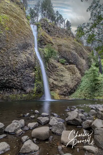
Last but certainly not least on this Historic Columbia River Highway drive is Horsetail Falls, which is located 2.5 miles from Multnomah Falls. There’s accessible parking in the lot across the street from the falls. From there a short paved level trail leads 150 feet over to a nice viewpoint. There are also a few picnic tables near the viewpoint, and although there are no services at this stop there’s a bench to sit and enjoy the falls. As an added bonus, you can also get an excellent view of Horsetail Falls from Highway 30 or even from the adjacent parking lot.
After you’d had time to enjoy the falls, continue east on Highway 30 to Dodson, and hop on Interstate 84. From there you can either circle back to Portland, or continue east to explore more of Oregon. Either way, this scenic drive is well worth the short detour.
Latourell Falls
Bridal Veil Falls
Multnomath Falls
Horsetail Falls
Historic Columbia River Highway Travel Tips
Although the scenic waterfall corridor is a must-do on any Oregon road trip, there are a few things you can do to make your visit go smoother.
First and foremost, try and arrive early in the day. The route gets extremely crowded in the afternoon, and parking places — even accessible spots — are hard to come by.
The early bird rule applies double for the Multnomah Falls area. Even if you don’t plan to stop, that section of the route routinely backs up after 11 AM, as people sit in the road and wait for available parking spots.
It’s also a good idea to travel from west to east along the route. Most of the e-bike rentals begin at Cascade Locks and head west along Highway 30; and since there aren’t any alternative trails they have to ride in the road along the waterfall corridor. This tends to slow down the traffic that’s going in the westerly direction, and even backs it up at some spots.
There aren’t many services along the waterfall corridor, so pack along water and snacks. There are however a lot of pleasant picnic spots to enjoy a quiet breakfast or lunch.
Summer is the most crowded season along the Columbia River Gorge, so try to visit in the off season. The peak flow seasons for the waterfalls are winter and spring, which are usually less crowded.
Fall is also becoming a busy time along the route, as the fall foliage show is spectacular. It’s especially crowded on the weekends, so try to visit mid-week if possible.
Finally, take your time and stay a while to enjoy the Columbia River Gorge. For a fun getaway, spend the night in an accessible treehouse at nearby Skamania Lodge.
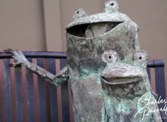
Every Spring professional frog teams from around the world flock to the heart of California Gold Country, to compete in the Calaveras County Frog Jump. Held on the third weekend in May in the tiny hamlet of Angels Camp, this competition first debuted in the pages of Mark Twain’s short story, “The Celebrated Jumping Frog of Calaveras County”.
As the story goes, a local man who was somewhat of a compulsive gambler bet a stranger that his frog would win a jumping contest. The stranger subsequently sabotaged the gambler’s frog, by filling its mouth with heavy lead bullets which rendered it too heavy to jump. And although the colorful characters in Twain’s tome were a product of the author’s vivid imagination; legend has it that the inspiration for this work came from a tale overheard in an Angels Camp tavern.
The first “modern” frog jump was held back in 1928; and today this popular event has evolved into a four-day celebration, which is now part of the Calaveras County Fair. And although access at the first frog jump was probably pretty difficult for wheelchair-users and slow walkers, today things have evolved so now everyone can enjoy this popular event. So make plans now to attend the famous, fun and festive Calaveras County Frog Jump.
Calaveras County Fair Basics
Held at the Calaveras County Fairgrounds, this small town fair is filled with fun activities and events. From the Youth Parade on Thursday morning to the Destruction Derby on Sunday afternoon, there’s no shortage of family friendly activities to be had.
There’s accessible parking near the fairgrounds entrance with level access over to the fairgrounds. Inside some of the pathways are steeper than others, but most are doable for manual wheelchair-users and slow walkers. And of course, there are also accessible restrooms on the grounds.
If you’d like to save a few bucks on parking and skip the traffic then park your car at Save Mart in Angels Camp and take the free Calaveras Connect shuttle directly to the fairgrounds. Access is excellent on all Calaveras Connect vehicles, as they offer lift access and wheelchair spaces. And the drivers, who are extremely friendly, are happy to lend a hand if you need assistance. For more information about the shuttle schedule and hours, visit www.calaverasconnect.org/.
Another way to save time at the gate is to purchase your tickets online at www.frogtown.org. Sometimes the line backs all the way out to the parking lot at this popular event; and if you have your tickets in hand you can just stroll past that long line to the entrance gate.
Once inside there’s no shortage of entertainment, from shows and skits for the kiddos to live music foe everyone. And there’s level access to the livestock area which is filled with chickens, goats, pigs and cows; as well as the inside exhibits which feature everything from artwork and baked goods to quilts, preserves and a smattering of local businesses. And of course there’s no shortage of fair food to whet your appetite.
On Your Mark, Get Set, Jump!
Of course the highlight of the fair is the Calaveras County Frog Jump. There are two frog jumping stages at the fairgrounds — the Main Stage and the Lily Pad. The serious competition takes place on the Main Stage, but anyone can jump their frog for fun on the Lily Pad. A lot of first timers practice on the Lily Pad, before they move on to the Main Stage.
The competition begins when a frog jumper places his frog on the starting pad. After that he’s not allowed to touch him; however he can jump, yell, sing, hop, or do whatever he can to get the frog to jump. After three jumps the distance is measured from the starting pad to the final landing spot. It’s entertaining to watch the frog jumpers as each one has their own unique method of getting their frog to jump. The current record is 21 feet 5¾ inches, which was set by Rosie the Ribiter in 1986.
The competition begins on Thursday, and the top 50 frogs compete in the finals on Sunday afternoon. And the winner gets bragging rights, and a $5000 prize if they beat the current record jump. And when they’re not competing the frogs stay in the luxurious Frog Spa, which is located near the competition area.
The Calaveras County Frog Jump is a fun and accessible event. Make plans to spend the whole weekend, and enjoy some of the other accessible offerings in the area.
Barrier-Free Travel California National Park Road Trips for Wheelchair-Users and Slow Walkers
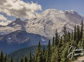
Located 100 miles southeast of Seattle, Mount Rainier National Park is situated in one of the most rugged areas of Washington state. At 14,410 feet, the namesake mountain towers over the park; and not only is this active volcano the most glaciated peak in the contiguous US, but it’s also a popular climb, with over 10,000 attempts each year. That said, you can certainly enjoy the park without attempting the summit, as there are also several developed areas that offer accessible trails, museums, campsites and overnight lodging.
Insider Tips
Be sure and stop at Christine Falls, which is located just past Longmire on the left side of the road. It’s easy to miss, and if you take time to admire it from the road, you’ll drive right by the pullout on the right side, which offers the best view of the falls. Unfortunately there are only stairs down to the lower viewing area, but you can still get a nice view of the top part of the 40-foot high waterfall from the 1928 masonry bridge near the pullout.
The most accessible trail in the park – the Kautz Creek Trail – is located across the street from the Kautz Creek Picnic Area. This level boardwalk trail winds through a section of the forest which was devastated by a 1947 glacier generated debris flow, and leads out to an overlook that offers an excellent view of Mount Rainier.
A timed entry reservation is required for visits to the Paradise Corridor and the Sunrise Corridor of the park, during the peak summer season. Reservations are released 90 days in advance and are available a www.recreation.gov. Plan ahead, because entry reservations are not available at the park; and if you don’t have one you won’t be admitted. And remember, even if you have a national park pass, you still need an entry permit.
Located in Southwestern Utah, Zion National Park was the Beehive State’s first national park. Although a good percentage of the park is designated as wilderness, there are many developed areas which can be visited with a minimal effort. At the top of the list is Zion Canyon, a 15-mile drive bordered by spectacular sandstone cliffs. Over on the west side of the park, Kolob Canyons offers a more bucolic view of the Colorado Plateau; while the eastern Zion-Mt. Carmel Highway connects Zion with Bryce Canyon and the Grand Canyon. No matter where you look, there’s no shortage of breathtaking scenery in this national park.
Insider Tips
Don’t miss the free Ride with a Ranger Tours that are offered twice daily on the park shuttle buses. These two-hour narrated tours include several stops along the Zion Canyon Scenic Drive. Advance reservations are required, and they can be made up to three days in advance. And the good news is, all park shuttle buses are lift-equipped, so everyone can enjoy these tours.
If you want to dodge the crowds, then explore the five-mile long Kolob Canyons Scenic Byway, located in the northwestern corner of the park. This scenic route climbs 1,000 feet in elevation and offers great views of the red Navajo sandstone canyon walls along the way. There are a number of paved pullouts on the route, and although none of them are striped, they are strategically placed so you can get good windshield views.
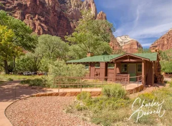
For a very accessible place to rest your head, consider staying in cabin 529 at Zion Lodge. This historic cabin dates back to the 1920s, and it includes a queen-sized bed and a bathroom with a roll-in shower. As an added bonus, this lodge is one of the most scenic national park properties around, as it’s surrounded by Zion Canyon.
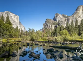
Set aside as a national park in 1890, Yosemite includes over 1,200 square miles of scenic beauty in the rugged Sierra Nevada Mountains. From glaciated granite formations to verdant meadows and ancient giant sequoias, there’s something for everyone in this Central California national park. And although Yosemite boasts a large wilderness area, there’s no shortage of accessible trails and attractions in Yosemite Valley, where the lion’s share of visitor services are located.
Insider Tips
The historic Yosemite Cemetery, which dates back to the 1870s, is often overlooked by visitors. Located across the street from the Yosemite Museum, it’s a must-see for history buffs. The hard-packed dirt paths through the cemetery are level, and although there are a few bumps near the entrance, the route is navigable for most wheelchair-users and slow walkers. A guide to the cemetery is available at the Yosemite Valley Visitor Center — and don’t miss the special ranger program and campfire at the cemetery on Halloween.
Although Hetch Hetchy Valley is the starting point for a number of inaccessible wilderness hikes, Hetch Hetchy Road also offers some beautiful windshield views along the drive. The road travels through gray pine, incense cedar and black oak forests, and features expansive views across the canyon once the road opens up. As an added bonus, you can catch glimpses of Hetch Hetchy Reservoir from almost the beginning of the road.
If you’d like a room with a spectacular view, then reserve room 421 at the Ahwahnee. Not only is this accessible room outfitted with a king-sized bed and a roll-in shower, but it also offers one of the best Half Dome views in the park.
America’s first national park spans nearly 3,500 square-miles, the bulk of which occupies the northwestern corner of Wyoming. Known for its geothermal wonders the park is a filled with gurgling geysers, bubbling mudpots and hidden hot springs. But Yellowstone is much more than geysers, as it also features dramatic canyons, lush forests, and fertile valleys that are home to bears, wolves, elk, antelope and an extremely healthy bison population. And with a handful of western highways leading to the park, there’s plenty of opportunity to explore this diverse ecosystem.
Insider Tips
Although there’s accessible parking near the Brink of the Upper Falls Viewpoint in the Grand Canyon of the Yellowstone, the viewpoint itself is not accessible due to stairs and a steep grade. That said, you can get a better – and quieter — view if you continue along the North Rim Trail, past the left turnoff to the brink. And if you’d like a short hike through the woods that crosses Canyon Bridge and offers excellent views of the Yellowstone River and the Chittenden Bridge, then just continue along this accessible trail for another half-mile.
For a break from the congested traffic along the road to Old Faithful, take a short detour along Firehole Lake Drive. This one-way loop begins about a mile south of Fountain Paint Pot, and features accessible stops at Firehole Spring, Giant Fountain Geyser and Firehole Lake. As an added bonus, this route is pleasantly devoid of the bus loads of tourists that frequent the other area attractions, as larger vehicles are prohibited on this road.
If you’d like to overnight in the park in an accessible room with a great view, then choose room 202 at the Yellowstone Lake Hotel. This corner room, which features a bird’s eye view of Yellowstone Lake, is furnished with a 25-inch high king-sized bed and is equipped with an accessible tub/shower combination.
Located in the Southern Sierra Nevada Mountains, Sequoia National Park is home to a large grove of stately giant sequoia trees, including the 275-foot tall General Sherman Tree, the largest tree on Earth. The park is about a four-hour drive from Yosemite Valley, via Highways 41, 99 and 198, through Visalia to the Ash Mountain park entrance. From there the Generals Highway travels through the foothills up to the Giant Forest, and then continues through the Sequoia National Forest and on to Kings Canyon National Park.
Insider Tips
The most accessible way to get to the General Sherman Tree is to park in the lower accessible parking lot on the Generals Highway, and take the quarter-mile paved trail over to the tree. And if you can’t manage the entire length of the trail, you can still get an excellent view of the towering giant about .1-mile up the trail.
You know you’ve found a good picnic spot when you see that the rangers also frequent it – and that’s exactly the case for Pinewood Picnic Area. Located on the Generals Highway just north of the Big Trees Trail, not only is this picnic area very pleasant, but it’s also one of the most accessible ones in the park. The shaded grove features a paved pathway over to the accessible tables and grills, with accessible vault toilets nearby. Additionally, there’s level access to many of the standard tables in the grove.
Wuksachi Lodge, which is located four miles north of the General Sherman Tree, offers a nice selection of accessible rooms. To be more specific, the property boasts eight accessible rooms, all of which have roll-in showers. There’s also good access to the main lodge building which houses the Peaks Restaurant, that offers patrons a panoramic view of the surrounding forest.
Located about three hours northeast of Sacramento, Lassen Volcanic National Park offers visitors a diverse landscape dotted with active geothermal features. Dominated by Mount Lassen which erupted in 1915, the park boasts an impressive collection of steam vents, mudpots and boiling springs, many of which are readily accessible. Add in wildflower-filled meadows, pristine mountain lakes, and the ruins of the last eruption and you have a park that truly stimulates all of the senses.
Insider Tips
Sulphur Works, which is one of the most active geothermal areas in the park, is a must-see for wheelchair-users and slow walkers. There’s accessible parking in the paved lot, with barrier-free access to a level sidewalk that leads past mudpots, steam vents and boiling springs. The crosswalk has curb-cut access, so wheelchair-users can enjoy the geothermal features on both sides of the street. All in all it’s a quarter-mile out-and-back jaunt; and although other areas of the park boast these geothermal features, this is the only accessible option.
One of the most accessible trails in the park is located in the Devastated Area, about 10 miles south of the Loomis Museum. The hard-packed dirt trail leads past the area devastated by the 1915 eruption of Mount Lassen. Interpretive plaques with audio descriptions are located along the trail, and signs of the eruption and the subsequent rebirth of the forest are evident along this easy half-mile loop. Additionally there are a few accessible picnic tables located near the trailhead, so it also makes for a nice lunch stop.
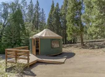
Spend the night on the shore of Manzanita Lake in one of four accessible camping cabins. All of the accessible cabins have parking in a level area with ramp access up to the front porch. They include level thresholds, wide doorways and adequate pathway access. The one-room cabins are furnished with a 19-inch high double bed, while the two room cabins include a 19-inch high double bed and three single beds. They all include a dining table with chairs, and a propane heater. Each cabin has a locking door, screened windows and a bare wood floor. Add in an accessible picnic table and a fire ring and you have everything you need to rough it in style.








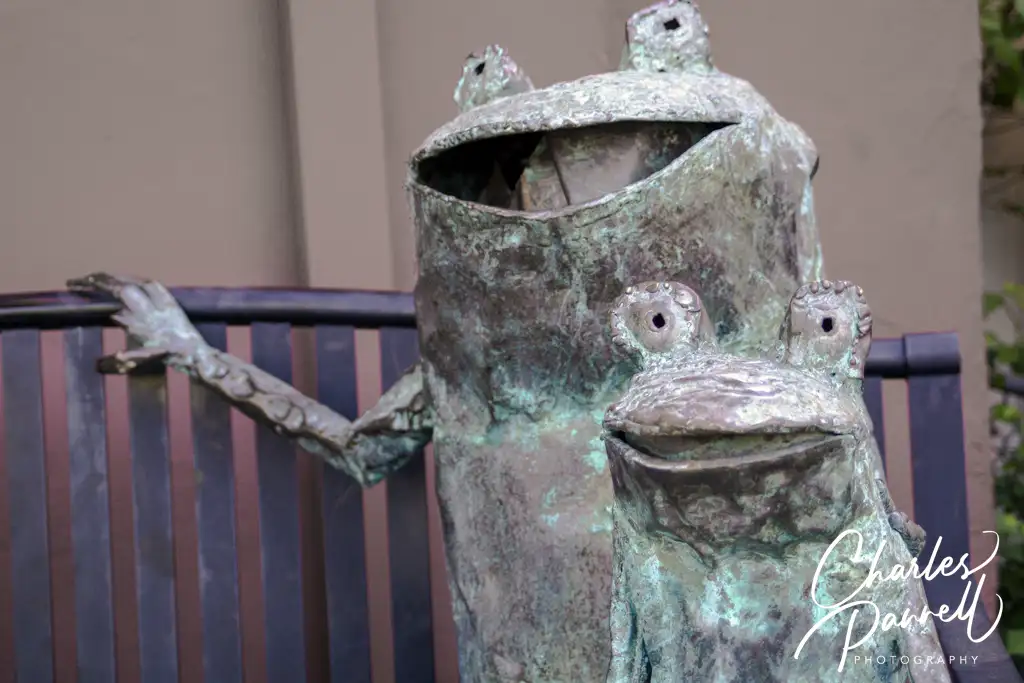 Every Spring professional frog teams from around the world flock to the heart of California Gold Country, to compete in the Calaveras County Frog Jump. Held on the third weekend in May in the tiny hamlet of Angels Camp, this competition first debuted in the pages of Mark Twain’s short story, “The Celebrated Jumping Frog of Calaveras County”.